Norton is a city in, and the county seat of, Norton County, Kansas, United States. As of the 2020 census, the population of the city was 2,747.
| Name: | Norton city |
|---|---|
| LSAD Code: | 25 |
| LSAD Description: | city (suffix) |
| State: | Kansas |
| County: | Norton County |
| Incorporated: | 1885 |
| Elevation: | 2,313 ft (705 m) |
| Total Area: | 1.91 sq mi (4.94 km²) |
| Land Area: | 1.91 sq mi (4.94 km²) |
| Water Area: | 0.00 sq mi (0.00 km²) |
| Total Population: | 2,747 |
| Population Density: | 1,400/sq mi (560/km²) |
| ZIP code: | 67654 |
| Area code: | 785 |
| FIPS code: | 2051500 |
| Website: | cityofnorton.com |
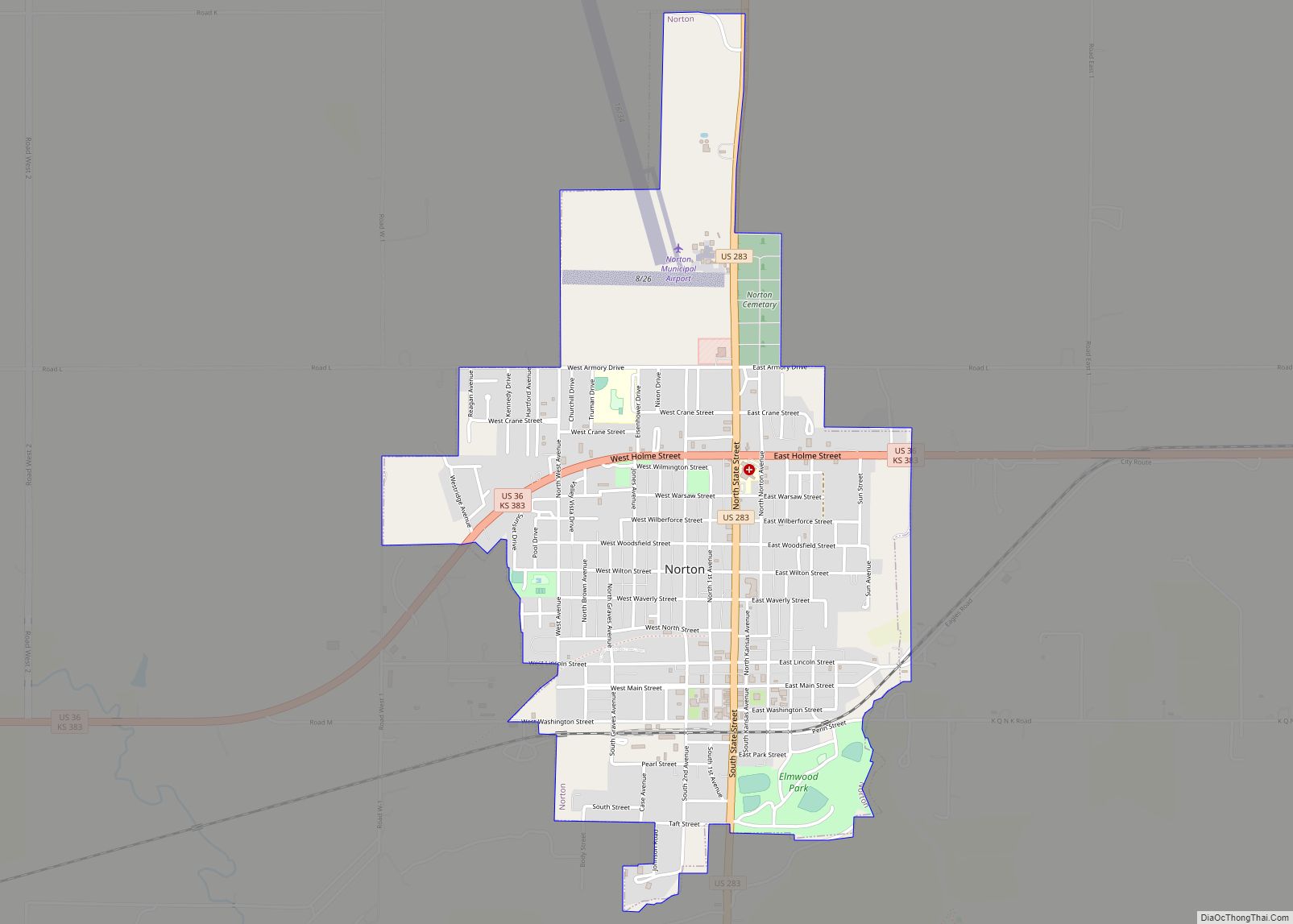
Online Interactive Map
Click on ![]() to view map in "full screen" mode.
to view map in "full screen" mode.
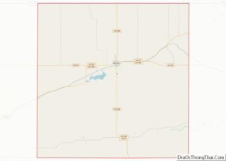
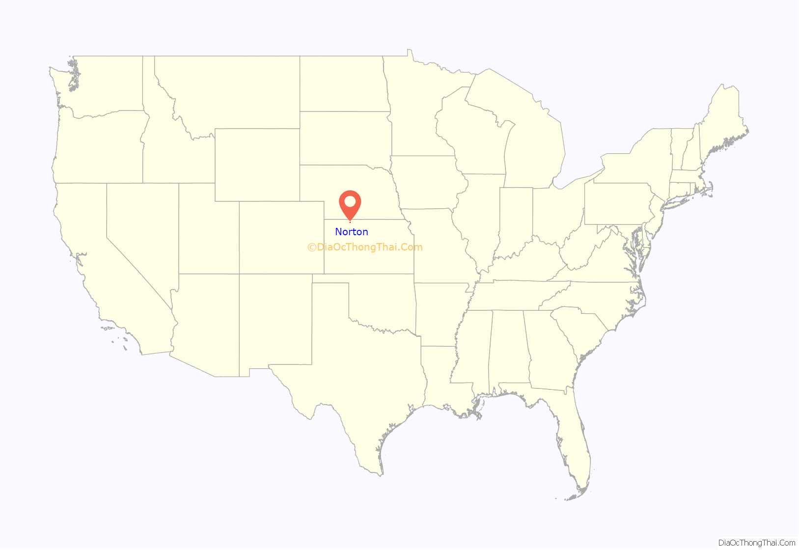
Norton location map. Where is Norton city?
History
Norton was founded in 1872. Like the county, it was named for Capt. Orloff Norton.
The first hotel was a log house, built in 1873.
One of the first recorded tornado pictures was taken in Norton, in 1909, by photographer Will Keller.
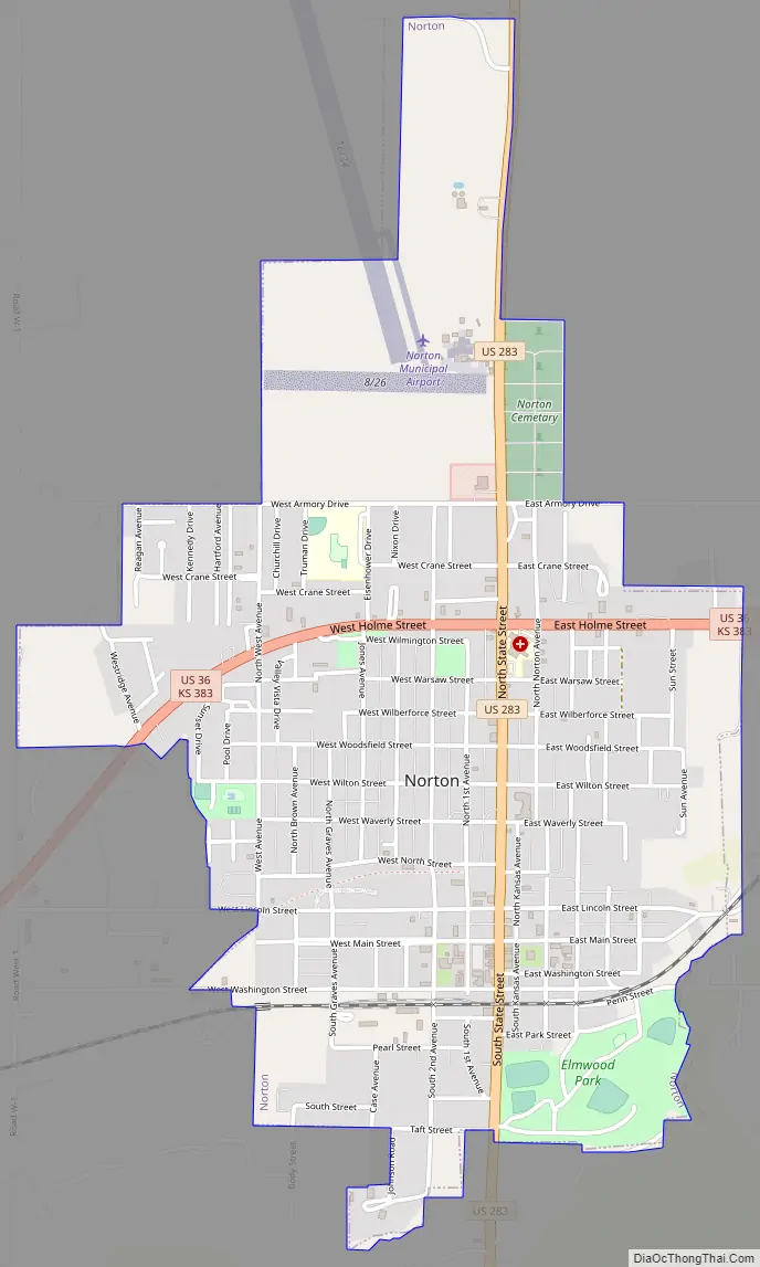
Norton Road Map
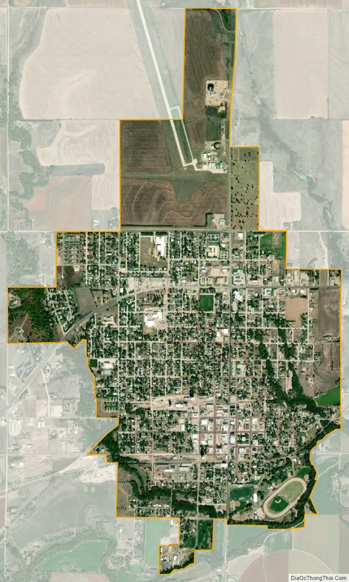
Norton city Satellite Map
Geography
Norton is located at 39°50′0″N 99°53′27″W / 39.83333°N 99.89083°W / 39.83333; -99.89083 (39.833338, -99.890899). According to the United States Census Bureau, the city has a total area of 1.93 square miles (5.00 km), all land. The city is situated on the north side of Prairie Dog Creek in Norton County. Before the Bureau of Reclamation constructed Keith Sebelius Lake in 1963, Norton was prone to frequent flooding. The construction of the Dam has since resolved the problem and created the current reservoir that sits 2.5 miles (4.0 km) southwest of Norton. The Nebraska border is located 11 miles (18 km) north of the city.
Climate
Norton is on the boundary of two climate zones, humid continental and semiarid. Temperatures can fluctuate drastically between the winter and summer seasons with average lows of 15 °F in January to average highs of 94 °F in July. Precipitation is relatively low with an average yearly rainfall of 21.1 inches. Snowfall throughout the year averages 25.1 inches (640 mm), however, because of its location on the high plains, snowfall totals can sometimes approach the yearly average after a single snowfall.
See also
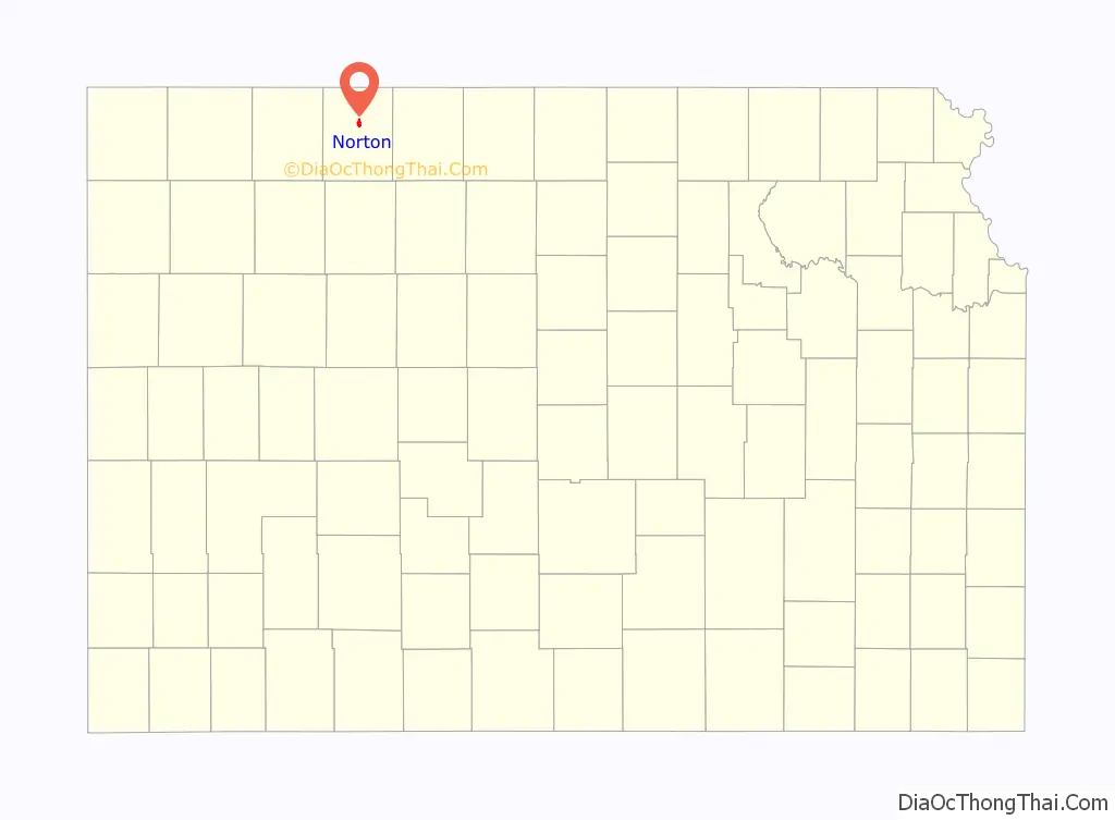
Map of Kansas State and its subdivision:- Allen
- Anderson
- Atchison
- Barber
- Barton
- Bourbon
- Brown
- Butler
- Chase
- Chautauqua
- Cherokee
- Cheyenne
- Clark
- Clay
- Cloud
- Coffey
- Comanche
- Cowley
- Crawford
- Decatur
- Dickinson
- Doniphan
- Douglas
- Edwards
- Elk
- Ellis
- Ellsworth
- Finney
- Ford
- Franklin
- Geary
- Gove
- Graham
- Grant
- Gray
- Greeley
- Greenwood
- Hamilton
- Harper
- Harvey
- Haskell
- Hodgeman
- Jackson
- Jefferson
- Jewell
- Johnson
- Kearny
- Kingman
- Kiowa
- Labette
- Lane
- Leavenworth
- Lincoln
- Linn
- Logan
- Lyon
- Marion
- Marshall
- McPherson
- Meade
- Miami
- Mitchell
- Montgomery
- Morris
- Morton
- Nemaha
- Neosho
- Ness
- Norton
- Osage
- Osborne
- Ottawa
- Pawnee
- Phillips
- Pottawatomie
- Pratt
- Rawlins
- Reno
- Republic
- Rice
- Riley
- Rooks
- Rush
- Russell
- Saline
- Scott
- Sedgwick
- Seward
- Shawnee
- Sheridan
- Sherman
- Smith
- Stafford
- Stanton
- Stevens
- Sumner
- Thomas
- Trego
- Wabaunsee
- Wallace
- Washington
- Wichita
- Wilson
- Woodson
- Wyandotte
- Alabama
- Alaska
- Arizona
- Arkansas
- California
- Colorado
- Connecticut
- Delaware
- District of Columbia
- Florida
- Georgia
- Hawaii
- Idaho
- Illinois
- Indiana
- Iowa
- Kansas
- Kentucky
- Louisiana
- Maine
- Maryland
- Massachusetts
- Michigan
- Minnesota
- Mississippi
- Missouri
- Montana
- Nebraska
- Nevada
- New Hampshire
- New Jersey
- New Mexico
- New York
- North Carolina
- North Dakota
- Ohio
- Oklahoma
- Oregon
- Pennsylvania
- Rhode Island
- South Carolina
- South Dakota
- Tennessee
- Texas
- Utah
- Vermont
- Virginia
- Washington
- West Virginia
- Wisconsin
- Wyoming