Map of Standish CDP

Map of Standish CDP, Maine

Standish, known locally as Standish Corner, is a census-designated place (CDP) in the town of Standish in Cumberland County, Maine, United States. The population was 469 at the 2010 census. It is part of the Portland–South Portland–Biddeford, Maine Metropolitan Statistical Area. Standish CDP overview: Name: Standish CDP LSAD Code: 57 LSAD Description: CDP (suffix) State: … Read more

Map of Southwest Harbor CDP

Map of Southwest Harbor CDP

Southwest Harbor is a census-designated place (CDP) in the town of Southwest Harbor in Hancock County, Maine, United States. The CDP population was 720 at the 2010 census, out of 1,764 people in the town as a whole. Southwest Harbor CDP overview: Name: Southwest Harbor CDP LSAD Code: 57 LSAD Description: CDP (suffix) State: Maine … Read more

Map of South Windham CDP, Maine

Map of South Windham CDP, Maine

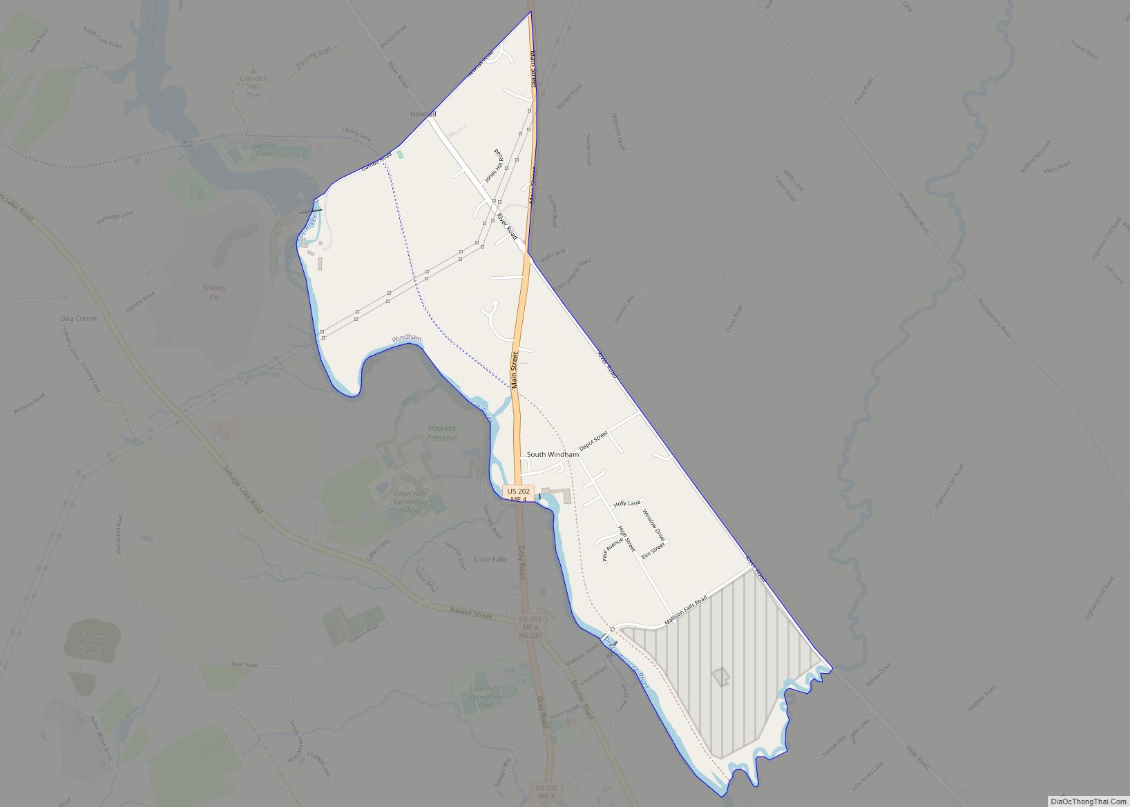
South Windham is a census-designated place (CDP) in the town of Windham in Cumberland County, Maine, United States. The population of the CDP was 1,374 at the 2010 census. Prior to 2010, South Windham was part of the Little Falls-South Windham census-designated place. It is part of the Portland–South Portland–Biddeford, Maine Metropolitan Statistical Area. South … Read more

Map of Van Buren CDP, Maine

Map of Van Buren CDP, Maine

Van Buren is a census-designated place (CDP) comprising the main village within the town of Van Buren in Aroostook County, Maine, United States. The population of the CDP was 1,937 at the 2010 census, out of a population of 2,171 for the entire town. Van Buren CDP overview: Name: Van Buren CDP LSAD Code: 57 … Read more

Map of Unity CDP

Map of Unity CDP, Maine

Unity is a census-designated place (CDP) in the town of Unity in Waldo County, Maine, United States. The population was 486 at the 2000 census. Unity CDP overview: Name: Unity CDP LSAD Code: 57 LSAD Description: CDP (suffix) State: Maine County: Waldo County Elevation: 220 ft (67 m) Total Area: 1.84 sq mi (4.76 km²) Land Area: 1.83 sq mi (4.75 km²) Water … Read more

Map of Topsham CDP

Map of Topsham CDP

Topsham is a census-designated place (CDP) in the town of Topsham in Sagadahoc County, Maine, United States. The population was 6,271 at the 2000 census. It is part of the Portland–South Portland–Biddeford, Maine Metropolitan Statistical Area. Topsham CDP overview: Name: Topsham CDP LSAD Code: 57 LSAD Description: CDP (suffix) State: Maine County: Sagadahoc County Elevation: … Read more

Map of Thomaston CDP, Maine

Map of Thomaston CDP, Maine

Thomaston is a census-designated place (CDP) comprising the main village in the town of Thomaston in Knox County, Maine, United States. The population was 1,875 at the 2010 census, out of 2,781 in the town of Thomaston as a whole. Thomaston CDP overview: Name: Thomaston CDP LSAD Code: 57 LSAD Description: CDP (suffix) State: Maine … Read more

Map of Steep Falls CDP

Map of Steep Falls CDP

Steep Falls is a census-designated place (CDP) in the town of Standish in Cumberland County, Maine, United States. The population was 1,139 at the 2010 census. It is part of the Portland–South Portland–Biddeford, Maine Metropolitan Statistical Area. The town is part of Maine School Administrative District #6, which includes Bonny Eagle Middle and High Schools. … Read more

Map of Westbrook city

Map of Westbrook city, Maine

Westbrook is a city in Cumberland County, Maine, United States and a suburb of Portland. The population was 20,400 at the 2020 census, making it the fastest-growing city in Maine between 2010 and 2020. It is part of the Portland–South Portland–Biddeford, Maine metropolitan statistical area. Westbrook city overview: Name: Westbrook city LSAD Code: 25 LSAD … Read more

Map of West Kennebunk CDP

Map of West Kennebunk CDP

West Kennebunk is a census-designated place (CDP) in the town of Kennebunk in York County, Maine, United States. The population was 1,176 at the 2010 census. It is part of the Portland–South Portland–Biddeford, Maine Metropolitan Statistical Area. West Kennebunk CDP overview: Name: West Kennebunk CDP LSAD Code: 57 LSAD Description: CDP (suffix) State: Maine County: … Read more

Map of Waterville city, Maine

Map of Waterville city, Maine

Waterville is a city in Kennebec County, Maine, United States, on the west bank of the Kennebec River. The city is home to Colby College and Thomas College. As of the 2020 census the population was 15,828. Along with Augusta, Waterville is one of the principal cities of the Augusta-Waterville, ME Micropolitan Statistical Area. Waterville … Read more

Map of Washburn CDP, Maine

Map of Washburn CDP, Maine

Washburn is a census-designated place (CDP) comprising the main village within the town of Washburn in Aroostook County, Maine, United States. The population of the CDP was 997 at the 2010 census, out of a population of 1,687 for the entire town. Washburn CDP overview: Name: Washburn CDP LSAD Code: 57 LSAD Description: CDP (suffix) … Read more