Map of Dixfield CDP

Map of Dixfield CDP

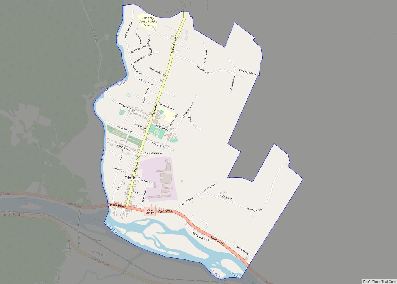
Dixfield is a census-designated place (CDP) in the town of Dixfield in Oxford County, Maine, United States. The population was 1,323 at the 2020 census. Dixfield CDP overview: Name: Dixfield CDP LSAD Code: 57 LSAD Description: CDP (suffix) State: Maine County: Oxford County Elevation: 436 ft (133 m) Total Area: 1.90 sq mi (4.91 km²) Land Area: 1.79 sq mi (4.64 km²) Water … Read more

Map of Dexter CDP, Maine

Map of Dexter CDP, Maine

Dexter is a census-designated place (CDP) comprising the main settlement within the town of Dexter in Penobscot County, Maine, United States. The population of the CDP was 2,158 at the 2010 census. Dexter CDP overview: Name: Dexter CDP LSAD Code: 57 LSAD Description: CDP (suffix) State: Maine County: Penobscot County Elevation: 417 ft (127 m) Total Area: … Read more

Map of Eastport city

Map of Eastport city, Maine

Eastport is a city and archipelago in Washington County, Maine, United States. The population was 1,288 at the 2020 census, making Eastport the least-populous city in Maine. The principal island is Moose Island, which is connected to the mainland by a causeway. Eastport is the easternmost city in the continental United States (although the nearby … Read more

Map of East Millinocket CDP

Map of East Millinocket CDP

East Millinocket is a census-designated place (CDP) consisting of the main settlement in the town of East Millinocket in Penobscot County, Maine, United States. The population was 1,567 at the 2010 census. East Millinocket CDP overview: Name: East Millinocket CDP LSAD Code: 57 LSAD Description: CDP (suffix) State: Maine County: Penobscot County Elevation: 367 ft (112 m) … Read more

Map of Eagle Lake CDP, Maine

Map of Eagle Lake CDP, Maine

Eagle Lake is a town in Aroostook County, Maine, United States. The population was 772 at the 2020 census. The town was named by a body of troops heading from Bangor to the Aroostook War for the many eagles that they saw around the lake. A total of 49.0% of the population speaks French, reflecting … Read more

Map of Falmouth Foreside CDP

Map of Falmouth Foreside CDP

Falmouth Foreside is a census-designated place (CDP) within the town of Falmouth in Cumberland County, Maine, in the United States. As of the 2010 census, the CDP population was 1,511. It is part of the Portland–South Portland–Biddeford, Maine Metropolitan Statistical Area. Falmouth Foreside CDP overview: Name: Falmouth Foreside CDP LSAD Code: 57 LSAD Description: CDP … Read more

Map of Fairfield CDP, Maine

Map of Fairfield CDP, Maine

Fairfield is a census-designated place (CDP) in the town of Fairfield in Somerset County, Maine, United States. The population was 2,569 at the 2000 census. Fairfield CDP overview: Name: Fairfield CDP LSAD Code: 57 LSAD Description: CDP (suffix) State: Maine County: Somerset County Elevation: 141 ft (43 m) Total Area: 2.03 sq mi (5.26 km²) Land Area: 1.84 sq mi (4.76 km²) Water … Read more

Map of Ellsworth city, Maine

Map of Ellsworth city, Maine

Ellsworth is a city in and the county seat of Hancock County, Maine, United States. The 2020 Census determined it had a population of 8,399. Named after United States Founding Father Oliver Ellsworth, it contains historic buildings and other points of interest, and is close to Acadia National Park. Ellsworth city overview: Name: Ellsworth city … Read more

Map of Farmington CDP, Maine

Map of Farmington CDP, Maine

Farmington is a census-designated place (CDP) comprising the center of the town of Farmington, which is the county seat of Franklin County in Maine, United States. The population of the CDP was 4,288 at the 2010 census, out of 7,760 people in the town as a whole. The University of Maine at Farmington is located … Read more

Map of Farmingdale CDP

Map of Farmingdale CDP, Maine

Farmingdale is a census-designated place (CDP) in the town of Farmingdale in Kennebec County, Maine, United States. The population was 1,970 at the 2010 census, out of 2,956 in the entire town. Farmingdale CDP overview: Name: Farmingdale CDP LSAD Code: 57 LSAD Description: CDP (suffix) State: Maine County: Kennebec County Elevation: 52 ft (16 m) Total Area: … Read more

Map of Falmouth CDP, Maine

Map of Falmouth CDP, Maine

Falmouth is a census-designated place (CDP) within the town of Falmouth in Cumberland County, Maine, United States. The population was 1,855 at the 2010 census. It is part of the Portland–South Portland–Biddeford, Maine Metropolitan Statistical Area. Falmouth CDP overview: Name: Falmouth CDP LSAD Code: 57 LSAD Description: CDP (suffix) State: Maine County: Cumberland County Elevation: … Read more

Map of Freeport CDP, Maine

Map of Freeport CDP, Maine

Freeport is a census-designated place (CDP) in the town of Freeport in Cumberland County, Maine, United States. The population was 1,485 at the 2010 census. It is part of the Portland–South Portland–Biddeford, Maine Metropolitan Statistical Area. Freeport CDP overview: Name: Freeport CDP LSAD Code: 57 LSAD Description: CDP (suffix) State: Maine County: Cumberland County Elevation: … Read more