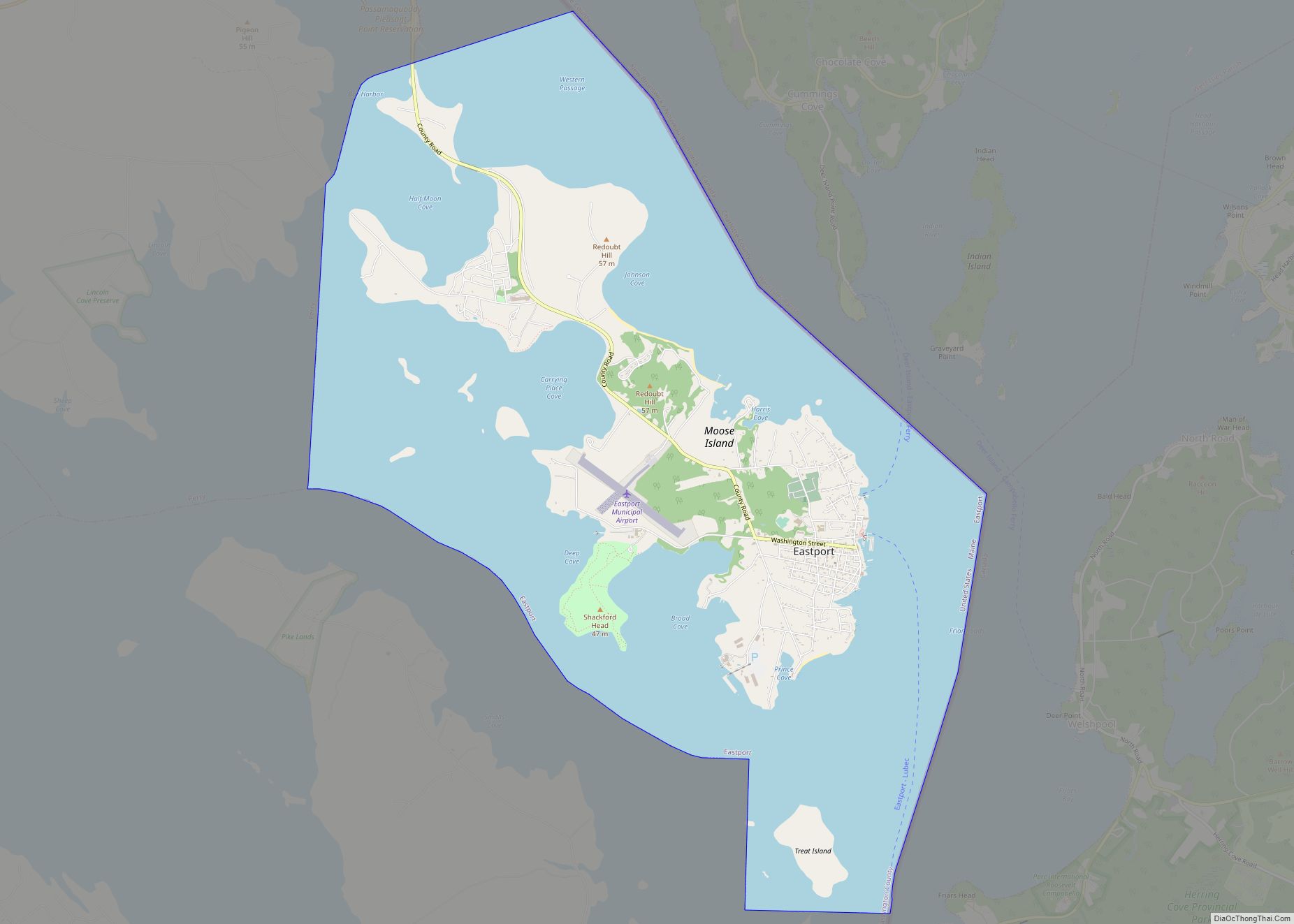
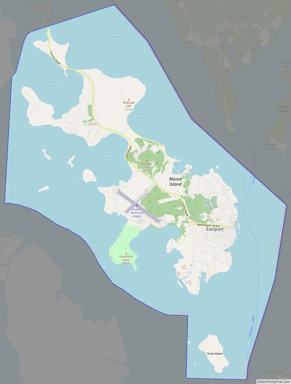
Eastport is a city and archipelago in Washington County, Maine, United States. The population was 1,288 at the 2020 census, making Eastport the least-populous city in Maine. The principal island is Moose Island, which is connected to the mainland by a causeway. Eastport is the easternmost city in the continental United States (although the nearby town of Lubec is the easternmost municipality).
| Name: | Eastport city |
|---|---|
| LSAD Code: | 25 |
| LSAD Description: | city (suffix) |
| State: | Maine |
| County: | Washington County |
| Elevation: | 105 ft (32 m) |
| Total Area: | 12.34 sq mi (31.95 km²) |
| Land Area: | 3.63 sq mi (9.41 km²) |
| Water Area: | 8.70 sq mi (22.53 km²) |
| Total Population: | 1,288 |
| Population Density: | 354.33/sq mi (136.82/km²) |
| ZIP code: | 04631 |
| Area code: | 207 |
| FIPS code: | 2321730 |
| GNISfeature ID: | 0565748 |
| Website: | eastport-me.gov |
Online Interactive Map
Click on ![]() to view map in "full screen" mode.
to view map in "full screen" mode.
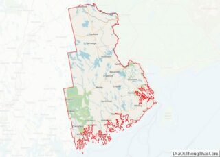
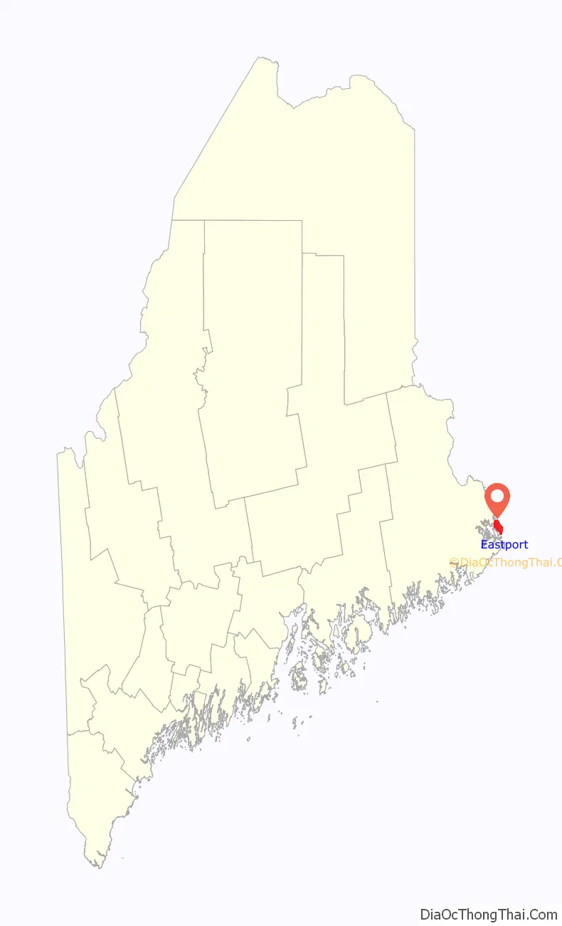
Eastport location map. Where is Eastport city?

History
The native Passamaquoddy Tribe has called this area home for at least 10,000 years. Some archeologists estimate the habitation at 20,000 years. The first known European contact was the St. Croix colony founded by the French explorer Samuel de Champlain in 1604. Near present-day Calais, the unsuccessful Saint Croix Island Acadia settlement predates the first successful English settlement at Jamestown, Virginia, by three years. On June 25, 1604, Champlain and his men spent a long and severe winter on St. Croix Island with no fresh water and diminished supplies. Two-fifths of the men died of scurvy, and the colony moved across the Bay of Fundy to Port Royal in present-day Nova Scotia.
Fishermen and traders visited the area in the 17th century. Moose Island was first settled in 1772 by James Cochrane of Newburyport, Massachusetts, who would be joined by other fishermen from Newburyport and Portsmouth, New Hampshire. On February 24, 1798, Eastport was incorporated as a town from Plantation Number 8 PS by the Massachusetts General Court, and named for being the easternmost port in the United States. Lubec, on the mainland, was set off and incorporated as a town on June 21, 1811.
From 1807 to 1809, the town was a center of extensive two-way smuggling during the Embargo Act imposed by President Thomas Jefferson. In 1809, Fort Sullivan was erected atop a village hill, but it was captured by a British fleet under command of Sir Thomas Hardy on July 11, 1814, during the War of 1812 as part of the initiative to establish the colony of New Ireland. England claimed that Moose Island was on the British side of the international border which had been determined in 1783. Nevertheless, the town was returned to United States’ control in 1818. The boundary between the U. S. and Canada in the area remained disputed until settled by the Webster–Ashburton Treaty of 1842. Eastport is the location most recently occupied by a foreign country in the contiguous United States.
In 1833 Eastport was the second largest trading port in the country after New York City. Farms produced hay and potatoes. Industries included a grain mill, box factory and carding mill. But the island’s economy was primarily directed at the sea. With tides of about 25 feet (7.6 m), Eastport’s spacious harbor remained ice-free year round. The first sardine factory was built here about 1875. The population grew with the emergence of the sardine fishery and related canning businesses, which studded the shoreline by the end of the 19th century. By 1886, the town contained 13 sardine factories, which operated day and night during the season, and produced approximately 5,000 cases per week. About 800 men, women and children worked in the plants. Eastport would be incorporated as a city on March 18, 1893. But the fishing industry would decline, and many people moved away. Indeed, the city went bankrupt in 1937. In 1976, the Groundhog Day Gale destroyed many structures along the waterfront. Today, catching fish remains the principal industry, although tourism has become important as well.
Eastport is a port of entry. An international ferry crosses to Deer Island, New Brunswick, during the summer months—this has been discontinued. Each 4th of July, the city becomes a destination for thousands of celebrants. Navy ships have docked there during the 4th of July celebration for many years. Eastport celebrated its bicentennial in 1998. Each September, the city hosts the annual Maine Salmon Festival in the historic downtown district. There is also a Pirate Festival the weekend after Labor Day, 2019 marks the 14th year of the festival.
Eastport and Passamaquoddy Bay, 1839, by William Henry Bartlett
Washington Street c. 1905
Water Street in 1906
Elm Street in 1909
View of the waterfront in 1908
Union Dock in 1910
Frontier National Bank c. 1915, once the Eastport Police Station, now vacant.
Water Street in 1973
Aerial photo from 1973
The Peavey Memorial Library, May 2014
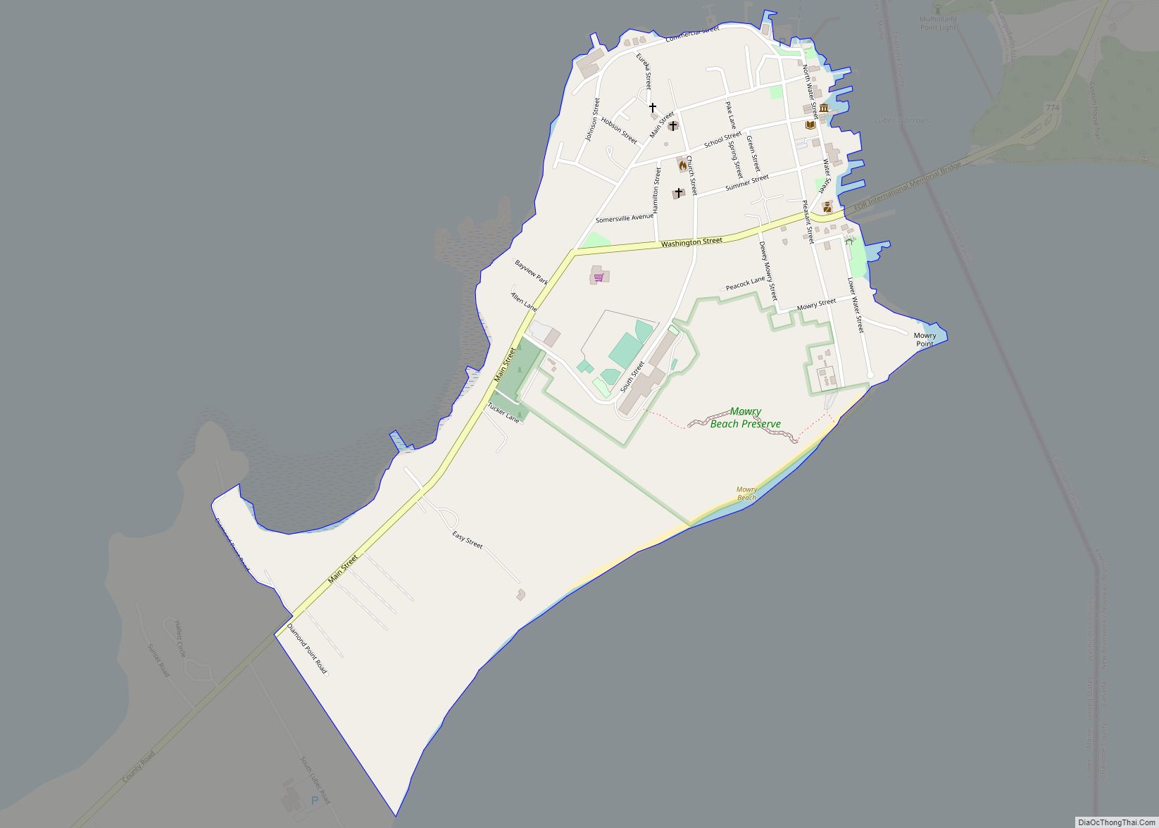
Eastport Road Map
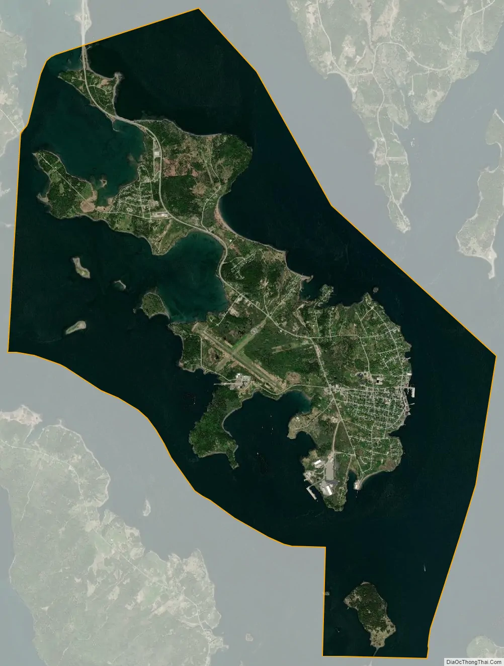
Eastport city Satellite Map
Geography
Eastport is the easternmost city in the United States; Lubec is farther east but is a town. According to the United States Census Bureau, the city has a total area of 12.34 square miles (31.96 km), of which 3.63 square miles (9.40 km) is land and 8.71 square miles (22.56 km) is water. Eastport is located on the southeasterly part of Moose Island, which lies between Cobscook Bay to the west and Passamaquoddy Bay to the east. The city faces Deer Island to the northeast and Campobello Island to the southeast—both in Canada.
Old Sow, the largest tidal whirlpool in the Western Hemisphere, sits on the international boundary between Eastport and Deer Island.
Climate
This climatic region is typified by large seasonal temperature differences, with warm (and often humid) summers and long, cold (sometimes severely cold) and snowy winters. According to the Köppen Climate Classification system, Eastport has a humid continental climate, abbreviated “Dfb” on climate maps.
See also
Map of Maine State and its subdivision: Map of other states:- Alabama
- Alaska
- Arizona
- Arkansas
- California
- Colorado
- Connecticut
- Delaware
- District of Columbia
- Florida
- Georgia
- Hawaii
- Idaho
- Illinois
- Indiana
- Iowa
- Kansas
- Kentucky
- Louisiana
- Maine
- Maryland
- Massachusetts
- Michigan
- Minnesota
- Mississippi
- Missouri
- Montana
- Nebraska
- Nevada
- New Hampshire
- New Jersey
- New Mexico
- New York
- North Carolina
- North Dakota
- Ohio
- Oklahoma
- Oregon
- Pennsylvania
- Rhode Island
- South Carolina
- South Dakota
- Tennessee
- Texas
- Utah
- Vermont
- Virginia
- Washington
- West Virginia
- Wisconsin
- Wyoming