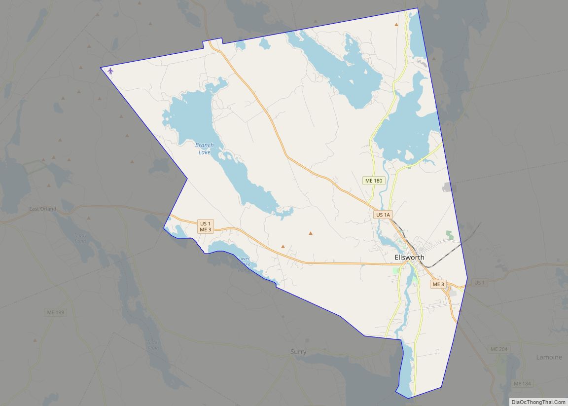
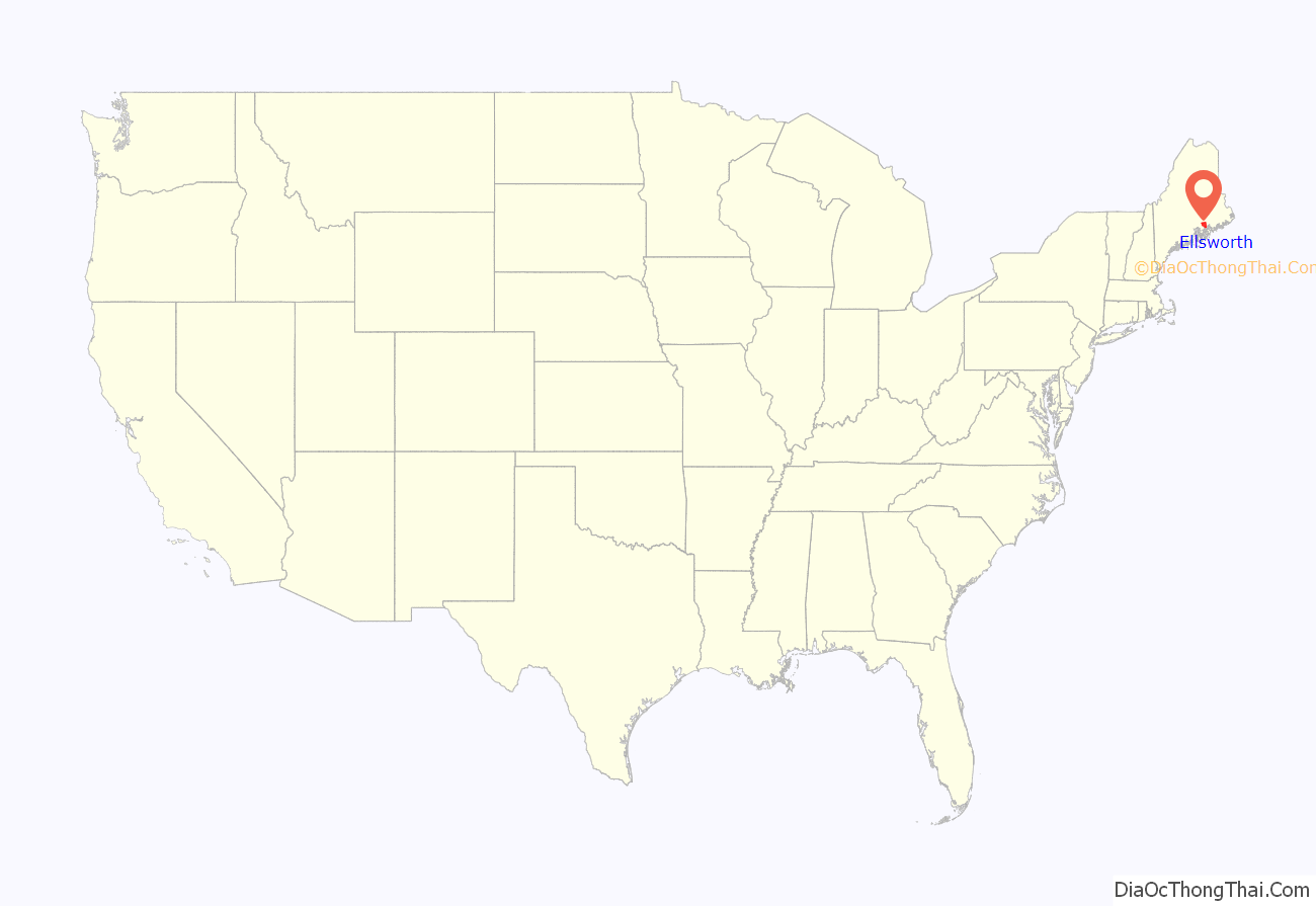
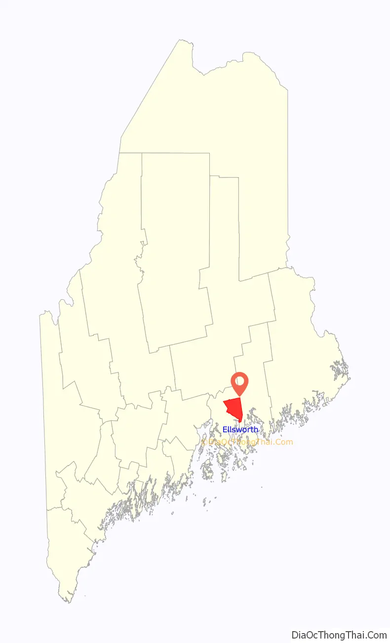
Ellsworth is a city in and the county seat of Hancock County, Maine, United States. The 2020 Census determined it had a population of 8,399. Named after United States Founding Father Oliver Ellsworth, it contains historic buildings and other points of interest, and is close to Acadia National Park.
| Name: | Ellsworth city |
|---|---|
| LSAD Code: | 25 |
| LSAD Description: | city (suffix) |
| State: | Maine |
| County: | Hancock County |
| Elevation: | 108 ft (33 m) |
| Total Area: | 93.92 sq mi (243.25 km²) |
| Land Area: | 79.29 sq mi (205.35 km²) |
| Water Area: | 14.63 sq mi (37.90 km²) |
| Total Population: | 8,399 |
| Population Density: | 105.93/sq mi (40.90/km²) |
| ZIP code: | 04605 |
| Area code: | 207 |
| FIPS code: | 2323200 |
| GNISfeature ID: | 0565863 |
| Website: | http://ellsworthmaine.gov/ |
Online Interactive Map
Click on ![]() to view map in "full screen" mode.
to view map in "full screen" mode.
Ellsworth location map. Where is Ellsworth city?
History
According to the history of the Passamaquoddy Indians, the Ellsworth area was originally inhabited by members of the Passamaquoddy and Penobscot tribes: “Both groups speak closely related Algonquian languages, although anthropologists generally group the Passamaquoddies linguistically with the Maliseets and the Penobscots with the Abenakis.” History
George J. Varney, in the ‘Hancock County, Maine’ section of his Gazetteer of the State of Maine, published in Boston in 1886, wrote:
It is likely that the French who founded a colony at Somes Sound on Mount Desert Island in 1613, under the patronage of Madame de Guercheville, explored the Ellsworth area and what is now the watershed of the Union River. Varney believes that there were French settlements of some kind or another as close to Ellsworth as Trenton, Oak Point, Newbury Neck and Surry.
The Ellsworth area was disputed between the English and the French throughout the 17th century and well into the 18th century, occasioning intermittent warfare which was known to the English as the French and Indian Wars. Native American inhabitants may have converted to Roman Catholicism and fought with the French against the British until the fall of Quebec City to the British in 1759. After the 1763 signing of the Treaty of Paris by the governments of the United Kingdom, France, Spain and Portugal, Ellsworth became part of the Commonwealth of Massachusetts.
The modern history of Ellsworth begins with the settlement of the Union River area around 1763 by a party of English led by entrepreneurs Benjamin Milliken and Benjamin Joy, from present-day southern Maine and New Hampshire, who intended to build dams and sawmills to exploit the area’s timber and water power. They applied for grants offered by the Commonwealth of Massachusetts to encourage settlement of the Hancock County area. Historian Albert H. Davis in his History of Ellsworth, Maine, published in Lewiston, Maine, in 1927, relates what is known of this early expedition and points to the northern end of the present Water Street, just to the south of the present bridge across the Union River, as the site of the earlier crude buildings erected by the pioneers.
George J. Varney describes the process of land grants by the Commonwealth of Massachusetts:
In 1773 the first schooner was built at Ellsworth. This was the Susan and Abigail, named after daughters of the two most prominent citizens, American Loyalist Benjamin Milliken and Benjamin Joy. The vessel carried pine shingles and oak staves in annual voyages to the West Indies. In the years up to the beginning of the 20th century, many schooners of various sizes were built in Ellsworth shipyards along the Union River.
Albert Davis records that in the latter part of the 18th century, Ellsworth was known as the Union River Settlement and was adjacent to the settlements of Surry (to the east) and Trenton (to the south). Later it was organized as Plantation No. 7 and at times called Bowdoin and New Bowdoin. In 1798 the inhabitants petitioned to be incorporated under the name Sumner. That name having been already taken by a settlement in present-day Oxford County, Maine, the town was incorporated by the Commonwealth of Massachusetts in 1800 as Ellsworth, named for Oliver Ellsworth, the Connecticut delegate to the 1787 National Convention that was then working on a Constitution for the new United States of America, and later the third Chief Justice of the Supreme Court. Oliver Ellsworth is thought to be first to suggest the name “United States of America”.
Davis reports that in the late 1770s, there were British raids on the Union River Settlement, with attempts to appropriate local cattle. However, there were no formal battles in the Ellsworth area during the Revolutionary War.
In 1838, Ellsworth became the county seat of Hancock County, replacing Castine. The 1838 county buildings still stand, west of the Union River, on Bridge Hill.
In 1859, when the town’s population was 4,009, industries included nine sawmills, two gristmills, one tannery, one carding machine, one pottery maker, eight brickyards, thirteen shipbuilders, five pail factories, two edge tool factories, one carriage manufacturer and eight box-making establishments.
Between 1860 and 1865, Ellsworth sent 653 soldiers to fight in the Civil War, according to historian Albert Davis. This was at a time when there were only 847 (male) voters in the area. Military training was held in front of the county buildings on Bridge Hill, west of the Union River, at the site of the present Civil War Monument.
In 1869, Ellsworth was incorporated as a city by the Maine Legislature. The first City Hall was Hancock Hall, which stood at the corner of Main Street and School Street. It was destroyed by the Great Ellsworth Fire of 1933.
In 1888, electricity was introduced into the Ellsworth area.
The disputed city elections in 1896 resulted in the appointment of two separate Ellsworth police forces, each of which threatened to arrest the other.
Work on the Ellsworth hydro-electric dam began in 1907, at the site of one of the original Benjamin Milliken Union River dams. This led to the creation of the present Leonard’s Lake just north of the city.
Ellsworth’s first disaster of the 20th century was the Great Flood of 1923. A spring freshet rushed over the dam and carried off the metal Union River Bridge, along with many buildings along the river, such as the Dirigo Theater, the Foundry and many wharves and warehouses. This event marked the end of Ellsworth’s prominence as a shipping center. The present concrete bridge was finished in 1924.
The Great Fire of 1933 destroyed most of Ellsworth’s downtown commercial district, on the east side of the Union River. New buildings were built in brick, mainly in Art Deco style. The unique Ellsworth City Hall dates from this period. Many old houses outside the business district survived the conflagration.
The 1960s and 1970s saw the development of an Ellsworth business district on High Street, which is the direct route to and from Bar Harbor and Acadia National Park. This area is now the largest shopping district in Hancock County, with several shopping centers and many large stores, stretching nearly to the Ellsworth-Trenton boundary.
Postcards of Ellsworth
Col. John Black House, built 1824–1827 after a pattern book design by Asher Benjamin; now part of Woodlawn Museum.
Street scene c. 1905
High Street in 1907
View of Main Street in 1907.
Main Street in 1910.
Ellsworth Public Library
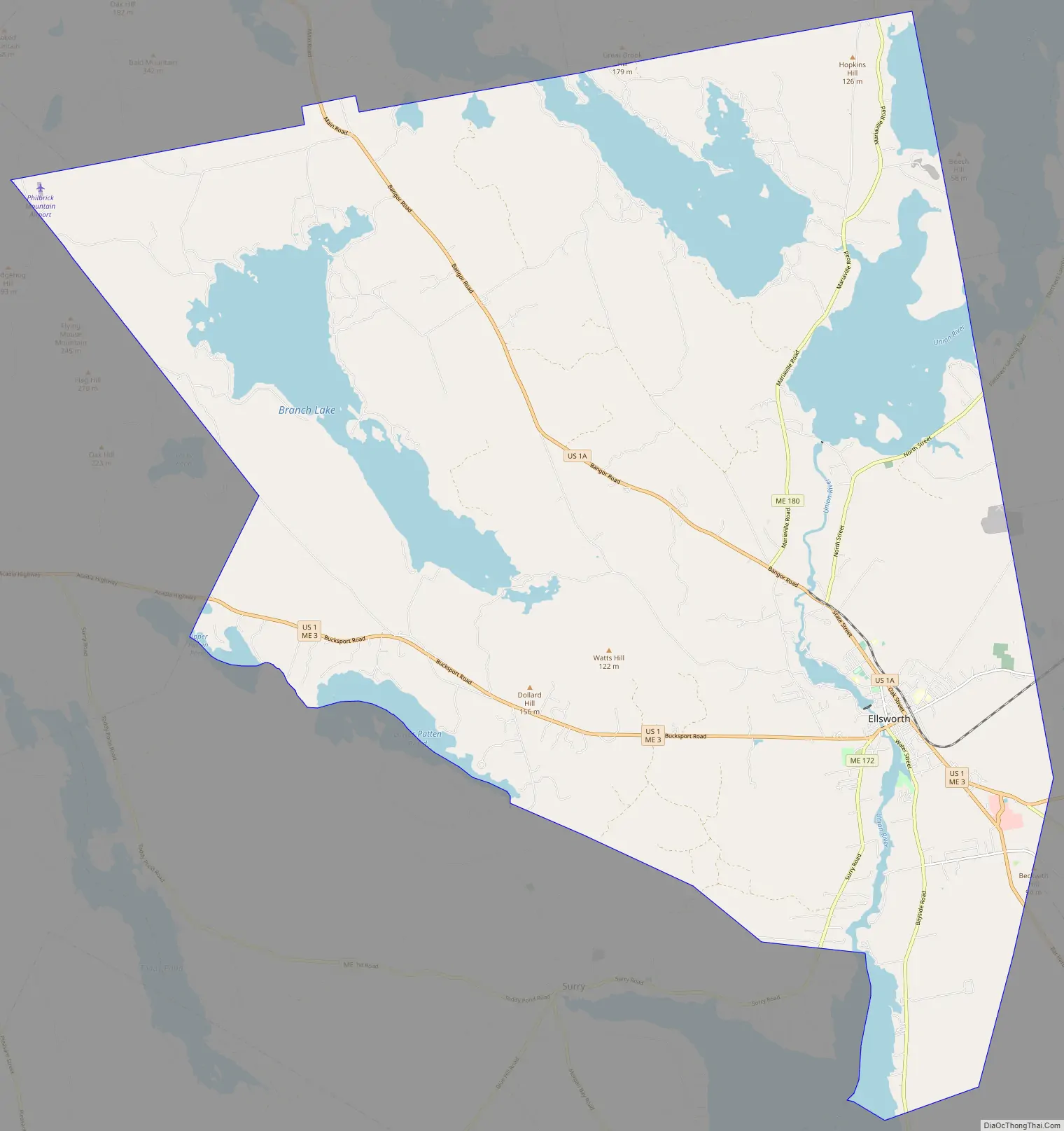
Ellsworth Road Map
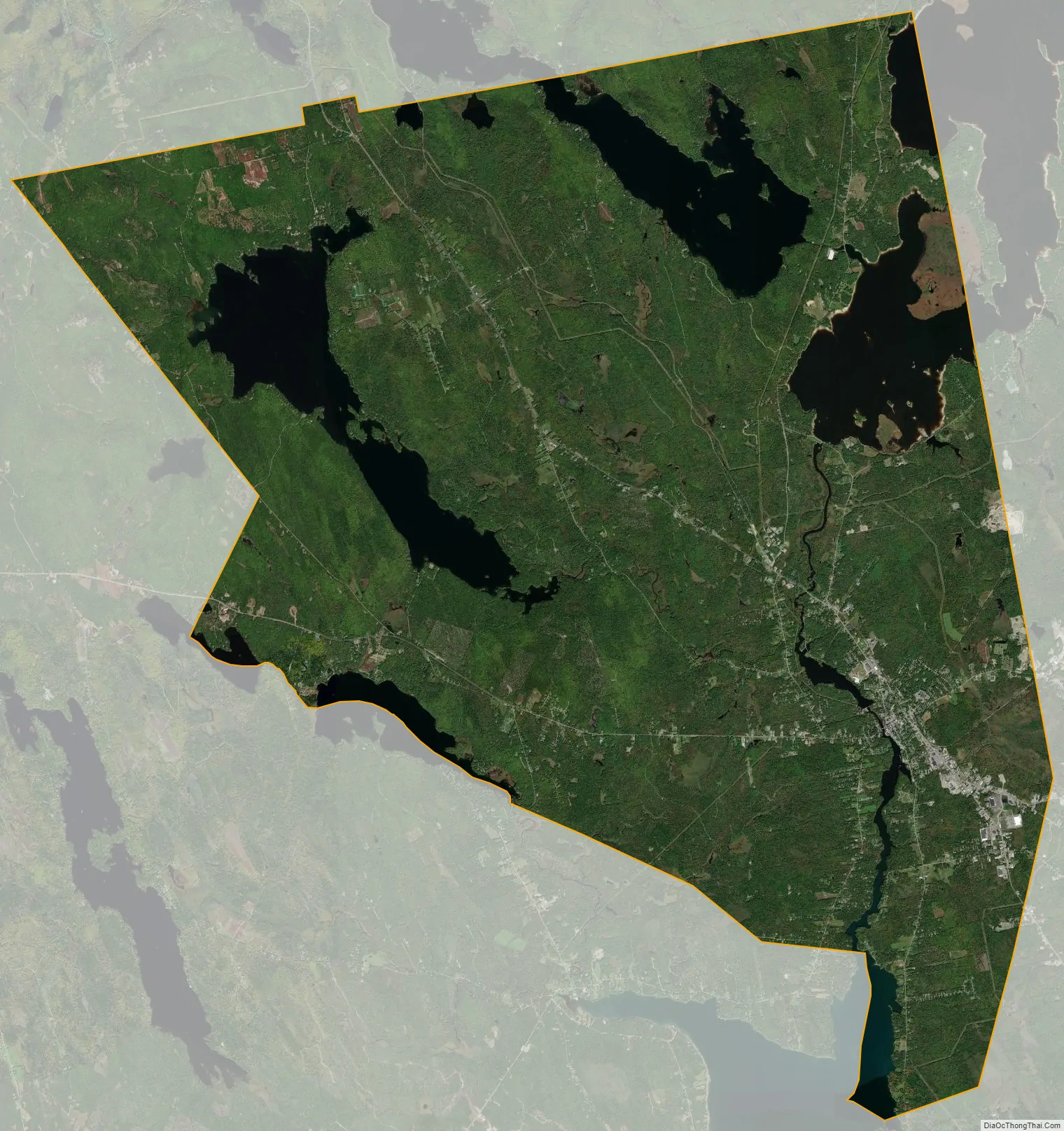
Ellsworth city Satellite Map
Geography
Ellsworth is located at 44°34’20” North, 68°28’34” West (44.572223, −68.476039).
According to the United States Census Bureau, the city has a total area of 93.92 sq mi (243.25 km), of which 79.28 sq mi (205.33 km) is land and 14.64 sq mi (37.92 km) is water. Located at the head of navigation, Ellsworth is drained by the Union River. Ellsworth Falls is the location of the Agassiz Outcrop Maine Geological Survey: Maine ACF, a National Historic Landmark, notable for its early recognition as evidence of glaciation.
The city is served by U.S. Route 1 and U.S. Route 1A, in addition to state routes 3, 172, 179, 180, 184 and 230.
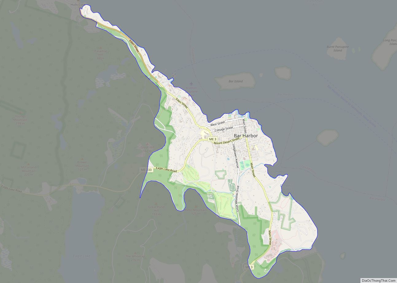
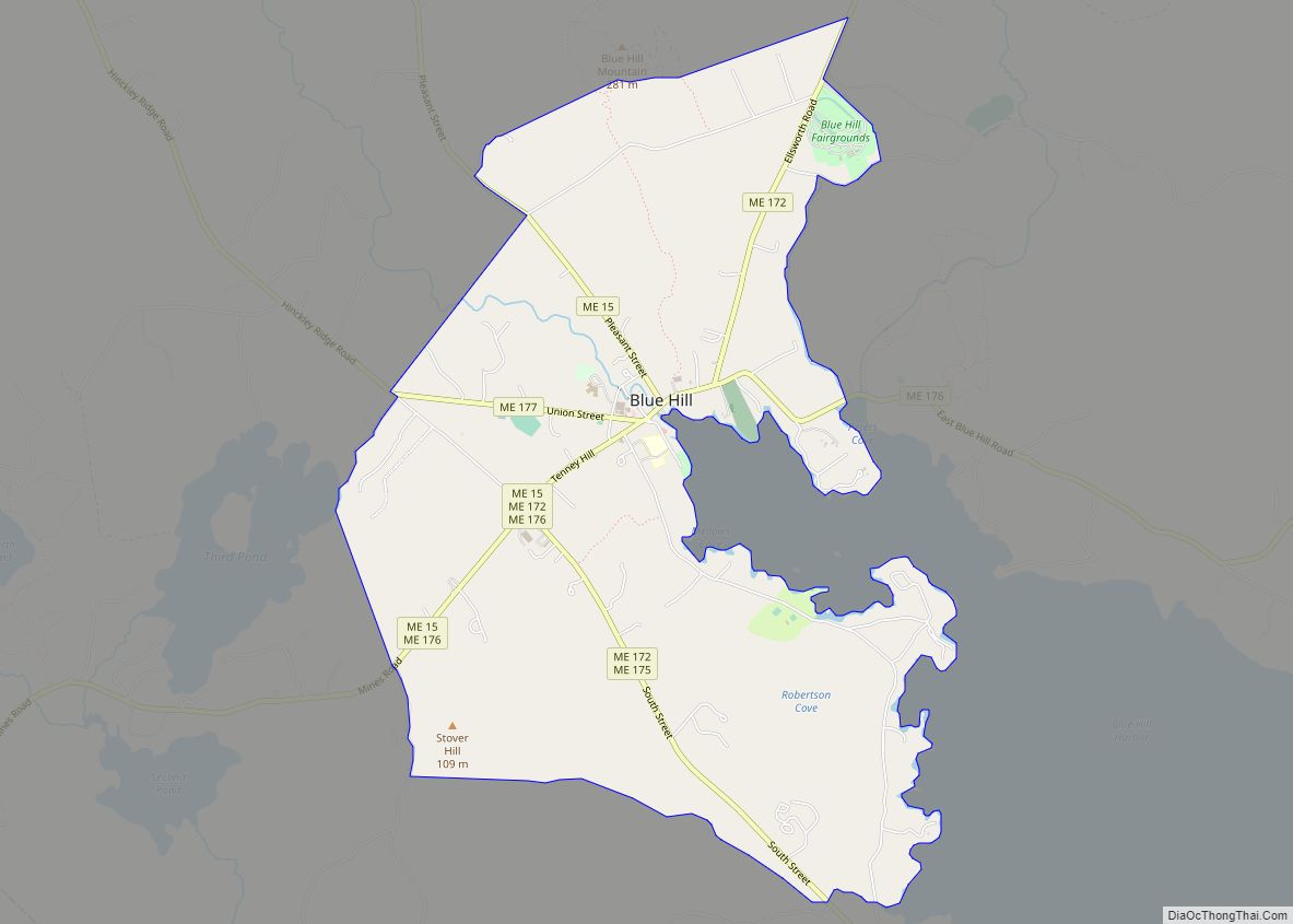
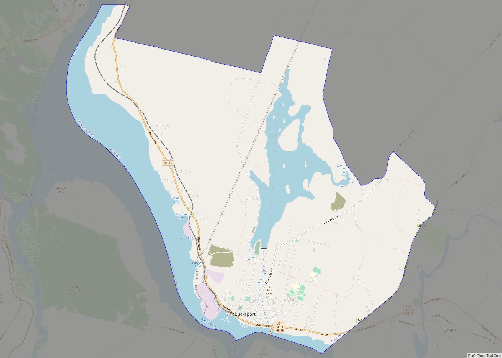
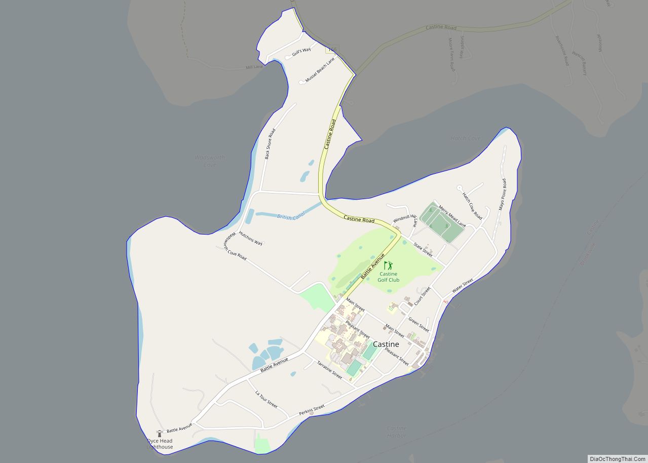
Neighboring cities and towns
Climate
Ellsworth has a humid continental climate (Köppen: Dfb) of the warm summer type. As much of Maine winters are harsh and snowy throughout the season, even being at latitudes similar to southern France, such discrepancies are due to the western patterns and the Labrador Current. In places to the northwest of the city, as around Branch Lake, the USDA hardiness zone is 5a, while in the urban area it is 5b, as is much of the state’s coastline.
See also
Map of Maine State and its subdivision: Map of other states:- Alabama
- Alaska
- Arizona
- Arkansas
- California
- Colorado
- Connecticut
- Delaware
- District of Columbia
- Florida
- Georgia
- Hawaii
- Idaho
- Illinois
- Indiana
- Iowa
- Kansas
- Kentucky
- Louisiana
- Maine
- Maryland
- Massachusetts
- Michigan
- Minnesota
- Mississippi
- Missouri
- Montana
- Nebraska
- Nevada
- New Hampshire
- New Jersey
- New Mexico
- New York
- North Carolina
- North Dakota
- Ohio
- Oklahoma
- Oregon
- Pennsylvania
- Rhode Island
- South Carolina
- South Dakota
- Tennessee
- Texas
- Utah
- Vermont
- Virginia
- Washington
- West Virginia
- Wisconsin
- Wyoming