Map of Downsville CDP, Maryland

Map of Downsville CDP, Maryland

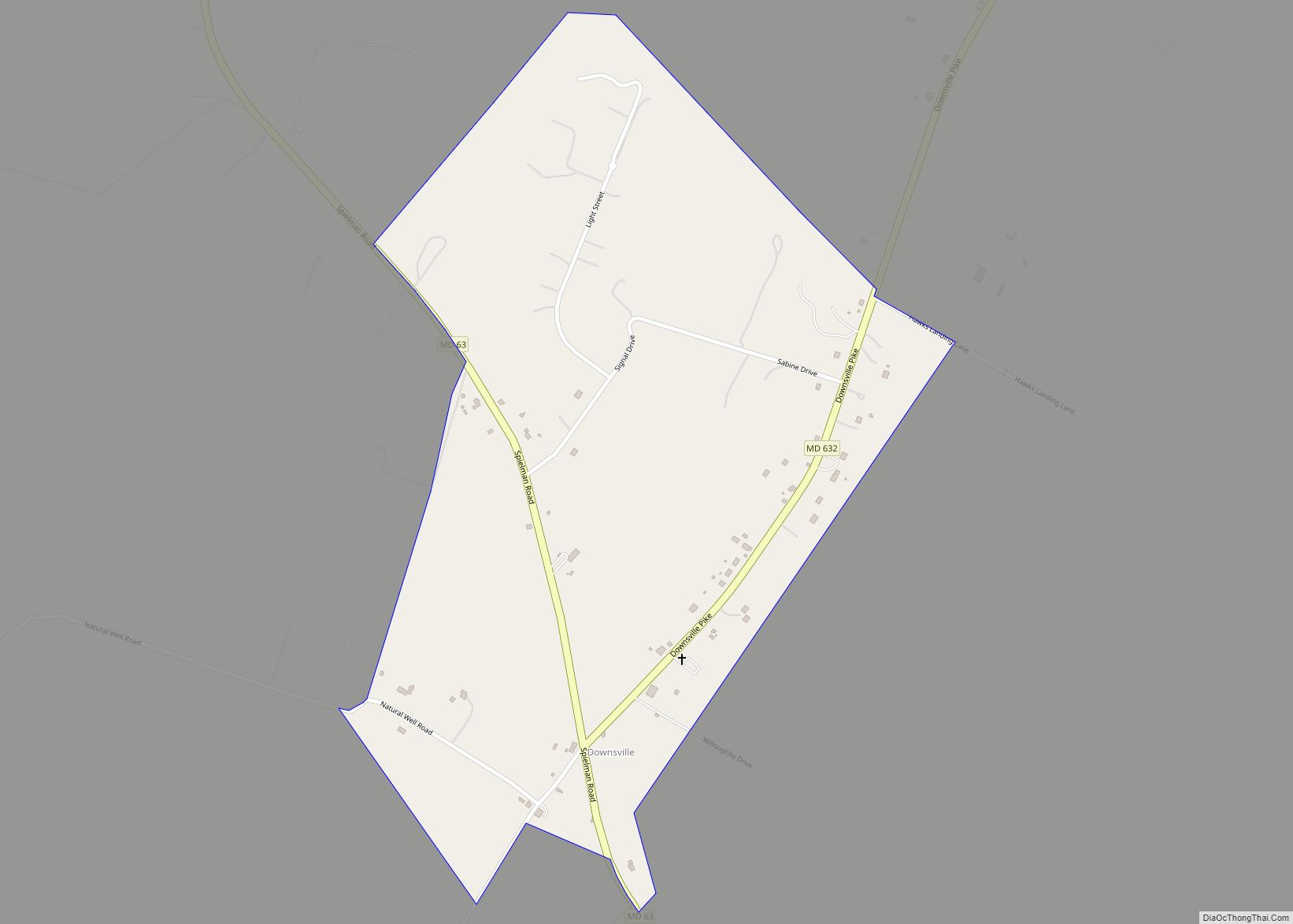
Downsville is an unincorporated community and census-designated place (CDP) in southwestern Washington County, Maryland, United States. Its population was 355 as of the 2010 census. It is located southeast of Williamsport on Maryland Route 63 and on Maryland Route 632, southwest of Hagerstown. It is officially included in the Hagerstown Metropolitan Area (Hagerstown-Martinsburg, MD-WV Metropolitan … Read more

Map of District Heights city

Map of District Heights city

District Heights is an incorporated municipality in Prince George’s County, Maryland, United States, located near Maryland Route 4. Per the 2020 census, the population was 5,959. For more information, see the separate articles on Forestville and Suitland. District Heights is located 9.85 miles (15.85 km) from central Washington. District Heights city overview: Name: District Heights city … Read more

Map of Detmold CDP

Map of Detmold CDP

Detmold is an unincorporated community and census-designated place (CDP) in Allegany County, Maryland, United States. As of the 2010 census it had a population of 71. Detmold is in western Allegany County along Maryland Route 36, which leads north 9 miles (14 km) to Frostburg and 7 miles (11 km) south to Westernport. The town is in … Read more

Map of Dunkirk CDP, Maryland

Map of Dunkirk CDP, Maryland

Dunkirk is a census-designated place (CDP) in Calvert County, Maryland, United States. The population was 2,521 at the 2010 census. Dunkirk CDP overview: Name: Dunkirk CDP LSAD Code: 57 LSAD Description: CDP (suffix) State: Maryland County: Calvert County Elevation: 121 ft (37 m) Total Area: 7.33 sq mi (19.00 km²) Land Area: 6.59 sq mi (17.06 km²) Water Area: 0.75 sq mi (1.94 km²) Total Population: … Read more

Map of Dundalk CDP

Map of Dundalk CDP

Dundalk (/ˈdʌndɔːk/ DUN-dawk or /ˈdʌndɒk/ DUN-dok) is an unincorporated community and census-designated place in Baltimore County, Maryland, United States. The population was 67,796 at the 2020 census. In 1960 and 1970, Dundalk was the largest unincorporated community in Maryland. It was named after the town of Dundalk, Ireland. Dundalk is considered one of the first … Read more

Map of Drum Point CDP

Map of Drum Point CDP

Drum Point is a census-designated place (CDP) in southern Calvert County, Maryland, United States, at the confluence of the Patuxent River with Chesapeake Bay. As of the 2010 census, the CDP had a population of 2,731. Prior to 2010 it was part of the Chesapeake Ranch Estates-Drum Point CDP. Drum Point CDP overview: Name: Drum … Read more

Map of East New Market town

Map of East New Market town

East New Market town overview: Name: East New Market town LSAD Code: 43 LSAD Description: town (suffix) State: Maryland County: Dorchester County Incorporated: 1832 Elevation: 39 ft (12 m) Total Area: 0.40 sq mi (1.04 km²) Land Area: 0.40 sq mi (1.04 km²) Water Area: 0.00 sq mi (0.00 km²) Total Population: 389 Population Density: 972.50/sq mi (375.68/km²) ZIP code: 21631 Area code: 410 FIPS code: 2424450 … Read more

Map of Eakles Mill CDP

Map of Eakles Mill CDP

Eakles Mills (also known as Eakles Mill) is an unincorporated community and census-designated place in Washington County, Maryland, United States. Its population was 26 as of the 2020 census. Snively Farm was listed on the National Register of Historic Places in 1979. Eakles Mill CDP overview: Name: Eakles Mill CDP LSAD Code: 57 LSAD Description: … Read more

Map of Eagle Harbor town

Map of Eagle Harbor town, Maryland

Eagle Harbor is an incorporated town in the far southeast corner of Prince George’s County, Maryland, United States, and near the rural community of Aquasco that is known as a historic African American community founded in 1925. Per the 2020 census, the population was 67. The Chalk Point Generating Station, owned by NRG Energy, which … Read more

Map of Eckhart Mines CDP

Map of Eckhart Mines CDP

Eckhart Mines is an unincorporated community and census-designated place (CDP) in Allegany County, Maryland, United States. As of the 2010 census it had a population of 932. Eckhart Mines lies at the southwestern base of Federal Hill, 1.8 miles (2.9 km) east of Frostburg and 0.8 miles (1.3 km) northwest of Clarysville. Braddock Run begins near Eckhart … Read more

Map of Easton town, Maryland

Map of Easton town, Maryland

Easton is an incorporated town in and the county seat of Talbot County, Maryland, United States. The population was 15,945 at the 2010 census, with an estimated population in 2019 of 16,671. The primary ZIP Code is 21601, and the secondary is 21606. The primary phone exchange is 822, the auxiliary exchanges are 820, 763, and … Read more

Map of East Riverdale CDP

Map of East Riverdale CDP

East Riverdale is an unincorporated area and census-designated place (CDP) in Prince George’s County, Maryland, United States. The population was 18,459 at the 2020 census. East Riverdale CDP overview: Name: East Riverdale CDP LSAD Code: 57 LSAD Description: CDP (suffix) State: Maryland County: Prince George’s County Elevation: 36 ft (11 m) Total Area: 1.61 sq mi (4.18 km²) Land Area: … Read more