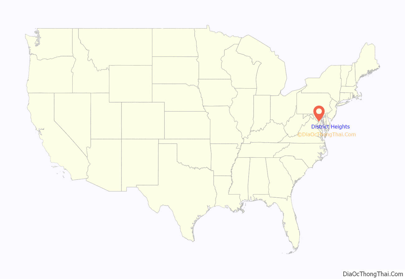
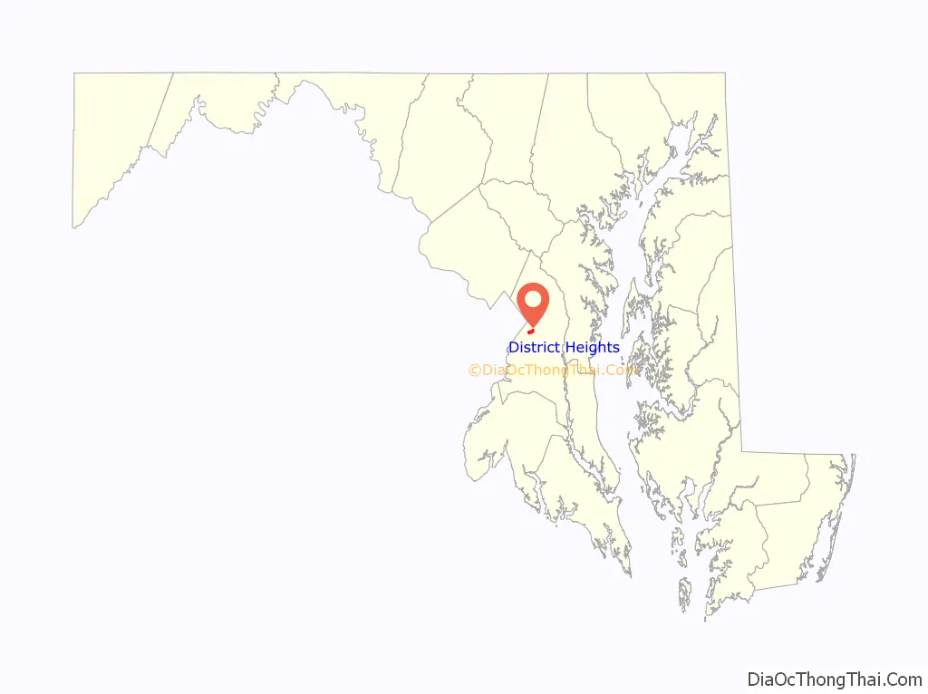
District Heights is an incorporated municipality in Prince George’s County, Maryland, United States, located near Maryland Route 4. Per the 2020 census, the population was 5,959. For more information, see the separate articles on Forestville and Suitland.
District Heights is located 9.85 miles (15.85 km) from central Washington.
| Name: | District Heights city |
|---|---|
| LSAD Code: | 25 |
| LSAD Description: | city (suffix) |
| State: | Maryland |
| County: | Prince George’s County |
| Incorporated: | 1936 |
| Elevation: | 266 ft (81 m) |
| Total Area: | 0.86 sq mi (2.24 km²) |
| Land Area: | 0.86 sq mi (2.24 km²) |
| Water Area: | 0.00 sq mi (0.00 km²) |
| Total Population: | 5,959 |
| Population Density: | 6,889.02/sq mi (2,659.75/km²) |
| ZIP code: | 20747, 20753 |
| Area code: | 301, 240 |
| FIPS code: | 2423025 |
| GNISfeature ID: | 0597330 |
| Website: | http://www.districtheights.org/ |
Online Interactive Map
Click on ![]() to view map in "full screen" mode.
to view map in "full screen" mode.
District Heights location map. Where is District Heights city?
History
District Heights was originally farmland owned by Major Leander P. Williams, purchased as four patented Lord Baltimore tracts known as: “Good Luck,” “Magruder’s Plains Enlarged,” “the Levels,” and “Offutt’s Adventure.” Under grants issued to Lord Baltimore by King Charles I of Great Britain, the tracts belonged to Colonel Ninian Beall, Benjamin Berry, and Alexander Magruder. District Heights evolved from one of the four patents. In 1925, 505-acres of the Williams farm was purchased and formed into the District Heights Company by Joseph Tepper, David L. Blanken, Henry Oxenberg, Gilbert Leventhal, Simon Gordon, and Simon Gerber. The land was farmed by Walter and Al Dustin, whose farmhouse stood at 7116 Foster Street. By 1925, streets laid out first three blocks of Halleck Street and Aztec. By 1926, the city had approximately 25 homes built, two businesses, a grocery store and filling station, a pump house and water tower to furnish the water and pressure for the City, a sewage system and a free Model T bus service to 17th and Pennsylvania Avenue, S.E. The Town of District Heights was incorporated in 1936 and recognized by act of the Maryland General Assembly. Many of the Cape Cod style houses seen today date to the 1940s, when several developers constructed affordable, single-family, houses with financing from the Federal Housing Administration (FHA), anticipating sales to federal employees and veterans returning from World War II. In 1946, the remaining and undeveloped 300-acres was bought and developed by New York City builder Samuel R. Rosoff, who established Washington Estates, Inc., thus adding additional tracts to District Heights which include areas now occupied by garden apartments.
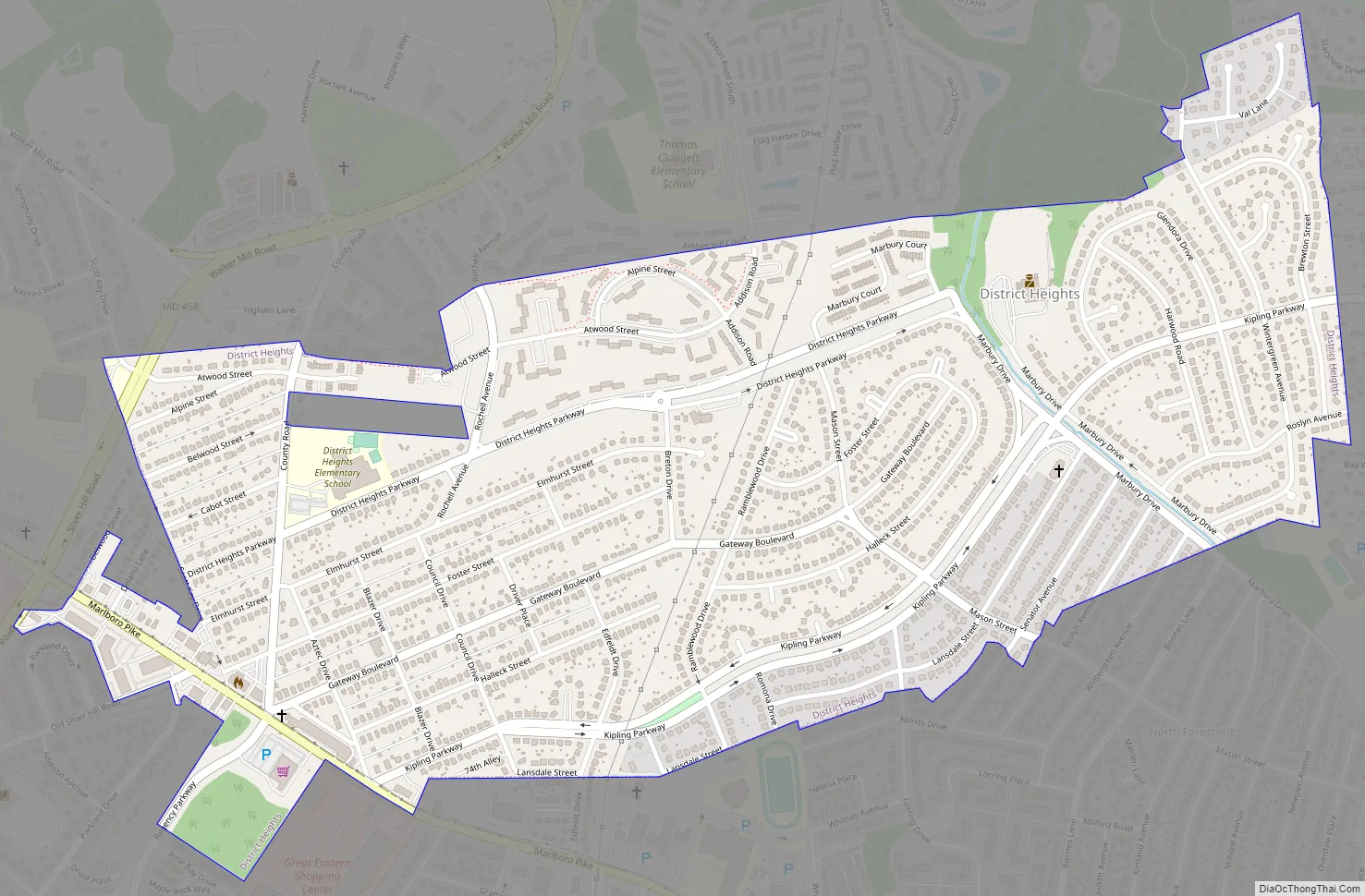
District Heights Road Map
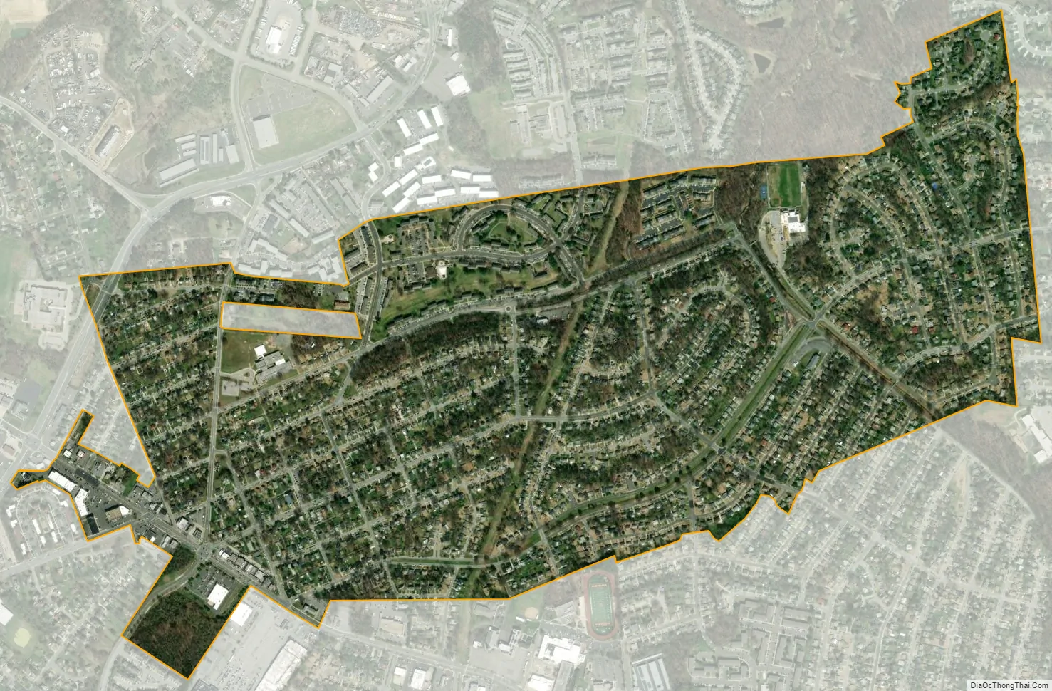
District Heights city Satellite Map
Geography
District Heights is located at 38°51′34″N 76°53′21″W / 38.85944°N 76.88917°W / 38.85944; -76.88917 (38.859545, −76.889139).
According to the United States Census Bureau, the city has a total area of 0.93 square miles (2.41 km), all land.
See also
Map of Maryland State and its subdivision: Map of other states:- Alabama
- Alaska
- Arizona
- Arkansas
- California
- Colorado
- Connecticut
- Delaware
- District of Columbia
- Florida
- Georgia
- Hawaii
- Idaho
- Illinois
- Indiana
- Iowa
- Kansas
- Kentucky
- Louisiana
- Maine
- Maryland
- Massachusetts
- Michigan
- Minnesota
- Mississippi
- Missouri
- Montana
- Nebraska
- Nevada
- New Hampshire
- New Jersey
- New Mexico
- New York
- North Carolina
- North Dakota
- Ohio
- Oklahoma
- Oregon
- Pennsylvania
- Rhode Island
- South Carolina
- South Dakota
- Tennessee
- Texas
- Utah
- Vermont
- Virginia
- Washington
- West Virginia
- Wisconsin
- Wyoming


