Map of Madison CDP, Maryland

Map of Madison CDP, Maryland

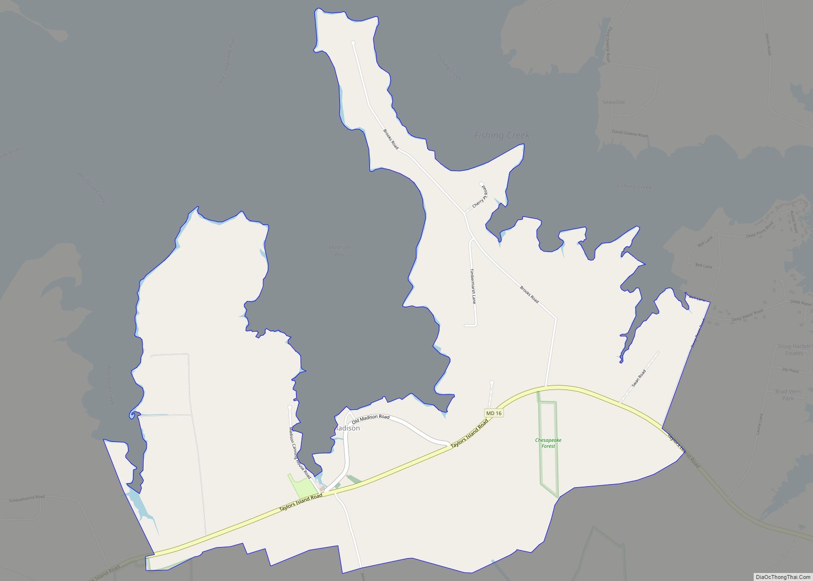
Madison is an unincorporated community and census-designated place (CDP) in Dorchester County, Maryland, United States. The population was 204 at the 2010 census. Madison CDP overview: Name: Madison CDP LSAD Code: 57 LSAD Description: CDP (suffix) State: Maryland County: Dorchester County Elevation: 4 ft (1 m) Total Area: 3.25 sq mi (8.40 km²) Land Area: 3.20 sq mi (8.30 km²) Water Area: 0.04 sq mi … Read more

Map of Lutherville CDP

Map of Lutherville CDP

Lutherville is a census-designated place (CDP) in Baltimore County, Maryland, United States. As of the 2010 census it had a population of 6,504. Prior to 2010 the area was part of the Lutherville-Timonium CDP. Within its borders lies the Lutherville Historic District. Lutherville CDP overview: Name: Lutherville CDP LSAD Code: 57 LSAD Description: CDP (suffix) … Read more

Map of Lusby CDP

Map of Lusby CDP

Lusby is an unincorporated community and census-designated place (CDP) in Calvert County, Maryland, United States. The population of the CDP was 1,835 at the 2010 census. Residents of the Chesapeake Ranch Estates and Drum Point communities also use the Lusby ZIP code designation. Lusby CDP overview: Name: Lusby CDP LSAD Code: 57 LSAD Description: CDP … Read more

Map of Mardela Springs town

Map of Mardela Springs town

Mardela Springs is a town in Wicomico County, Maryland, United States. The population was 357 at the 2010 census. It is included in the Salisbury, Maryland-Delaware Metropolitan Statistical Area. Mardela Springs town overview: Name: Mardela Springs town LSAD Code: 43 LSAD Description: town (suffix) State: Maryland County: Wicomico County Incorporated: 1906 Elevation: 26 ft (8 m) Total … Read more

Map of Mapleville CDP

Map of Mapleville CDP

Mapleville is an unincorporated community and census-designated place in eastern Washington County, Maryland, United States. Its population was 243 as of the 2020 census. It is officially a part of the Hagerstown Metropolitan Area. Mapleville lies along MD Route 66, known locally as the Mapleville Road, north of Boonsboro and just south of the community … Read more

Map of Manchester town, Maryland

Map of Manchester town, Maryland

Manchester is a small incorporated town in northeastern Carroll County, Maryland, United States, located just south of the Pennsylvania state line and north of Baltimore. The population was 4,808 at the 2010 census. Manchester was incorporated in 1833 and is the second oldest incorporated area in Carroll County after Westminster, which was incorporated in 1818. … Read more

Map of Marlboro Village CDP

Map of Marlboro Village CDP

Marlboro Village is an unincorporated community and census-designated place (CDP) in Prince George’s County, Maryland, United States. Per the 2020 census, the population was 9,221. It was newly delineated for the 2010 census prior to which the area was part of the Greater Upper Marlboro census-designated place. Marlboro Village CDP overview: Name: Marlboro Village CDP … Read more

Map of Marlboro Meadows CDP

Map of Marlboro Meadows CDP

Marlboro Meadows is an unincorporated community and census-designated place (CDP) in Prince George’s County, Maryland, United States. Per the 2020 census, the population was 3,655. It was newly delineated for the 2010 census prior to which the area was part of the Greater Upper Marlboro census-designated place. Marlboro Meadows CDP overview: Name: Marlboro Meadows CDP … Read more

Map of Marlow Heights CDP

Map of Marlow Heights CDP

Marlow Heights is an unincorporated area and census-designated place (CDP) in Prince George’s County, Maryland, United States. The population was 6,169 at the 2020 census. The Marlow Heights Shopping Center first opened in 1957 (but extended in 1960 with Hecht’s), adjacent to the large community of Hillcrest Heights. It was joined ten years later, in … Read more

Map of Marydel town

Map of Marydel town

Marydel is an incorporated town in Caroline County, Maryland, United States. The population was 141 at the 2010 United States Census. Its name is a portmanteau, after its location, being partially located in Maryland and partially in Delaware. Marydel was originally known as Halltown. Publisher James Gordon Bennett Jr. participated in a duel near Marydel … Read more

Map of Martin's Additions village

Map of Martin’s Additions village

Martin’s Additions is a village in Montgomery County, Maryland, United States. It was established as a Special Tax District in 1916 and incorporated as a village in 1985. The population was 946 at the 2020 Census. The town is part of a larger community, colloquially referred to as Chevy Chase, that includes several adjoining settlements … Read more

Map of Marlton CDP

Map of Marlton CDP, Maryland

Marlton is an unincorporated area and census-designated place (CDP) in Prince George’s County, Maryland, United States. The population was 9,802 at the 2020 census. The Marlton housing development, at first briefly called “Brandywine Country”, grew up along U.S. Route 301 in the 1970s, and is part of the greater Upper Marlboro community. Originally made up … Read more