Map of Seat Pleasant city

Map of Seat Pleasant city

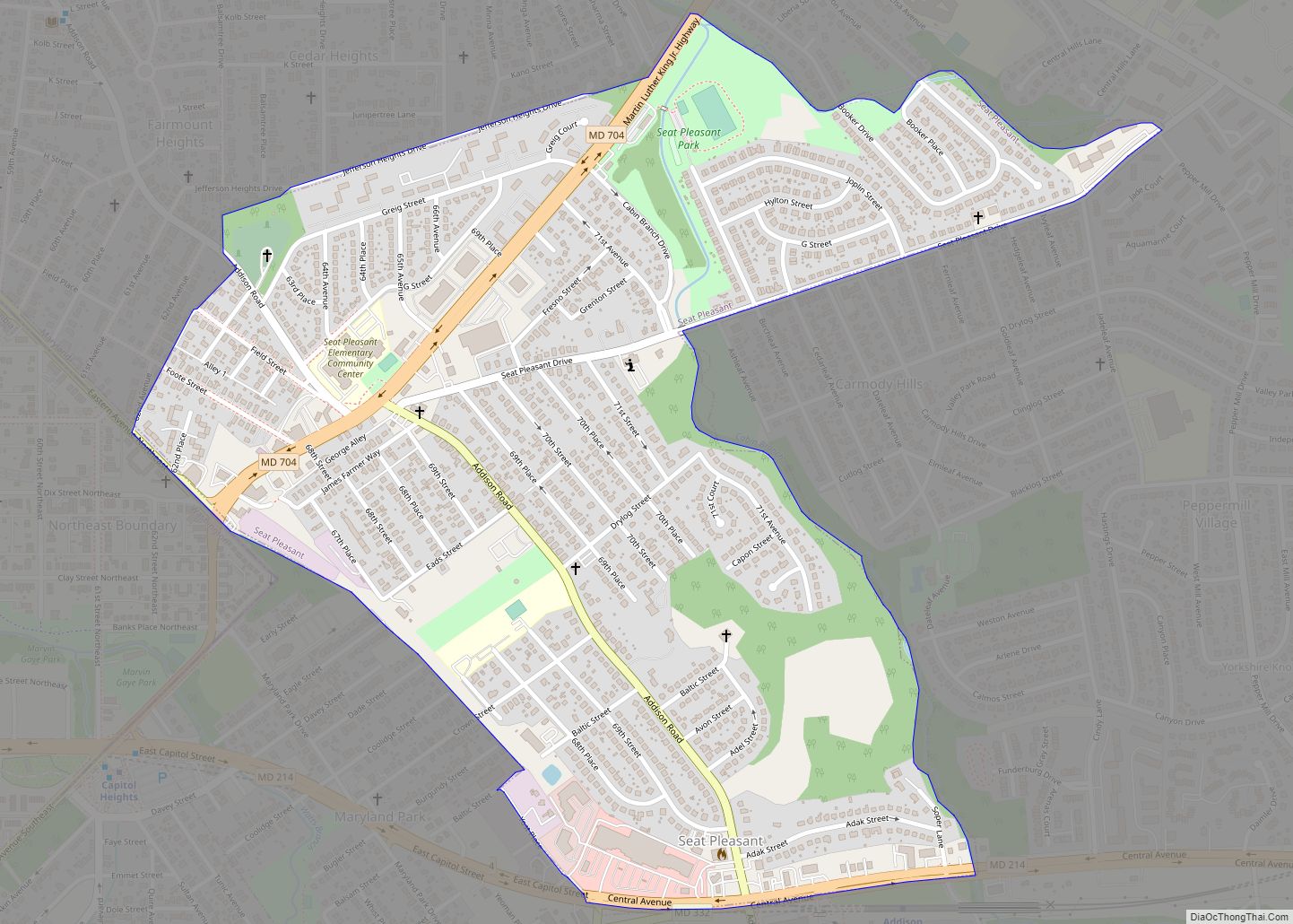
Seat Pleasant is an incorporated city in Prince George’s County, Maryland, United States, located immediately east of Washington. Per the 2020 census, the population was 4,522. Two state highways pass through the community — Maryland routes 704 (now called Martin Luther King Jr. Highway and previously named George Palmer Highway in honor of banker and … Read more

Map of Seabrook CDP, Maryland

Map of Seabrook CDP, Maryland

Seabrook is an unincorporated community and census-designated place (CDP) in Prince George’s County, Maryland, United States, located approximately 12 miles (19 km) east of Washington, D.C.. Per the 2020 census, the population was 19,627. Prior to 2010, Seabrook was part of the Lanham-Seabrook census-designated place. Seabrook CDP overview: Name: Seabrook CDP LSAD Code: 57 LSAD Description: … Read more

Map of Scaggsville CDP

Map of Scaggsville CDP

Scaggsville is an unincorporated community and census-designated place in Howard County, Maryland, United States. It is situated near the southeastern tip of Howard County, between Laurel and Fulton. As of the 2010 census it had a population of 24,333. The town mainly consists of residences, with some commercial establishments. Scaggsville generally falls within ZIP code … Read more

Map of Severna Park CDP

Map of Severna Park CDP

Severna Park is a census-designated place (CDP) in Anne Arundel County, Maryland, United States. Severna Park is part of the Baltimore-Washington Metropolitan Area, and is located approximately 8 miles (13 km) north of Annapolis, 17 miles (27 km) south of Baltimore and 39 miles (63 km) east of Washington, D.C. Severna Park’s population was 39,933 at the 2020 … Read more

Map of Severn CDP

Map of Severn CDP, Maryland

Severn is a census-designated place (CDP) in Anne Arundel County, Maryland, United States. According to the 2020 U.S. census, the population of Severn is 57,118, a 22.6% increase from 44,231 in 2010. The zip code is 21144. Severn CDP overview: Name: Severn CDP LSAD Code: 57 LSAD Description: CDP (suffix) State: Maryland County: Anne Arundel … Read more

Map of Secretary town

Map of Secretary town

Secretary is a town in Dorchester County, Maryland, United States. The population was 535 at the 2010 census. Lord Baltimore named the town after his secretary. Secretary town overview: Name: Secretary town LSAD Code: 43 LSAD Description: town (suffix) State: Maryland County: Dorchester County Incorporated: 1900 Elevation: 20 ft (6 m) Total Area: 0.29 sq mi (0.75 km²) Land Area: … Read more

Map of Sharpsburg town, Maryland

Map of Sharpsburg town, Maryland

Sharpsburg is a town in Washington County, Maryland. The town is approximately 13 miles (21 km) south of Hagerstown. Its population was 705 at the 2010 census. During the American Civil War, the Battle of Antietam, sometimes referred to as the Battle of Sharpsburg, was fought on what is now Antietam National Battlefield, in the vicinity … Read more

Map of Shaft CDP

Map of Shaft CDP

Shaft is a census-designated place (CDP) corresponding to the unincorporated community of Borden Shaft in Allegany County, Maryland, United States. As of the 2010 census, the CDP had a population of 235. It is located south of Frostburg, in the Georges Creek Valley. It lies at an elevation of 1,795 feet (547 m). Borden, or Borden … Read more

Map of Shady Side CDP

Map of Shady Side CDP

Shady Side is a census-designated place (CDP) in Anne Arundel County, Maryland, United States. The population was 5,803 at the 2010 census. Shady Side CDP overview: Name: Shady Side CDP LSAD Code: 57 LSAD Description: CDP (suffix) State: Maryland County: Anne Arundel County Elevation: 9 ft (3 m) Total Area: 7.86 sq mi (20.35 km²) Land Area: 6.65 sq mi (17.22 km²) Water … Read more

Map of Smith Island CDP

Map of Smith Island CDP

Smith Island is a collection of three distinct island communities, Tylerton, Rhodes Point, and Ewell, Maryland on the Chesapeake Bay, on the border of Maryland and Virginia territorial waters in the United States. The island is the last inhabited island in Maryland that is not accessible by vehicle, where most of the islands are eroding … Read more

Map of Silver Hill CDP

Map of Silver Hill CDP

Silver Hill is an unincorporated community and census-designated place (CDP) in Prince George’s County, Maryland, United States, approximately 1 mile (1.6 km) southeast of Washington, D.C. Per the 2020 census, the population was 6,381. Prior to 2010, Silver Hill was part of the Suitland-Silver Hill census-designated place. Silver Hill CDP overview: Name: Silver Hill CDP LSAD … Read more

Map of Sharptown town

Map of Sharptown town

Sharptown is a town in Wicomico County, Maryland, United States. The population was 651 at the 2010 census. It is included in the Salisbury, Maryland-Delaware Metropolitan Statistical Area. Sharptown town overview: Name: Sharptown town LSAD Code: 43 LSAD Description: town (suffix) State: Maryland County: Wicomico County Incorporated: 1874 Elevation: 10 ft (3 m) Total Area: 0.42 sq mi (1.09 km²) … Read more