Severna Park is a census-designated place (CDP) in Anne Arundel County, Maryland, United States. Severna Park is part of the Baltimore-Washington Metropolitan Area, and is located approximately 8 miles (13 km) north of Annapolis, 17 miles (27 km) south of Baltimore and 39 miles (63 km) east of Washington, D.C. Severna Park’s population was 39,933 at the 2020 census.
| Name: | Severna Park CDP |
|---|---|
| LSAD Code: | 57 |
| LSAD Description: | CDP (suffix) |
| State: | Maryland |
| County: | Anne Arundel County |
| Elevation: | 39 ft (12 m) |
| Total Area: | 19.29 sq mi (49.96 km²) |
| Land Area: | 16.53 sq mi (42.82 km²) |
| Water Area: | 2.76 sq mi (7.15 km²) |
| Total Population: | 39,933 |
| Population Density: | 2,415.50/sq mi (932.64/km²) |
| ZIP code: | 21146 |
| Area code: | 410, 443, and 667 |
| FIPS code: | 2471200 |
| GNISfeature ID: | 0591251 |
Online Interactive Map
Click on ![]() to view map in "full screen" mode.
to view map in "full screen" mode.
Severna Park location map. Where is Severna Park CDP?


History
The name Severna Park is rumored to originate from a 1906 contest held by Oscar Hatton while the modern community was first becoming established. The winner would receive a portion of land but controversy arose because the winner was an African-American woman, who was instead rewarded $500. However, extensive research by local historian Nelson Molter found no corroborative evidence for this story, suggesting the naming contest is merely a local myth.
Robinson House was listed on the National Register of Historic Places in 2009. Severna Park was originally named “Boone,” and was a stop along the Baltimore and Annapolis Railroad, which was converted to the B&A Rail Trail in 1990. Severna Park is also home to the Severn School, a private high school established in 1914 by Rolland Teel as a feeder school to the United States Naval Academy, as well as several other old homes and buildings.
In many Slavic languages, Severna means “northern”.
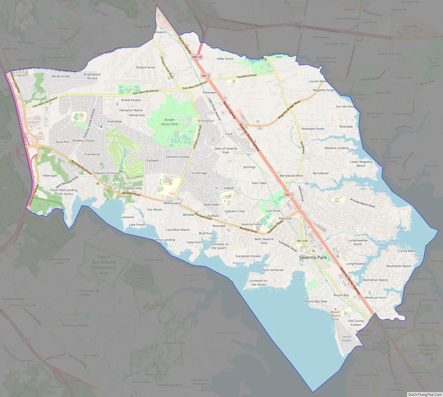
Severna Park Road Map
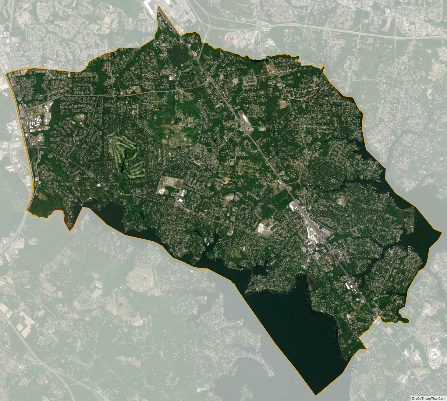
Severna Park city Satellite Map
Geography
Severna Park is located at 39°4′56″N 76°33′56″W / 39.08222°N 76.56556°W / 39.08222; -76.56556 (39.082109, −76.565656), between the eastern shore of the Severn River and northwestern shore of the Magothy River, approximately 17 miles (27 km) south of Baltimore and 39 miles (63 km) east of Washington, D.C. It is bordered to the north by Pasadena, to the east (across the Magothy River) by Lake Shore, to the southeast by Arnold, to the southwest (across the Severn River) by Herald Harbor and Arden on the Severn, and to the west by Gambrills and Millersville.
Severna Park is split by Ritchie Highway (Maryland Route 2), which runs between Baltimore and Annapolis and directly through Severna Park, serving as one of the main thoroughfares in the area. Other main roads include Benfield Road and Baltimore-Annapolis Boulevard (Maryland Route 648). Interstate 97 runs from Annapolis to Baltimore directly west of Severna Park, passing through Millersville. Severna Park is accessible from I-97 via exit 10 to Benfield Boulevard/Veterans Highway.
Severna Park is served by the Maryland Transit Administration’s Route 70. A large portion of the Baltimore & Annapolis Trail also runs through Severna Park. The trail, which is now a bike trail, was originally a rail trail before being converted as part of the East Coast Greenway in 1996. The trail’s headquarters are located on Earleigh Heights Road in Severna Park.
According to the United States Census Bureau, Severna Park has a total area of 19.3 square miles (50.1 km), of which 16.5 square miles (42.7 km) is land and 2.9 square miles (7.4 km), or 14.76%, is water.
See also
Map of Maryland State and its subdivision: Map of other states:- Alabama
- Alaska
- Arizona
- Arkansas
- California
- Colorado
- Connecticut
- Delaware
- District of Columbia
- Florida
- Georgia
- Hawaii
- Idaho
- Illinois
- Indiana
- Iowa
- Kansas
- Kentucky
- Louisiana
- Maine
- Maryland
- Massachusetts
- Michigan
- Minnesota
- Mississippi
- Missouri
- Montana
- Nebraska
- Nevada
- New Hampshire
- New Jersey
- New Mexico
- New York
- North Carolina
- North Dakota
- Ohio
- Oklahoma
- Oregon
- Pennsylvania
- Rhode Island
- South Carolina
- South Dakota
- Tennessee
- Texas
- Utah
- Vermont
- Virginia
- Washington
- West Virginia
- Wisconsin
- Wyoming


