Seat Pleasant is an incorporated city in Prince George’s County, Maryland, United States, located immediately east of Washington. Per the 2020 census, the population was 4,522. Two state highways pass through the community — Maryland routes 704 (now called Martin Luther King Jr. Highway and previously named George Palmer Highway in honor of banker and community leader George Palmer) and 214 (Central Avenue). The Washington Metro’s Blue and Silver Lines are nearby. The Washington Commanders’ stadium is east of Seat Pleasant, near the Capital Beltway (I-95/495).
| Name: | Seat Pleasant city |
|---|---|
| LSAD Code: | 25 |
| LSAD Description: | city (suffix) |
| State: | Maryland |
| County: | Prince George’s County |
| Incorporated: | 1931 |
| Elevation: | 108 ft (33 m) |
| Total Area: | 0.74 sq mi (1.92 km²) |
| Land Area: | 0.74 sq mi (1.92 km²) |
| Water Area: | 0.00 sq mi (0.00 km²) |
| Total Population: | 4,522 |
| Population Density: | 6,094.34/sq mi (2,352.59/km²) |
| ZIP code: | 20743 |
| Area code: | 301, 240 |
| FIPS code: | 2470850 |
| GNISfeature ID: | 0598069 |
Online Interactive Map
Click on ![]() to view map in "full screen" mode.
to view map in "full screen" mode.
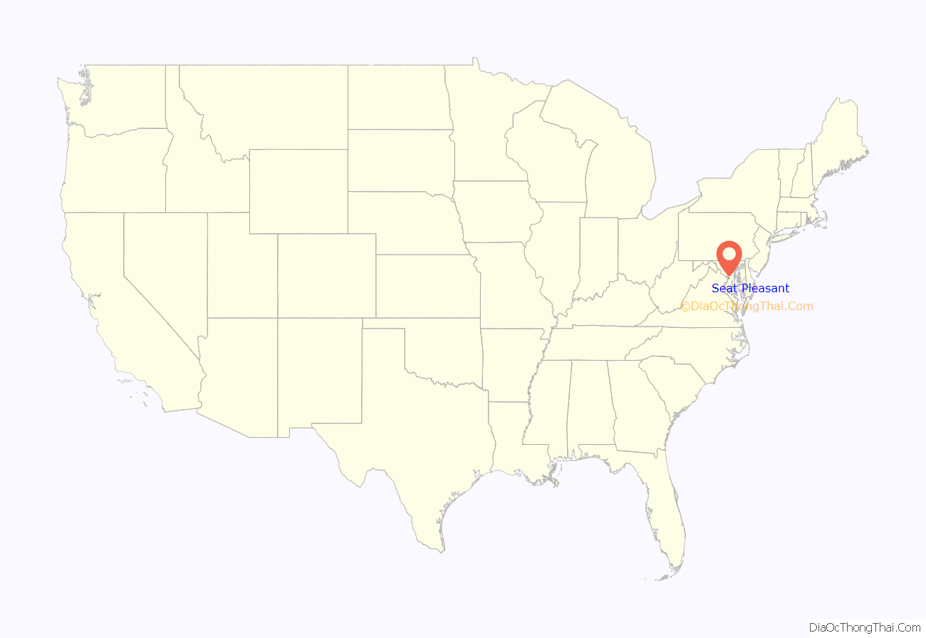
Seat Pleasant location map. Where is Seat Pleasant city?

History
Seat Pleasant is located on part of what had been the Williams-Berry estate. In 1850, the descendants of General Otho Holland Williams, a Revolutionary War hero, and James Berry, a mid-17th-century Puritan leader, sold it to Joseph Gregory. Seat Pleasant was developed on the dairy farm of Joseph Gregory, the farm of the Hill family, and the land of building contractor Francis Carmody, among others. In 1873, some of the land along Addison Road was subdivided into small farms and rural home sites known as Jackson’s Subdivision.
Designers of the Chesapeake Beach Railway, constructed in 1897–99 between Washington, D.C. and Chesapeake Beach, Maryland, located their first station in Maryland outside Washington on the railway’s right-of-way that traversed the Gregory property. They called the station “District Line”. The Columbia Railway Company operated a streetcar system that extended through Northeast Washington and terminated in Seat Pleasant at Eastern Avenue, near what is today Martin Luther King Jr. Highway. Finally, the Washington, Baltimore and Annapolis Electric Railway passed through Seat Pleasant in 1908. In 1906, the growing number of residents in the area around the station adopted a more imaginative name for their community — Seat Pleasant, after the early Williams-Berry estate. Prior to that, the area was known as Chesapeake Junction.
Steady growth of traffic on the railway between 1900 and its peak in 1920 translated into steady development for Seat Pleasant as a railroad suburb. Subdivisions were soon created, such as Seat Pleasant, Seat Pleasant Heights, Oakmont, Palmer’s, Boyer’s Addition, and Pleasant Hills. By 1915, two churches had been organized, and a fire department had been founded. The introduction of street lighting followed in 1918. When the community was incorporated as a town in 1931, it had a school, water company, sewer connections courtesy of the District of Columbia’s sanitary system, and reliable fire protection by the Seat Pleasant Fire and Community Welfare Association. The Chesapeake Beach Railway ceased operations in 1935. In the 1980s, the old railroad roundhouse and turntable were demolished to make room for the Addison Plaza Shopping Center on Central Avenue.
Post-World War II state highway construction spurred further development. Construction of “affordable” housing, notably the Gregory Estates apartments in 1949, was the catalyst for the migration of African-American families from the District of Columbia; before that time, the community had been all white. The right of way of the former Washington, Baltimore and Annapolis Electric Railway was utilized in the early 1940s for the George Palmer Highway, later renamed the Martin Luther King Jr. Highway. The Addison Road Metro station opened for service on November 22, 1980.
Most of the testaments to the town’s past are long gone. Two that remain are the Episcopal Addison Chapel (1809) and Mount Victory Baptist Church (1908).
Seat Pleasant’s crime rate is higher than the national average. The violent crime rate, while still above average, has improved in recent years, dropping from 768.6 in 2003 to 272.2 in 2011.
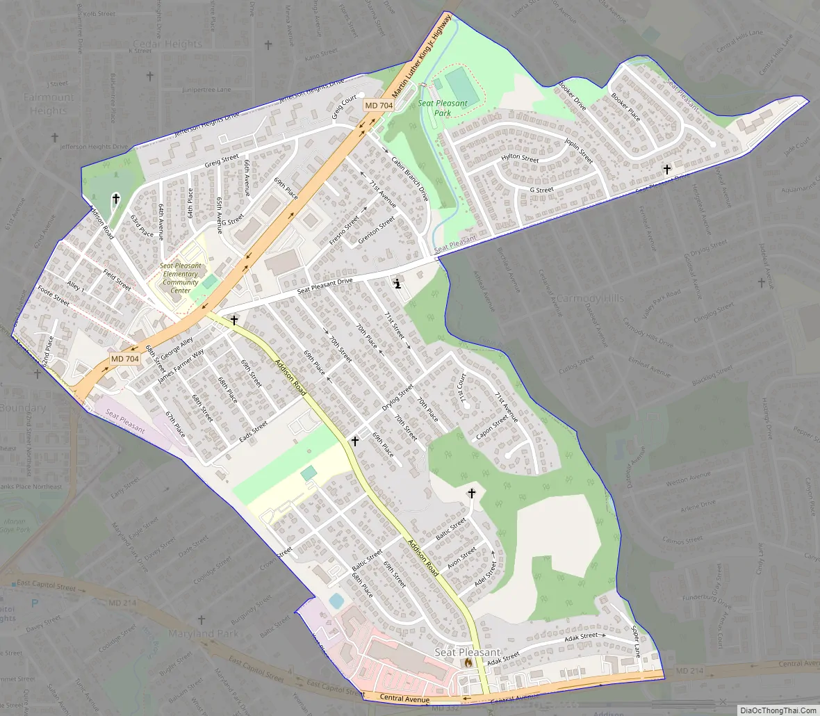
Seat Pleasant Road Map
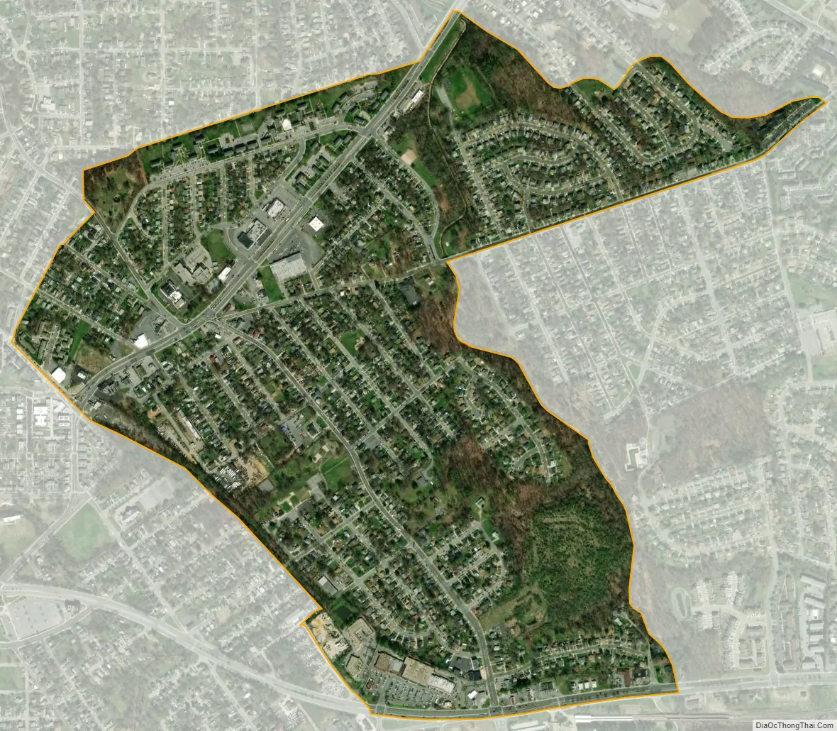
Seat Pleasant city Satellite Map
Geography
Seat Pleasant is located at 38°53′43″N 76°54′8″W / 38.89528°N 76.90222°W / 38.89528; -76.90222 (38.895362, -76.902205).
According to the United States Census Bureau, the city has a total area of 0.73 square miles (1.89 km), all land.
See also
Map of Maryland State and its subdivision: Map of other states:- Alabama
- Alaska
- Arizona
- Arkansas
- California
- Colorado
- Connecticut
- Delaware
- District of Columbia
- Florida
- Georgia
- Hawaii
- Idaho
- Illinois
- Indiana
- Iowa
- Kansas
- Kentucky
- Louisiana
- Maine
- Maryland
- Massachusetts
- Michigan
- Minnesota
- Mississippi
- Missouri
- Montana
- Nebraska
- Nevada
- New Hampshire
- New Jersey
- New Mexico
- New York
- North Carolina
- North Dakota
- Ohio
- Oklahoma
- Oregon
- Pennsylvania
- Rhode Island
- South Carolina
- South Dakota
- Tennessee
- Texas
- Utah
- Vermont
- Virginia
- Washington
- West Virginia
- Wisconsin
- Wyoming


