Map of Omer city
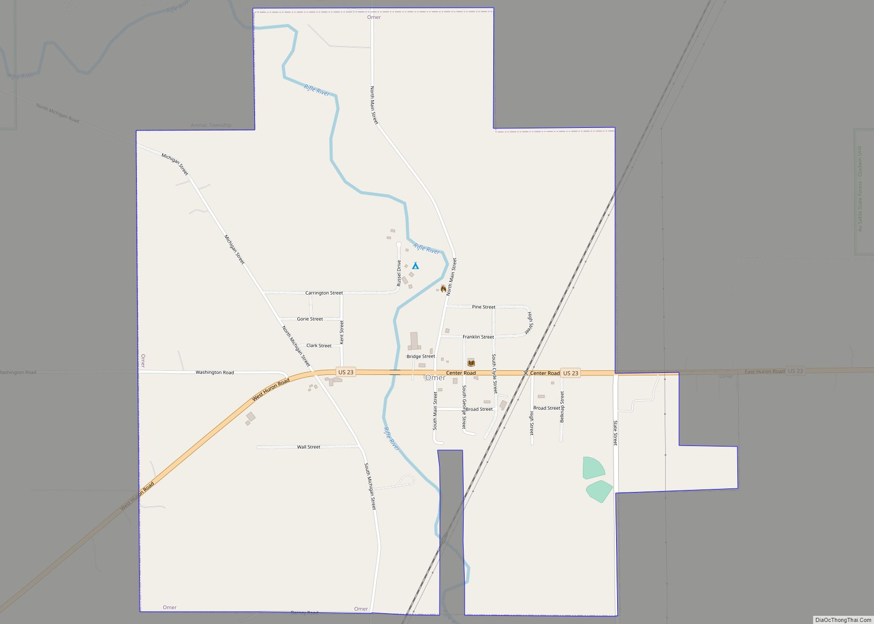
Omer is a city in Arenac County in the U.S. state of Michigan. The population was 274 at the 2020 census, which ranks it as the least-populated city in the state. Omer is consistently ranked as “Michigan’s Smallest City” in terms of population, although the city of Lake Angelus held this distinction when it recorded ... Read more
Map of Omer city
Map of Omena CDP
Omena (/ˈoʊmiːnə/ oh-MEE-nə) is a small unincorporated community and census-designated place (CDP) in Leelanau Township of Leelanau County in the U.S. state of Michigan. As of the 2020 census it had a population of 295. Overlooking Omena Bay, on the western side of Grand Traverse Bay, Omena is home to wineries and farms including a ... Read more
Map of Omena CDP
Map of Olivet city, Michigan
Olivet is a city in Eaton County in the U.S. state of Michigan. The population was 1,605 at the 2010 census. Olivet College is located in the city. Olivet city overview: Name: Olivet city LSAD Code: 25 LSAD Description: city (suffix) State: Michigan County: Eaton County Founded: 1844 Elevation: 919 ft ( m) Total Area: 1.02 sq mi (2.65 km²) ... Read more
Map of Olivet city, Michigan
Map of Oscoda CDP
Oscoda (/ɒˈskoʊdə/ ah-SKOH-də) is an unincorporated community and census-designated place (CDP) in Iosco County in the U.S. state of Michigan. The CDP had a population of 916 at the 2020 census. The community is located within Au Sable Township and Oscoda Township at the mouth of the Au Sable River along Lake Huron. Oscoda CDP ... Read more
Map of Oscoda CDP
Map of Ortonville village, Michigan
Ortonville is a village in north Oakland County in the U.S. state of Michigan. The village is within Brandon Township, although some development near the village lies within adjacent Oakland County, Groveland township and Lapeer County, Hadley township. The population was 1,442 at the 2010 census. Ortonville lies on the northern edge of Metro Detroit ... Read more
Map of Ortonville village, Michigan
Map of Orchard Lake Village city
Orchard Lake Village is a city in Oakland County in the U.S. state of Michigan. The population was 2,375 at the 2010 census. A northern suburb of Metro Detroit, Orchard Lake Village is located about 3 miles (4.8 km) southwest of the city of Pontiac and 16 miles (25.7 km) northwest of the city of Detroit. The ... Read more
Map of Orchard Lake Village city
Map of Ontonagon village
Ontonagon (/ˌɒntəˈnɑːɡən/ ON-tə-NAH-gən) is a village in the Upper Peninsula of the U.S. state of Michigan. The population was 1,285 at the 2020 census. It is the county seat and only village of Ontonagon County. The village is located within Ontonagon Township, at the mouth of the Ontonagon River on Lake Superior. Industry was centered ... Read more
Map of Ontonagon village
Map of Onsted village
Onsted is a village within Lenawee County in the U.S. state of Michigan. The village had a population of 917 at the 2010 census. Located within the Irish Hills region, the village is part of Cambridge Township. Onsted was first settled in 1883 and named after early settler John Onsted. The community incorporated as a ... Read more
Map of Onsted village
Map of Otisville village, Michigan
Otisville is a village in Forest Township, Genesee County in the U.S. state of Michigan. The population was 864 at the 2010 census. It is located along M-15, just south of M-57. Otisville village overview: Name: Otisville village LSAD Code: 47 LSAD Description: village (suffix) State: Michigan County: Genesee County Incorporated: 1877 Elevation: 814 ft (248 m) ... Read more
Map of Otisville village, Michigan
Map of Ossineke CDP
Ossineke is an unincorporated community and census-designated place in Alpena County in the U.S. state of Michigan. The population was 938 at the 2010 census. The community is located within Sanborn Township, several miles south of Alpena on U.S. Highway 23. The name is derived from the Anishinaabe word (either the Ojibwa or the Ottawa) ... Read more
Map of Ossineke CDP
Map of Ovid city, Michigan
Ovid is a city in the U.S. state of Michigan. Nearly all of the city is located within Clinton County with only a very small portion extending east into Shiawassee County. The population was 1,603 at the 2010 census. The city is located along M-21, about 9 miles (14 km) east of St. Johns and about ... Read more
Map of Ovid city, Michigan
Map of Otter Lake village
Otter Lake is a village in the U.S. state of Michigan. Approximately half of the village lies in Marathon Township in Lapeer County and half in Forest Township in Genesee County. The population was 389 at the 2010 census. The village is named after the nearby body of water which had numerous otters. Otter Lake ... Read more
Map of Otter Lake village