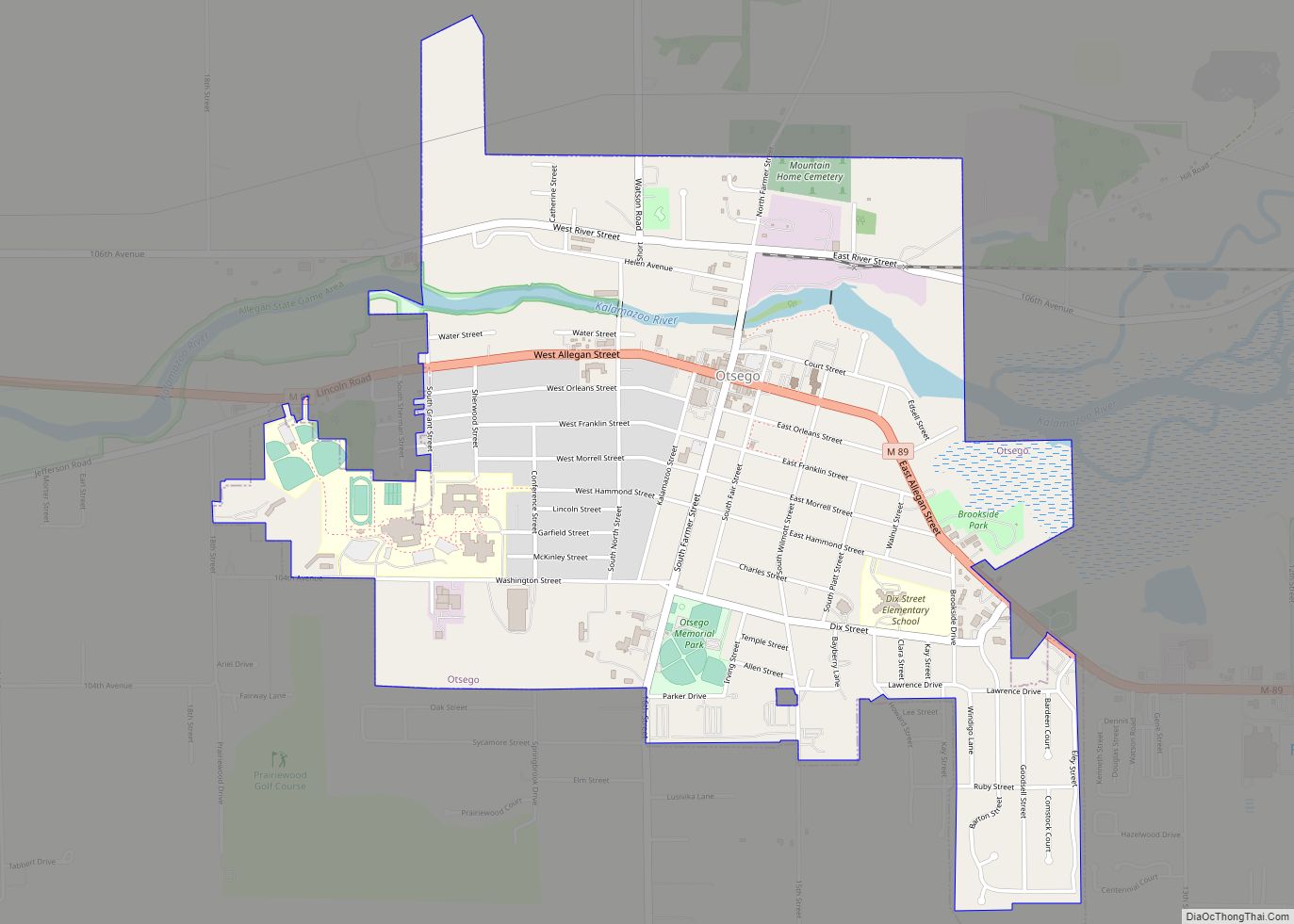
Map of Ossineke CDP

Map of Ossineke CDP

Ossineke is an unincorporated community and census-designated place in Alpena County in the U.S. state of Michigan. The population was 938 at the 2010 census. The community is located within Sanborn Township, several miles south of Alpena on U.S. Highway 23. The name is derived from the Anishinaabe word (either the Ojibwa or the Ottawa) … Read more

Map of Parchment city

Map of Parchment city

Parchment is a city in Kalamazoo County in the U.S. state of Michigan. The 2010 census recorded a population of 1,804. The name is derived from the parchment company that used to manufacture paper on the East bank of the Kalamazoo River. Parchment is located just northeast of the city of Kalamazoo, and it is … Read more

Map of Palmer CDP, Michigan

Map of Palmer CDP, Michigan

Palmer is an unincorporated community in Marquette County in the U.S. state of Michigan. It is a census-designated place (CDP) for statistical purposes and has no legal status as an incorporated municipality. The CDP had a population of 378 at the 2020 census. It is located within Richmond Township along M-35. The Palmer 49871 ZIP … Read more

Map of Oxford village, Michigan

Map of Oxford village, Michigan

Oxford is a village in Oakland County in the U.S. state of Michigan. The population was 3,436 at the 2010 census. The village is located within Oxford Township. Located about 30 miles (48 km) north of Detroit, it is a northern suburb of the Metro Detroit region. Oxford village overview: Name: Oxford village LSAD Code: 47 … Read more

Map of Owosso city

Map of Owosso city

Owosso is the largest city in Shiawassee County in the U.S. state of Michigan. The population was 15,194 at the 2010 census. The city is mostly surrounded by Owosso Township on its west, but the two are administered autonomously. The city was named after Chief Wosso, an Ojibwe leader of the Shiawassee area. Owosso city … Read more

Map of Owendale village

Map of Owendale village

Owendale is a village in Huron County of the U.S. state of Michigan. The population was 241 at the 2010 census. The village is within Brookfield Township. Owendale village overview: Name: Owendale village LSAD Code: 47 LSAD Description: village (suffix) State: Michigan County: Huron County Elevation: 640 ft (195 m) Total Area: 0.74 sq mi (1.93 km²) Land Area: 0.74 sq mi … Read more

Map of Parkdale CDP, Michigan

Map of Parkdale CDP, Michigan

Parkdale is an unincorporated community and census-designated place located within Manistee Township, Manistee County, Michigan, United States. Its population was 704 as of the 2010 census. The community is in the southwest corner of the township, on the northern edge of Manistee Lake where the Manistee River enters the lake. It is on US 31 … Read more

Map of Pearl Beach CDP

Map of Pearl Beach CDP

Pearl Beach is an unincorporated community in St. Clair County in the U.S. state of Michigan. Located in Clay Township, it is a census-designated place (CDP) used for statistical purposes. The population was 3,224 at the 2000 census. Pearl Beach CDP overview: Name: Pearl Beach CDP LSAD Code: 57 LSAD Description: CDP (suffix) State: Michigan … Read more

Map of Paw Paw village, Michigan

Map of Paw Paw village, Michigan

Paw Paw is a village in the U.S. state of Michigan. The population was 3,534 at the 2010 census. It is the county seat of Van Buren County. Paw Paw village overview: Name: Paw Paw village LSAD Code: 47 LSAD Description: village (suffix) State: Michigan County: Van Buren County Elevation: 732 ft (223 m) Total Area: 2.89 sq mi … Read more

Map of Paw Paw Lake CDP

Map of Paw Paw Lake CDP

Paw Paw Lake is an unincorporated community in Berrien County in the U.S. state of Michigan. It is a census-designated place (CDP) for statistical purposes, without legal status as a municipality. The community is located within areas of both Coloma Charter Township and Watervliet Township in the area surrounding Paw Paw Lake and Little Paw … Read more

Map of Parma village, Michigan

Map of Parma village, Michigan

Parma is a village in Jackson County in the U.S. state of Michigan. The population was 769 at the 2010 census. The village is divided into three sections with boundaries in Parma Township and Sandstone Charter Township. Parma village overview: Name: Parma village LSAD Code: 47 LSAD Description: village (suffix) State: Michigan County: Jackson County … Read more

Map of Perry city, Michigan

Map of Perry city, Michigan

Perry is a city in Shiawassee County in the U.S. state of Michigan. The population was 2,188 at the 2010 census. The city is surrounded by Perry Township, but the two are administered autonomously. Perry city overview: Name: Perry city LSAD Code: 25 LSAD Description: city (suffix) State: Michigan County: Shiawassee County Incorporated: 1893 (village)1964 … Read more