Map of Bridgeport CDP, Michigan

Map of Bridgeport CDP, Michigan

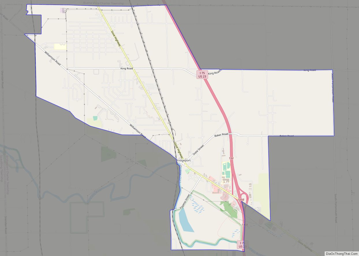
Bridgeport is an unincorporated community in Bridgeport Charter Township, Saginaw County in the U.S. state of Michigan. It is also a census-designated place (CDP) for statistical purposes. The population was 6,571 at the 2020 census. Bridgeport is also the name of a post office with ZIP code 48722. The area served by the ZIP code … Read more

Map of Brethren CDP

Map of Brethren CDP

Brethren is an unincorporated community and census-designated place in Dickson Township, Manistee County, Michigan, United States. Its population was 410 as of the 2010 census. The community is located in the Manistee National Forest roughly 15 miles (24 km) east of Manistee. Brethren has a post office with ZIP code 49619. According to the U.S. Census … Read more

Map of Breedsville village

Map of Breedsville village

Breedsville is a village in Van Buren County of the U.S. state of Michigan. The population was 199 at the 2010 census. The village is within Columbia Township. Breedsville village overview: Name: Breedsville village LSAD Code: 47 LSAD Description: village (suffix) State: Michigan County: Van Buren County Elevation: 666 ft (203 m) Total Area: 0.67 sq mi (1.72 km²) Land … Read more

Map of Breckenridge village, Michigan

Map of Breckenridge village, Michigan

Breckenridge is a village in Gratiot County in the U.S. state of Michigan. The population was 1,328 at the 2010 census. The village is located in Wheeler Township. Breckenridge village overview: Name: Breckenridge village LSAD Code: 47 LSAD Description: village (suffix) State: Michigan County: Gratiot County Incorporated: 1908 Elevation: 735 ft (224 m) Total Area: 1.07 sq mi (2.76 km²) … Read more

Map of Brown City city

Map of Brown City

Brown City is a city in Lapeer and Sanilac counties in the U.S. state of Michigan. The population was 1,325 at the 2010 census. The city is located almost exclusively in Sanilac County, with only a small portion of the city extending into Lapeer County. Brown City overview: Name: Brown City LSAD Code: 25 LSAD … Read more

Map of Brooklyn village, Michigan

Map of Brooklyn village, Michigan

Brooklyn is a village in Jackson County in the U.S. state of Michigan. The population was 1,206 at the 2010 census. It is located in the Irish Hills region of southern Michigan, just north of U.S. Route 12 along M-50. The village is located within Columbia Township. The village is well known for its proximity … Read more

Map of Bronson city, Michigan

Map of Bronson city, Michigan

Bronson is a city located in west central Branch County in the U.S. state of Michigan. The population was 2,349 at the 2010 census. Bronson is situated on U.S. Highway 12 about 12 miles (19 km) southwest of Coldwater. The ZIP code is 49028 and the FIPS place code is 10860. The city is located within … Read more

Map of Britton village

Map of Britton village, Michigan

Britton is a village in Lenawee County in the U.S. state of Michigan. The population was 586 at the 2010 census. The village is located within Ridgeway Township. Britton village overview: Name: Britton village LSAD Code: 47 LSAD Description: village (suffix) State: Michigan County: Lenawee County Elevation: 699 ft (213 m) Total Area: 0.79 sq mi (2.05 km²) Land Area: … Read more

Map of Brighton city, Michigan

Map of Brighton city, Michigan

Brighton is a city in the Detroit metropolitan area in southeastern Livingston County, Michigan, United States. As of the 2020 census, the city population was 7,446. Brighton forms part of the South Lyon-Howell-Brighton Urban Area. It is one of two incorporated cities in Livingston County, and incorporates land that was part of Brighton, Green Oak … Read more

Map of Buena Vista CDP, Michigan

Map of Buena Vista CDP, Michigan

Buena Vista (/ˌbjuːnəˈvɪstə/ BEW-nə-VIS-tə) is an unincorporated community and census-designated place within Buena Vista Charter Township, Saginaw County in the U.S. state of Michigan. The U.S. Census Bureau has defined a census-designated place (CDP) with the same name for statistical purposes. The CDP has no official status as a municipality and the boundaries defined by … Read more

Map of Buckley village, Michigan

Map of Buckley village, Michigan

Buckley is a village in Wexford County in the U.S. state of Michigan. The population was 775 at the 2020 census. The village is located within Hanover Township. Buckley village overview: Name: Buckley village LSAD Code: 47 LSAD Description: village (suffix) State: Michigan County: Wexford County Founded: 1905 Incorporated: 1907 Elevation: 1,050 ft (320 m) Total Area: … Read more

Map of Buchanan city, Michigan

Map of Buchanan city, Michigan

Buchanan is a city in Berrien County in the U.S. state of Michigan. The population was 4,456 at the 2010 census. The city is located at the southeast corner of Buchanan Township, about 5 miles (8.0 km) west of Niles. Buchanan city overview: Name: Buchanan city LSAD Code: 25 LSAD Description: city (suffix) State: Michigan County: … Read more