Map of Grand Marais city
Grand Marais (/ˌɡrænd məˈreɪ/ GRAND mə-RAY) is a city and the county seat of Cook County, Minnesota, United States, of which it is the only municipality. It is on Lake Superior’s North Shore. Grand Marais had a population of 1,337 at the 2020 census. Before it was settled by French Canadians and before Minnesota’s statehood, ... Read more
Map of Grand Marais city
Map of Granada city, Minnesota
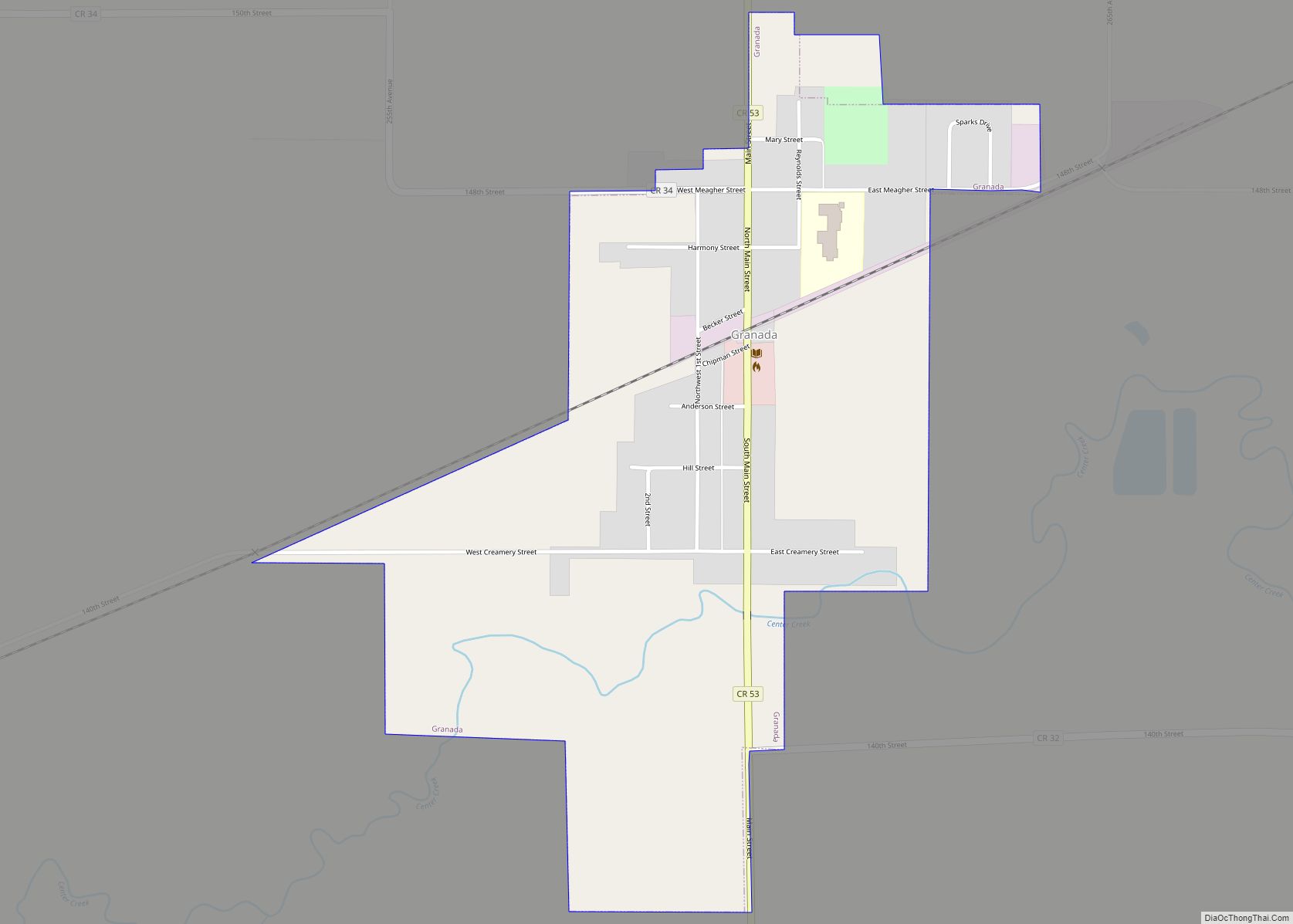
Granada (/ɡrəˈneɪdə/ grə-NAY-də) is a city in Martin County, Minnesota, United States. Continuously populated since the late 19th century and booming during World War II, the population declined significantly thereafter and was recorded at 303 as of the 2010 census. Granada city overview: Name: Granada city LSAD Code: 25 LSAD Description: city (suffix) State: Minnesota ... Read more
Map of Granada city, Minnesota
Map of Greenfield city, Minnesota
Greenfield is a city in northwestern Hennepin County, Minnesota. It has a population of 2,903 residents, according to the 2020 United States Census, and is located 26.5 miles northwest of Minneapolis. It is part of the Twin Cities Metropolitan Statistical Area. Greenfield city overview: Name: Greenfield city LSAD Code: 25 LSAD Description: city (suffix) State: ... Read more
Map of Greenfield city, Minnesota
Map of Greenbush city, Minnesota
Greenbush is a city in Roseau County, Minnesota, United States. The population was 719 at the 2010 census. Minnesota State Highways 11 and 32 are two of the main arterial routes in the community. Greenbush city overview: Name: Greenbush city LSAD Code: 25 LSAD Description: city (suffix) State: Minnesota County: Roseau County Elevation: 1,076 ft (328 m) ... Read more
Map of Greenbush city, Minnesota
Map of Green Isle city
Green Isle is a city in Sibley County, Minnesota, United States. The population was 522 at the 2020 census. Green Isle city overview: Name: Green Isle city LSAD Code: 25 LSAD Description: city (suffix) State: Minnesota County: Sibley County Elevation: 1,004 ft (306 m) Total Area: 1.02 sq mi (2.65 km²) Land Area: 1.01 sq mi (2.63 km²) Water Area: 0.01 sq mi (0.02 km²) Total ... Read more
Map of Green Isle city
Map of Grasston city
Grasston is a city in Kanabec County, Minnesota, United States. The population was 158 at the 2010 census. Grasston city overview: Name: Grasston city LSAD Code: 25 LSAD Description: city (suffix) State: Minnesota County: Kanabec County Elevation: 968 ft (295 m) Total Area: 0.97 sq mi (2.51 km²) Land Area: 0.93 sq mi (2.42 km²) Water Area: 0.04 sq mi (0.09 km²) Total Population: 154 Population ... Read more
Map of Grasston city
Map of Grant city, Minnesota
Grant is a city in Washington County, Minnesota, and a suburb of St. Paul. The population was 4,096 at the time of the 2010 census. Grant city overview: Name: Grant city LSAD Code: 25 LSAD Description: city (suffix) State: Minnesota County: Washington County Elevation: 1,011 ft (308 m) Total Area: 26.50 sq mi (68.64 km²) Land Area: 25.08 sq mi (64.96 km²) Water ... Read more
Map of Grant city, Minnesota
Map of Granite Falls city, Minnesota
Granite Falls is a city located mostly in Yellow Medicine County, Minnesota, of which it is the county seat with a small portion in Chippewa County, Minnesota. The population was 2,737 at the 2020 census. The Andrew John Volstead House, a National Historic Landmark, is located in Granite Falls. Granite Falls city overview: Name: Granite ... Read more
Map of Granite Falls city, Minnesota
Map of Grand Rapids city, Minnesota
Grand Rapids is a city in Itasca County, Minnesota, United States, and it is the county seat. The population was 11,126 at the 2020 census. The city is named for the 3.5-mile (5.6 km) long rapids in the Mississippi River which was the uppermost limit of practical steamboat travel during the late 19th century. Today the ... Read more
Map of Grand Rapids city, Minnesota
Map of Hallock city
Hallock (/ˈhælɒk/ HAL-ok) is a city in and the county seat of Kittson County, Minnesota, United States. The population was 906 at the 2020 census. Hallock city overview: Name: Hallock city LSAD Code: 25 LSAD Description: city (suffix) State: Minnesota County: Kittson County Founded: 1879 Incorporated: 1887 Elevation: 817 ft (249 m) Total Area: 2.20 sq mi (5.69 km²) Land ... Read more
Map of Hallock city
Map of Hadley city, Minnesota
Hadley (/ˈhædliː/ (listen), HAD-lee) is a city in Murray County, Minnesota, United States. The population was 61 at the 2010 census. Hadley city overview: Name: Hadley city LSAD Code: 25 LSAD Description: city (suffix) State: Minnesota County: Murray County Elevation: 1,686 ft (514 m) Total Area: 0.41 sq mi (1.06 km²) Land Area: 0.29 sq mi (0.76 km²) Water Area: 0.11 sq mi (0.30 km²) Total ... Read more
Map of Hadley city, Minnesota
Map of Hackensack city, Minnesota
Hackensack is a city in Cass County, Minnesota, United States. The population was 313 at the 2010 census. It is part of the Brainerd Micropolitan Statistical Area. Hackensack city overview: Name: Hackensack city LSAD Code: 25 LSAD Description: city (suffix) State: Minnesota County: Cass County Elevation: 1,391 ft (424 m) Total Area: 1.03 sq mi (2.67 km²) Land Area: 1.02 sq mi ... Read more
Map of Hackensack city, Minnesota