Grand Rapids is a city in Itasca County, Minnesota, United States, and it is the county seat. The population was 11,126 at the 2020 census. The city is named for the 3.5-mile (5.6 km) long rapids in the Mississippi River which was the uppermost limit of practical steamboat travel during the late 19th century. Today the rapids are hidden below the dam of UPM Paper Company.
| Name: | Grand Rapids city |
|---|---|
| LSAD Code: | 25 |
| LSAD Description: | city (suffix) |
| State: | Minnesota |
| County: | Itasca County |
| Elevation: | 1,289 ft (393 m) |
| Total Area: | 24.46 sq mi (63.36 km²) |
| Land Area: | 22.57 sq mi (58.46 km²) |
| Water Area: | 1.89 sq mi (4.90 km²) |
| Total Population: | 11,126 |
| Population Density: | 492.91/sq mi (190.32/km²) |
| ZIP code: | 55744 |
| Area code: | 218 |
| FIPS code: | 2725118 |
| GNISfeature ID: | 0656428 |
| Website: | cityofgrandrapidsmn.com |
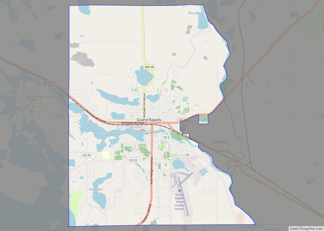
Online Interactive Map
Click on ![]() to view map in "full screen" mode.
to view map in "full screen" mode.
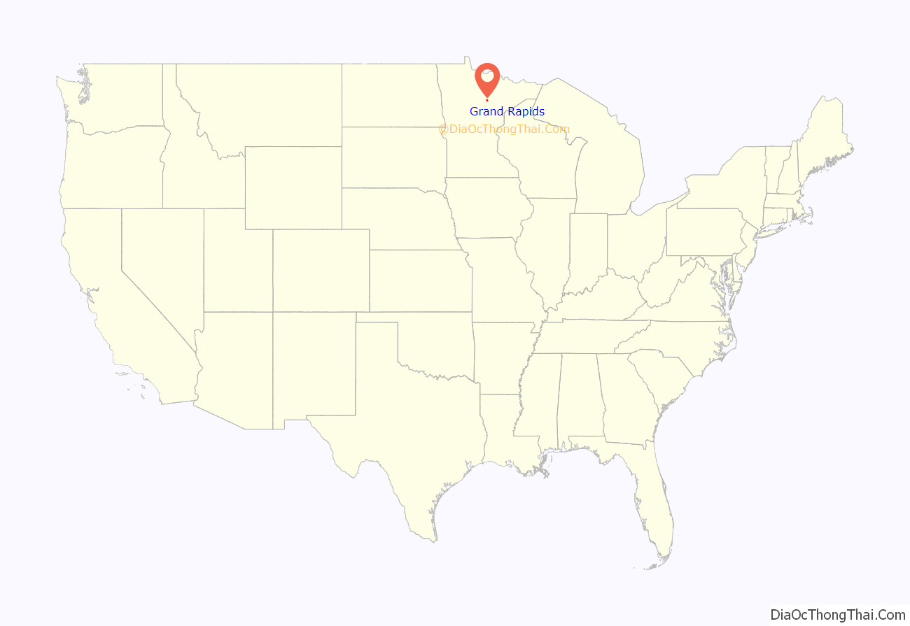
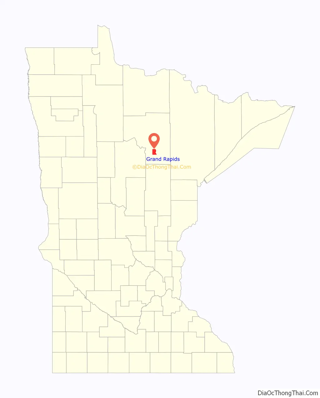
Grand Rapids location map. Where is Grand Rapids city?
History
Grand Rapids became a logging town, as the Mississippi River provided an optimal method of log shipment to population centers. Blandin paper mill opened in 1902. The Forest History Center is a State Historic Site and a living history museum that recreates life as it was in a turn of the 20th century logging camp. Costumed interpreters guide visitors through a recreated circa 1890s logging camp to educate the public on the history of white pine logging and its relevance to today’s economy. Miles of nature trails, educational naturalist programming, and an interpretive museum are also located on the site.
Old Central School, located in downtown Grand Rapids, was built in 1895 in the Richardsonian Romanesque style of architecture. The three story building served as an elementary school from 1895 to 1972. A community effort restored the building in 1984 and it now serves as a location for commerce and is listed on the National Register of Historic Places.
In 1991 Enbridge’s Line 3 pipeline ruptured, spilling 1.7 million of gallons of oil into the area, including the Prairie River, in the largest inland oil spill in US history.
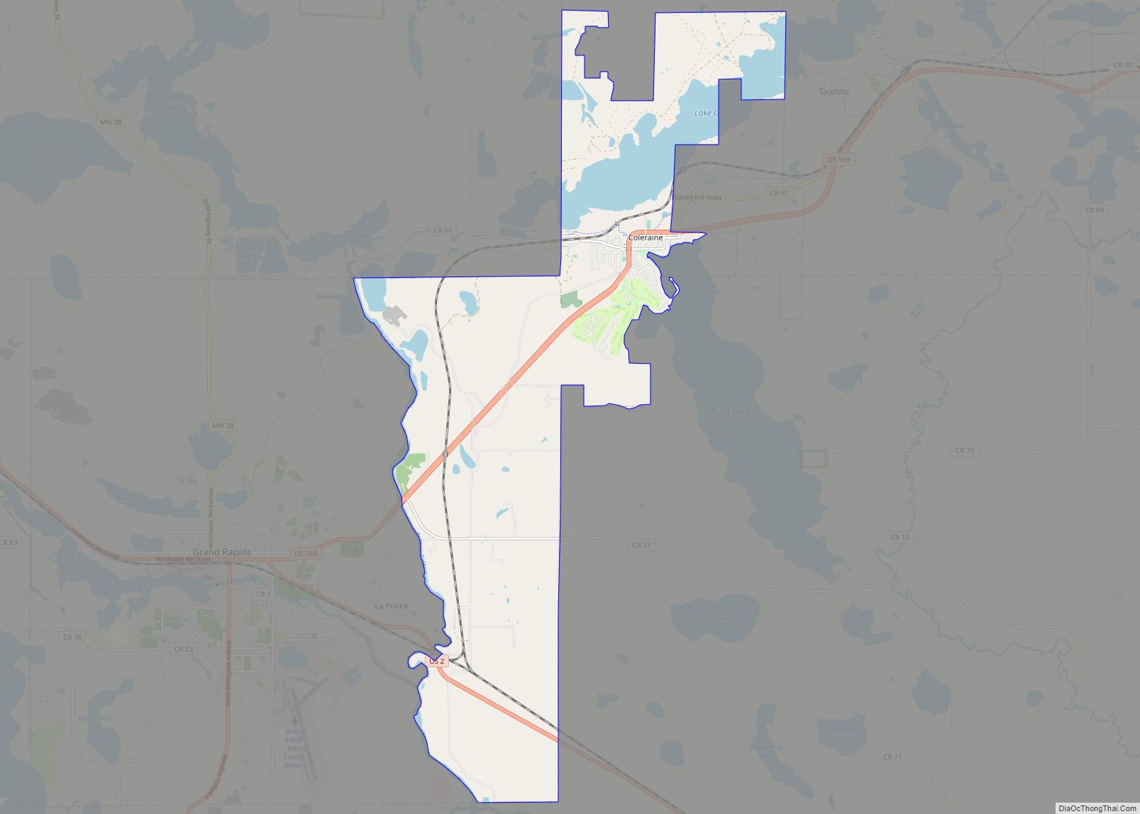
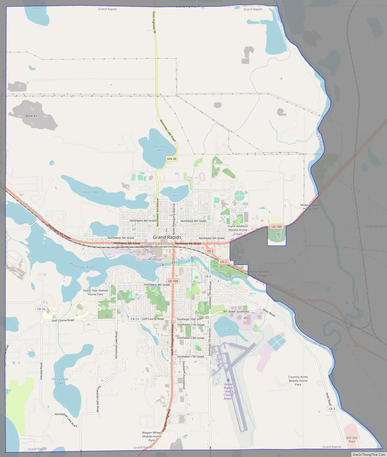
Grand Rapids Road Map
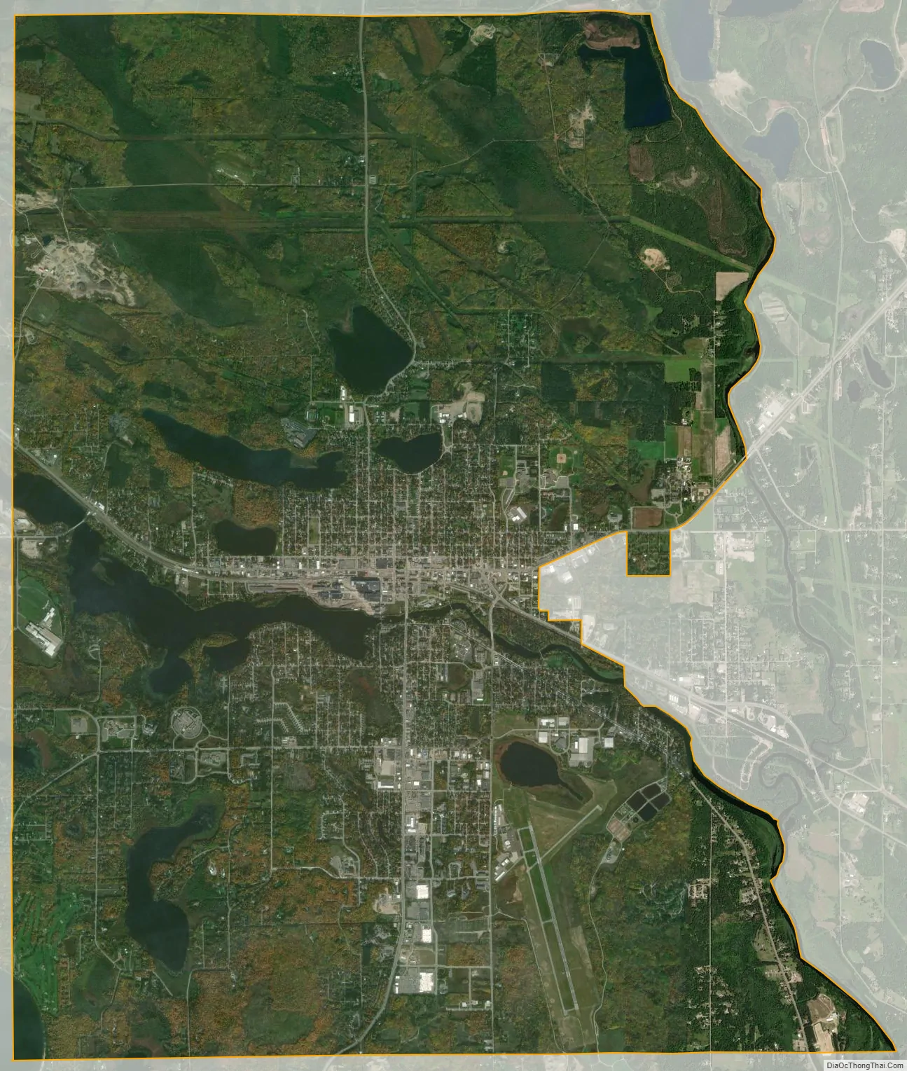
Grand Rapids city Satellite Map
Geography
According to the United States Census Bureau, the city has a total area of 24.44 square miles (63.30 km), of which 22.56 square miles (58.43 km) is land and 1.88 square miles (4.87 km) is water.
Major highways
The city of Grand Rapids sits at the junction of U.S. Highways 2 and 169. U.S. Highway 2 runs west towards Bemidji and east towards Duluth. U.S. Highway 169 heads south to Hill City, and ultimately towards the city of Minneapolis. In the opposite direction, U.S. Highway 169 heads up the Mesabi Range passing through Hibbing and several smaller towns along the way until it reaches the city of Virginia. Grand Rapids is also the starting point of State Highway 38, designated a National Scenic Byway by the USDOT, and marked as the Edge of the Wilderness Scenic Byway as it travels toward Effie. The following routes are located within the city of Grand Rapids.
- U.S. Highway 2
- U.S. Highway 169
- Minnesota State Highway 38 – Edge of the Wilderness Scenic Byway
Climate
The city of Grand Rapids has a Humid continental climate (Köppen Climate Classification Dfb) with warm summers and long, cold winters, typical of its location on the Mesabi Iron Range.
See also
Map of Minnesota State and its subdivision:- Aitkin
- Anoka
- Becker
- Beltrami
- Benton
- Big Stone
- Blue Earth
- Brown
- Carlton
- Carver
- Cass
- Chippewa
- Chisago
- Clay
- Clearwater
- Cook
- Cottonwood
- Crow Wing
- Dakota
- Dodge
- Douglas
- Faribault
- Fillmore
- Freeborn
- Goodhue
- Grant
- Hennepin
- Houston
- Hubbard
- Isanti
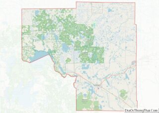
- Itasca
- Jackson
- Kanabec
- Kandiyohi
- Kittson
- Koochiching
- Lac qui Parle
- Lake
- Lake of the Woods
- Lake Superior
- Le Sueur
- Lincoln
- Lyon
- Mahnomen
- Marshall
- Martin
- McLeod
- Meeker
- Mille Lacs
- Morrison
- Mower
- Murray
- Nicollet
- Nobles
- Norman
- Olmsted
- Otter Tail
- Pennington
- Pine
- Pipestone
- Polk
- Pope
- Ramsey
- Red Lake
- Redwood
- Renville
- Rice
- Rock
- Roseau
- Saint Louis
- Scott
- Sherburne
- Sibley
- Stearns
- Steele
- Stevens
- Swift
- Todd
- Traverse
- Wabasha
- Wadena
- Waseca
- Washington
- Watonwan
- Wilkin
- Winona
- Wright
- Yellow Medicine
- Alabama
- Alaska
- Arizona
- Arkansas
- California
- Colorado
- Connecticut
- Delaware
- District of Columbia
- Florida
- Georgia
- Hawaii
- Idaho
- Illinois
- Indiana
- Iowa
- Kansas
- Kentucky
- Louisiana
- Maine
- Maryland
- Massachusetts
- Michigan
- Minnesota
- Mississippi
- Missouri
- Montana
- Nebraska
- Nevada
- New Hampshire
- New Jersey
- New Mexico
- New York
- North Carolina
- North Dakota
- Ohio
- Oklahoma
- Oregon
- Pennsylvania
- Rhode Island
- South Carolina
- South Dakota
- Tennessee
- Texas
- Utah
- Vermont
- Virginia
- Washington
- West Virginia
- Wisconsin
- Wyoming