Map of Lauderdale CDP, Mississippi

Map of Lauderdale CDP, Mississippi

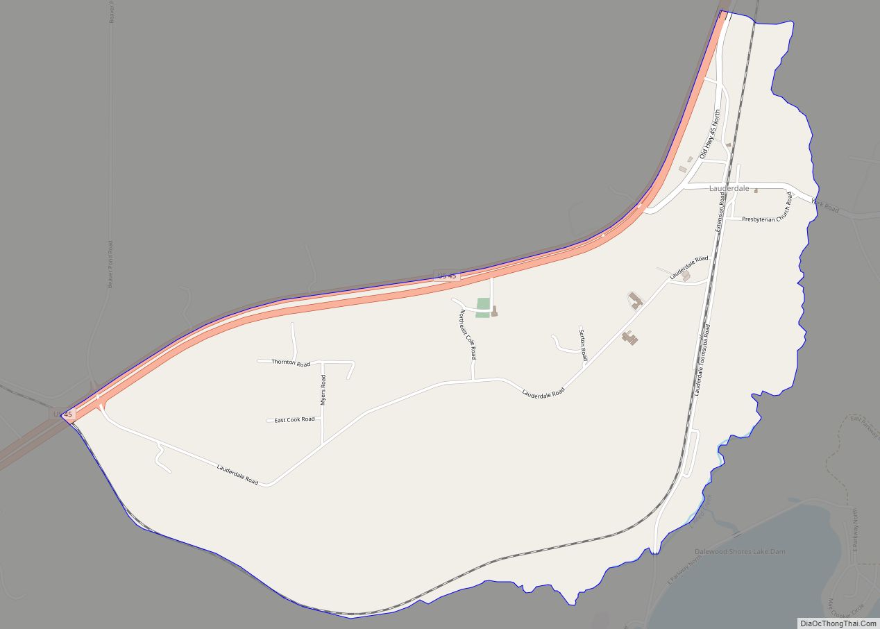
Lauderdale is an unincorporated community and census-designated place (CDP) in Lauderdale County, Mississippi, United States. It is situated along U.S. Highway 45, 16 miles (26 km) northeast of Meridian, the county seat. The population of Lauderdale was 395 at the 2020 census. Lauderdale CDP overview: Name: Lauderdale CDP LSAD Code: 57 LSAD Description: CDP (suffix) State: … Read more

Map of Latimer CDP, Mississippi

Map of Latimer CDP, Mississippi

Latimer is a census-designated place (CDP) in Jackson County, Mississippi, United States. It is part of the Pascagoula Metropolitan Statistical Area. The population was 6,079 at the 2010 census, up from 4,288 at the 2000 census. Latimer CDP overview: Name: Latimer CDP LSAD Code: 57 LSAD Description: CDP (suffix) State: Mississippi County: Jackson County Elevation: … Read more

Map of Lambert town, Mississippi

Map of Lambert town, Mississippi

Lambert is a town in Quitman County, Mississippi. The population was 1,638 at the 2010 census. Lambert town overview: Name: Lambert town LSAD Code: 43 LSAD Description: town (suffix) State: Mississippi County: Quitman County Elevation: 157 ft (48 m) Total Area: 0.85 sq mi (2.19 km²) Land Area: 0.85 sq mi (2.19 km²) Water Area: 0.00 sq mi (0.00 km²) Total Population: 1,273 Population Density: 1,504.73/sq mi … Read more

Map of Liberty town, Mississippi

Map of Liberty town, Mississippi

Liberty is a town in Amite County, Mississippi. It is part of the McComb, Mississippi micropolitan statistical area. It is the county seat of Amite County. The town can be accessed via I-55, then west on Mississippi Highway 24. McGehee Air Park is located about a mile west of town. Liberty celebrates its Heritage Days … Read more

Map of Lexington city, Mississippi

Map of Lexington city, Mississippi

Lexington is a city in and the county seat of Holmes County, Mississippi, United States. The county was organized in 1833 and the city in 1836. The population was 1,731 at the 2010 census, down from 2,025 at the 2000 census. The estimated population in 2018 was 1,496. It has declined from its high of … Read more

Map of Lena town, Mississippi

Map of Lena town, Mississippi

Lena is a town in Leake County, Mississippi, United States. The population was 148 at the 2010 census. The center of population of Mississippi is located in Lena. Lena town overview: Name: Lena town LSAD Code: 43 LSAD Description: town (suffix) State: Mississippi County: Leake County Elevation: 344 ft (105 m) Total Area: 1.66 sq mi (4.30 km²) Land Area: … Read more

Map of Leland city, Mississippi

Map of Leland city, Mississippi

Leland is a city in Washington County, Mississippi, United States. It is located within the Mississippi Delta, on the banks of Deer Creek. The population was 4,481 at the 2010 census. It was once a railway town and had long been a center of cotton culture, which is still an important commodity crop in the … Read more

Map of Learned town

Map of Learned town

Learned is a town in Hinds County, Mississippi, United States. Learned town overview: Name: Learned town LSAD Code: 43 LSAD Description: town (suffix) State: Mississippi County: Hinds County Elevation: 203 ft (62 m) Total Area: 0.34 sq mi (0.88 km²) Land Area: 0.34 sq mi (0.87 km²) Water Area: 0.00 sq mi (0.01 km²) Total Population: 56 Population Density: 166.67/sq mi (64.43/km²) ZIP code: 39154 Area code: … Read more

Map of Louin town

Map of Louin town

Louin is a town in Jasper County, Mississippi, United States, located along Mississippi Highway 15. The population was 277 at the 2010 census, down from 339 at the 2000 census. Louin town overview: Name: Louin town LSAD Code: 43 LSAD Description: town (suffix) State: Mississippi County: Jasper County Elevation: 423 ft (129 m) Total Area: 6.08 sq mi (15.75 km²) … Read more

Map of Long Beach city, Mississippi

Map of Long Beach city, Mississippi

Long Beach is a city located in Harrison County, Mississippi, United States. It is part of the Gulfport-Biloxi metropolitan area. As of the 2020 census, the city had a population of 15,829. Long Beach city overview: Name: Long Beach city LSAD Code: 25 LSAD Description: city (suffix) State: Mississippi County: Harrison County Elevation: 26 ft (8 m) … Read more

Map of Lucedale city

Map of Lucedale city

Lucedale (/ˈluːsdeɪl/) is a city in George County, Mississippi, United States. It is part of the Pascagoula, Mississippi Metropolitan Statistical Area. Lucedale was founded in 1901 when Governor A.H. Longino signed his name and his seal to the proclamation. It was named after its founder, Gregory Marston Luce, who operated a lumber business there. The … Read more

Map of Louisville city, Mississippi

Map of Louisville city, Mississippi

Louisville (pronounced LEW-iss-vill) is a city in Winston County, Mississippi. The population was 6,631 at the 2010 census. It is the county seat of Winston County. Louisville city overview: Name: Louisville city LSAD Code: 25 LSAD Description: city (suffix) State: Mississippi County: Winston County Elevation: 571 ft (174 m) Total Area: 15.27 sq mi (39.56 km²) Land Area: 15.10 sq mi (39.10 km²) … Read more