Lucedale (/ˈluːsdeɪl/) is a city in George County, Mississippi, United States. It is part of the Pascagoula, Mississippi Metropolitan Statistical Area. Lucedale was founded in 1901 when Governor A.H. Longino signed his name and his seal to the proclamation. It was named after its founder, Gregory Marston Luce, who operated a lumber business there. The population was 2,923 at the 2010 census, up from 2,458 at the 2000 census. It is the county seat of George County.
| Name: | Lucedale city |
|---|---|
| LSAD Code: | 25 |
| LSAD Description: | city (suffix) |
| State: | Mississippi |
| County: | George County |
| Elevation: | 281 ft (86 m) |
| Total Area: | 6.39 sq mi (16.55 km²) |
| Land Area: | 6.39 sq mi (16.55 km²) |
| Water Area: | 0.00 sq mi (0.00 km²) |
| Total Population: | 2,869 |
| Population Density: | 448.91/sq mi (173.33/km²) |
| ZIP code: | 39452 |
| Area code: | 601, 769 |
| FIPS code: | 2842440 |
| GNISfeature ID: | 0672944 |
| Website: | cityoflucedale.com |
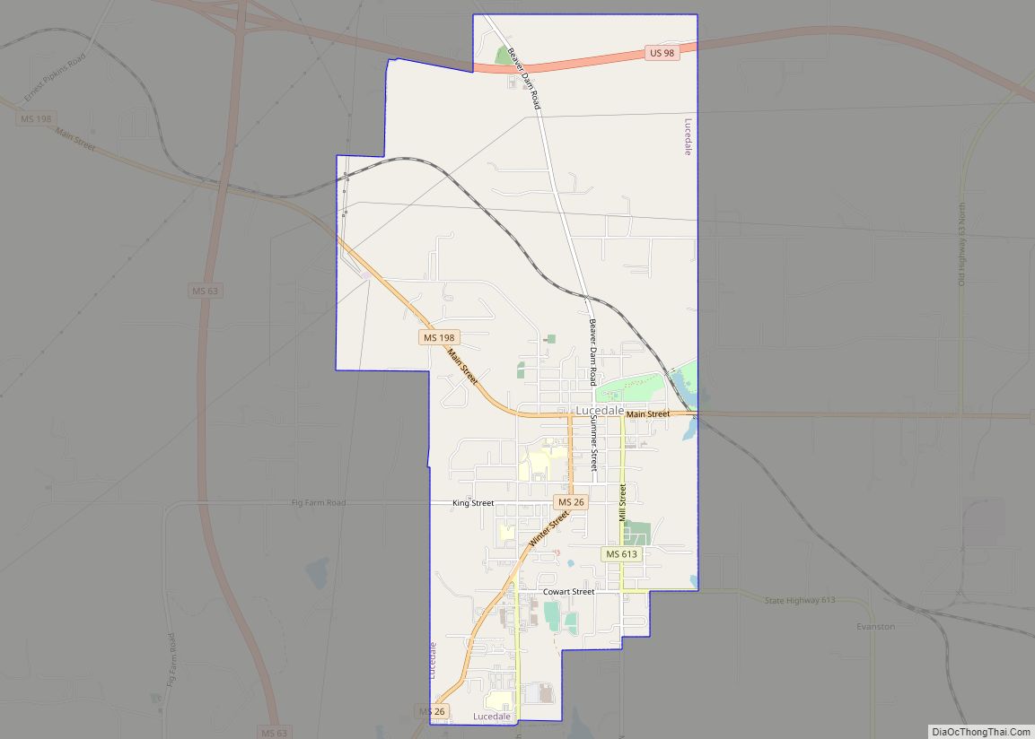
Online Interactive Map
Click on ![]() to view map in "full screen" mode.
to view map in "full screen" mode.
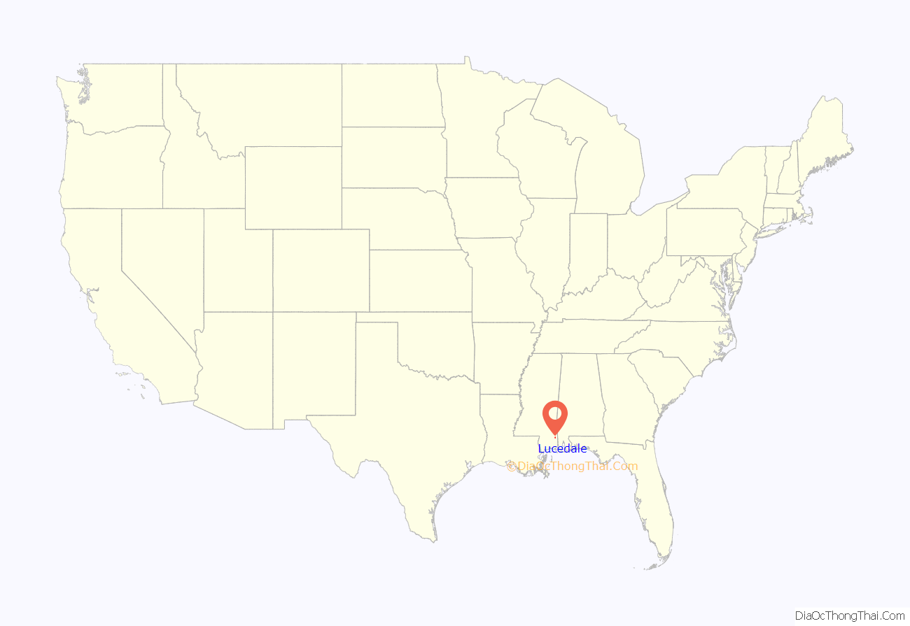
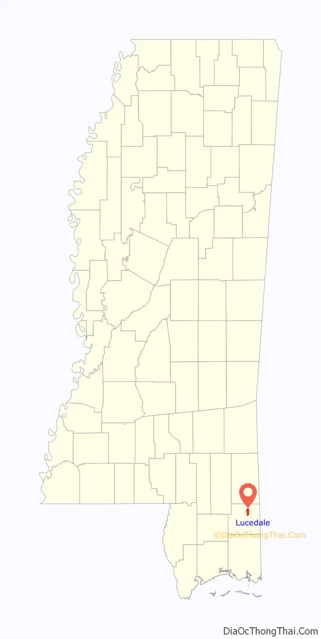
Lucedale location map. Where is Lucedale city?
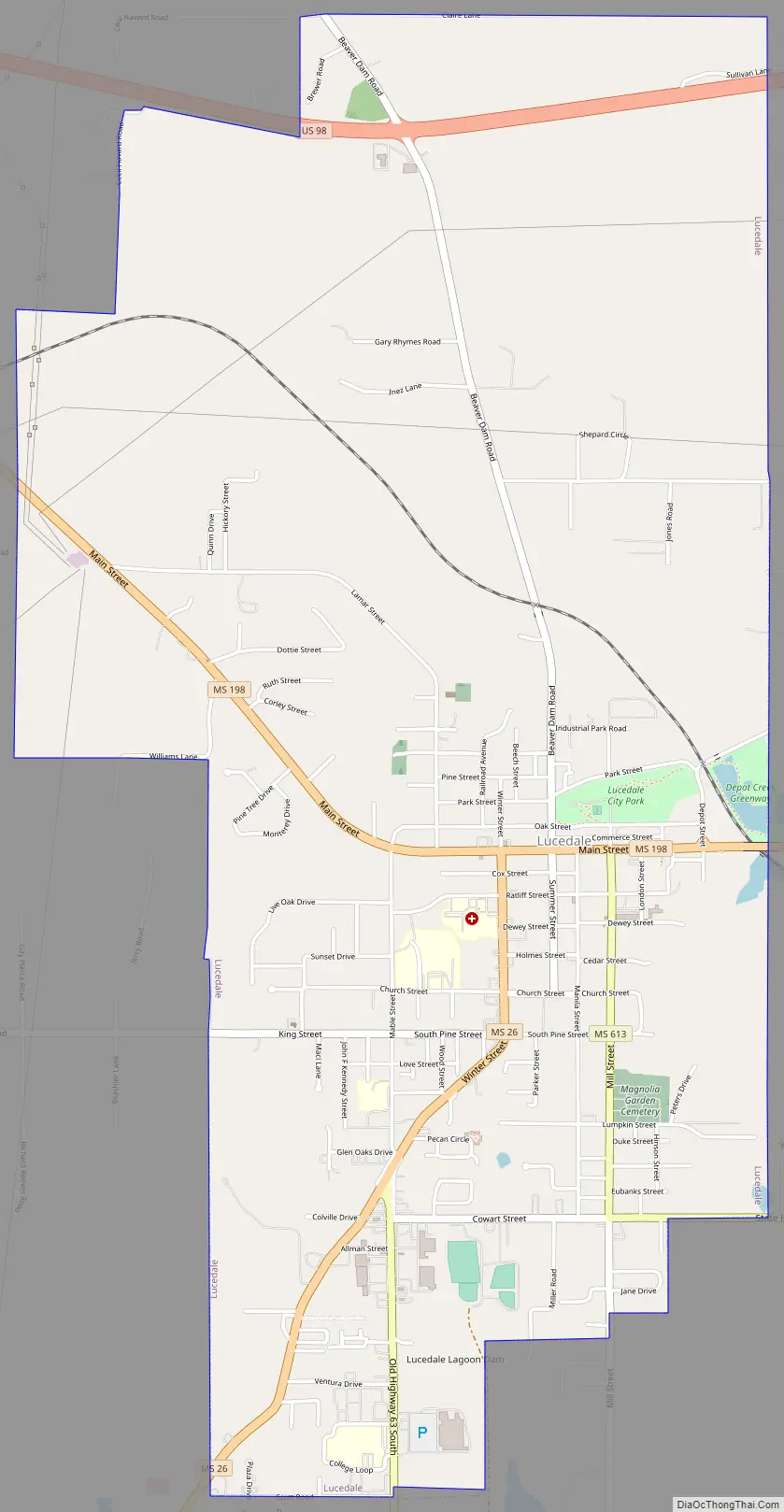
Lucedale Road Map
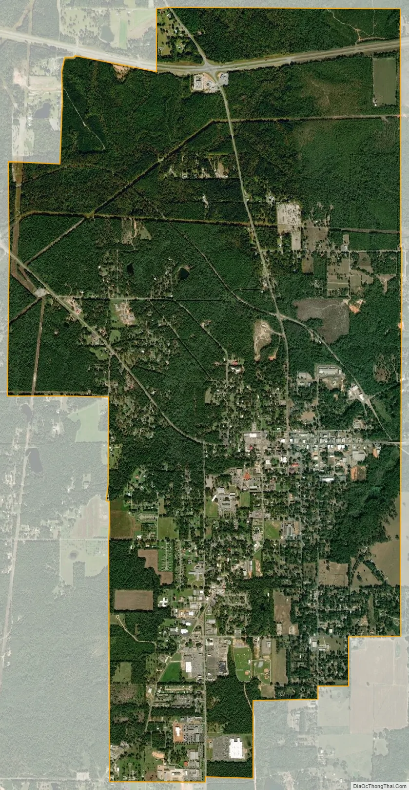
Lucedale city Satellite Map
Geography
Lucedale is located in northern George County at 30°55′11″N 88°35′30″W / 30.91972°N 88.59167°W / 30.91972; -88.59167 (30.919824, -88.591669). Mississippi Highway 198 passes through the city as Main Street, leading east 4.5 miles (7.2 km) to U.S. Route 98 and northwest 2.5 miles (4.0 km) to Mississippi Highway 63, both of which are four-lane highways bypassing Lucedale. US 98 leads southeast 40 miles (64 km) to Mobile, Alabama, and northwest 54 miles (87 km) to Hattiesburg, while Highway 63 leads north 20 miles (32 km) to Leakesville and south 43 miles (69 km) to Pascagoula.
According to the United States Census Bureau, Lucedale has a total area of 6.4 square miles (16.6 km), all land.
See also
Map of Mississippi State and its subdivision:- Adams
- Alcorn
- Amite
- Attala
- Benton
- Bolivar
- Calhoun
- Carroll
- Chickasaw
- Choctaw
- Claiborne
- Clarke
- Clay
- Coahoma
- Copiah
- Covington
- Desoto
- Forrest
- Franklin
- George
- Greene
- Grenada
- Hancock
- Harrison
- Hinds
- Holmes
- Humphreys
- Issaquena
- Itawamba
- Jackson
- Jasper
- Jefferson
- Jefferson Davis
- Jones
- Kemper
- Lafayette
- Lamar
- Lauderdale
- Lawrence
- Leake
- Lee
- Leflore
- Lincoln
- Lowndes
- Madison
- Marion
- Marshall
- Monroe
- Montgomery
- Neshoba
- Newton
- Noxubee
- Oktibbeha
- Panola
- Pearl River
- Perry
- Pike
- Pontotoc
- Prentiss
- Quitman
- Rankin
- Scott
- Sharkey
- Simpson
- Smith
- Stone
- Sunflower
- Tallahatchie
- Tate
- Tippah
- Tishomingo
- Tunica
- Union
- Walthall
- Warren
- Washington
- Wayne
- Webster
- Wilkinson
- Winston
- Yalobusha
- Yazoo
- Alabama
- Alaska
- Arizona
- Arkansas
- California
- Colorado
- Connecticut
- Delaware
- District of Columbia
- Florida
- Georgia
- Hawaii
- Idaho
- Illinois
- Indiana
- Iowa
- Kansas
- Kentucky
- Louisiana
- Maine
- Maryland
- Massachusetts
- Michigan
- Minnesota
- Mississippi
- Missouri
- Montana
- Nebraska
- Nevada
- New Hampshire
- New Jersey
- New Mexico
- New York
- North Carolina
- North Dakota
- Ohio
- Oklahoma
- Oregon
- Pennsylvania
- Rhode Island
- South Carolina
- South Dakota
- Tennessee
- Texas
- Utah
- Vermont
- Virginia
- Washington
- West Virginia
- Wisconsin
- Wyoming