Map of Bay St. Louis city

Map of Bay St. Louis city

Bay St. Louis is a city in and the county seat of Hancock County, Mississippi, in the United States. Located on the Gulf Coast on the west side of the Bay of St. Louis, it is part of the Gulfport–Biloxi Metropolitan Statistical Area. The population was 9,284 at the 2020 census, up from 9,260 at … Read more

Map of Bay Springs city

Map of Bay Springs city

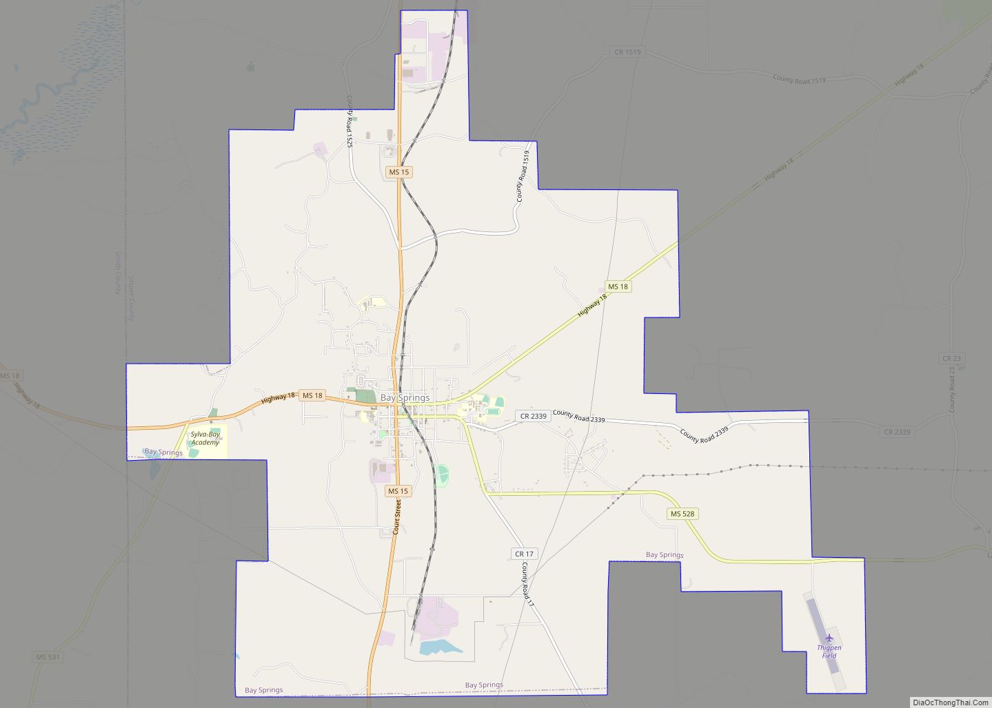
Bay Springs is a city in and the western county seat of Jasper County, Mississippi, United States. The population was 1,670 at the 2020 census, down from 1,786 at the 2010 census. State highways 15 and 18 intersect at the city. It is part of the Laurel, Mississippi (in Jones County) micropolitan area. The area … Read more

Map of Bentonia town

Map of Bentonia town

Bentonia is a town in Yazoo County, Mississippi, United States. The population as of the 2020 census was 319. The Bentonia School of blues singing and guitar-playing is named for Bentonia. Bentonia town overview: Name: Bentonia town LSAD Code: 43 LSAD Description: town (suffix) State: Mississippi County: Yazoo County Elevation: 197 ft (60 m) Total Area: 1.42 sq mi … Read more

Map of Benoit town

Map of Benoit town

Benoit /bɪˈnɔɪt/ is a town in Bolivar County, Mississippi, United States. Per the 2020 Census, the population was 365. Benoit town overview: Name: Benoit town LSAD Code: 43 LSAD Description: town (suffix) State: Mississippi County: Bolivar County Elevation: 141 ft (43 m) Total Area: 0.99 sq mi (2.56 km²) Land Area: 0.97 sq mi (2.52 km²) Water Area: 0.01 sq mi (0.03 km²) Total Population: 365 … Read more

Map of Belzoni city

Map of Belzoni city

Belzoni (/bɛlˈzoʊnə/ bel-ZOHN-ə) is a city in Humphreys County, Mississippi, United States, in the Mississippi Delta region, on the Yazoo River. The population was 2,235 at the 2010 census. It is the county seat of Humphreys County. It was named for the 19th-century Italian archaeologist/explorer Giovanni Battista Belzoni. The area was named Farm-Raised Catfish Capital … Read more

Map of Belmont town, Mississippi

Map of Belmont town, Mississippi

Belmont is a town in Tishomingo County, Mississippi, United States. The population was 2,021 at the 2010 census. Belmont town overview: Name: Belmont town LSAD Code: 43 LSAD Description: town (suffix) State: Mississippi County: Tishomingo County Elevation: 581 ft (177 m) Total Area: 4.74 sq mi (12.28 km²) Land Area: 4.73 sq mi (12.25 km²) Water Area: 0.01 sq mi (0.03 km²) Total Population: 1,859 Population … Read more

Map of Beechwood CDP, Mississippi

Map of Beechwood CDP, Mississippi

Beechwood is a census-designated place (CDP) in Warren County, Mississippi, United States. The population was 3,469 at the 2020 census. Beechwood CDP overview: Name: Beechwood CDP LSAD Code: 57 LSAD Description: CDP (suffix) State: Mississippi County: Warren County Total Area: 6.32 sq mi (16.38 km²) Land Area: 6.26 sq mi (16.23 km²) Water Area: 0.06 sq mi (0.16 km²) Total Population: 3,469 Population Density: … Read more

Map of Blue Springs village, Mississippi

Map of Blue Springs village, Mississippi

Blue Springs is a village in Union County, Mississippi, United States. Located near Tupelo in northeastern Mississippi, the village had a population of 144 at the 2000 census. It is the site of Toyota Motor Manufacturing Mississippi, Toyota’s eighth North American vehicle assembly plant. Blue Springs village overview: Name: Blue Springs village LSAD Code: 47 … Read more

Map of Blue Mountain town, Mississippi

Map of Blue Mountain town, Mississippi

Blue Mountain is a town in Tippah County, Mississippi. The population was 920 at the 2010 census. It is the location of Blue Mountain College, a private Christian liberal arts college. Blue Mountain town overview: Name: Blue Mountain town LSAD Code: 43 LSAD Description: town (suffix) State: Mississippi County: Tippah County Elevation: 446 ft (136 m) Total … Read more

Map of Big Point CDP

Map of Big Point CDP

Big Point is an unincorporated community and census-designated place (CDP) in Jackson County, Mississippi, United States. It is part of the Pascagoula, Mississippi Metropolitan Statistical Area. Per the 2020 Census, the population was 618. Big Point CDP overview: Name: Big Point CDP LSAD Code: 57 LSAD Description: CDP (suffix) State: Mississippi County: Jackson County Elevation: … Read more

Map of Big Creek village, Mississippi

Map of Big Creek village, Mississippi

Big Creek is a village in Calhoun County, Mississippi, United States. The population was 154 at the 2010 census. Big Creek village overview: Name: Big Creek village LSAD Code: 47 LSAD Description: village (suffix) State: Mississippi County: Calhoun County Elevation: 276 ft (84 m) Total Area: 1.14 sq mi (2.94 km²) Land Area: 1.14 sq mi (2.94 km²) Water Area: 0.00 sq mi (0.00 km²) Total … Read more

Map of Beulah town, Mississippi

Map of Beulah town, Mississippi

Beulah is a town in Bolivar County, Mississippi, United States. Per the 2020 census, the population was 242. Beulah is served by Mississippi Highway 1. Lake Beulah, an oxbow lake formerly connected to the Mississippi River, is west of the town. The Illinois Central Railroad had a station in Beulah, but the line is now … Read more