Map of Anguilla town

Map of Anguilla town

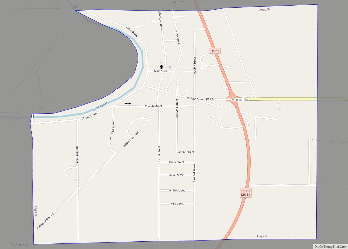
Anguilla is a town in Sharkey County, Mississippi, United States. The population was 496 at the 2020 census, down from 726 at the 2010 census. Anguilla town overview: Name: Anguilla town LSAD Code: 43 LSAD Description: town (suffix) State: Mississippi County: Sharkey County Elevation: 105 ft (32 m) Total Area: 1.03 sq mi (2.68 km²) Land Area: 1.03 sq mi (2.68 km²) Water … Read more

Map of Amory city

Map of Amory city

Amory is a city in Monroe County, Mississippi, United States. The population was 6,666 at the 2020 census, down from 7,316 at the 2010 census. Located in the northeastern part of the state near the Alabama border, it was founded in 1887 as a railroad town by the Kansas City, Memphis and Birmingham Railroad. As … Read more

Map of Alligator town

Map of Alligator town

Alligator is a town in Bolivar County, Mississippi, United States. Per the 2020 Census, the population was 116. In 2009, Tommie “Tomaso” Brown was elected Alligator’s first black mayor. He defeated Robert Fava, the mayor since 1979. Alligator town overview: Name: Alligator town LSAD Code: 43 LSAD Description: town (suffix) State: Mississippi County: Bolivar County … Read more

Map of Algoma town

Map of Algoma town, Mississippi

Algoma is a town in Pontotoc County, Mississippi. The population was 705 at the 2020 census, up from 590 at the 2010 census. Algoma is a Native American word meaning “vale of flowers”. Algoma town overview: Name: Algoma town LSAD Code: 43 LSAD Description: town (suffix) State: Mississippi County: Pontotoc County Elevation: 417 ft (127 m) Total … Read more

Map of Bassfield town

Map of Bassfield town

Bassfield is a town in Jefferson Davis County, Mississippi, United States. The population was 192 at the 2020 census, down from 254 at the 2010 census. Bassfield town overview: Name: Bassfield town LSAD Code: 43 LSAD Description: town (suffix) State: Mississippi County: Jefferson Davis County Elevation: 456 ft (139 m) Total Area: 1.00 sq mi (2.59 km²) Land Area: 1.00 sq mi … Read more

Map of Baldwyn city

Map of Baldwyn city

Baldwyn is a city located in Lee and Prentiss counties, Mississippi, located in the northern part of the Tupelo micropolitan area. The population was 3,071 at the 2020 census. Baldwyn city overview: Name: Baldwyn city LSAD Code: 25 LSAD Description: city (suffix) State: Mississippi County: Lee County, Prentiss County Incorporated: April 1, 1861(162 years ago) (1861-04-01) Elevation: … Read more

Map of Ashland town, Mississippi

Map of Ashland town, Mississippi

Ashland is a town in Benton County, Mississippi, United States and the county seat. The population was 551 at the 2020 census, down from 569 at the 2010 census. Ashland was incorporated on March 8, 1871, and has a Mayor-Aldermen form of government. Mitch Carroll is the 28th mayor of Ashland. Ashland town overview: Name: … Read more

Map of Artesia town, Mississippi

Map of Artesia town, Mississippi

Artesia is a town in Lowndes County, Mississippi. The population was 304 at the 2020 census, down from 440 at the 2010 census. Artesia town overview: Name: Artesia town LSAD Code: 43 LSAD Description: town (suffix) State: Mississippi County: Lowndes County Elevation: 230 ft (70 m) Total Area: 0.72 sq mi (1.88 km²) Land Area: 0.72 sq mi (1.87 km²) Water Area: 0.00 sq mi … Read more

Map of Arnold Line CDP

Map of Arnold Line CDP

Arnold Line is an unincorporated area and census-designated place (CDP) in Lamar County, Mississippi, United States. As of the 2020 census it had a population of 2,333. It is part of the Hattiesburg Metropolitan Statistical Area. It is in the northeast part of Lamar County and is bordered to the north, east, and south by … Read more

Map of Beauregard village

Map of Beauregard village

Beauregard is a village in Copiah County, Mississippi, United States. The population was 326 at the 2010 census. It is part of the Jackson Metropolitan Statistical Area. Beauregard is named for P. G. T. Beauregard. Beauregard village overview: Name: Beauregard village LSAD Code: 47 LSAD Description: village (suffix) State: Mississippi County: Copiah County Elevation: 463 ft … Read more

Map of Beaumont town, Mississippi

Map of Beaumont town, Mississippi

Beaumont is a town in Perry County, Mississippi. It is part of the Hattiesburg, Mississippi Metropolitan Statistical Area, and located on the edge of the De Soto National Forest. The population was 951 at the 2010 census. Beaumont town overview: Name: Beaumont town LSAD Code: 43 LSAD Description: town (suffix) State: Mississippi County: Perry County … Read more

Map of Bay St. Louis city

Map of Bay St. Louis city

Bay St. Louis is a city in and the county seat of Hancock County, Mississippi, in the United States. Located on the Gulf Coast on the west side of the Bay of St. Louis, it is part of the Gulfport–Biloxi Metropolitan Statistical Area. The population was 9,284 at the 2020 census, up from 9,260 at … Read more