Map of Ellisville city, Missouri

Map of Ellisville city, Missouri

Ellisville is a city in St. Louis County, Missouri, United States within Greater St. Louis. It is a western outer-ring suburb of St. Louis. The population was 9,985 at the 2020 census. In 2009, Money magazine ranked Ellisville #25 on the annual Best Places to Live in America list. The city is also currently home … Read more

Map of Ellington city

Map of Ellington city

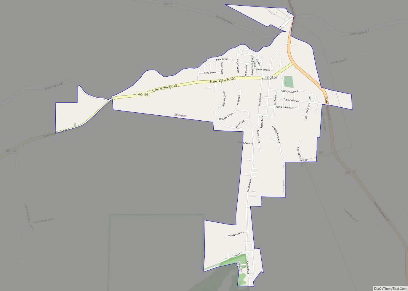
Ellington is a city in Reynolds County, Missouri, United States. The population was 790 at the 2020 census. In 1925, the infamous Tri-State Tornado began just northwest of Ellington. Ellington city overview: Name: Ellington city LSAD Code: 25 LSAD Description: city (suffix) State: Missouri County: Reynolds County Elevation: 732 ft (223 m) Total Area: 1.46 sq mi (3.79 km²) Land … Read more

Map of Elmira village, Missouri

Map of Elmira village, Missouri

Elmira is a village in northwest Ray County, Missouri, and part of the Kansas City metropolitan area within the United States. The population was 39 at the 2020 census. Elmira village overview: Name: Elmira village LSAD Code: 47 LSAD Description: village (suffix) State: Missouri County: Ray County Elevation: 942 ft (287 m) Total Area: 0.07 sq mi (0.19 km²) Land … Read more

Map of Elmer city

Map of Elmer city, Missouri

Elmer is a city in Macon County, Missouri, United States. The population was 51 at the 2020 census. Elmer city overview: Name: Elmer city LSAD Code: 25 LSAD Description: city (suffix) State: Missouri County: Macon County Elevation: 735 ft (224 m) Total Area: 0.25 sq mi (0.66 km²) Land Area: 0.25 sq mi (0.66 km²) Water Area: 0.00 sq mi (0.00 km²) Total Population: 51 Population … Read more

Map of Ellsinore city

Map of Ellsinore city

Ellsinore is a town in Carter County, Missouri, United States. The 2020 U.S. Census showed Ellsinore with a population of 416. Ellsinore city overview: Name: Ellsinore city LSAD Code: 25 LSAD Description: city (suffix) State: Missouri County: Carter County Elevation: 732 ft (223 m) Total Area: 0.51 sq mi (1.31 km²) Land Area: 0.51 sq mi (1.31 km²) Water Area: 0.00 sq mi (0.00 km²) Total … Read more

Map of Emerald Beach village

Map of Emerald Beach village

Emerald Beach is a village in White River Township, Barry County, Missouri, United States. The community is located on a bend in the White River now Table Rock Lake. Cassville is approximately 13 miles to the northwest and Rogers, Arkansas is 32 mile to the southwest. It was incorporated in 1981. The village is served … Read more

Map of Elsberry city

Map of Elsberry city

Elsberry is a city in Lincoln County, Missouri, United States. The population was 1,937 at the 2020 census. Elsberry city overview: Name: Elsberry city LSAD Code: 25 LSAD Description: city (suffix) State: Missouri County: Lincoln County Elevation: 486 ft (148 m) Total Area: 1.51 sq mi (3.91 km²) Land Area: 1.51 sq mi (3.91 km²) Water Area: 0.00 sq mi (0.00 km²) Total Population: 1,937 Population … Read more

Map of Elmo city

Map of Elmo city, Missouri

Elmo is a city in Nodaway County, Missouri, United States. The population was 168 at the 2010 census. Elmo city overview: Name: Elmo city LSAD Code: 25 LSAD Description: city (suffix) State: Missouri County: Nodaway County Elevation: 1,014 ft (309 m) Total Area: 0.22 sq mi (0.56 km²) Land Area: 0.22 sq mi (0.56 km²) Water Area: 0.00 sq mi (0.00 km²) Total Population: 114 Population … Read more

Map of Eolia village

Map of Eolia village

Eolia is a village in Pike County, Missouri, United States. The population was 522 at the 2010 census. Eolia village overview: Name: Eolia village LSAD Code: 47 LSAD Description: village (suffix) State: Missouri County: Pike County Elevation: 827 ft (252 m) Total Area: 1.23 sq mi (3.18 km²) Land Area: 1.22 sq mi (3.16 km²) Water Area: 0.01 sq mi (0.02 km²) Total Population: 472 Population … Read more

Map of Emma city

Map of Emma city

Emma is a city in Lafayette and Saline counties in the U.S. state of Missouri and is part of the Kansas City metropolitan area. The population was 233 at the 2010 census. Emma city overview: Name: Emma city LSAD Code: 25 LSAD Description: city (suffix) State: Missouri County: Lafayette County, Saline County Elevation: 745 ft (227 m) … Read more

Map of Eminence city, Missouri

Map of Eminence city, Missouri

Eminence is a city in Shannon County, Missouri, United States. The population was 515 at the 2020 census. It is the county seat of Shannon County. Eminence city overview: Name: Eminence city LSAD Code: 25 LSAD Description: city (suffix) State: Missouri County: Shannon County Elevation: 686 ft (209 m) Total Area: 1.89 sq mi (4.88 km²) Land Area: 1.89 sq mi (4.88 km²) … Read more

Map of Eugene city

Map of Eugene CDP, Missouri

Eugene is an unincorporated community in extreme southwestern Cole County, Missouri, United States. As of the 2020 census, the population is 140. It is located 10 miles (16 km) east of Eldon on Route 17, approximately 3 miles (5 km) south of U.S. Route 54. Eugene was founded in 1904, and named after Eugene Simpson, the original … Read more