Map of Augusta town, Missouri

Map of Augusta town, Missouri

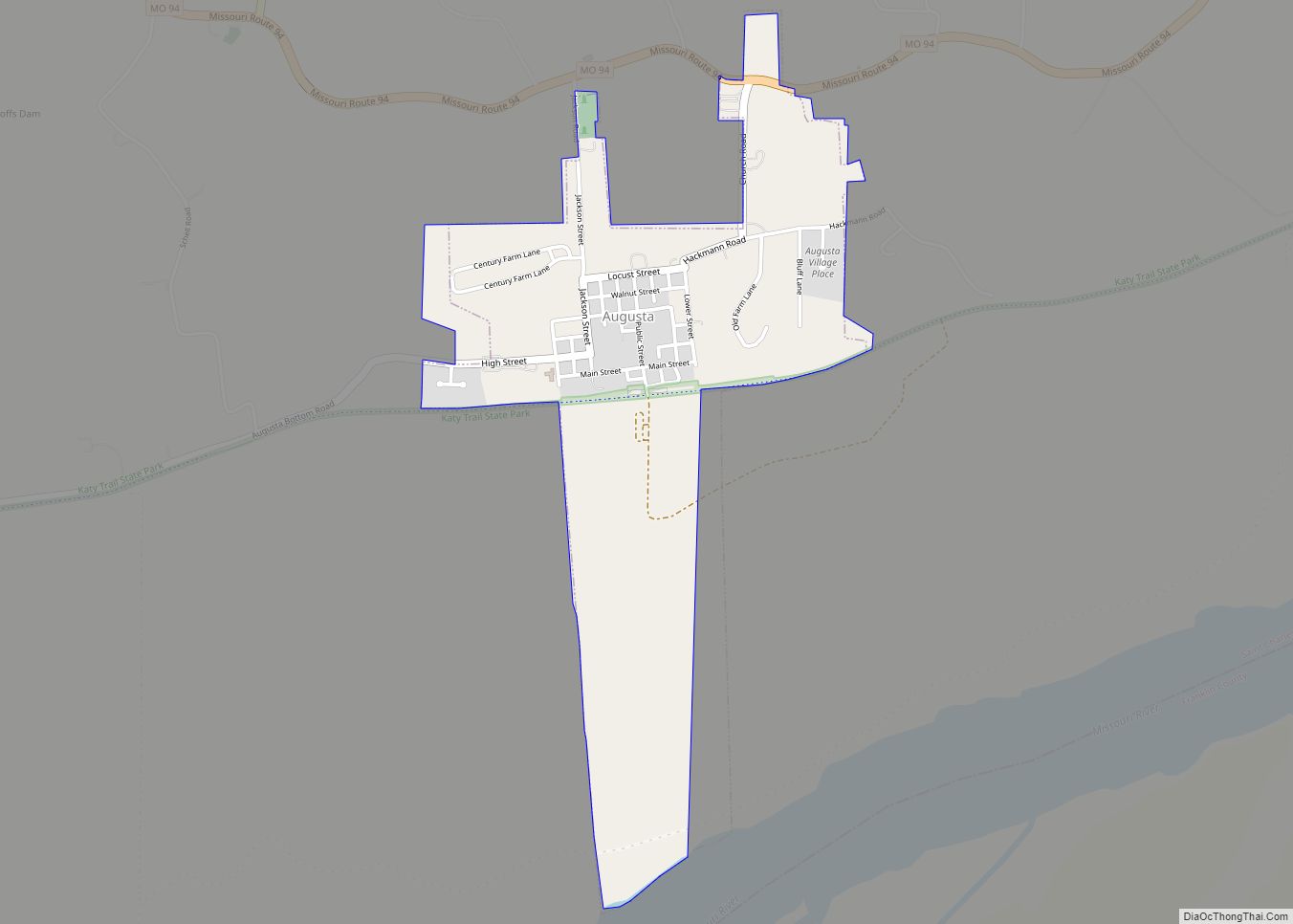
Augusta is a city in St. Charles County, Missouri, United States. The population was 253 at the 2010 census. The city boasts wineries, antique shops, restaurants, B&B’s, a wood shop, a glass studio, massage therapy, a historic museum and The Augusta Brewery. Augusta is located in the Missouri Rhineland. As a result, it is home … Read more

Map of Atlanta city, Missouri

Map of Atlanta city, Missouri

Atlanta is a city in Macon County, Missouri, United States. The population was 379 at the 2020 census. Atlanta city overview: Name: Atlanta city LSAD Code: 25 LSAD Description: city (suffix) State: Missouri County: Macon County Elevation: 906 ft (276 m) Total Area: 0.34 sq mi (0.89 km²) Land Area: 0.34 sq mi (0.89 km²) Water Area: 0.00 sq mi (0.00 km²) Total Population: 379 Population … Read more

Map of Auxvasse city

Map of Auxvasse city

Auxvasse (/ʌvˈɔːz/ uv-AWZ) is a city in northern Callaway County, Missouri, United States. It is part of the Jefferson City, Missouri Metropolitan Statistical Area. The population was 983 at the 2010 census. Auxvasse city overview: Name: Auxvasse city LSAD Code: 25 LSAD Description: city (suffix) State: Missouri County: Callaway County Founded: 1873 (as Clinton City) … Read more

Map of Aurora city, Missouri

Map of Aurora city, Missouri

Aurora is a city in Lawrence County, Missouri, United States. As of the 2020 census, the population of the city was 7,432. Aurora city overview: Name: Aurora city LSAD Code: 25 LSAD Description: city (suffix) State: Missouri County: Lawrence County Founded: 1870 Incorporated: 1885 Elevation: 1,401 ft (427 m) Total Area: 6.33 sq mi (16.39 km²) Land Area: 6.30 sq mi (16.31 km²) … Read more

Map of Ava city, Missouri

Map of Ava city, Missouri

Ava is the only incorporated city in Douglas County, Missouri, United States. The population was 2,894 at the 2020 census. Ava is the county seat of Douglas County. The city was founded in 1871. It was renamed Ava in 1881, the town’s original name having been “Militia Springs.” Ava city overview: Name: Ava city LSAD … Read more

Map of Bagnell town

Map of Bagnell town

Bagnell is a town in Miller County, Missouri, United States. The population was 93 at the 2010 census. Bagnell town overview: Name: Bagnell town LSAD Code: 43 LSAD Description: town (suffix) State: Missouri County: Miller County Elevation: 581 ft (177 m) Total Area: 0.60 sq mi (1.55 km²) Land Area: 0.47 sq mi (1.22 km²) Water Area: 0.13 sq mi (0.33 km²) Total Population: 43 Population … Read more

Map of Avondale city, Missouri

Map of Avondale city, Missouri

Avondale is a city in Clay County, Missouri, United States. The population was 436 at the 2020 census. It is part of the Kansas City metropolitan area. Avondale city overview: Name: Avondale city LSAD Code: 25 LSAD Description: city (suffix) State: Missouri County: Clay County Elevation: 810 ft (250 m) Total Area: 0.14 sq mi (0.35 km²) Land Area: 0.14 sq mi … Read more

Map of Avilla town, Missouri

Map of Avilla town, Missouri

Avilla is a rural village in Jasper County, Missouri, United States. The population was 103 at the 2020 census. It is part of the Joplin, Missouri Metropolitan Statistical Area. Avilla is the fourth-oldest settlement in Jasper County today, founded in 1856. It was platted and laid out for public use July 23, 1858, by Andrew … Read more

Map of Baldwin Park village, Missouri

Map of Baldwin Park village, Missouri

Baldwin Park is a village in Cass County, Missouri, United States. The population was 92 at the 2010 census. It is part of the Kansas City metropolitan area. Baldwin Park village overview: Name: Baldwin Park village LSAD Code: 47 LSAD Description: village (suffix) State: Missouri County: Cass County Elevation: 879 ft (268 m) Total Area: 0.12 sq mi (0.31 km²) … Read more

Map of Bakersfield village, Missouri

Map of Bakersfield village, Missouri

Bakersfield is a village in southeastern Ozark County in the Ozarks of southern Missouri, United States. The population was 186 at the 2020 census. Bakersfield village overview: Name: Bakersfield village LSAD Code: 47 LSAD Description: village (suffix) State: Missouri County: Ozark County Elevation: 702 ft (214 m) Total Area: 1.37 sq mi (3.55 km²) Land Area: 1.37 sq mi (3.55 km²) Water Area: … Read more

Map of Baker village, Missouri

Map of Baker village, Missouri

Baker village overview: Name: Baker village LSAD Code: 47 LSAD Description: village (suffix) State: Missouri County: Stoddard County FIPS code: 2903034 Online Interactive Map Baker online map. Source: Basemap layers from Google Map, Open Street Map (OSM), Arcgisonline, Wmflabs. Boundary Data from Database of Global Administrative Areas. Baker location map. Where is Baker village? Baker … Read more

Map of Barnard city, Missouri

Map of Barnard city, Missouri

Barnard is a city in Nodaway County, Missouri, United States. As of the 2010 census, the city population was 221. Barnard city overview: Name: Barnard city LSAD Code: 25 LSAD Description: city (suffix) State: Missouri County: Nodaway County Elevation: 991 ft (302 m) Total Area: 0.15 sq mi (0.39 km²) Land Area: 0.15 sq mi (0.39 km²) Water Area: 0.00 sq mi (0.00 km²) Total Population: … Read more