Bakersfield is a village in southeastern Ozark County in the Ozarks of southern Missouri, United States. The population was 186 at the 2020 census.
| Name: | Bakersfield village |
|---|---|
| LSAD Code: | 47 |
| LSAD Description: | village (suffix) |
| State: | Missouri |
| County: | Ozark County |
| Elevation: | 702 ft (214 m) |
| Total Area: | 1.37 sq mi (3.55 km²) |
| Land Area: | 1.37 sq mi (3.55 km²) |
| Water Area: | 0.00 sq mi (0.00 km²) |
| Total Population: | 186 |
| Population Density: | 135.77/sq mi (52.43/km²) |
| ZIP code: | 65609 |
| Area code: | 417 |
| FIPS code: | 2903052 |
Online Interactive Map
Click on ![]() to view map in "full screen" mode.
to view map in "full screen" mode.
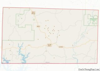
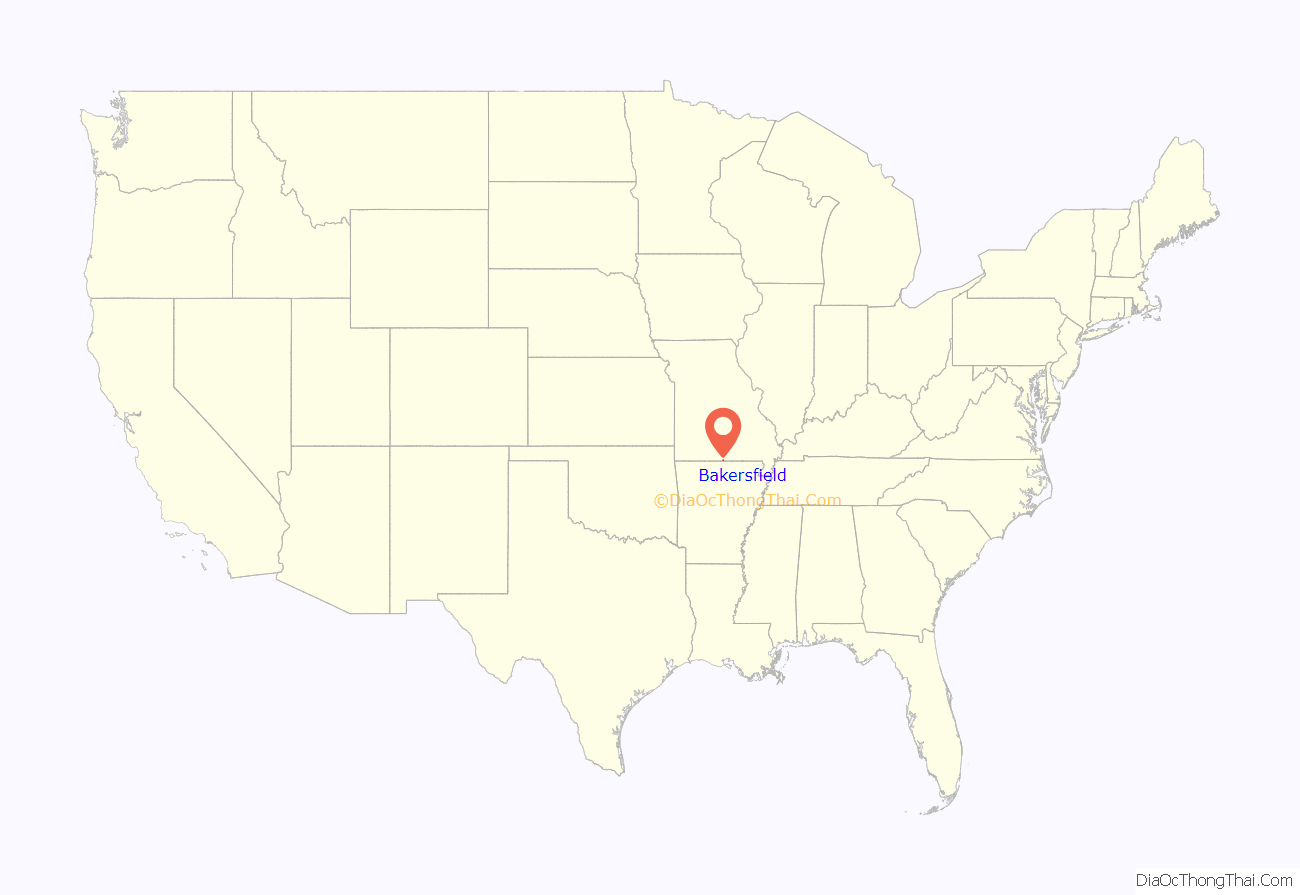
Bakersfield location map. Where is Bakersfield village?
History
A post office called Bakersfield has been in operation since 1873. Variant names were “Bakersville” and “Waterville”. The community was named after Jim Baker, the original owner of the town site.
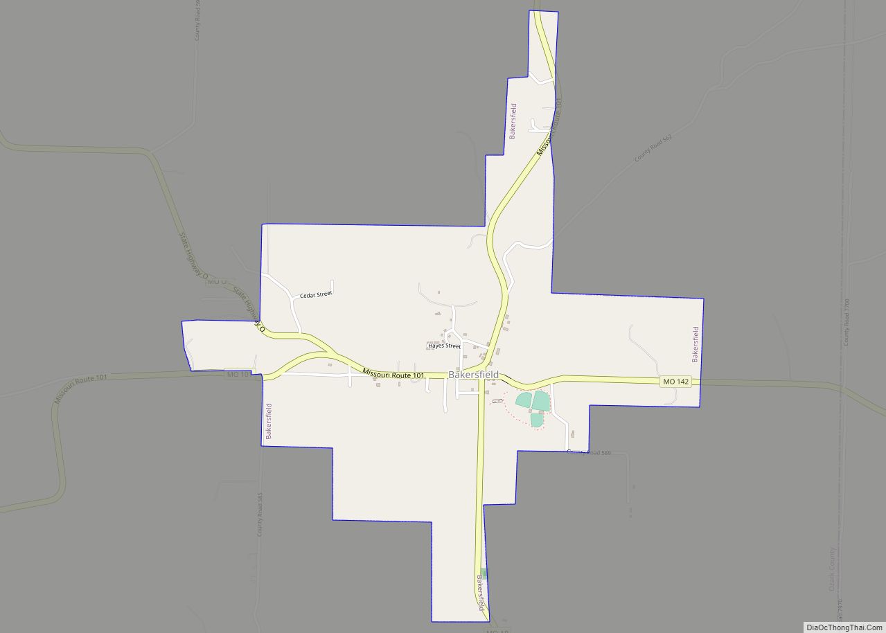
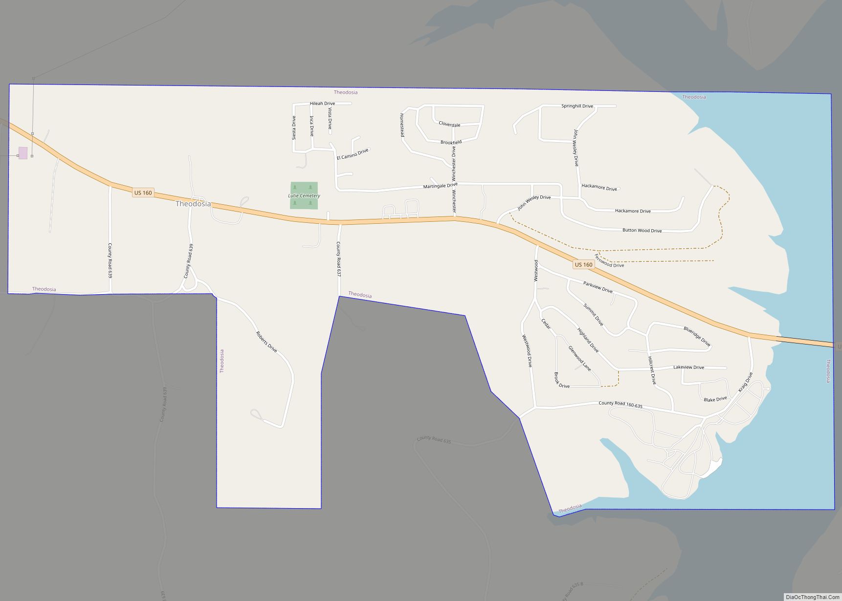
Bakersfield Road Map

Bakersfield city Satellite Map

Geography
The community is located in the Bayou I Township, on the west side of Bennetts Bayou at the intersection of Missouri routes 101 and 142. It is approximately 1.5 miles north of the Missouri-Arkansas state line. Caulfield lies about seven miles to the northeast on route 101.
According to the United States Census Bureau, the village has a total area of 1.37 square miles (3.55 km), all land.
See also
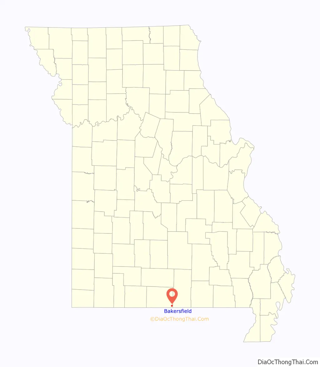
Map of Missouri State and its subdivision:- Adair
- Andrew
- Atchison
- Audrain
- Barry
- Barton
- Bates
- Benton
- Bollinger
- Boone
- Buchanan
- Butler
- Caldwell
- Callaway
- Camden
- Cape Girardeau
- Carroll
- Carter
- Cass
- Cedar
- Chariton
- Christian
- Clark
- Clay
- Clinton
- Cole
- Cooper
- Crawford
- Dade
- Dallas
- Daviess
- De Kalb
- Dent
- Douglas
- Dunklin
- Franklin
- Gasconade
- Gentry
- Greene
- Grundy
- Harrison
- Henry
- Hickory
- Holt
- Howard
- Howell
- Iron
- Jackson
- Jasper
- Jefferson
- Johnson
- Knox
- Laclede
- Lafayette
- Lawrence
- Lewis
- Lincoln
- Linn
- Livingston
- Macon
- Madison
- Maries
- Marion
- McDonald
- Mercer
- Miller
- Mississippi
- Moniteau
- Monroe
- Montgomery
- Morgan
- New Madrid
- Newton
- Nodaway
- Oregon
- Osage
- Ozark
- Pemiscot
- Perry
- Pettis
- Phelps
- Pike
- Platte
- Polk
- Pulaski
- Putnam
- Ralls
- Randolph
- Ray
- Reynolds
- Ripley
- Saint Charles
- Saint Clair
- Saint Francois
- Saint Louis
- Sainte Genevieve
- Saline
- Schuyler
- Scotland
- Scott
- Shannon
- Shelby
- Stoddard
- Stone
- Sullivan
- Taney
- Texas
- Vernon
- Warren
- Washington
- Wayne
- Webster
- Worth
- Wright
- Alabama
- Alaska
- Arizona
- Arkansas
- California
- Colorado
- Connecticut
- Delaware
- District of Columbia
- Florida
- Georgia
- Hawaii
- Idaho
- Illinois
- Indiana
- Iowa
- Kansas
- Kentucky
- Louisiana
- Maine
- Maryland
- Massachusetts
- Michigan
- Minnesota
- Mississippi
- Missouri
- Montana
- Nebraska
- Nevada
- New Hampshire
- New Jersey
- New Mexico
- New York
- North Carolina
- North Dakota
- Ohio
- Oklahoma
- Oregon
- Pennsylvania
- Rhode Island
- South Carolina
- South Dakota
- Tennessee
- Texas
- Utah
- Vermont
- Virginia
- Washington
- West Virginia
- Wisconsin
- Wyoming