Map of Manchester city, Missouri

Map of Manchester city, Missouri

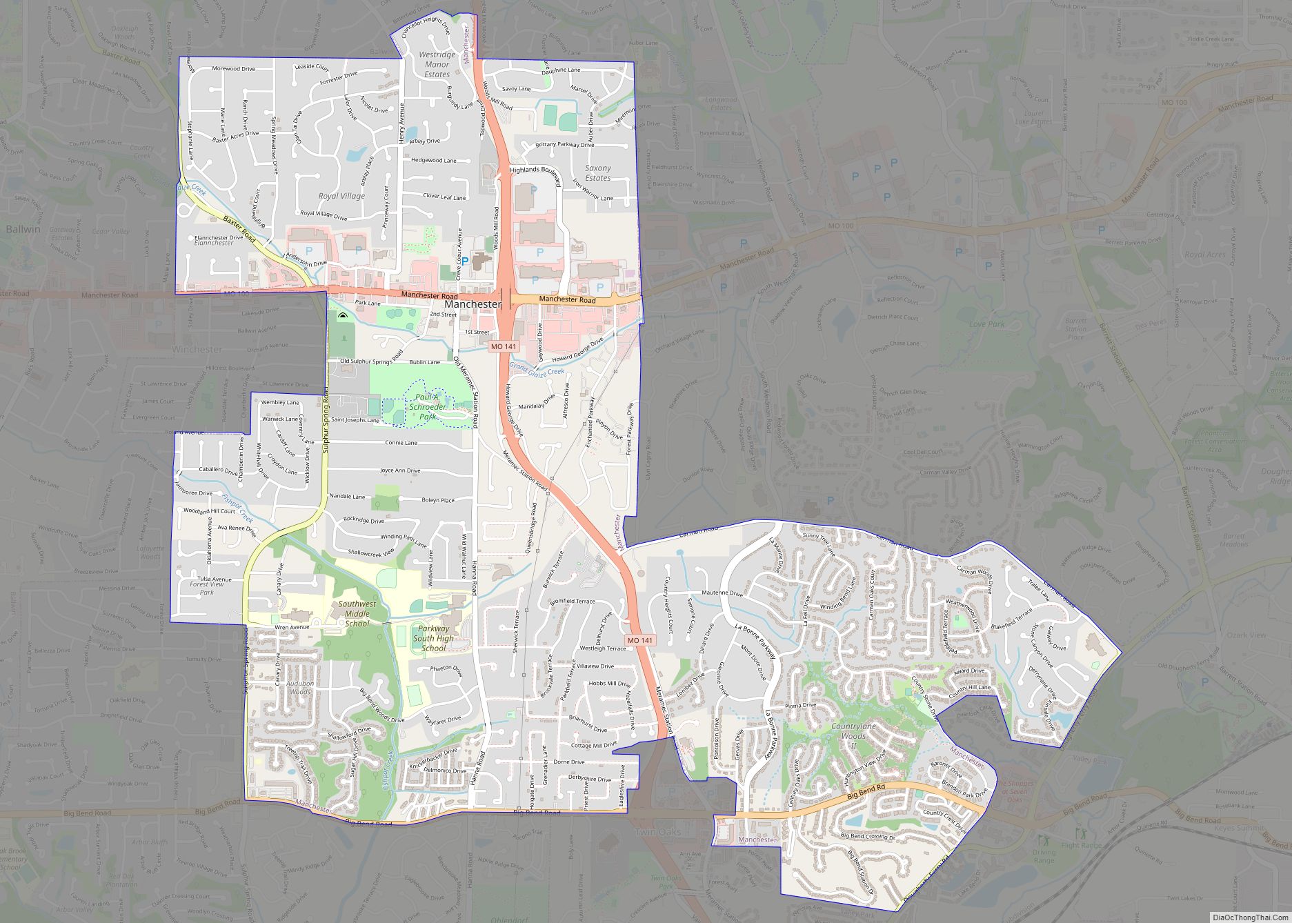
Manchester is a city in St. Louis County, Missouri, United States. The population was 18,333 at the 2020 census. Manchester city overview: Name: Manchester city LSAD Code: 25 LSAD Description: city (suffix) State: Missouri County: St. Louis County Elevation: 604 ft (184 m) Total Area: 5.03 sq mi (13.03 km²) Land Area: 5.03 sq mi (13.03 km²) Water Area: 0.00 sq mi (0.00 km²) Total Population: … Read more

Map of Malta Bend town

Map of Malta Bend town

Malta Bend is a city in Saline County, Missouri, United States. The population was 250 at the 2010 census. Malta Bend town overview: Name: Malta Bend town LSAD Code: 43 LSAD Description: town (suffix) State: Missouri County: Saline County Elevation: 699 ft (213 m) Total Area: 0.25 sq mi (0.65 km²) Land Area: 0.25 sq mi (0.65 km²) Water Area: 0.00 sq mi (0.00 km²) Total … Read more

Map of Marceline city

Map of Marceline city

Marceline is a city in Chariton and Linn counties in the U.S. state of Missouri. The population was 2,123 at the 2020 census. Marceline city overview: Name: Marceline city LSAD Code: 25 LSAD Description: city (suffix) State: Missouri County: Chariton County, Linn County Elevation: 866 ft (264 m) Total Area: 3.32 sq mi (8.60 km²) Land Area: 3.28 sq mi (8.50 km²) Water … Read more

Map of Marble Hill city

Map of Marble Hill city

Marble Hill is a fourth-class city in central Bollinger County in Southeast Missouri, United States. Located at the intersection of State Highways 34 and 51, it is the largest city in Bollinger and serves as the county seat. The population was 1,388 at the 2020 census. The city was officially organized in July 1851 and … Read more

Map of Maplewood city, Missouri

Map of Maplewood city, Missouri

Maplewood is an inner-ring suburb of St. Louis, located in St. Louis County, Missouri, United States. Maplewood city overview: Name: Maplewood city LSAD Code: 25 LSAD Description: city (suffix) State: Missouri County: St. Louis County Elevation: 518 ft (158 m) Total Area: 1.56 sq mi (4.05 km²) Land Area: 1.56 sq mi (4.05 km²) Water Area: 0.00 sq mi (0.00 km²) Total Population: 8,269 Population Density: … Read more

Map of Marlborough village, Missouri

Map of Marlborough village, Missouri

Marlborough is a village in St. Louis County, Missouri, United States. The population was 2,179 at the 2010 census. Marlborough village overview: Name: Marlborough village LSAD Code: 47 LSAD Description: village (suffix) State: Missouri County: St. Louis County Elevation: 535 ft (163 m) Total Area: 0.23 sq mi (0.59 km²) Land Area: 0.23 sq mi (0.59 km²) Water Area: 0.00 sq mi (0.00 km²) Total Population: … Read more

Map of Marionville city

Map of Marionville city

Marionville is a city in Lawrence County, Missouri, United States. The population was 2,225 at the 2010 census. Marionville is known for its large population of white squirrels. Marionville city overview: Name: Marionville city LSAD Code: 25 LSAD Description: city (suffix) State: Missouri County: Lawrence County Elevation: 1,365 ft (416 m) Total Area: 1.79 sq mi (4.63 km²) Land Area: … Read more

Map of Marquand city

Map of Marquand city

Marquand is a small city located in eastern Madison County, Missouri, United States. The population was 186 at the 2020 census. Marquand was officially recognized and incorporated as a town in 1906. Marquand city overview: Name: Marquand city LSAD Code: 25 LSAD Description: city (suffix) State: Missouri County: Madison County Elevation: 564 ft (172 m) Total Area: … Read more

Map of Marston city

Map of Marston city

Marston is a city in New Madrid County, Missouri, United States. The population was 503 at the 2010 census. Marston city overview: Name: Marston city LSAD Code: 25 LSAD Description: city (suffix) State: Missouri County: New Madrid County Elevation: 292 ft (89 m) Total Area: 1.11 sq mi (2.86 km²) Land Area: 1.10 sq mi (2.86 km²) Water Area: 0.00 sq mi (0.00 km²) Total Population: … Read more

Map of Marshfield city, Missouri

Map of Marshfield city, Missouri

Marshfield is a city in Missouri and the county seat of Webster County, Missouri. As of the 2010 census, the city population was 6,633. As of the 2020 census, Marshfield had a population of 7,458. It is part of the Springfield, Missouri, metropolitan area. Marshfield city overview: Name: Marshfield city LSAD Code: 25 LSAD Description: … Read more

Map of Marshall city, Missouri

Map of Marshall city, Missouri

Marshall is a city in Saline County, Missouri, United States. The population was 13,065 at the 2010 census. It is the county seat of Saline County. The Marshall Micropolitan Statistical Area consists of Saline County. It is home to Missouri Valley College. Marshall city overview: Name: Marshall city LSAD Code: 25 LSAD Description: city (suffix) … Read more

Map of Maryland Heights city

Map of Maryland Heights city

Maryland Heights is a second-ring north suburb of St. Louis, located in St. Louis County, Missouri, United States. The population was 27,472 at the 2010 census. The city was incorporated in 1985. Edwin L. Dirck was appointed the city’s first mayor by then County Executive Gene McNary. Mark M. Levin served as City Administrator from … Read more