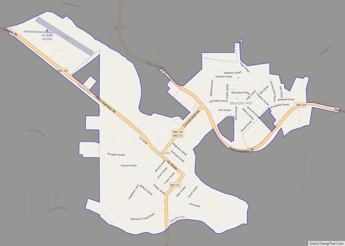
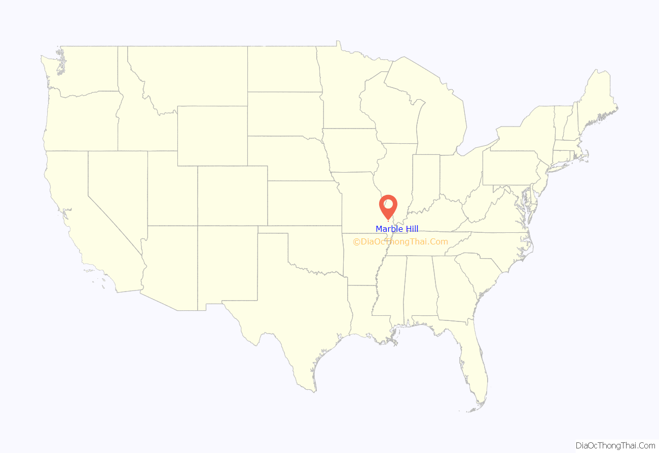
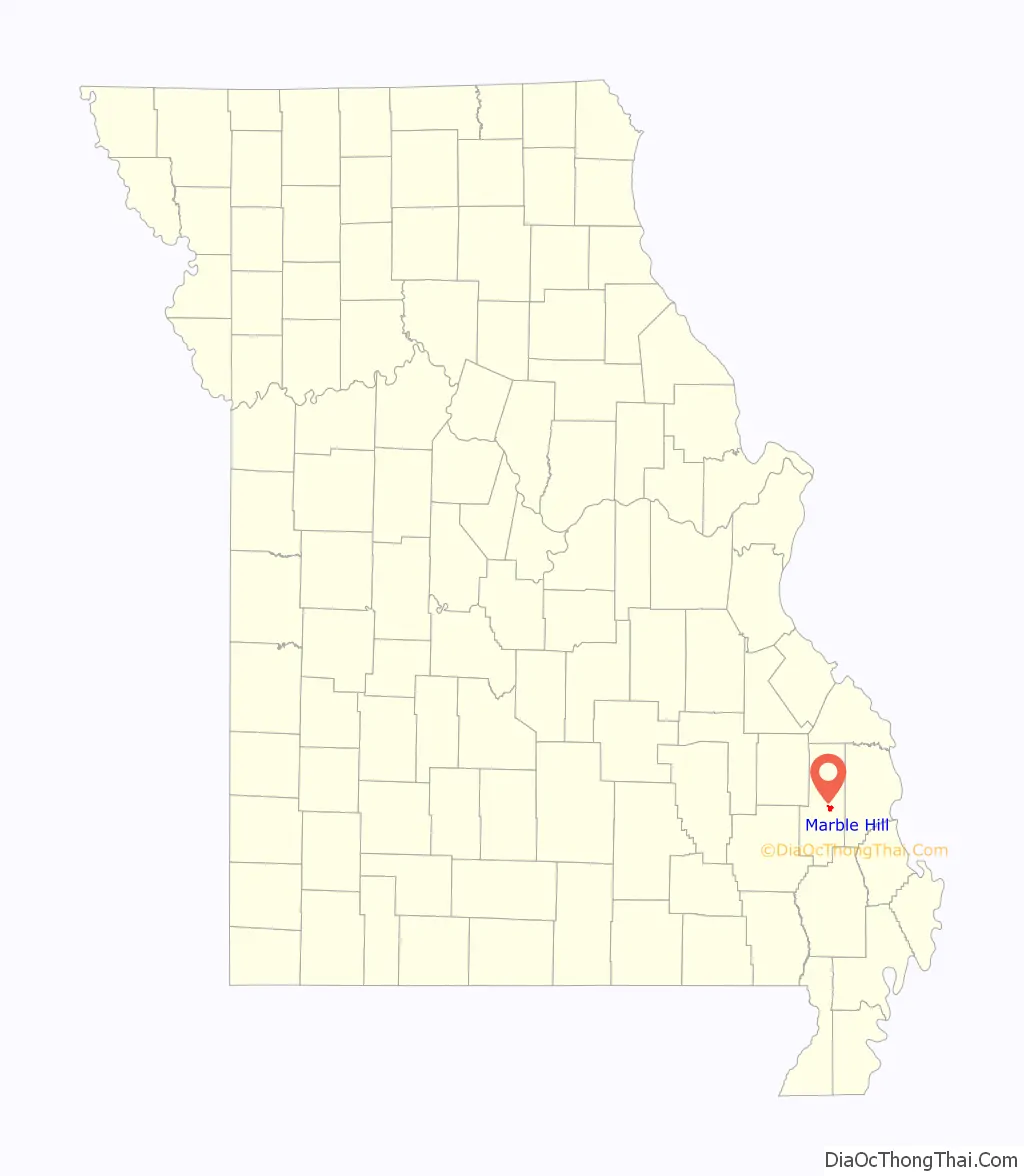
Marble Hill is a fourth-class city in central Bollinger County in Southeast Missouri, United States. Located at the intersection of State Highways 34 and 51, it is the largest city in Bollinger and serves as the county seat. The population was 1,388 at the 2020 census. The city was officially organized in July 1851 and is named after a marble-like rock.
Marble Hill is part of the Cape Girardeau−Jackson, MO-IL Metropolitan Statistical Area.
| Name: | Marble Hill city |
|---|---|
| LSAD Code: | 25 |
| LSAD Description: | city (suffix) |
| State: | Missouri |
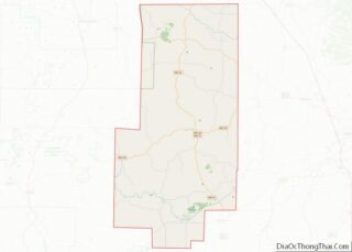
| County: | Bollinger County |
| Elevation: | 400 ft (100 m) |
| Total Area: | 1.66 sq mi (4.30 km²) |
| Land Area: | 1.65 sq mi (4.28 km²) |
| Water Area: | 0.01 sq mi (0.01 km²) |
| Total Population: | 1,388 |
| Population Density: | 839.18/sq mi (323.93/km²) |
| ZIP code: | 63764 |
| Area code: | 573 |
| FIPS code: | 2945848 |
Online Interactive Map
Click on ![]() to view map in "full screen" mode.
to view map in "full screen" mode.
Marble Hill location map. Where is Marble Hill city?
History
The area that would eventually become known as Marble Hill was established in 1842 as New California. Nine years later, it was renamed Dallas in 1851. As the area grew over the years, the First Baptist Church was built in 1856 near the oldest cemetery in Marble Hill. In 1862, the courthouse and town of Dallas was raided by Colonel S.D. Kitchen, along with 120 Confederate soldiers. Finally, in 1868, the name of the town was changed again, this time to Marble Hill, to prevent confusion with the already existing Dallas County.
A year after the name change, a man by the name of Eli Lutes laid out what would become known as Lutesville. Lutes offered 10 acres (40,000 m) to the railroad for a depot location which would be used as a shipping and trading point. Disputes with leaders of Marble Hill persuaded the railroad to relocate their route through Lutesville instead.
In 1880, Will Mayfield College moved to Marble Hill from Smithville. It remained in operation there until its closing in 1934. In 1893, Wicecarver’s Store was built across from the courthouse where the steps in front were formerly used for mounting horses and carriages. Between 1904 and 1905, the Mineral Well was dug on the courthouse square and was used until 1947–1948. The year 1932 marked the last passenger line on the Belmont Branch of the St. Louis & Iron Mountain Railroad. The railroad company ceased operations through Lutesville in 1973. In August 1953, an artesian well was discovered approximately 1,800 feet (550 m) deep while drilling for oil in the area. In 1973, voters approved a measure to build what would become known as Twin City Airport.
It was suggested in 1985 that the towns of Marble Hill and Lutesville should merge. Lutesville, which had been founded in 1869 and later became the main business and shipping center for the area, merged with Marble Hill and maintained the name of Marble Hill because it was the current county seat. The portion of Marble Hill that was the former city of Lutesville is the portion southwest of Crooked Creek. Crooked Creek has flooded the town on many occasions.
Marble Hill Road Map
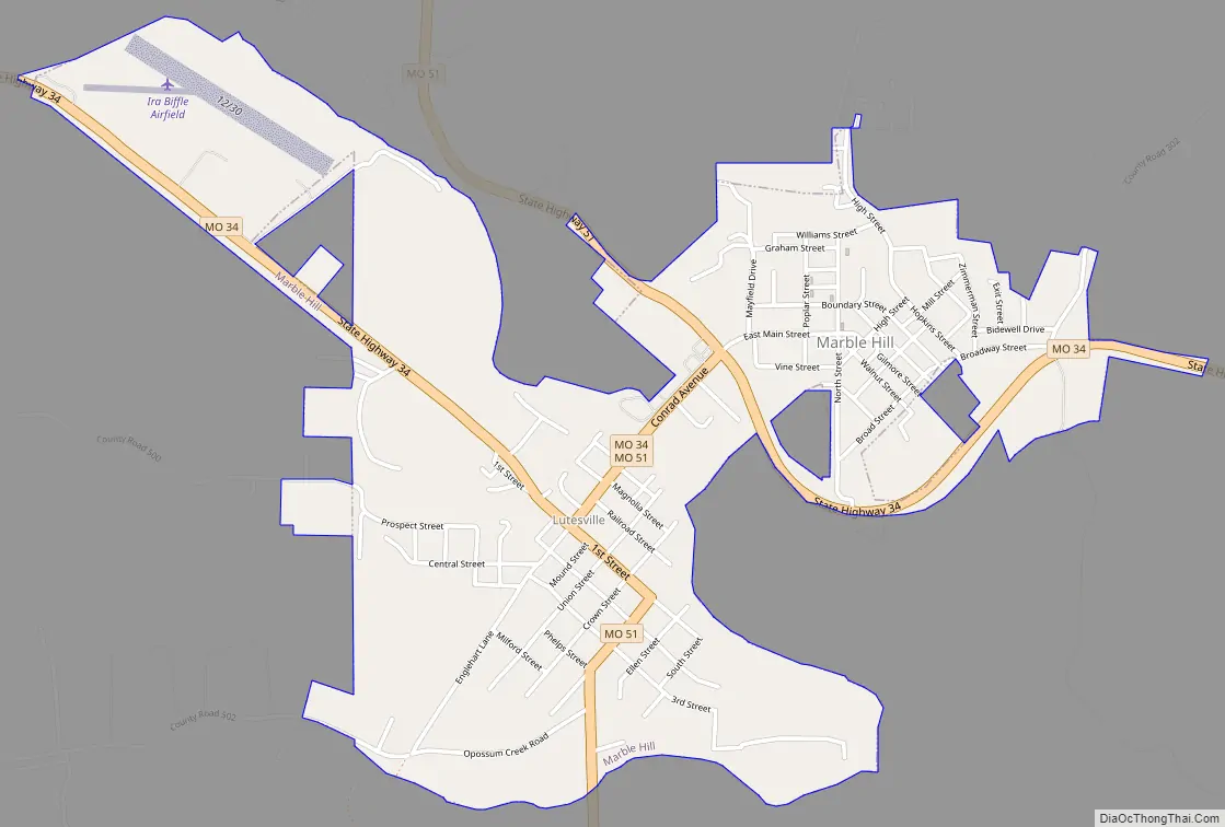
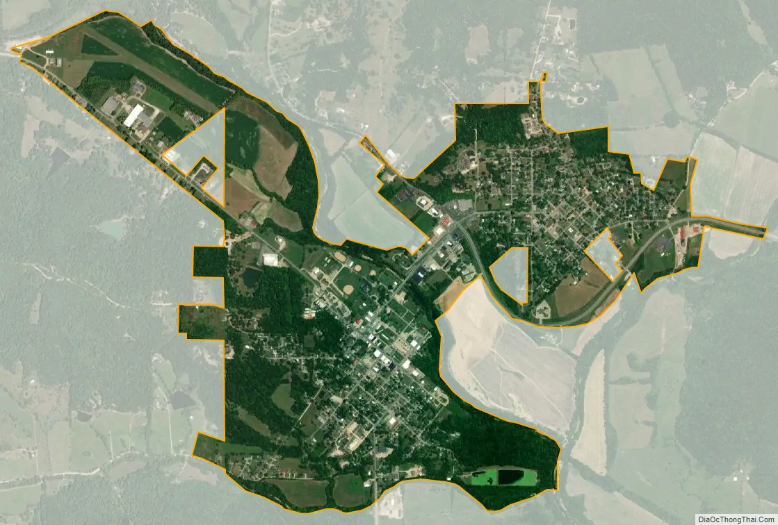
Marble Hill city Satellite Map
Geography
Marble Hill is located just north of the confluence of Hurricane Creek and Crooked Creek. Lutesville lies to the south across Crooked Creek. Missouri routes 34 and 51 pass through the community.
According to the United States Census Bureau, the city has a total area of 1.65 square miles (4.27 km), of which 1.64 square miles (4.25 km) is land and 0.01 square miles (0.03 km) is water.
See also
Map of Missouri State and its subdivision:- Adair
- Andrew
- Atchison
- Audrain
- Barry
- Barton
- Bates
- Benton
- Bollinger
- Boone
- Buchanan
- Butler
- Caldwell
- Callaway
- Camden
- Cape Girardeau
- Carroll
- Carter
- Cass
- Cedar
- Chariton
- Christian
- Clark
- Clay
- Clinton
- Cole
- Cooper
- Crawford
- Dade
- Dallas
- Daviess
- De Kalb
- Dent
- Douglas
- Dunklin
- Franklin
- Gasconade
- Gentry
- Greene
- Grundy
- Harrison
- Henry
- Hickory
- Holt
- Howard
- Howell
- Iron
- Jackson
- Jasper
- Jefferson
- Johnson
- Knox
- Laclede
- Lafayette
- Lawrence
- Lewis
- Lincoln
- Linn
- Livingston
- Macon
- Madison
- Maries
- Marion
- McDonald
- Mercer
- Miller
- Mississippi
- Moniteau
- Monroe
- Montgomery
- Morgan
- New Madrid
- Newton
- Nodaway
- Oregon
- Osage
- Ozark
- Pemiscot
- Perry
- Pettis
- Phelps
- Pike
- Platte
- Polk
- Pulaski
- Putnam
- Ralls
- Randolph
- Ray
- Reynolds
- Ripley
- Saint Charles
- Saint Clair
- Saint Francois
- Saint Louis
- Sainte Genevieve
- Saline
- Schuyler
- Scotland
- Scott
- Shannon
- Shelby
- Stoddard
- Stone
- Sullivan
- Taney
- Texas
- Vernon
- Warren
- Washington
- Wayne
- Webster
- Worth
- Wright
- Alabama
- Alaska
- Arizona
- Arkansas
- California
- Colorado
- Connecticut
- Delaware
- District of Columbia
- Florida
- Georgia
- Hawaii
- Idaho
- Illinois
- Indiana
- Iowa
- Kansas
- Kentucky
- Louisiana
- Maine
- Maryland
- Massachusetts
- Michigan
- Minnesota
- Mississippi
- Missouri
- Montana
- Nebraska
- Nevada
- New Hampshire
- New Jersey
- New Mexico
- New York
- North Carolina
- North Dakota
- Ohio
- Oklahoma
- Oregon
- Pennsylvania
- Rhode Island
- South Carolina
- South Dakota
- Tennessee
- Texas
- Utah
- Vermont
- Virginia
- Washington
- West Virginia
- Wisconsin
- Wyoming