Map of Rocheport city

Map of Rocheport city

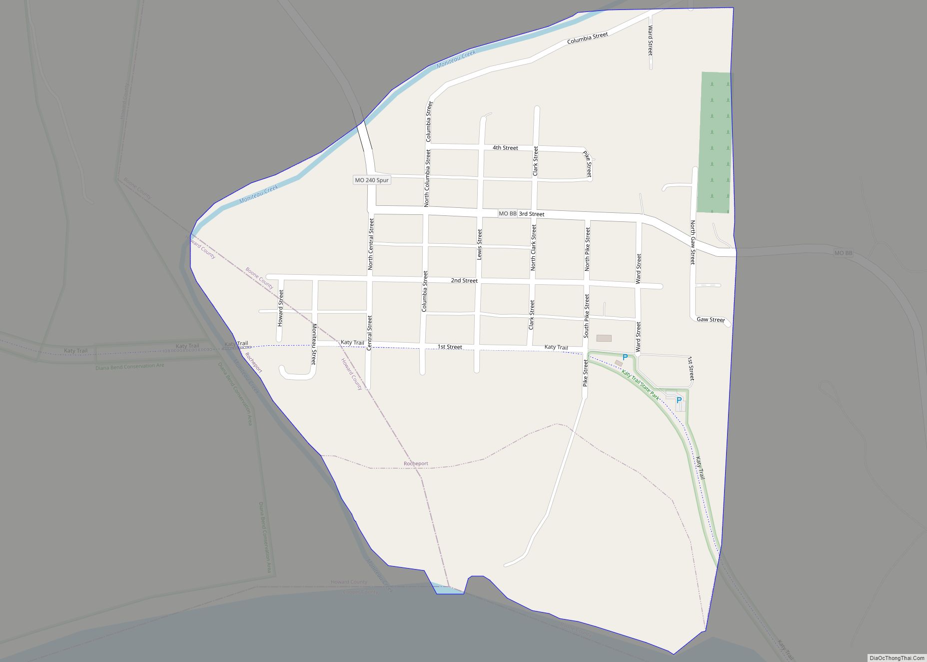
Rocheport is a city in Boone County, Missouri, United States. It is part of the Columbia, Missouri Metropolitan Statistical Area. The population was 239 at the 2010 census. Rocheport includes the Rocheport Historic District, an area with buildings dating from 1830 and which is listed on the National Register of Historic Places. Rocheport city overview: … Read more

Map of Rives town

Map of Rives town, Missouri

Rives town overview: Name: Rives town LSAD Code: 43 LSAD Description: town (suffix) State: Missouri County: Dunklin County FIPS code: 2962228 Online Interactive Map Rives online map. Source: Basemap layers from Google Map, Open Street Map (OSM), Arcgisonline, Wmflabs. Boundary Data from Database of Global Administrative Areas. Rives location map. Where is Rives town? Rives … Read more

Map of Rockville city, Missouri

Map of Rockville city, Missouri

Rockville is a city in Bates County, Missouri, and is part of the Kansas City metropolitan area within the United States. The population was 135 at the 2020 census. Rockville city overview: Name: Rockville city LSAD Code: 25 LSAD Description: city (suffix) State: Missouri County: Bates County Elevation: 771 ft (235 m) Total Area: 0.33 sq mi (0.85 km²) Land … Read more

Map of Rockaway Beach city

Map of Rockaway Beach city, Missouri

Rockaway Beach is a city in Taney County, Missouri, United States. The population was 829 at the 2020 census. It lies on the shoreline of the White River. Rockaway Beach is part of the Branson, Missouri Micropolitan Statistical Area. Rockaway Beach city overview: Name: Rockaway Beach city LSAD Code: 25 LSAD Description: city (suffix) State: … Read more

Map of Rock Port city

Map of Rock Port city

Rock Port is a city in, and the county seat of, Atchison County, Missouri, United States. The population was 1,278 at the 2020 census. Rock Port city overview: Name: Rock Port city LSAD Code: 25 LSAD Description: city (suffix) State: Missouri County: Atchison County Elevation: 1,116 ft (340 m) Total Area: 2.77 sq mi (7.18 km²) Land Area: 2.77 sq mi (7.18 km²) … Read more

Map of Roscoe village, Missouri

Map of Roscoe village, Missouri

Roscoe is a village in St. Clair County, Missouri, United States. The population was 89 at the 2020 census. Roscoe village overview: Name: Roscoe village LSAD Code: 47 LSAD Description: village (suffix) State: Missouri County: St. Clair County Elevation: 781 ft (238 m) Total Area: 1.65 sq mi (4.28 km²) Land Area: 1.53 sq mi (3.96 km²) Water Area: 0.12 sq mi (0.32 km²) Total Population: … Read more

Map of Rolla city, Missouri

Map of Rolla city, Missouri

Rolla (/ˈrɒlə/) is a city in, and the county seat of, Phelps County, Missouri, United States. Its population in the 2020 United States Census was 19,943. It is approximately midway between St. Louis and Springfield along I-44. Its micropolitan statistical area consists of Phelps County, Missouri. It is the home of the Missouri University of … Read more

Map of Rogersville city, Missouri

Map of Rogersville city, Missouri

Rogersville is a city in Greene and Webster counties in the U.S. state of Missouri. The population is 3,897 as of the 2020 census. It is part of the Springfield, Missouri Metropolitan Statistical Area. Rogersville was formally known as the “Raccoon Capital of the World”. In 2006, 417 Magazine ranked Rogersville as the eighth-best place … Read more

Map of Rosebud city

Map of Rosebud city, Missouri

Rosebud is a city in Gasconade County, Missouri, United States. The population was 390 at the 2020 census. Rosebud city overview: Name: Rosebud city LSAD Code: 25 LSAD Description: city (suffix) State: Missouri County: Gasconade County Elevation: 869 ft (265 m) Total Area: 0.88 sq mi (2.26 km²) Land Area: 0.87 sq mi (2.26 km²) Water Area: 0.00 sq mi (0.01 km²) Total Population: 390 Population … Read more

Map of Rothville village

Map of Rothville village

Rothville is a village in northern Chariton County, Missouri, United States. The population was 63 at the 2020 census. Rothville village overview: Name: Rothville village LSAD Code: 47 LSAD Description: village (suffix) State: Missouri County: Chariton County Elevation: 735 ft (224 m) Total Area: 0.20 sq mi (0.51 km²) Land Area: 0.20 sq mi (0.51 km²) Water Area: 0.00 sq mi (0.00 km²) Total Population: 63 … Read more

Map of Rosendale city

Map of Rosendale city, Missouri

Rosendale is a city in Andrew County, Missouri, United States. The population was 143 at the 2010 census. Rosendale is part of the St. Joseph, MO–KS Metropolitan Statistical Area. Rosendale city overview: Name: Rosendale city LSAD Code: 25 LSAD Description: city (suffix) State: Missouri County: Andrew County Elevation: 919 ft (280 m) Total Area: 0.30 sq mi (0.79 km²) Land … Read more

Map of Russellville city, Missouri

Map of Russellville city, Missouri

Russellville is a city in Cole County, Missouri, United States. The population was 778 at the 2020 census. It is part of the Jefferson City, Missouri Metropolitan Statistical Area. Russellville city overview: Name: Russellville city LSAD Code: 25 LSAD Description: city (suffix) State: Missouri County: Cole County Founded: 1838 Incorporated: 1848 Elevation: 873 ft (266 m) Total … Read more