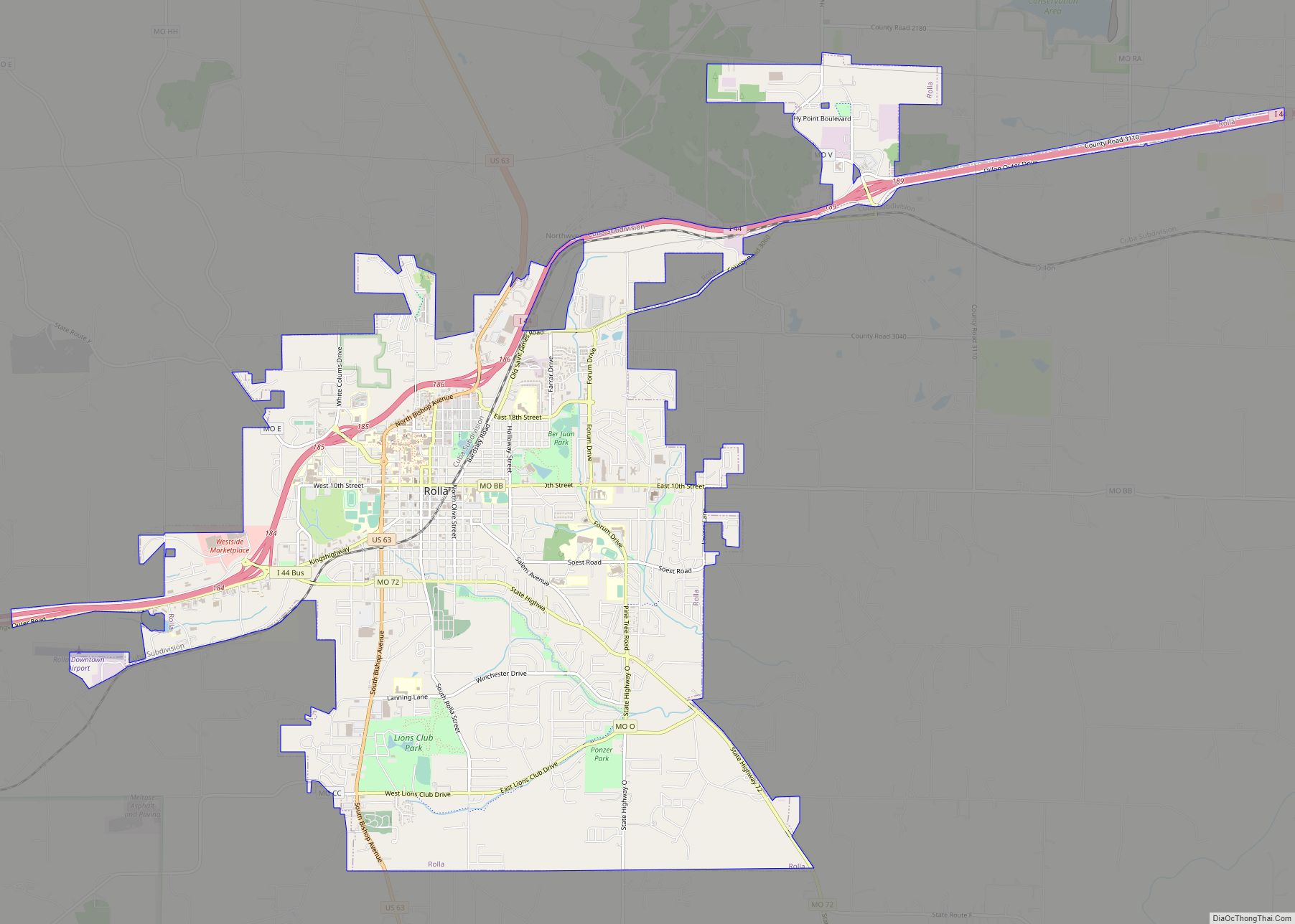
Rolla (/ˈrɒlə/) is a city in, and the county seat of, Phelps County, Missouri, United States. Its population in the 2020 United States Census was 19,943. It is approximately midway between St. Louis and Springfield along I-44. Its micropolitan statistical area consists of Phelps County, Missouri.
It is the home of the Missouri University of Science and Technology, well known for its many engineering departments and computer science department.
The headquarters of the Mark Twain National Forest is in Rolla. The city is also within the Ozark Highlands American Viticultural Area, with vineyards first established by Italian immigrants to the area.
| Name: | Rolla city |
|---|---|
| LSAD Code: | 25 |
| LSAD Description: | city (suffix) |
| State: | Missouri |
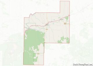
| County: | Phelps County |
| Founded: | 1858 |
| Elevation: | 1,099 ft (335 m) |
| Total Area: | 12.15 sq mi (31.47 km²) |
| Land Area: | 12.13 sq mi (31.41 km²) |
| Water Area: | 0.02 sq mi (0.05 km²) |
| Total Population: | 19,943 |
| Population Density: | 1,644.24/sq mi (634.86/km²) |
| ZIP code: | 65401, 65402, 65409 |
| Area code: | 573 |
| FIPS code: | 2962912 |
| GNISfeature ID: | 2396418 |
| Website: | rollacity.org |
Online Interactive Map
Click on ![]() to view map in "full screen" mode.
to view map in "full screen" mode.
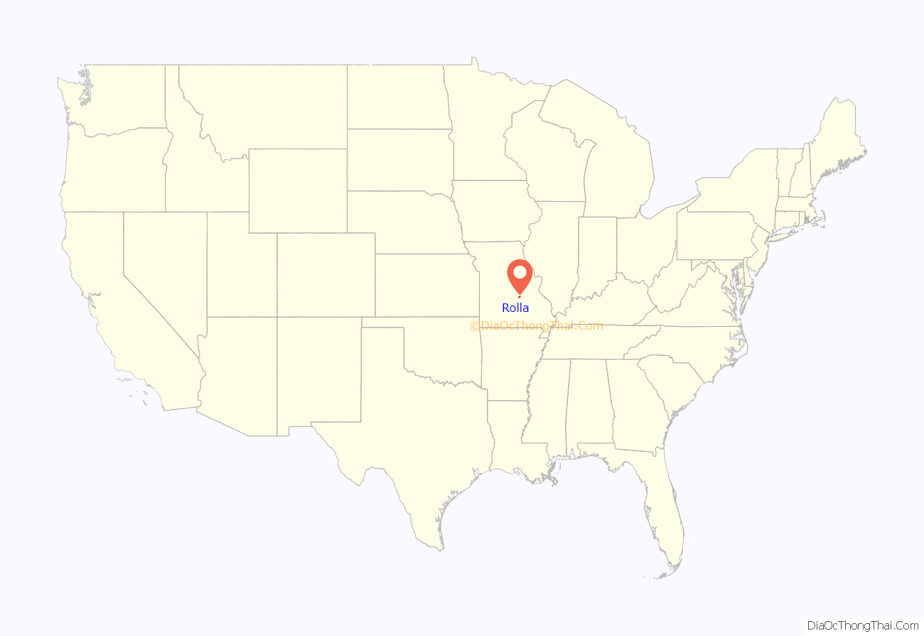
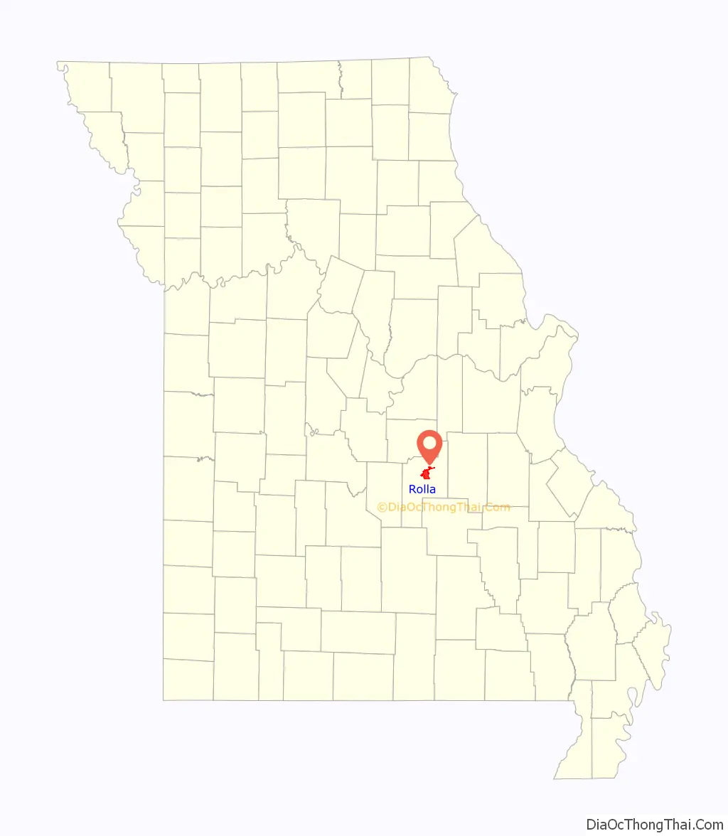
Rolla location map. Where is Rolla city?
History
The first European-American settlers in Phelps County arrived in the early 19th century, working as farmers and iron workers along the local rivers, such as the Meramec, the Gasconade, and the Little Piney. In 1842, John Webber built the first house in what became the City of Rolla. Nine years later, railroad contractor Edmund Ward Bishop, considered to be the founder of Rolla, settled in the area. The state officially established Rolla as a town in 1858.
Two stories account for how Rolla was named. One story, widely regarded as a folk legend, and acknowledged as such by the Phelps County Historical Society, arises from the competition between Rolla and neighboring Dillon, Missouri, to be designated the county seat. When Rolla was made the county seat in 1861, the residents of Dillon, having lost a round, were allowed to choose the name of the new city and named it Rolla, after a good-for-nothing hunting dog.
The more widely accepted story came from a citizens’ meeting about naming the town. Webber was said to prefer the name Hardscrabble (which was used to describe the soils in the region) and Bishop pushed for the name Phelps Center. George Coppedge, representing new settlers from North Carolina, wanted to name the community after Raleigh. Bishop broke the three-way tie by agreeing with Coppedge as long as the name was spelled properly for the region, Rolla.
With numerous settlers from the South, many residents of Rolla leaned toward the Confederacy during the American Civil War; however, the town was taken by Union forces in June 1861. They built two minor forts — Fort Wyman and Fort Dette — during their occupation. Rolla was also the location of Camp Glover and Camp Davies. From 1863 to 1865, Rolla was the regimental headquarters of the 5th Missouri State Militia.
For most of its history, Rolla has served as a transportation and trading center. It was the original terminus of the St. Louis-San Francisco Railway, colloquially known as the “Frisco Line”. Today, the BNSF Railway directly runs through the town.
Rolla was also a regular stop along U.S. Route 66, as it is almost located exactly halfway between the larger cities of St. Louis and Springfield. Today, Interstate 44, U.S. Route 63, and Route 72 all run through Rolla.
Rolla Road Map
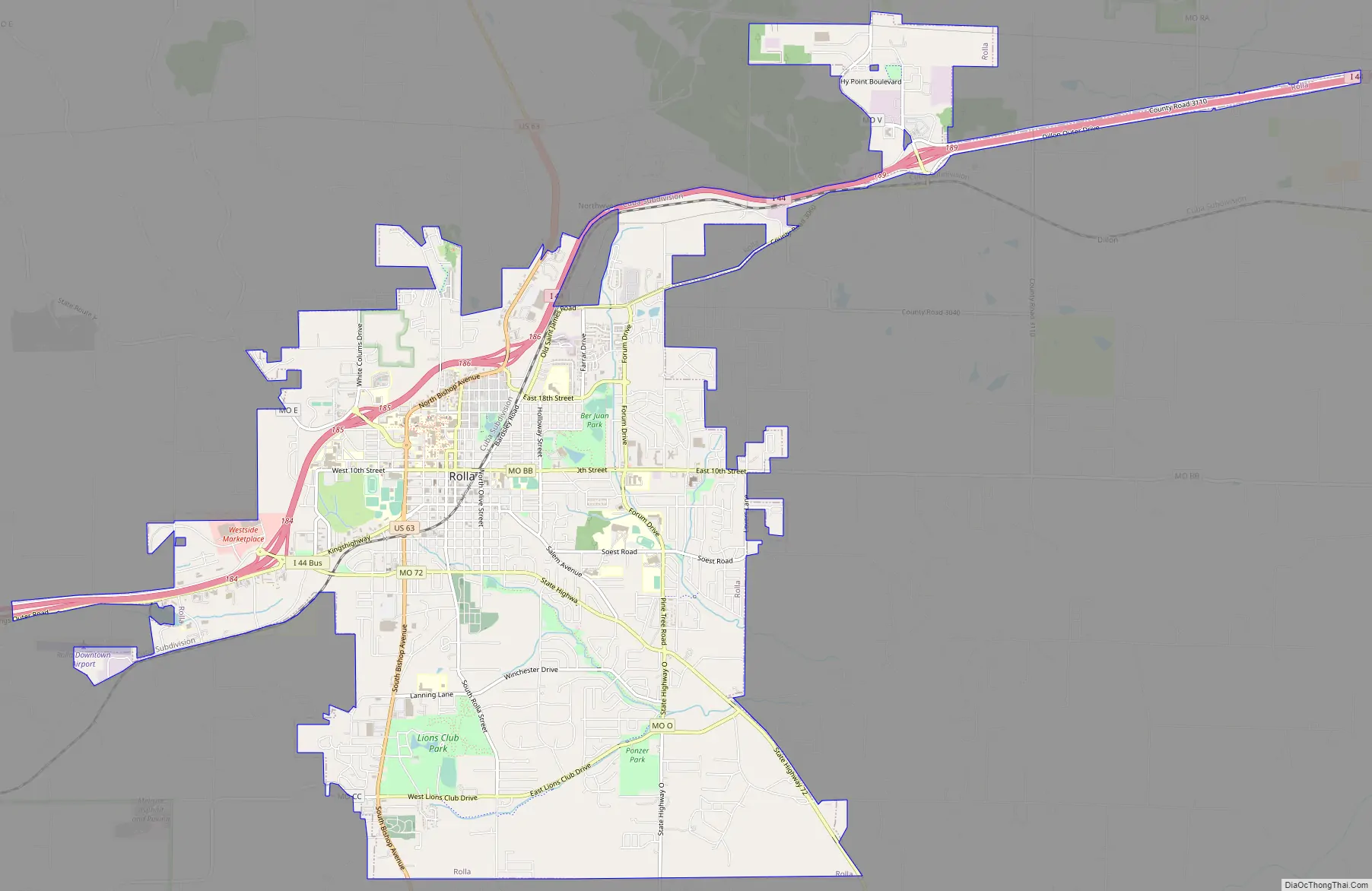
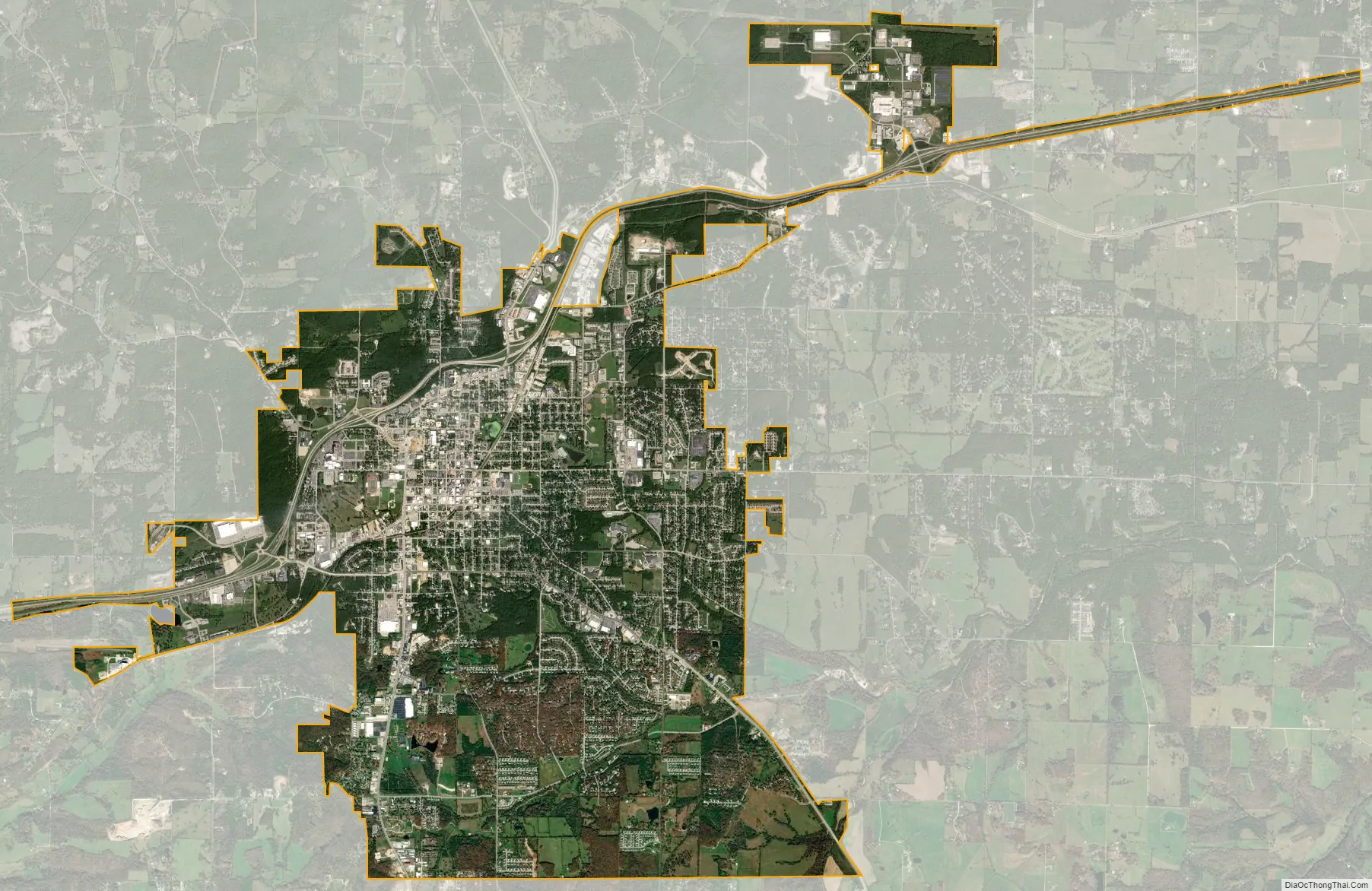
Rolla city Satellite Map
Geography
According to the United States Census Bureau, the city has a total area of 11.85 square miles (30.69 km), of which 11.83 square miles (30.64 km) is land and 0.02 square miles (0.05 km) is water. Running through the city is the divide line that separates the vast Missouri watershed (via the Little Piney and the Gasconade) from the substantially smaller Meremec watershed (via the Bourbeuse).
Climate
Rolla has a humid subtropical climate. The Köppen Climate Classification subtype for this climate is “Cfa”.
See also
Map of Missouri State and its subdivision:- Adair
- Andrew
- Atchison
- Audrain
- Barry
- Barton
- Bates
- Benton
- Bollinger
- Boone
- Buchanan
- Butler
- Caldwell
- Callaway
- Camden
- Cape Girardeau
- Carroll
- Carter
- Cass
- Cedar
- Chariton
- Christian
- Clark
- Clay
- Clinton
- Cole
- Cooper
- Crawford
- Dade
- Dallas
- Daviess
- De Kalb
- Dent
- Douglas
- Dunklin
- Franklin
- Gasconade
- Gentry
- Greene
- Grundy
- Harrison
- Henry
- Hickory
- Holt
- Howard
- Howell
- Iron
- Jackson
- Jasper
- Jefferson
- Johnson
- Knox
- Laclede
- Lafayette
- Lawrence
- Lewis
- Lincoln
- Linn
- Livingston
- Macon
- Madison
- Maries
- Marion
- McDonald
- Mercer
- Miller
- Mississippi
- Moniteau
- Monroe
- Montgomery
- Morgan
- New Madrid
- Newton
- Nodaway
- Oregon
- Osage
- Ozark
- Pemiscot
- Perry
- Pettis
- Phelps
- Pike
- Platte
- Polk
- Pulaski
- Putnam
- Ralls
- Randolph
- Ray
- Reynolds
- Ripley
- Saint Charles
- Saint Clair
- Saint Francois
- Saint Louis
- Sainte Genevieve
- Saline
- Schuyler
- Scotland
- Scott
- Shannon
- Shelby
- Stoddard
- Stone
- Sullivan
- Taney
- Texas
- Vernon
- Warren
- Washington
- Wayne
- Webster
- Worth
- Wright
- Alabama
- Alaska
- Arizona
- Arkansas
- California
- Colorado
- Connecticut
- Delaware
- District of Columbia
- Florida
- Georgia
- Hawaii
- Idaho
- Illinois
- Indiana
- Iowa
- Kansas
- Kentucky
- Louisiana
- Maine
- Maryland
- Massachusetts
- Michigan
- Minnesota
- Mississippi
- Missouri
- Montana
- Nebraska
- Nevada
- New Hampshire
- New Jersey
- New Mexico
- New York
- North Carolina
- North Dakota
- Ohio
- Oklahoma
- Oregon
- Pennsylvania
- Rhode Island
- South Carolina
- South Dakota
- Tennessee
- Texas
- Utah
- Vermont
- Virginia
- Washington
- West Virginia
- Wisconsin
- Wyoming