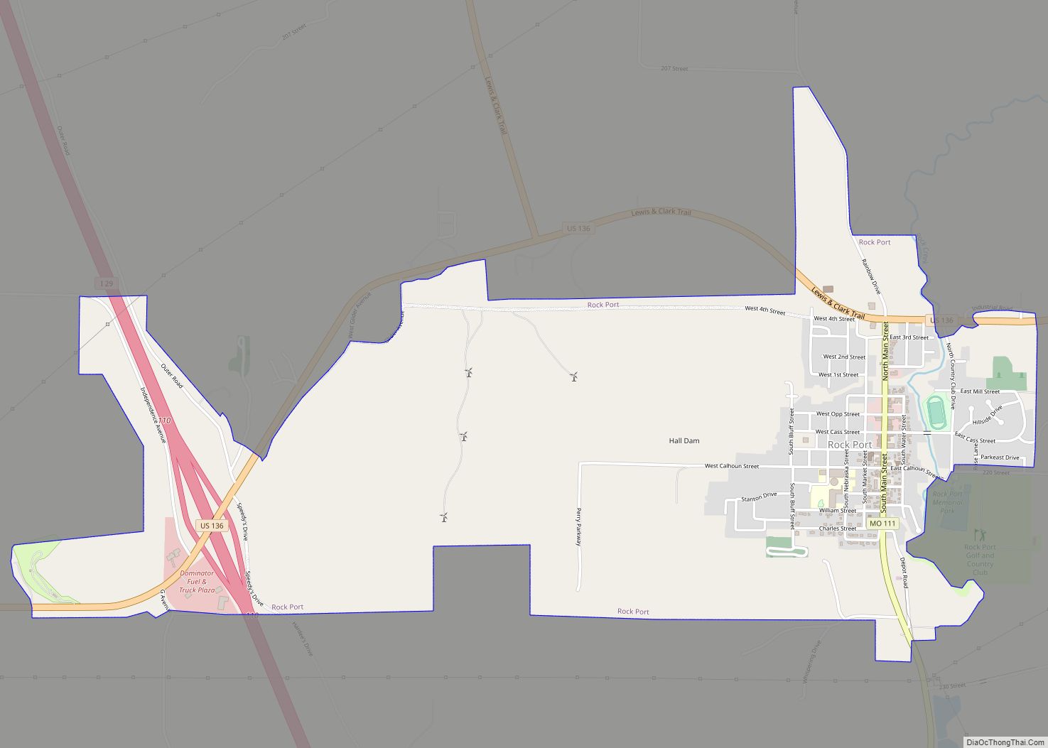
Rock Port is a city in, and the county seat of, Atchison County, Missouri, United States. The population was 1,278 at the 2020 census.
| Name: | Rock Port city |
|---|---|
| LSAD Code: | 25 |
| LSAD Description: | city (suffix) |
| State: | Missouri |
| County: | Atchison County |
| Elevation: | 1,116 ft (340 m) |
| Total Area: | 2.77 sq mi (7.18 km²) |
| Land Area: | 2.77 sq mi (7.18 km²) |
| Water Area: | 0.00 sq mi (0.00 km²) |
| Total Population: | 1,278 |
| Population Density: | 461.21/sq mi (178.08/km²) |
| ZIP code: | 64482 |
| Area code: | 660 |
| FIPS code: | 2962696 |
| GNISfeature ID: | 2396401 |
| Website: | rpmo.com |
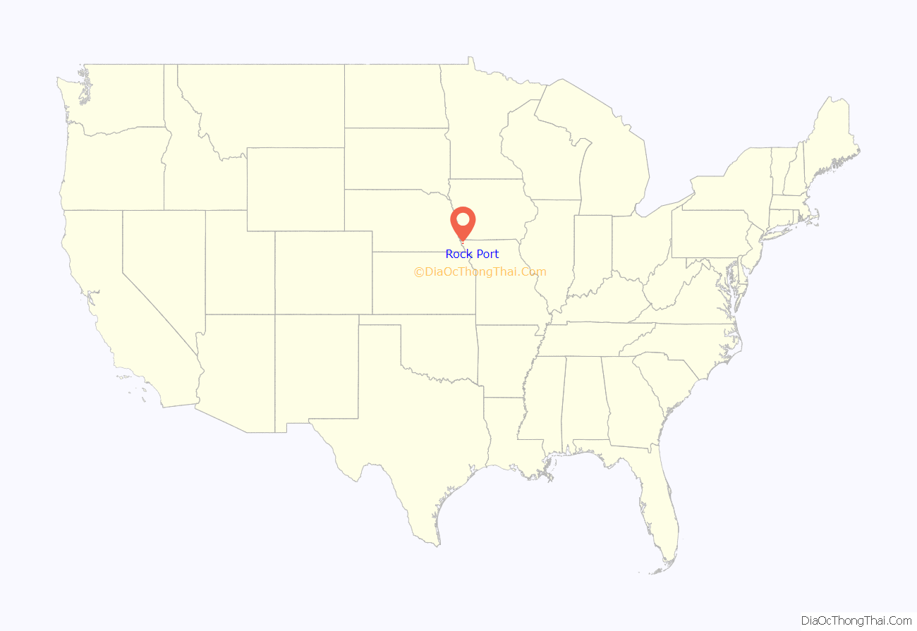
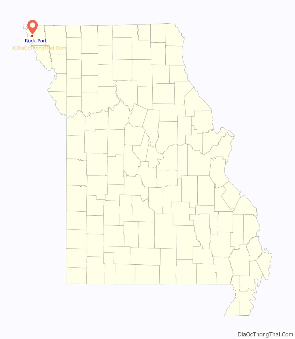
Online Interactive Map
Click on ![]() to view map in "full screen" mode.
to view map in "full screen" mode.
Rock Port location map. Where is Rock Port city?
History
Rock Port was laid out in 1851. The city, which is eight miles east of the Missouri River in the Loess Hills bluffs above the river, derives its name from Rock Creek, which flows through it. Following the Honey War border dispute with Iowa when Missouri’s northern border was shifted farther south, the original county seat was moved from Linden to Rock Port .
The original city is off I-29, but an additional area is built that is a travel hub. Truck stops, motels, fast food and firework stands are located along the interstate hosting a large amount of day time visitors, despite the city’s small size.
The city of Rock Port has become largely energy self-sufficient. In April 2008, Rock Port claimed to be the first community in the United States to have its electricity 100 percent generated by wind power. Rock Port, which uses about 13 million kWh a year, has its power generated by the Loess Hills Wind Farm. The farm has four Suzlon 1.25-megawatt wind turbines. Excess power is sold to the Missouri Public Utility Alliance in Columbia, Missouri. The idea for the wind turbines came from the town’s former mortuary worker, Eric Chamberlain. The farm was built by Wind Capital Group and is by far the company’s smallest wind farm developed through January 2009. Wind Capital in 2008 built the bigger 50.4MW Cow Branch Wind Farm between Rock Port and Tarkio.
The Atchison County Memorial Building and John Dickinson Dopf Mansion are listed on the National Register of Historic Places.
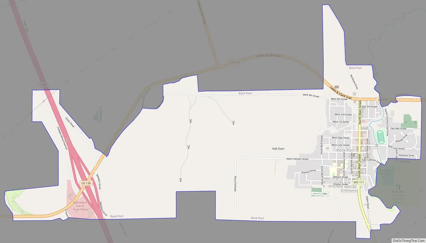
Rock Port Road Map
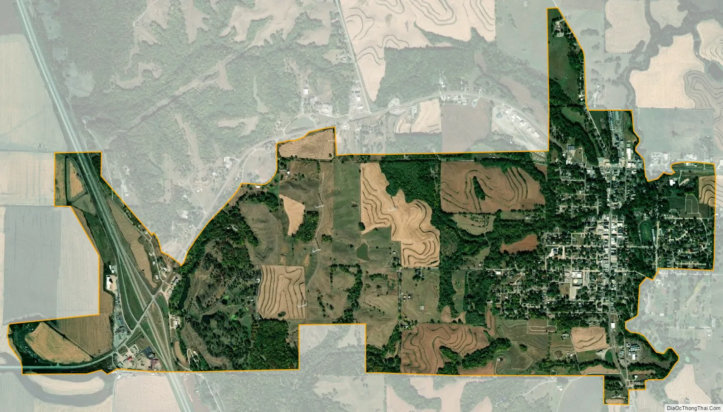
Rock Port city Satellite Map
Geography
Rock Port is located along Rock Creek approximately 2.5 miles east of the Missouri River Valley.
According to the United States Census Bureau, the city has a total area of 2.77 square miles (7.17 km), all land.
See also
Map of Missouri State and its subdivision:- Adair
- Andrew
- Atchison
- Audrain
- Barry
- Barton
- Bates
- Benton
- Bollinger
- Boone
- Buchanan
- Butler
- Caldwell
- Callaway
- Camden
- Cape Girardeau
- Carroll
- Carter
- Cass
- Cedar
- Chariton
- Christian
- Clark
- Clay
- Clinton
- Cole
- Cooper
- Crawford
- Dade
- Dallas
- Daviess
- De Kalb
- Dent
- Douglas
- Dunklin
- Franklin
- Gasconade
- Gentry
- Greene
- Grundy
- Harrison
- Henry
- Hickory
- Holt
- Howard
- Howell
- Iron
- Jackson
- Jasper
- Jefferson
- Johnson
- Knox
- Laclede
- Lafayette
- Lawrence
- Lewis
- Lincoln
- Linn
- Livingston
- Macon
- Madison
- Maries
- Marion
- McDonald
- Mercer
- Miller
- Mississippi
- Moniteau
- Monroe
- Montgomery
- Morgan
- New Madrid
- Newton
- Nodaway
- Oregon
- Osage
- Ozark
- Pemiscot
- Perry
- Pettis
- Phelps
- Pike
- Platte
- Polk
- Pulaski
- Putnam
- Ralls
- Randolph
- Ray
- Reynolds
- Ripley
- Saint Charles
- Saint Clair
- Saint Francois
- Saint Louis
- Sainte Genevieve
- Saline
- Schuyler
- Scotland
- Scott
- Shannon
- Shelby
- Stoddard
- Stone
- Sullivan
- Taney
- Texas
- Vernon
- Warren
- Washington
- Wayne
- Webster
- Worth
- Wright
- Alabama
- Alaska
- Arizona
- Arkansas
- California
- Colorado
- Connecticut
- Delaware
- District of Columbia
- Florida
- Georgia
- Hawaii
- Idaho
- Illinois
- Indiana
- Iowa
- Kansas
- Kentucky
- Louisiana
- Maine
- Maryland
- Massachusetts
- Michigan
- Minnesota
- Mississippi
- Missouri
- Montana
- Nebraska
- Nevada
- New Hampshire
- New Jersey
- New Mexico
- New York
- North Carolina
- North Dakota
- Ohio
- Oklahoma
- Oregon
- Pennsylvania
- Rhode Island
- South Carolina
- South Dakota
- Tennessee
- Texas
- Utah
- Vermont
- Virginia
- Washington
- West Virginia
- Wisconsin
- Wyoming