Map of Shoal Creek Drive village

Map of Shoal Creek Drive village

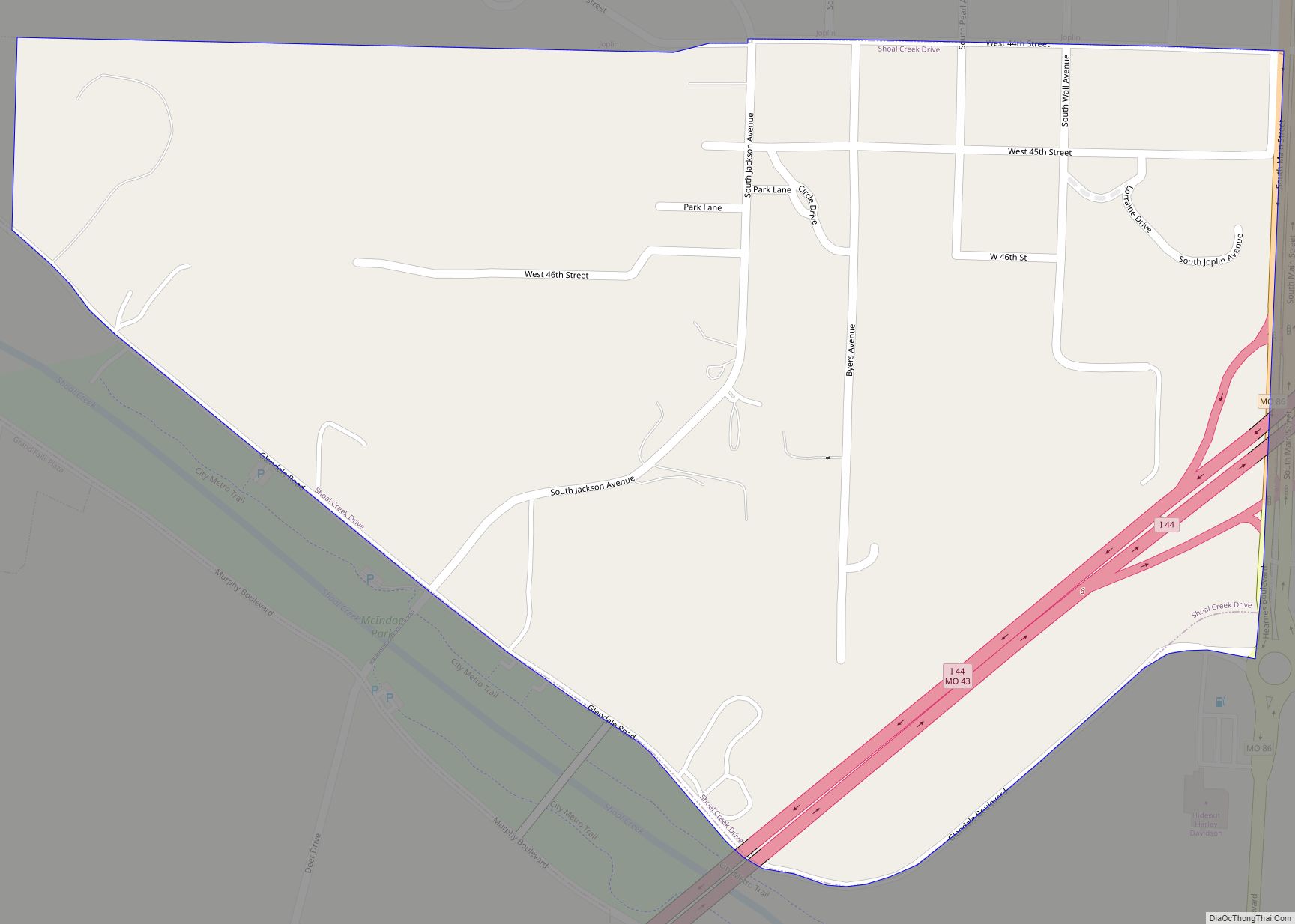
Shoal Creek Drive is a village in Newton County, Missouri, United States. The population was 337 at the 2010 census. It is part of the Joplin, Missouri Metropolitan Statistical Area. Shoal Creek Drive village overview: Name: Shoal Creek Drive village LSAD Code: 47 LSAD Description: village (suffix) State: Missouri County: Newton County Elevation: 997 ft (304 m) … Read more

Map of Sheridan town, Missouri

Map of Sheridan town, Missouri

Sheridan is a city in northwest Worth County, Missouri, United States, near the Platte River. The population was 195 at the 2010 census. Sheridan town overview: Name: Sheridan town LSAD Code: 43 LSAD Description: town (suffix) State: Missouri County: Worth County Elevation: 1,056 ft (322 m) Total Area: 0.19 sq mi (0.50 km²) Land Area: 0.19 sq mi (0.50 km²) Water Area: 0.00 sq mi … Read more

Map of Sikeston city

Map of Sikeston city

Sikeston /ˈsaɪkstən/ is a city located both in southern Scott County and northern New Madrid County, in the state of Missouri, United States. It is situated just north of the “Missouri Bootheel”, although many locals consider Sikeston a part of it. By way of Interstate 55, Interstate 57, and U.S. Route 60, Sikeston is close … Read more

Map of Sibley village, Missouri

Map of Sibley village, Missouri

Sibley is a village in Jackson County, Missouri, United States. The population was 314 at the 2020 census. It is known as the home of Fort Osage National Historic Landmark. It is part of the Kansas City metropolitan area. Sibley village overview: Name: Sibley village LSAD Code: 47 LSAD Description: village (suffix) State: Missouri County: … Read more

Map of Shrewsbury city

Map of Shrewsbury city, Missouri

Shrewsbury is an inner-ring suburb of St. Louis, located in St. Louis County, Missouri, United States. The population was 6,254 at the 2010 census. Shrewsbury city overview: Name: Shrewsbury city LSAD Code: 25 LSAD Description: city (suffix) State: Missouri County: St. Louis County Elevation: 522 ft (159 m) Total Area: 1.44 sq mi (3.73 km²) Land Area: 1.44 sq mi (3.73 km²) Water … Read more

Map of Slater city, Missouri

Map of Slater city, Missouri

Slater is a city in Saline County, Missouri, United States. The population was 1,856 at the 2010 census. Slater city overview: Name: Slater city LSAD Code: 25 LSAD Description: city (suffix) State: Missouri County: Saline County Elevation: 840 ft (260 m) Total Area: 1.45 sq mi (3.75 km²) Land Area: 1.45 sq mi (3.74 km²) Water Area: 0.00 sq mi (0.00 km²) Total Population: 1,834 Population … Read more

Map of Skidmore city

Map of Skidmore city, Missouri

Skidmore is a city in western Nodaway County, Missouri, United States. The population was 245 at the 2020 Census. The small farming community is known for the unsolved extrajudicial killing of Ken Rex McElroy. Skidmore also has a yearly “Punkin’ Show.” Skidmore city overview: Name: Skidmore city LSAD Code: 25 LSAD Description: city (suffix) State: … Read more

Map of Silex village

Map of Silex village

Silex is a 4th-class city in Lincoln County, Missouri, United States. The population was 280 at the 2010 census. Silex village overview: Name: Silex village LSAD Code: 47 LSAD Description: village (suffix) State: Missouri County: Lincoln County Elevation: 505 ft (154 m) Total Area: 0.29 sq mi (0.75 km²) Land Area: 0.29 sq mi (0.75 km²) Water Area: 0.00 sq mi (0.00 km²) Total Population: 24 … Read more

Map of Smithton city, Missouri

Map of Smithton city, Missouri

Smithton is a city in Pettis County, Missouri, United States. The population was 570 at the 2010 census. Smithton city overview: Name: Smithton city LSAD Code: 25 LSAD Description: city (suffix) State: Missouri County: Pettis County Elevation: 873 ft (266 m) Total Area: 0.30 sq mi (0.78 km²) Land Area: 0.30 sq mi (0.78 km²) Water Area: 0.00 sq mi (0.00 km²) Total Population: 506 Population … Read more

Map of South Fork CDP, Missouri

Map of South Fork CDP, Missouri

South Fork is an unincorporated community and census-designated place (CDP) in Howell County, Missouri, United States. It is located 10 miles (16 km) southwest of West Plains on U.S. Route 160. As of the 2010 census, South Fork had a population of 241. A post office called South Fork was established in 1860, and remained in … Read more

Map of Smithville city, Missouri

Map of Smithville city, Missouri

Smithville is a city in Clay and Platte counties in the U.S. state of Missouri and is part of the Kansas City metropolitan area, along the Little Platte River. The population was 10,406 at the 2020 United States Census. Smithville city overview: Name: Smithville city LSAD Code: 25 LSAD Description: city (suffix) State: Missouri County: … Read more

Map of South Greenfield village

Map of South Greenfield village

South Greenfield is a village in Dade County, Missouri, United States. The population was 122 at the 2020 census. South Greenfield village overview: Name: South Greenfield village LSAD Code: 47 LSAD Description: village (suffix) State: Missouri County: Dade County Elevation: 961 ft (293 m) Total Area: 0.18 sq mi (0.47 km²) Land Area: 0.18 sq mi (0.47 km²) Water Area: 0.00 sq mi (0.00 km²) Total … Read more