Shrewsbury is an inner-ring suburb of St. Louis, located in St. Louis County, Missouri, United States. The population was 6,254 at the 2010 census.
| Name: | Shrewsbury city |
|---|---|
| LSAD Code: | 25 |
| LSAD Description: | city (suffix) |
| State: | Missouri |
| County: | St. Louis County |
| Elevation: | 522 ft (159 m) |
| Total Area: | 1.44 sq mi (3.73 km²) |
| Land Area: | 1.44 sq mi (3.73 km²) |
| Water Area: | 0.00 sq mi (0.00 km²) |
| Total Population: | 6,406 |
| Population Density: | 4,445.52/sq mi (1,716.09/km²) |
| FIPS code: | 2967700 |
| GNISfeature ID: | 2395878 |
| Website: | www.cityofshrewsbury.com |
Online Interactive Map
Click on ![]() to view map in "full screen" mode.
to view map in "full screen" mode.
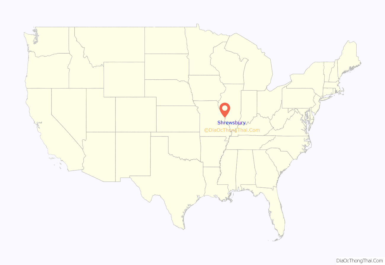
Shrewsbury location map. Where is Shrewsbury city?

History
Shrewsbury was officially platted in 1889. The land which became Shrewsbury originally belonged to Gregorie Sarpy and Charles Gratiot; by 1890, it was divided into farms and sold to families. The area now known as Shrewsbury was a 278-acre (1.13 km) farm owned by General John Murdoch. The Murdoch farm was called Shrewsbury Park, named after a town in England.
In 1913, concerned resident Joseph Burge organized the Shrewsbury Improvement Association to improve Shrewsbury and develop its first sewer system. Shrewsbury was incorporated and became a village in 1913; shortly thereafter a sanitation system was established, reducing water-borne diseases prevalent at the time.
In 1938, the United States government offered financial aid to the city of Shrewsbury, and land was acquired for the construction of a new city hall replacing the 1912 original. The new City Hall building was completed in October 1938. Shrewsbury’s new fire engine house and state-of-the-art equipment were dedicated in 1947; it was during this period that the Shrewsbury Garden Club was formed to maintain the beautiful trees and flowers throughout the city. The early 1950s were marked by the expansion of the public bus routes to connect Shrewsbury to St. Louis. The 1960s and ’70s were times of great community growth, noted by the construction of city parks, a municipal pool, and Interstate 44.
The 1980s and ’90s saw increased development of new homes, condominiums, apartments, shopping areas, and a new and improved City Center, which opened May 8, 1993, to coincide with Shrewsbury’s 80th year of incorporation. With the opening of the City Center, the previous City Hall building was converted to house the police and fire departments, and is now called the Public Safety Building.
Construction finished in 2006 on the Shrewsbury–Lansdowne Interstate 44 St. Louis MetroLink station on the eastern edge of the city, at Lansdowne Avenue and River Des Peres Boulevard.
Shrewsbury is home to the seminary of the Roman Catholic Archdiocese of Saint Louis, Kenrick–Glennon Seminary.
The Shrewsbury City Council in fall 2010 was expected to consider a plan to turn Kenrick Plaza, which has several open storefronts, into a Walmart store.[1]
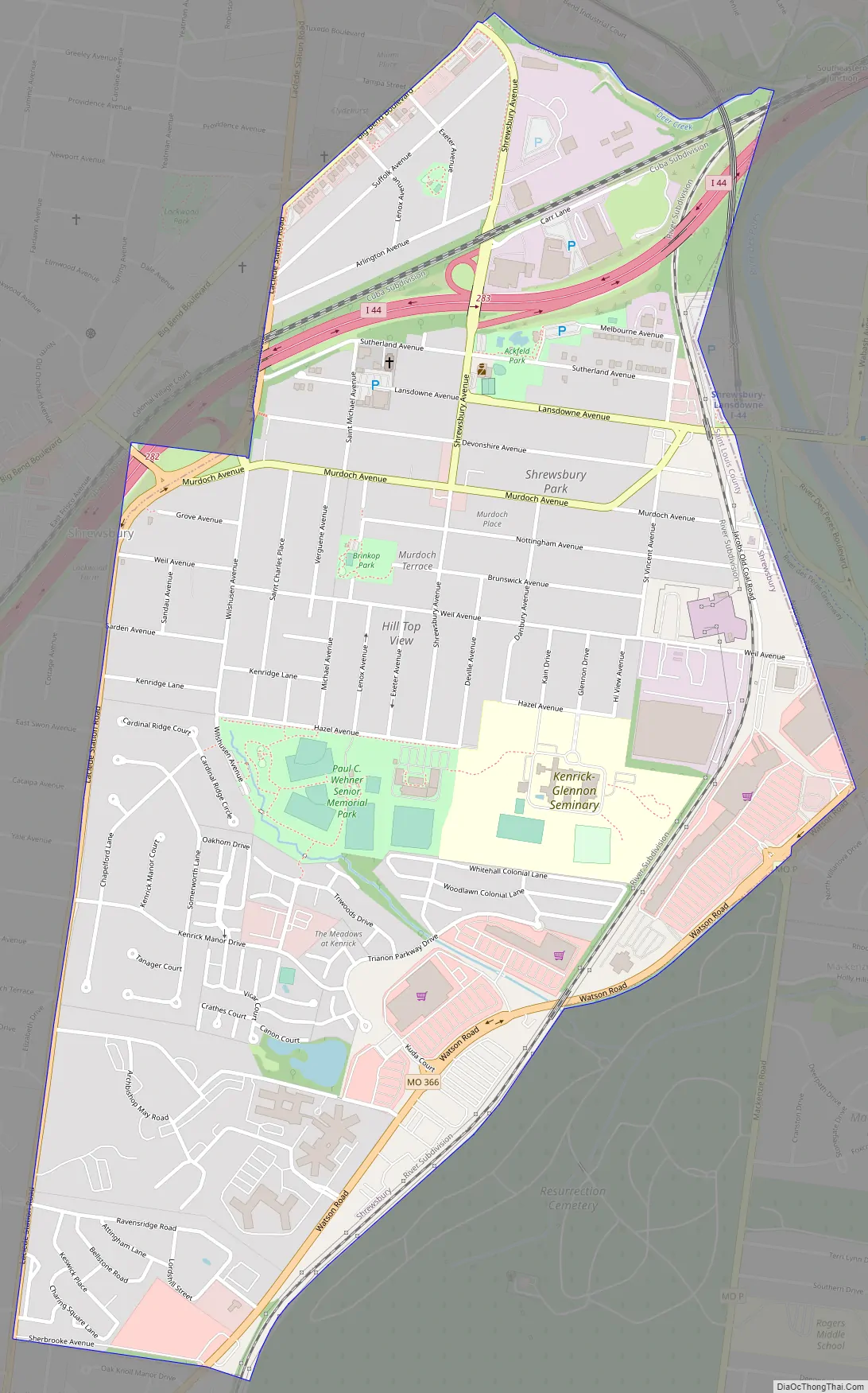
Shrewsbury Road Map
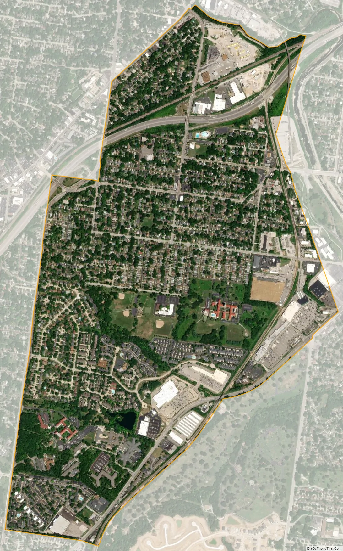
Shrewsbury city Satellite Map
Geography
According to the United States Census Bureau, the city has a total area of 1.43 square miles (3.70 km), all land.
The city is roughly bounded by St. Louis to the east, Webster Groves to the north, Marlborough to the west and Mackenzie and Affton to the south.
Children in Shrewsbury attend Webster Groves and Affton school districts.
See also
Map of Missouri State and its subdivision:- Adair
- Andrew
- Atchison
- Audrain
- Barry
- Barton
- Bates
- Benton
- Bollinger
- Boone
- Buchanan
- Butler
- Caldwell
- Callaway
- Camden
- Cape Girardeau
- Carroll
- Carter
- Cass
- Cedar
- Chariton
- Christian
- Clark
- Clay
- Clinton
- Cole
- Cooper
- Crawford
- Dade
- Dallas
- Daviess
- De Kalb
- Dent
- Douglas
- Dunklin
- Franklin
- Gasconade
- Gentry
- Greene
- Grundy
- Harrison
- Henry
- Hickory
- Holt
- Howard
- Howell
- Iron
- Jackson
- Jasper
- Jefferson
- Johnson
- Knox
- Laclede
- Lafayette
- Lawrence
- Lewis
- Lincoln
- Linn
- Livingston
- Macon
- Madison
- Maries
- Marion
- McDonald
- Mercer
- Miller
- Mississippi
- Moniteau
- Monroe
- Montgomery
- Morgan
- New Madrid
- Newton
- Nodaway
- Oregon
- Osage
- Ozark
- Pemiscot
- Perry
- Pettis
- Phelps
- Pike
- Platte
- Polk
- Pulaski
- Putnam
- Ralls
- Randolph
- Ray
- Reynolds
- Ripley
- Saint Charles
- Saint Clair
- Saint Francois
- Saint Louis
- Sainte Genevieve
- Saline
- Schuyler
- Scotland
- Scott
- Shannon
- Shelby
- Stoddard
- Stone
- Sullivan
- Taney
- Texas
- Vernon
- Warren
- Washington
- Wayne
- Webster
- Worth
- Wright
- Alabama
- Alaska
- Arizona
- Arkansas
- California
- Colorado
- Connecticut
- Delaware
- District of Columbia
- Florida
- Georgia
- Hawaii
- Idaho
- Illinois
- Indiana
- Iowa
- Kansas
- Kentucky
- Louisiana
- Maine
- Maryland
- Massachusetts
- Michigan
- Minnesota
- Mississippi
- Missouri
- Montana
- Nebraska
- Nevada
- New Hampshire
- New Jersey
- New Mexico
- New York
- North Carolina
- North Dakota
- Ohio
- Oklahoma
- Oregon
- Pennsylvania
- Rhode Island
- South Carolina
- South Dakota
- Tennessee
- Texas
- Utah
- Vermont
- Virginia
- Washington
- West Virginia
- Wisconsin
- Wyoming


