Map of Long Pine city

Map of Long Pine city

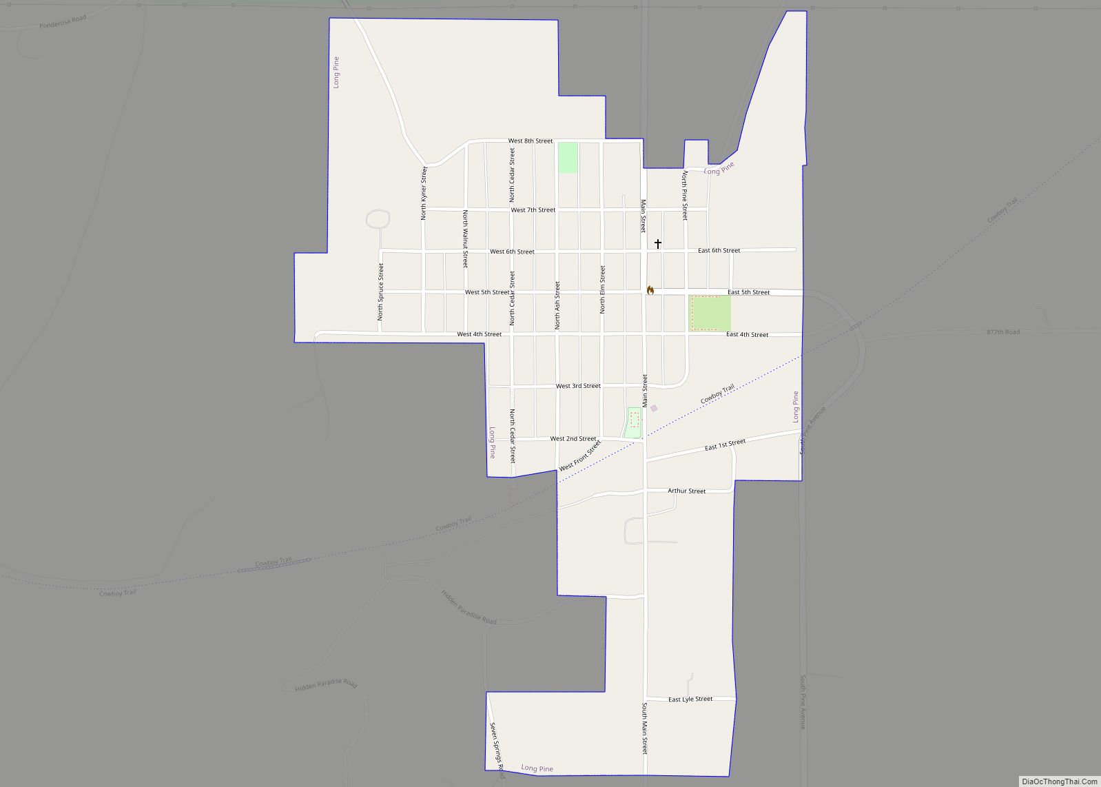
Long Pine is a city in Brown County, Nebraska, United States. The population was 305 at the 2010 census. Long Pine city overview: Name: Long Pine city LSAD Code: 25 LSAD Description: city (suffix) State: Nebraska County: Brown County Elevation: 2,402 ft (732 m) Total Area: 0.58 sq mi (1.50 km²) Land Area: 0.58 sq mi (1.50 km²) Water Area: 0.00 sq mi (0.00 km²) Total … Read more

Map of Lodgepole village

Map of Lodgepole village

Lodgepole is a village in Cheyenne County, Nebraska, United States. The population was 318 at the 2010 census. Lodgepole village overview: Name: Lodgepole village LSAD Code: 47 LSAD Description: village (suffix) State: Nebraska County: Cheyenne County Elevation: 3,845 ft (1,172 m) Total Area: 0.48 sq mi (1.24 km²) Land Area: 0.48 sq mi (1.24 km²) Water Area: 0.00 sq mi (0.00 km²) Total Population: 312 Population … Read more

Map of Litchfield village, Nebraska

Map of Litchfield village, Nebraska

Litchfield is a village in Sherman County, Nebraska, United States. The population was 262 at the 2010 census. Litchfield village overview: Name: Litchfield village LSAD Code: 47 LSAD Description: village (suffix) State: Nebraska County: Sherman County Elevation: 2,165 ft (660 m) Total Area: 0.30 sq mi (0.79 km²) Land Area: 0.30 sq mi (0.79 km²) Water Area: 0.00 sq mi (0.00 km²) Total Population: 220 Population … Read more

Map of Lisco CDP

Map of Lisco CDP

Lisco is an unincorporated community and census-designated place (CDP) in Garden County, Nebraska, United States. The population was 64 at the 2010 census. Lisco CDP overview: Name: Lisco CDP LSAD Code: 57 LSAD Description: CDP (suffix) State: Nebraska County: Garden County Elevation: 3,485 ft (1,062 m) Total Area: 0.59 sq mi (1.54 km²) Land Area: 0.59 sq mi (1.54 km²) Water Area: 0.00 sq mi … Read more

Map of Linwood village, Nebraska

Map of Linwood village, Nebraska

Linwood is a village in Butler County, Nebraska, United States. The population was 88 at the 2010 census. Linwood village overview: Name: Linwood village LSAD Code: 47 LSAD Description: village (suffix) State: Nebraska County: Butler County Elevation: 1,339 ft (408 m) Total Area: 0.38 sq mi (0.98 km²) Land Area: 0.38 sq mi (0.98 km²) Water Area: 0.00 sq mi (0.00 km²) Total Population: 94 Population … Read more

Map of Lindy CDP

Map of Lindy CDP

Lindy is an unincorporated community and census-designated place located on the Santee Sioux Reservation in Knox County, in the northeastern part of the state of Nebraska in the Midwestern United States. As of the 2010 census it had a population of 13. Lindy CDP overview: Name: Lindy CDP LSAD Code: 57 LSAD Description: CDP (suffix) … Read more

Map of Lindsay village, Nebraska

Map of Lindsay village, Nebraska

Lindsay is a village in Platte County, Nebraska, United States. The population was 255 at the 2010 census. Lindsay village overview: Name: Lindsay village LSAD Code: 47 LSAD Description: village (suffix) State: Nebraska County: Platte County Elevation: 1,690 ft (515 m) Total Area: 0.48 sq mi (1.24 km²) Land Area: 0.47 sq mi (1.23 km²) Water Area: 0.01 sq mi (0.02 km²) Total Population: 283 Population … Read more

Map of Liberty village, Nebraska

Map of Liberty village, Nebraska

Liberty is a village in Gage County, Nebraska, United States. The population was 37 at the 2020 census. Liberty village overview: Name: Liberty village LSAD Code: 47 LSAD Description: village (suffix) State: Nebraska County: Gage County Elevation: 1,306 ft (398 m) Total Area: 0.25 sq mi (0.64 km²) Land Area: 0.25 sq mi (0.64 km²) Water Area: 0.00 sq mi (0.00 km²) Total Population: 37 Population … Read more

Map of Lexington city, Nebraska

Map of Lexington city, Nebraska

Lexington is a city in Dawson County, Nebraska, United States. The population was 10,348 at the 2020 census. It is the county seat of Dawson County. Lexington is located in southern Nebraska, on the Platte River, southeast of North Platte. It sits along the route of U.S. Route 30 and the Union Pacific Railroad. In … Read more

Map of Lewiston village, Nebraska

Map of Lewiston village, Nebraska

Lewiston is a village in northwest Pawnee County, Nebraska, United States. The population was 54 at the 2020 census. Lewiston village overview: Name: Lewiston village LSAD Code: 47 LSAD Description: village (suffix) State: Nebraska County: Pawnee County Elevation: 1,450 ft (440 m) Total Area: 0.10 sq mi (0.27 km²) Land Area: 0.10 sq mi (0.27 km²) Water Area: 0.00 sq mi (0.00 km²) Total Population: 54 … Read more

Map of Lyons city, Nebraska

Map of Lyons city, Nebraska

Lyons is a city in Burt County, Nebraska, United States. The population was 851 in the 2010 census. The city is named after its founder. Lyons city overview: Name: Lyons city LSAD Code: 25 LSAD Description: city (suffix) State: Nebraska County: Burt County Elevation: 1,293 ft (394 m) Total Area: 0.69 sq mi (1.79 km²) Land Area: 0.68 sq mi (1.77 km²) Water … Read more

Map of Lynch village, Nebraska

Map of Lynch village, Nebraska

Lynch is a village in Boyd County, Nebraska, United States. The population was 194 at the 2020 census, down from 245 in 2010. Lynch is located in northern Nebraska, between the Missouri and Niobrara rivers. Lynch village overview: Name: Lynch village LSAD Code: 47 LSAD Description: village (suffix) State: Nebraska County: Boyd County Elevation: 1,401 ft … Read more