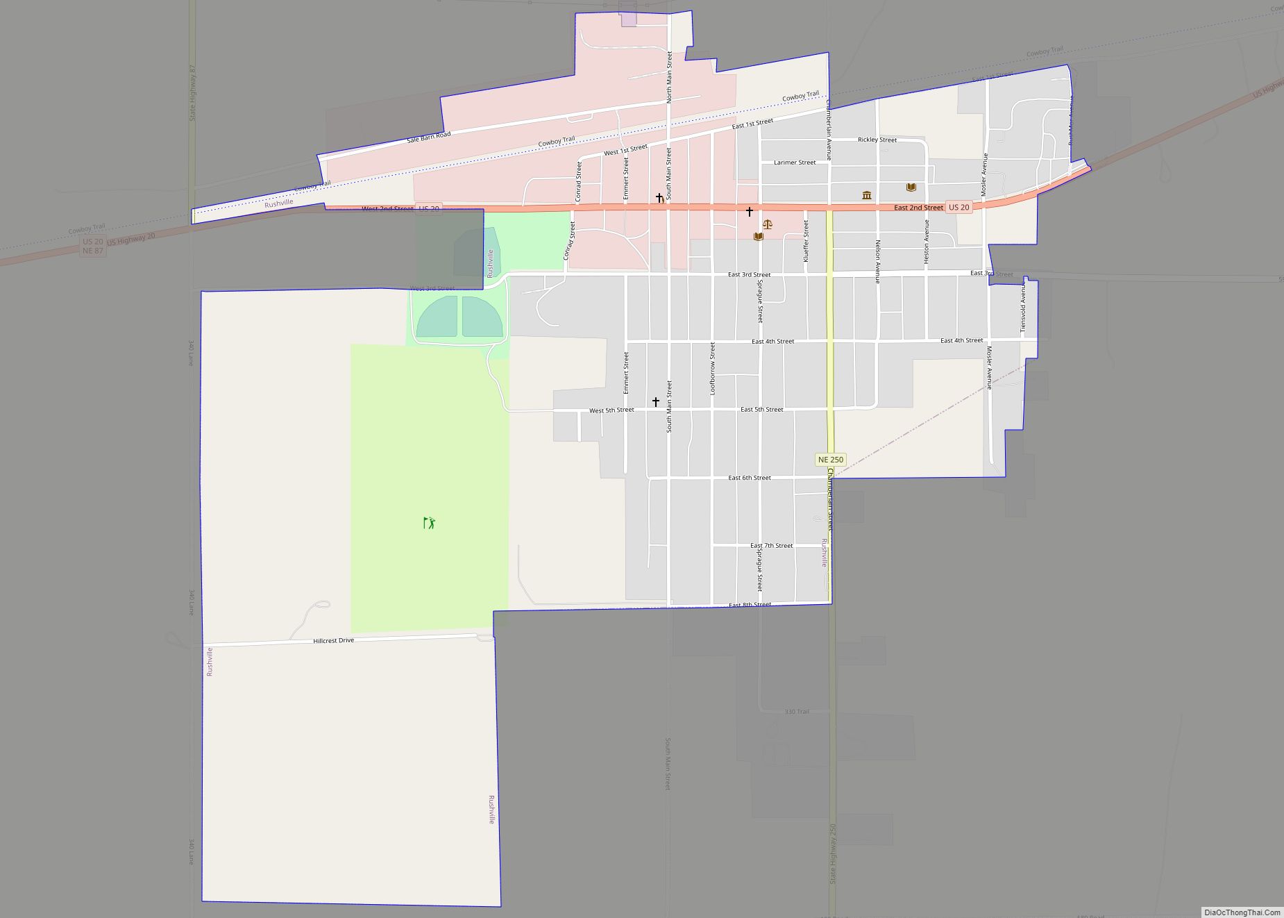
Map of Sargent city

Map of Sargent city

Sargent is a city in Custer County, Nebraska, United States. The population was 525 at the 2010 census. Sargent city overview: Name: Sargent city LSAD Code: 25 LSAD Description: city (suffix) State: Nebraska County: Custer County Elevation: 2,316 ft (706 m) Total Area: 1.09 sq mi (2.81 km²) Land Area: 1.09 sq mi (2.81 km²) Water Area: 0.00 sq mi (0.00 km²) Total Population: 500 Population … Read more

Map of Sarben CDP

Map of Sarben CDP

Sarben is an unincorporated community and census-designated place in Keith County, Nebraska, United States. As of the 2010 census it had a population of 31. Sarben CDP overview: Name: Sarben CDP LSAD Code: 57 LSAD Description: CDP (suffix) State: Nebraska County: Keith County Elevation: 3,008 ft (917 m) Total Area: 0.16 sq mi (0.41 km²) Land Area: 0.16 sq mi (0.41 km²) Water … Read more

Map of Santee village, Nebraska

Map of Santee village, Nebraska

Santee is the principal village of the Santee Sioux Reservation in Knox County, Nebraska, United States. The population was 346 at the 2010 census. Santee village overview: Name: Santee village LSAD Code: 47 LSAD Description: village (suffix) State: Nebraska County: Knox County Elevation: 1,243 ft (379 m) Total Area: 0.56 sq mi (1.46 km²) Land Area: 0.56 sq mi (1.46 km²) Water Area: … Read more

Map of Salem village, Nebraska

Map of Salem village, Nebraska

Salem is a village in Richardson County, Nebraska, United States. The population was 84 at the 2020 census. Salem village overview: Name: Salem village LSAD Code: 47 LSAD Description: village (suffix) State: Nebraska County: Richardson County Elevation: 1,063 ft (324 m) Total Area: 0.62 sq mi (1.61 km²) Land Area: 0.62 sq mi (1.61 km²) Water Area: 0.00 sq mi (0.00 km²) Total Population: 84 Population … Read more

Map of Sholes village

Map of Sholes village

Sholes is a village in Wayne County, Nebraska, United States. The population was 15 at the 2020 census. Sholes village overview: Name: Sholes village LSAD Code: 47 LSAD Description: village (suffix) State: Nebraska County: Wayne County Elevation: 1,729 ft (527 m) Total Area: 0.14 sq mi (0.36 km²) Land Area: 0.14 sq mi (0.36 km²) Water Area: 0.00 sq mi (0.00 km²) Total Population: 15 Population … Read more

Map of Shickley village

Map of Shickley village

Shickley is a village in Fillmore County, Nebraska, United States. The population was 343 at the 2020 census. Shickley village overview: Name: Shickley village LSAD Code: 47 LSAD Description: village (suffix) State: Nebraska County: Fillmore County Elevation: 1,650 ft (503 m) Total Area: 0.31 sq mi (0.79 km²) Land Area: 0.31 sq mi (0.79 km²) Water Area: 0.00 sq mi (0.00 km²) Total Population: 343 Population … Read more

Map of Shelton village, Nebraska

Map of Shelton village, Nebraska

Shelton is a village in Buffalo and Hall counties, Nebraska, United States. It is part of the Kearney, Nebraska Micropolitan Statistical Area. The population was 1,059 at the 2010 census. It is located west of Grand Island along both the Union Pacific Railroad and U.S. Route 30. Nebraska Link 10-D connects Shelton with Interstate 80. … Read more

Map of Shelby village, Nebraska

Map of Shelby village, Nebraska

Shelby is a village in Polk County, Nebraska, United States. The population was 714 at the 2010 census. Shelby lies along the north side of U.S. Highway 81 near the eastern edge of Polk County. It is six miles (10 km) east of Osceola, and just 17 miles (27 km) south and three miles (5 km) west of … Read more

Map of Seward city, Nebraska

Map of Seward city, Nebraska

Seward is a city and county seat of Seward County, Nebraska, United States. The population was 6,964 at the 2010 census. Seward is part of the Lincoln, Nebraska Metropolitan Statistical Area. It is known for its large Fourth of July (Independence Day) celebration. Seward city overview: Name: Seward city LSAD Code: 25 LSAD Description: city … Read more

Map of Seneca CDP, Nebraska

Map of Seneca CDP, Nebraska

Seneca is an unincorporated community in Thomas County, in the state of Nebraska in the Great Plains region of the United States. The population was 33 at the 2010 census. Seneca was established on the Chicago, Burlington and Quincy Railroad in 1888. The location of a division point on the railroad, it was for some … Read more

Map of Scribner city

Map of Scribner city

Scribner is a city in Dodge County, Nebraska, United States. The population was 857 at the 2010 census. Scribner city overview: Name: Scribner city LSAD Code: 25 LSAD Description: city (suffix) State: Nebraska County: Dodge County Elevation: 1,253 ft (382 m) Total Area: 0.67 sq mi (1.72 km²) Land Area: 0.65 sq mi (1.69 km²) Water Area: 0.01 sq mi (0.04 km²) Total Population: 843 Population … Read more

Map of Scottsbluff city

Map of Scottsbluff city

Scottsbluff is a city in Scotts Bluff County, in the western part of the state of Nebraska, in the Great Plains region of the United States. The population was 14,436 at the 2020 census. Scottsbluff is the largest city in the Nebraska Panhandle, and the 13th largest city in Nebraska. Scottsbluff was founded in 1899 … Read more