Map of Imlay CDP
Imlay is an unincorporated town in Pershing County, Nevada, United States. It has an elementary school, a general store, a post office, and a trading post. As of the 2010 census the population was 171. It is a nearly abandoned railroad town, named for a nearby mine or for the civil engineer who surveyed the ... Read more
Map of Imlay CDP
Map of Humboldt River Ranch CDP
Humboldt River Ranch is a census-designated place (CDP) in Pershing County, Nevada, United States. As of the 2010 census the population was 119. Humboldt River Ranch CDP overview: Name: Humboldt River Ranch CDP LSAD Code: 57 LSAD Description: CDP (suffix) State: Nevada County: Pershing County Elevation: 4,316 ft (1,316 m) Total Area: 20.18 sq mi (52.27 km²) Land Area: 20.18 sq mi ... Read more
Map of Humboldt River Ranch CDP
Map of Hiko CDP
Hiko is a small, agrarian community in the Tonopah Basin on State Route 318 in Lincoln County, Nevada, United States. It is a census-designated place, with a population of 119 at the 2010 census. Hiko CDP overview: Name: Hiko CDP LSAD Code: 57 LSAD Description: CDP (suffix) State: Nevada County: Lincoln County Elevation: 3,869 ft (1,179 m) ... Read more
Map of Hiko CDP
Map of Hawthorne CDP, Nevada
Hawthorne is a census-designated place (CDP) in Mineral County, Nevada, United States. At the 2010 census, the population was 3,269, a decrease since the 2000 census, when it was 3,311. It is the county seat of Mineral County. The nearby Hawthorne Army Depot is the primary economic base of the town. Hawthorne CDP overview: Name: ... Read more
Map of Hawthorne CDP, Nevada
Map of Grass Valley CDP, Nevada
Grass Valley is a census-designated place (CDP) in northeastern Pershing County, Nevada, United States. As of the 2010 census the population was 1,161. Grass Valley CDP overview: Name: Grass Valley CDP LSAD Code: 57 LSAD Description: CDP (suffix) State: Nevada County: Pershing County Elevation: 4,390 ft (1,338 m) Total Area: 34.51 sq mi (89.38 km²) Land Area: 34.51 sq mi (89.38 km²) Water ... Read more
Map of Grass Valley CDP, Nevada
Map of Goodsprings CDP
Goodsprings is an unincorporated community in Clark County, Nevada, United States. The population was 229 at the 2010 census. Goodsprings CDP overview: Name: Goodsprings CDP LSAD Code: 57 LSAD Description: CDP (suffix) State: Nevada County: Clark County Founded: 1900; 123 years ago (1900) Elevation: 3,707 ft (1,130 m) Total Area: 0.98 sq mi (2.53 km²) Land Area: 0.98 sq mi (2.53 km²) Water Area: 0.00 sq mi ... Read more
Map of Goodsprings CDP
Map of Goldfield CDP, Nevada
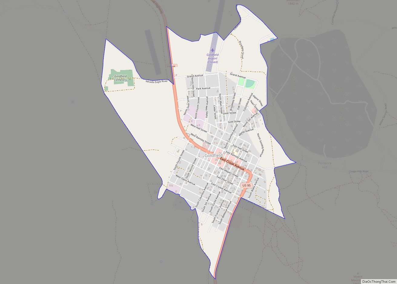
Goldfield is an unincorporated small desert city and the county seat of Esmeralda County, Nevada. It is the locus of the Goldfield CDP which had a resident population of 268 at the 2010 census, down from 440 in 2000. Goldfield is located 247 miles (398 km) southeast of Carson City, along U.S. Route 95. Goldfield was ... Read more
Map of Goldfield CDP, Nevada
Map of Golden Valley CDP, Nevada
Golden Valley is a census-designated place (CDP) in Washoe County, Nevada, United States. The population was 1,556 at the 2010 census. It is a northern suburb of the city of Reno and is part of the Reno–Sparks Metropolitan Statistical Area. Prior to 2010, it was listed by the U.S. Census Bureau as part of the ... Read more
Map of Golden Valley CDP, Nevada
Map of Indian Springs CDP, Nevada
Indian Springs is an unincorporated town and a census-designated place located on U.S. Route 95 next to Creech Air Force Base in northwestern Clark County and southern Nevada. The population was 991 at the 2010 census. Indian Springs CDP overview: Name: Indian Springs CDP LSAD Code: 57 LSAD Description: CDP (suffix) State: Nevada County: Clark ... Read more
Map of Indian Springs CDP, Nevada
Map of Logan Creek CDP
Logan Creek is a census-designated place (CDP) on the east shore of Lake Tahoe in Douglas County, Nevada, United States. The population was 26 at the 2010 census. Logan Creek CDP overview: Name: Logan Creek CDP LSAD Code: 57 LSAD Description: CDP (suffix) State: Nevada County: Douglas County Elevation: 7,097 ft (2,163 m) Total Area: 1.81 sq mi (4.68 km²) ... Read more
Map of Logan Creek CDP
Map of Lemmon Valley CDP
Lemmon Valley is a census-designated place (CDP) in Washoe County, Nevada, United States. The population was 5,040 at the 2010 census. It is a northern suburb of the city of Reno and is part of the Reno–Sparks Metropolitan Statistical Area. Prior to 2010 it was listed by the U.S. Census Bureau as part of the ... Read more
Map of Lemmon Valley CDP
Map of Laughlin CDP
Laughlin /ˈlɔːf.lɪn/ is an unincorporated resort town and census-designated place in Clark County, Nevada, United States. Laughlin lies 90 miles (140 km) south of Las Vegas, in the far southern tip of Nevada, and is known for its gaming and water recreation. It is located on the Colorado River, downstream from the Davis Dam and Lake ... Read more
Map of Laughlin CDP