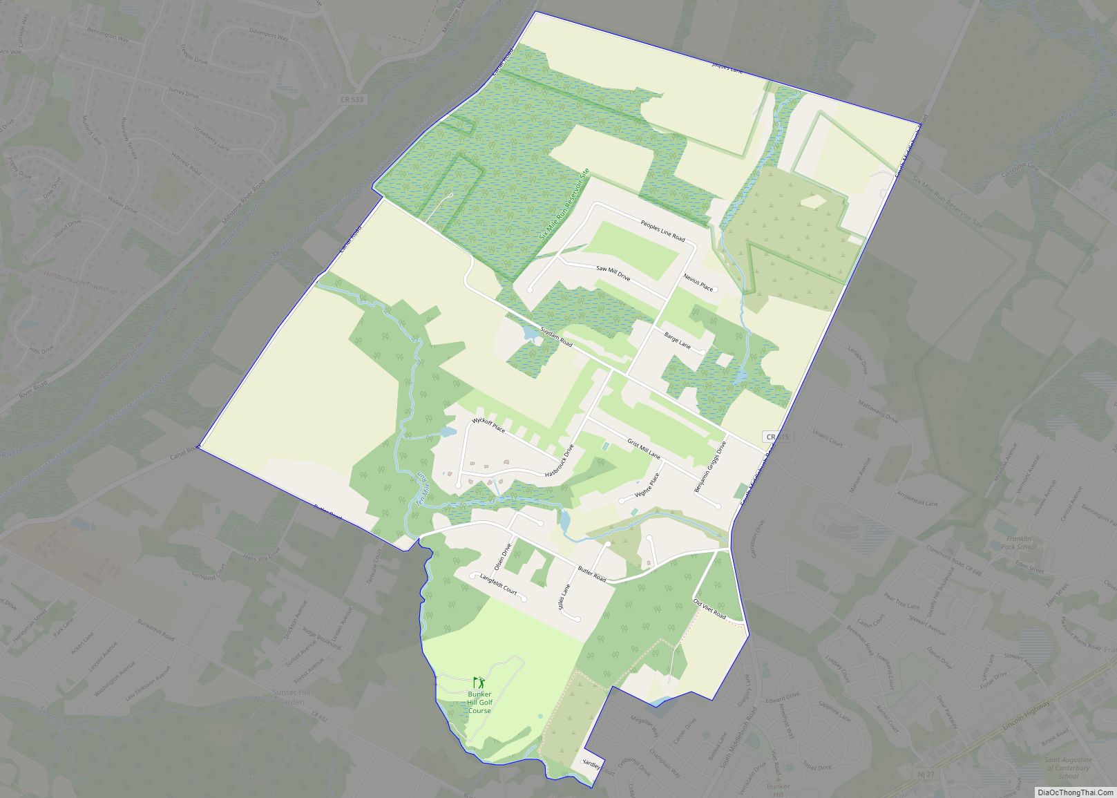
Map of Pitman borough

Map of Pitman borough

Pitman is a borough in Gloucester County, in the U.S. state of New Jersey. As of the 2020 United States census, the borough’s population was 8,780, a decrease of 231 (−2.6%) from the 2010 census count of 9,011, which in turn reflected a decline of 320 (−3.4%) from the 9,331 in the 2000 census. The … Read more

Map of Pine Valley borough, New Jersey

Map of Pine Valley borough, New Jersey

Pine Valley borough overview: Name: Pine Valley borough LSAD Code: 21 LSAD Description: borough (suffix) State: New Jersey County: Camden County FIPS code: 3458920 Online Interactive Map Pine Valley online map. Source: Basemap layers from Google Map, Open Street Map (OSM), Arcgisonline, Wmflabs. Boundary Data from Database of Global Administrative Areas. Pine Valley location map. … Read more

Map of Port Republic city

Map of Port Republic city

Port Republic is a city on the Mullica River, located in Atlantic County, in the U.S. state of New Jersey. As of the 2020 United States census, the city’s population was 1,101, a decrease of 14 (−1.3%) from the 2010 census count of 1,115, which in turn reflected an increase of 78 (+7.5%) from the … Read more

Map of Port Reading CDP

Map of Port Reading CDP

Port Reading is a census-designated place and unincorporated community located within Woodbridge Township, in Middlesex County, New Jersey. As of the 2010 U.S. census, Port Reading’s population was 3,728. Port Reading CDP overview: Name: Port Reading CDP LSAD Code: 57 LSAD Description: CDP (suffix) State: New Jersey County: Middlesex County Elevation: 13 ft (4 m) Total Area: … Read more

Map of Port Norris CDP

Map of Port Norris CDP

Port Norris is an unincorporated community and census-designated place (CDP) located within Commercial Township, in Cumberland County, New Jersey, United States. It is part of the Vineland–Millville– Bridgeton Primary Metropolitan Statistical Area for statistical purposes. As of the 2000 United States Census, the CDP’s population was 1,377. Legislation was passed in 1911 allowing voters to … Read more

Map of Port Murray CDP

Map of Port Murray CDP

Port Murray is an unincorporated community and census-designated place (CDP) located within Mansfield Township in Warren County, in the U.S. state of New Jersey, that was created as part of the 2010 United States Census. As of the 2010 Census, the CDP’s population was 129. The community was long known by this name for its … Read more

Map of Port Monmouth CDP

Map of Port Monmouth CDP

Port Monmouth is an unincorporated community and census-designated place (CDP) within Middletown Township, in Monmouth County, New Jersey, United States. At the 2010 census, the CDP’s population was 3,818. Port Monmouth CDP overview: Name: Port Monmouth CDP LSAD Code: 57 LSAD Description: CDP (suffix) State: New Jersey County: Monmouth County Elevation: 10 ft (3 m) Total Area: … Read more

Map of Port Colden CDP

Map of Port Colden CDP

Port Colden is an unincorporated community and census-designated place (CDP) located within Washington Township, in Warren County, New Jersey, United States, that was created as part of the 2010 United States Census. As of the 2010 Census, the CDP’s population was 122. The community was named for its location on the Morris Canal and after … Read more

Map of Princeton, New Jersey

Map of Princeton, New Jersey

Princeton is a municipality with a borough form of government in Mercer County, in the U.S. state of New Jersey. It was established on January 1, 2013, through the consolidation of the Borough of Princeton and Princeton Township, both of which are now defunct. As of the 2020 United States census, the borough’s population was … Read more

Map of Princeton Meadows CDP

Map of Princeton Meadows CDP

Princeton Meadows is an unincorporated community and census-designated place (CDP) located within Plainsboro Township, in Middlesex County, New Jersey, United States. As of the 2010 United States Census, the CDP’s population was 13,834. Princeton Meadows CDP overview: Name: Princeton Meadows CDP LSAD Code: 57 LSAD Description: CDP (suffix) State: New Jersey County: Middlesex County Elevation: … Read more

Map of Princeton Junction CDP

Map of Princeton Junction CDP

Princeton Junction is an unincorporated community and census-designated place (CDP) located within West Windsor, in Mercer County, in the U.S. state of New Jersey. As of the 2010 United States Census, the CDP’s population was 2,465. Princeton Junction CDP overview: Name: Princeton Junction CDP LSAD Code: 57 LSAD Description: CDP (suffix) State: New Jersey County: … Read more

Map of Presidential Lakes Estates CDP

Map of Presidential Lakes Estates CDP

Presidential Lakes Estates is an unincorporated community and census-designated place (CDP) located within Pemberton Township, in Burlington County, New Jersey, United States. As of the 2010 United States Census, the CDP’s population was 2,365. Presidential Lakes Estates CDP overview: Name: Presidential Lakes Estates CDP LSAD Code: 57 LSAD Description: CDP (suffix) State: New Jersey County: … Read more