Map of Woodbury Heights borough

Map of Woodbury Heights borough

Woodbury Heights is a borough in Gloucester County, in the U.S. state of New Jersey. As of the 2020 United States census, the borough’s population was 3,098, an increase of 43 (+1.4%) from the 2010 census count of 3,055, which in turn reflected an increase of 67 (+2.2%) from the 2,988 counted in the 2000 … Read more

Map of Woodbridge CDP, New Jersey

Map of Woodbridge CDP, New Jersey

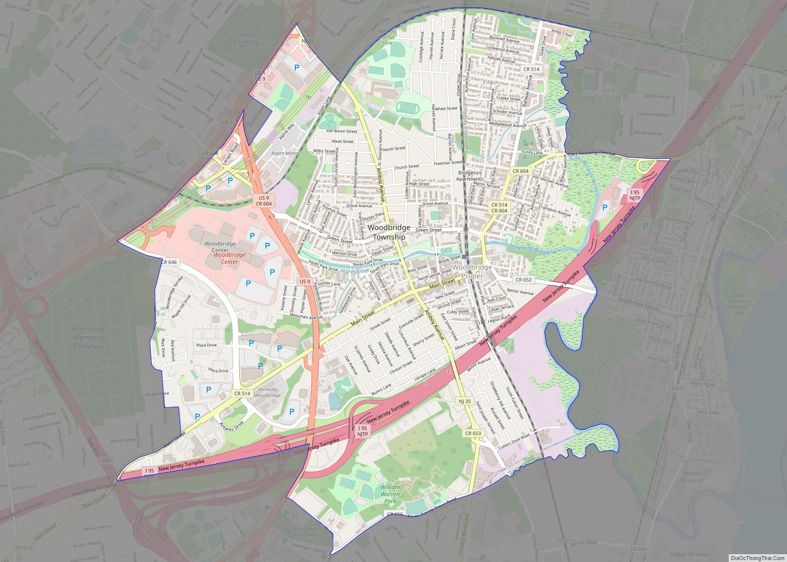
Woodbridge is an unincorporated community and census-designated place (CDP) within Woodbridge Township, in Middlesex County, New Jersey, United States. As of the 2010 United States Census, the CDP’s population was 19,265. Despite the similarity in the name of the CDP and the township, the two are not coextensive; the CDP occupies 15.7% of the township’s … Read more

Map of Woodbine borough, New Jersey

Map of Woodbine borough, New Jersey

Woodbine is a borough in Cape May County, in the U.S. state of New Jersey. The borough, and all of Cape May County, is part of the South Jersey region of the state and of the Ocean City metropolitan statistical area, which is part of the Philadelphia–Wilmington–Camden, PA-NJ-DE–MD combined statistical area, also known as the … Read more

Map of Wood-Ridge borough

Map of Wood-Ridge borough

Wood-Ridge is a borough in Bergen County, in the U.S. state of New Jersey. As of the 2020 United States census, the borough’s population was 10,137, an increase of 2,511 (+32.9%) from the 2010 census count of 7,626, which in turn reflected a decline of 18 (-0.2%) from the 7,644 counted in the 2000 census. … Read more

Map of Williamstown CDP, New Jersey

Map of Williamstown CDP, New Jersey

Williamstown is an unincorporated community and census-designated place (CDP) located in Monroe Township in Gloucester County, New Jersey. As of the 2010 U.S. census, Williamstown’s population was 15,567. Williamstown CDP overview: Name: Williamstown CDP LSAD Code: 57 LSAD Description: CDP (suffix) State: New Jersey County: Gloucester County Elevation: 141 ft (43 m) Total Area: 7.42 sq mi (19.23 km²) Land … Read more

Map of Wildwood city, New Jersey

Map of Wildwood city, New Jersey

Wildwood is a city in Cape May County in the U.S. state of New Jersey. The city, and all of Cape May County, is part of the Ocean City metropolitan statistical area, and is part of the Philadelphia–Wilmington–Camden, PA-NJ-DE–MD combined statistical area, also known as the Delaware Valley or Philadelphia metropolitan area. As of the … Read more

Map of Wildwood Crest borough

Map of Wildwood Crest borough

Wildwood Crest is a borough in Cape May County, in the U.S. state of New Jersey. The borough, and all of Cape May County, is part of the Ocean City metropolitan statistical area, and is part of the Philadelphia–Wilmington–Camden, PA-NJ-DE–MD combined statistical area, also known as the Delaware Valley or Philadelphia metropolitan area. As of … Read more

Map of Whittingham CDP

Map of Whittingham CDP

Whittingham, also known as Greenbriar at Whittingham, is an unincorporated community and census-designated place (CDP) located within Monroe Township, in Middlesex County, New Jersey, United States. As of the 2010 United States Census, the CDP’s population was 2,476. The area is focused around the age-restricted gated community of Whittingham. Whittingham CDP overview: Name: Whittingham CDP … Read more

Map of Wrightstown borough

Map of Wrightstown borough, New Jersey

Wrightstown is a borough in Burlington County, in the U.S. state of New Jersey. As of the 2020 United States census, the borough’s population was 720, a decrease of 82 (−10.2%) from the 2010 census count of 802, which in turn reflected an increase of 54 (+7.2%) from the 748 counted in the 2000 census. … Read more

Map of Woodstown borough

Map of Woodstown borough

Woodstown is a borough in Salem County, in the U.S. state of New Jersey. As of the 2020 United States census, the borough’s population was 3,678, an increase of 173 (+4.9%) from the 2010 census count of 3,505, which in turn reflected an increase of 369 (+11.8%) from the 3,136 counted in the 2000 census. … Read more

Map of Woodlynne borough

Map of Woodlynne borough

Woodlynne is a borough in Camden County, in the U.S. state of New Jersey. As of the 2020 United States census, the borough’s population was 2,902, a decrease of 76 (−2.6%) from the 2010 census count of 2,978, which in turn reflected an increase of 182 (+6.5%) from the 2,796 counted in the 2000 census. … Read more

Map of Woodland Park borough, New Jersey

Map of Woodland Park borough, New Jersey

Woodland Park (formerly West Paterson) is a borough in Passaic County, in the U.S. state of New Jersey. As of the 2020 United States census, the borough’s population was 13,484, an increase of 1,665 (+14.1%) from the 2010 census count of 11,819, which in turn reflected an increase of 832 (+7.6%) from the 10,987 counted … Read more