Map of Pueblo of Sandia Village CDP

Map of Pueblo of Sandia Village CDP

Pueblo of Sandia Village is a census-designated place (CDP) in Sandoval County, New Mexico, United States. The population was 344 at the 2000 census. It is part of the Albuquerque Metropolitan Statistical Area. Pueblo of Sandia Village CDP overview: Name: Pueblo of Sandia Village CDP LSAD Code: 57 LSAD Description: CDP (suffix) State: New Mexico … Read more

Map of Pueblitos CDP

Map of Pueblitos CDP

Pueblitos is a census-designated place in Valencia County, New Mexico, United States. Its population was 794 as of the 2010 census. New Mexico State Road 116 passes through the community. Pueblitos CDP overview: Name: Pueblitos CDP LSAD Code: 57 LSAD Description: CDP (suffix) State: New Mexico County: Valencia County Elevation: 4,797 ft (1,462 m) Total Area: 2.13 sq mi … Read more

Map of Pueblito CDP

Map of Pueblito CDP

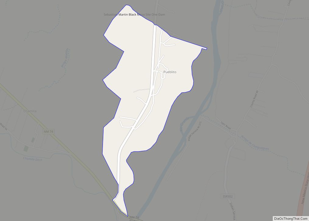
Pueblito is an unincorporated community and census-designated place in Rio Arriba County, New Mexico, United States. Its population was 91 as of the 2010 census. Pueblito was settled in the 1850s by former residents of La Parida, which was flooded by the Rio Grande. Pueblito CDP overview: Name: Pueblito CDP LSAD Code: 57 LSAD Description: … Read more

Map of Portales city

Map of Portales city

Portales is a city in and the county seat of Roosevelt County, New Mexico, United States. Its population was 12,280 at the 2010 census. Portales is located near the larger city of Clovis, and Cannon Air Force Base, a major contributor to the economy of the region. Eastern New Mexico University opened in Portales in … Read more

Map of Ponderosa CDP, New Mexico

Map of Ponderosa CDP, New Mexico

Ponderosa is a census-designated place (CDP) in Sandoval County, New Mexico, United States. The population was 383 as of New Mexico’s 2015 Census. It is part of the Albuquerque Metropolitan Statistical Area. Ponderosa CDP overview: Name: Ponderosa CDP LSAD Code: 57 LSAD Description: CDP (suffix) State: New Mexico County: Sandoval County Elevation: 6,010 ft (1,832 m) Total … Read more

Map of Ponderosa Pine CDP

Map of Ponderosa Pine CDP

Ponderosa Pine is a census-designated place (CDP) in Bernalillo County, New Mexico, United States. The population was 1,195 at the 2010 census. It is part of the Albuquerque Metropolitan Statistical Area. Ponderosa Pine CDP overview: Name: Ponderosa Pine CDP LSAD Code: 57 LSAD Description: CDP (suffix) State: New Mexico County: Bernalillo County Elevation: 7,440 ft (2,270 m) … Read more

Map of Polvadera CDP

Map of Polvadera CDP

Polvadera (La Polvadera de San Lorenzo) is an unincorporated community and census-designated place in Socorro County in central New Mexico, United States. It is located on the west bank of the Rio Grande, near the mouth of the Rio Salado, and on the western spur of El Camino Real de Tierra Adentro. Polvadera CDP overview: … Read more

Map of Puerto de Luna CDP

Map of Puerto de Luna CDP

Puerto de Luna is a census-designated place (CDP) in Guadalupe County, New Mexico, United States. It lies approximately 9+1⁄2 miles (15.3 km) south-southeast of Santa Rosa on New Mexico State Road 91 and on the bank of the Pecos River. The community is located west of, but not within, the Llano Estacado of Eastern New Mexico … Read more

Map of Regina CDP

Map of Regina CDP

Regina is a census-designated place (CDP)) in Sandoval County, New Mexico, United States. The population was 99 at the 2000 census. It is part of the Albuquerque Metropolitan Statistical Area. It was named for Regina, Saskatchewan. Regina CDP overview: Name: Regina CDP LSAD Code: 57 LSAD Description: CDP (suffix) State: New Mexico County: Sandoval County … Read more

Map of Red River town

Map of Red River town

Red River is a resort town in Taos County, New Mexico, located in the Sangre de Cristo Mountains. The population was 477 at the 2010 census. Red River is located along the Enchanted Circle Scenic Byway, and is 36 miles (58 km) from Taos. Red River town overview: Name: Red River town LSAD Code: 43 LSAD … Read more

Map of Raton city

Map of Raton city

Raton (/rəˈtoʊn/ rə-TONE) is a city and the county seat of Colfax County in northeastern New Mexico. The city is located just south of Raton Pass. The city is also located about 6.5 miles south of the New Mexico–Colorado border and 85 miles west of Texas. Raton city overview: Name: Raton city LSAD Code: 25 … Read more

Map of Ranchos de Taos CDP

Map of Ranchos de Taos CDP

Ranchos de Taos is a census-designated place (CDP) in Taos County, New Mexico. The population was 2,390 at the time of the 2000 census. The historic district is the Ranchos de Taos Plaza, which includes the San Francisco de Asis Mission Church. Ranchos de Taos CDP overview: Name: Ranchos de Taos CDP LSAD Code: 57 … Read more