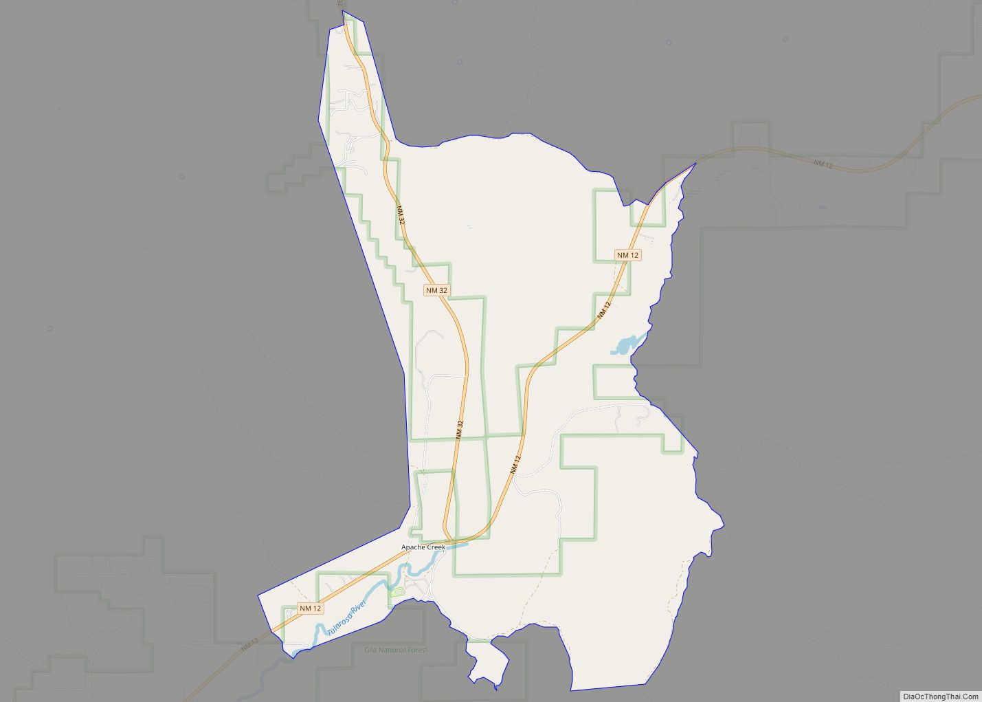
Map of Arroyo Hondo CDP
Arroyo Hondo is a census-designated place in Taos County near Taos, New Mexico, United States. As of the 2010 census it had a population of 474. It is historically notable as the site of the killing of six to eight employees by a force of allied Native Americans at Simeon Turley’s mill and distillery trading ... Read more
Map of Arroyo Hondo CDP
Map of Arrey CDP
Arrey is a census-designated place in Sierra County, New Mexico, United States. It lies about 22 miles (35.4 km) south of Truth or Consequences. As of the 2010 census, its population was 232. In 1890, the town was founded as Bonito when several Hispanic families made a deal with a cattle agent to settle here. ... Read more
Map of Arrey CDP
Map of Arenas Valley CDP
Arenas Valley is a census-designated place in Grant County, New Mexico, United States. Its population was 1,522 as of the 2010 census. Arenas Valley had a post office from December 20, 1944, to April 20, 1987; it still has its own ZIP code, 88022. It was named because it was in the valley of the ... Read more
Map of Arenas Valley CDP
Map of Aragon CDP, New Mexico
Aragon is a census-designated place on the Tularosa River in Catron County, New Mexico, United States. As of the 2010 census it had a population of 94. It is located at an altitude of 7,135 feet (2,175 m), 7 miles (11 km) northeast of Apache Creek. The latitude is 33.88 N, longitude 108.54 W. Aragon CDP overview: ... Read more
Map of Aragon CDP, New Mexico
Map of Black Rock CDP, New Mexico
Black Rock (Navajo: Tsézhįįh Deezlį́) is an unincorporated community and a census-designated place (CDP) in McKinley County, New Mexico, United States. The population was 1,323 at the 2010 census. Black Rock CDP overview: Name: Black Rock CDP LSAD Code: 57 LSAD Description: CDP (suffix) State: New Mexico County: McKinley County Elevation: 6,453 ft (1,967 m) Total Area: ... Read more
Map of Black Rock CDP, New Mexico
Map of Bibo CDP
Bibo is an unincorporated community and census-designated place in Cibola County, New Mexico, United States. As of the 2010 census it had a population of 140. Bibo is located approximately 13 miles (21 km) north of Laguna on Route 279 (north of Interstate 40). The Bibo Bar and Grill is located in the community. The Nextera ... Read more
Map of Bibo CDP
Map of Bernalillo town
Bernalillo (/ˌbɜːrnəˈliːjoʊ/) is a town in Sandoval County, New Mexico, United States. As of the 2010 census, the town population was 8,320. It is the county seat of Sandoval County. Bernalillo is part of the Albuquerque Metropolitan Statistical Area. Bernalillo town overview: Name: Bernalillo town LSAD Code: 43 LSAD Description: town (suffix) State: New Mexico ... Read more
Map of Bernalillo town
Map of Berino CDP
Berino is a census-designated place in Doña Ana County, New Mexico, United States. Berino is located along Interstate 10, 23 miles (37 km) south of Las Cruces. As of the 2010 census, its population was 1,441. The village of Berino is populated to 98% by Hispanics. The church of the small New Mexican community is called ... Read more
Map of Berino CDP
Map of Bent CDP
Bent is a census-designated place in Otero County, New Mexico, United States. Its population was 119 as of the 2010 census. Bent has a post office with ZIP code 88314. U.S. Route 70 passes through the community. Bent CDP overview: Name: Bent CDP LSAD Code: 57 LSAD Description: CDP (suffix) State: New Mexico County: Otero ... Read more
Map of Bent CDP
Map of Belen city
Belén (/bəˈlɪn/; Spanish: Belén) is the second most populous city in Valencia County, New Mexico, United States, after its county seat, Los Lunas. The population was 7,360 at the 2020 Census. Belén is Spanish for Bethlehem but gained the nickname “The Hub City”. The city is geographically near the center of New Mexico and has ... Read more
Map of Belen city
Map of Beclabito CDP
Beclabito (Navajo: Bitłʼááh Bitoʼ) is a census-designated place (CDP) in San Juan County, New Mexico, United States. The population was 317 at the 2010 census. It is part of the Farmington Metropolitan Statistical Area. Beclabito CDP overview: Name: Beclabito CDP LSAD Code: 57 LSAD Description: CDP (suffix) State: New Mexico County: San Juan County Elevation: ... Read more
Map of Beclabito CDP
Map of Bayard city, New Mexico
Bayard is a city in Grant County, New Mexico, United States. It is near Santa Rita, east of Silver City. The population was 2,328 at the 2010 census, down from 2,534 in 2000. This city was incorporated on August 20, 1938. Bayard city overview: Name: Bayard city LSAD Code: 25 LSAD Description: city (suffix) State: ... Read more
Map of Bayard city, New Mexico