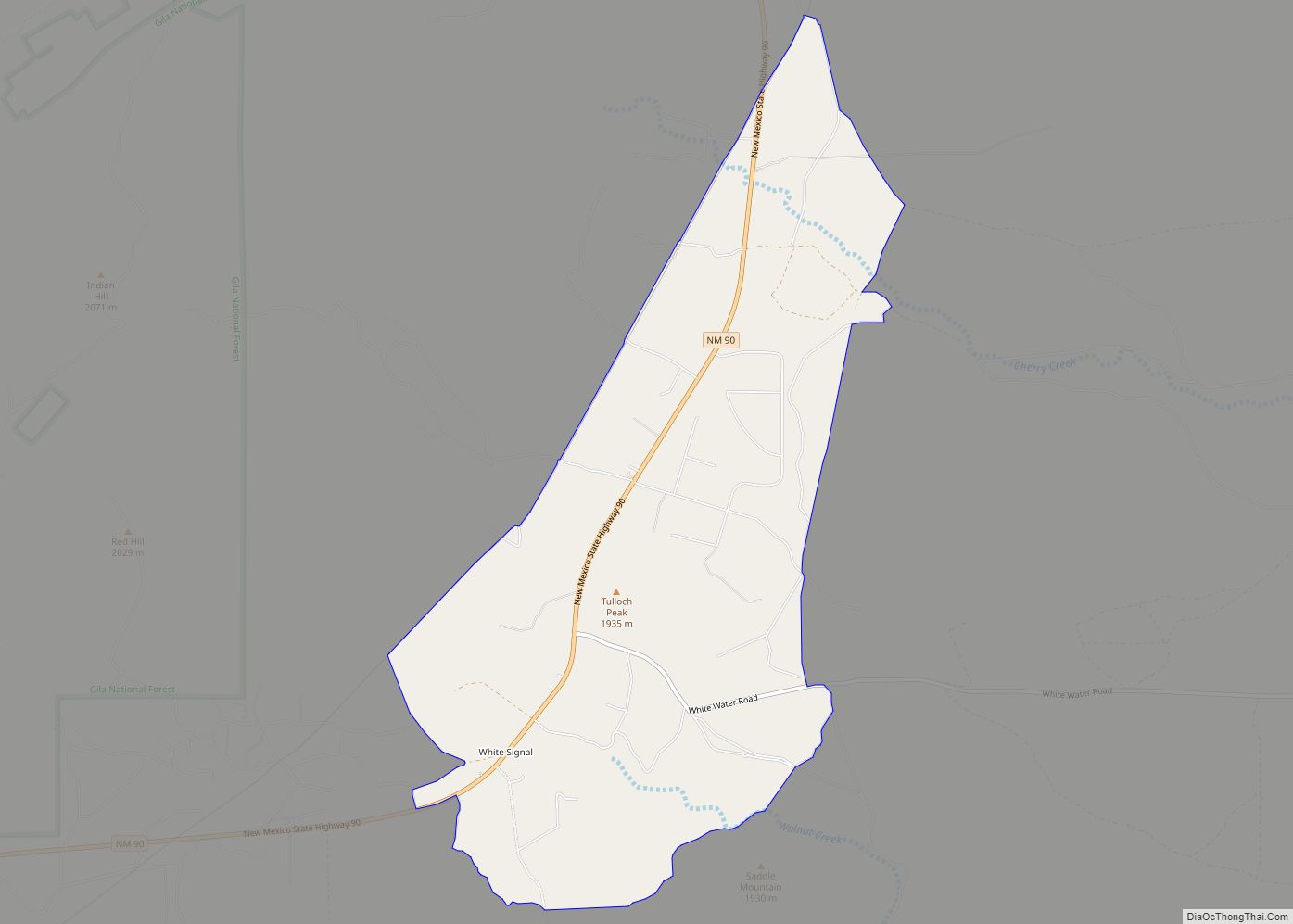
Map of White Rock CDP

Map of White Rock CDP, New Mexico

White Rock is an unincorporated community and census-designated place (CDP) in Los Alamos County, New Mexico. It is one of two major population centers in the county; the other is Los Alamos (the county seat). The population was 5,725 at the 2010 census. It is largely a bedroom community for employees of Los Alamos National … Read more

Map of West Hammond CDP

Map of West Hammond CDP

West Hammond is a census-designated place in San Juan County, New Mexico, United States. Its population was 2,790 as of the 2010 census. West Hammond CDP overview: Name: West Hammond CDP LSAD Code: 57 LSAD Description: CDP (suffix) State: New Mexico County: San Juan County Elevation: 4,842 ft (1,476 m) Total Area: 9.18 sq mi (23.79 km²) Land Area: 9.11 sq mi … Read more

Map of Weed CDP, New Mexico

Map of Weed CDP, New Mexico

Weed is a hamlet and a census-designated place in Otero County, New Mexico, United States. It lies alongside New Mexico State Road 24 on the southeastern slopes of the Sacramento Mountains at an elevation of 7,215 ft. It has had a Post Office since 1885. As of the 2010 census, its population was 63. Weed CDP … Read more

Map of Watrous CDP

Map of Watrous CDP

Watrous is a census-designated place in Mora County, New Mexico, United States. Its population was 135 as of the 2010 census. Watrous has a post office with ZIP code 87753, which opened on April 14, 1868. The community is located along Interstate 25. It was named after merchant and landowner Samuel Watrous, who moved to … Read more

Map of Waterflow CDP

Map of Waterflow CDP

Waterflow is an unincorporated community and census-designated place in San Juan County, New Mexico, United States on the north side of the San Juan River. It is immediately west of Fruitland and north across the river from the Navajo Nation. It is east of Shiprock. Waterflow CDP overview: Name: Waterflow CDP LSAD Code: 57 LSAD … Read more

Map of Wagon Mound village

Map of Wagon Mound village

Wagon Mound is a village in Mora County, New Mexico, United States. It is named after and located at the foot of a butte called Wagon Mound, which was a landmark for covered wagon trains and traders going up and down the Santa Fe Trail and is now Wagon Mound National Historic Landmark. It was … Read more

Map of Virden village, New Mexico

Map of Virden village, New Mexico

Virden is a village in Hidalgo County, New Mexico, United States. The population was 152 at the 2010 census. Growth and new construction is almost non-existent, but together with the Arizona sister-village of Duncan 7 miles (11 km) to the west, the consolidated area might experience minimal population and infrastructural growth in the next decade. Virden … Read more

Map of Villanueva CDP

Map of Villanueva CDP

Villanueva is an unincorporated community and census-designated place in San Miguel County, New Mexico, United States. Known as La Cuesta until 1890, it is located along the Pecos River and New Mexico State Road 3. Villanueva has the ZIP code 87583. The 87583 ZIP Code Tabulation Area had a population of 234 in the 2010 … Read more

Map of Williamsburg village, New Mexico

Map of Williamsburg village, New Mexico

Williamsburg is a village in Sierra County, New Mexico, United States. The population was 449 at the 2010 census. The village, though small, is located adjacent to Truth or Consequences, and has essentially become a suburb. Though the town is experiencing moderate growth now, especially along I-25, in the near future there is a high … Read more

Map of Willard village, New Mexico

Map of Willard village, New Mexico

Willard is a village in Torrance County, New Mexico, United States. The population was 253 at the 2010 census. It is part of the Albuquerque Metropolitan Statistical Area. The village is not experiencing the same extreme growth that towns farther north in the state are. A wind farm has recently been constructed upon the mesa … Read more

Map of Whites City CDP

Map of Whites City CDP

Whites City is a census-designated place and unincorporated community in Eddy County, New Mexico, United States. Its population was 7 as of the 2010 census. By 2020 the population increased to 85. Whites City has a post office with ZIP code 88268. Whites City began in the 1920s as a commercial resort owned by Charlie … Read more

Map of Zuni Pueblo CDP

Map of Zuni Pueblo CDP

Zuni Pueblo (also Zuñi Pueblo, Zuni: Halona Idiwan’a meaning ‘Middle Place’) is a census-designated place (CDP) in McKinley County, New Mexico, United States. The population was 6,302 as of the 2010 Census. It is inhabited largely by members of the Zuni people (A:shiwi). The first contact with Spaniards occurred in 1539 in the ancient village … Read more