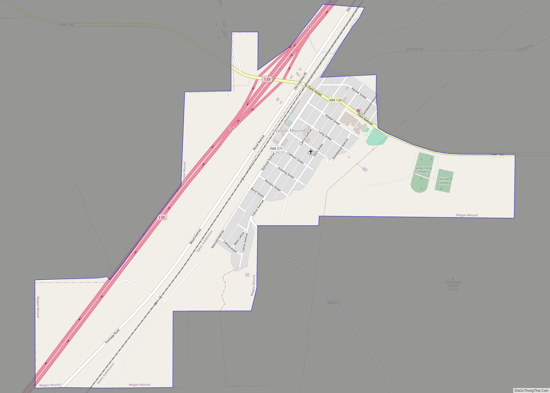
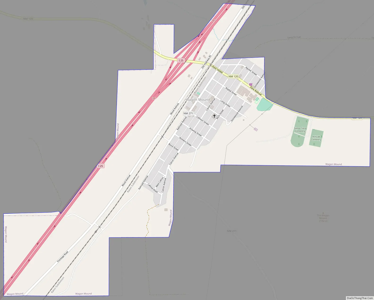
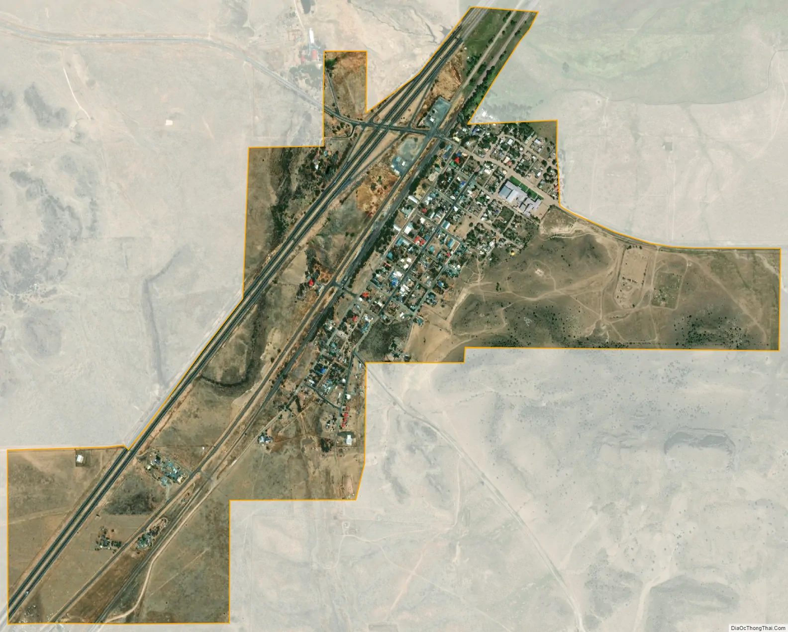
Wagon Mound is a village in Mora County, New Mexico, United States. It is named after and located at the foot of a butte called Wagon Mound, which was a landmark for covered wagon trains and traders going up and down the Santa Fe Trail and is now Wagon Mound National Historic Landmark. It was previously an isolated ranch that housed four families that served as local traders. The shape of the mound is said to resemble a Conestoga wagon. As of the 2010 census, the village population was 314. It was also called Santa Clara for many years. The village, with brightly painted houses and several stores and shops, is located on the plains of northeastern New Mexico. Interstate 25, which skirts the western side of town, gives a view of the majority of the town. Wagon Mound is not growing rapidly, but it has seen new construction along I-25, with new buildings on the northeast side of town as well.
| Name: | Wagon Mound village |
|---|---|
| LSAD Code: | 47 |
| LSAD Description: | village (suffix) |
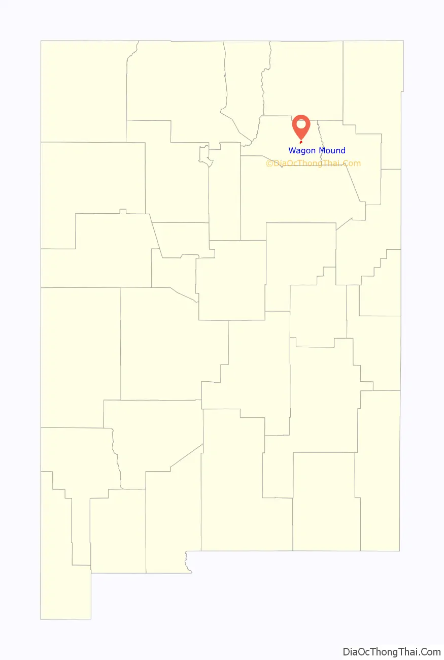
| State: | New Mexico |
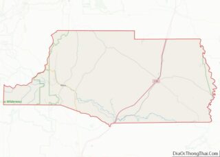
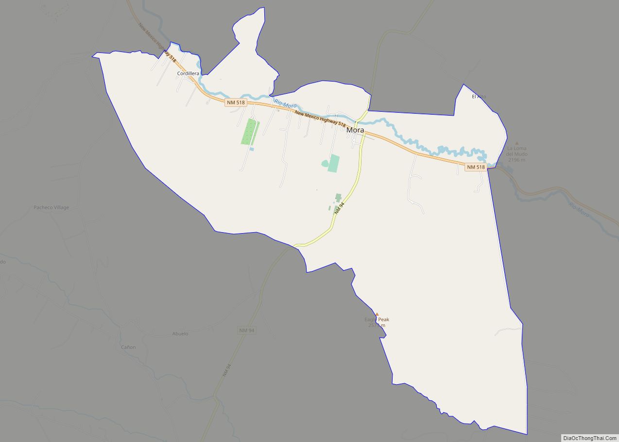
| County: | Mora County |
| Elevation: | 6,201 ft (1,890 m) |
| Total Area: | 1.01 sq mi (2.62 km²) |
| Land Area: | 1.01 sq mi (2.62 km²) |
| Water Area: | 0.00 sq mi (0.00 km²) |
| Total Population: | 266 |
| Population Density: | 262.85/sq mi (101.52/km²) |
| Area code: | 575 |
| FIPS code: | 3583340 |
| GNISfeature ID: | 0915913 |
Online Interactive Map
Click on ![]() to view map in "full screen" mode.
to view map in "full screen" mode.
Wagon Mound location map. Where is Wagon Mound village?

Wagon Mound Road Map
Wagon Mound city Satellite Map
Geography
Wagon Mound is located at 36°0′26″N 104°42′26″W / 36.00722°N 104.70722°W / 36.00722; -104.70722 (36.007223, -104.707194).
According to the United States Census Bureau, the village has a total area of 1.0 square mile (2.6 km), all land.
See also
Map of New Mexico State and its subdivision: Map of other states:- Alabama
- Alaska
- Arizona
- Arkansas
- California
- Colorado
- Connecticut
- Delaware
- District of Columbia
- Florida
- Georgia
- Hawaii
- Idaho
- Illinois
- Indiana
- Iowa
- Kansas
- Kentucky
- Louisiana
- Maine
- Maryland
- Massachusetts
- Michigan
- Minnesota
- Mississippi
- Missouri
- Montana
- Nebraska
- Nevada
- New Hampshire
- New Jersey
- New Mexico
- New York
- North Carolina
- North Dakota
- Ohio
- Oklahoma
- Oregon
- Pennsylvania
- Rhode Island
- South Carolina
- South Dakota
- Tennessee
- Texas
- Utah
- Vermont
- Virginia
- Washington
- West Virginia
- Wisconsin
- Wyoming