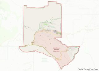
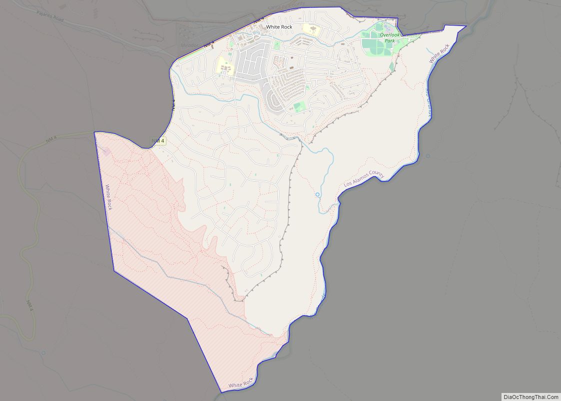
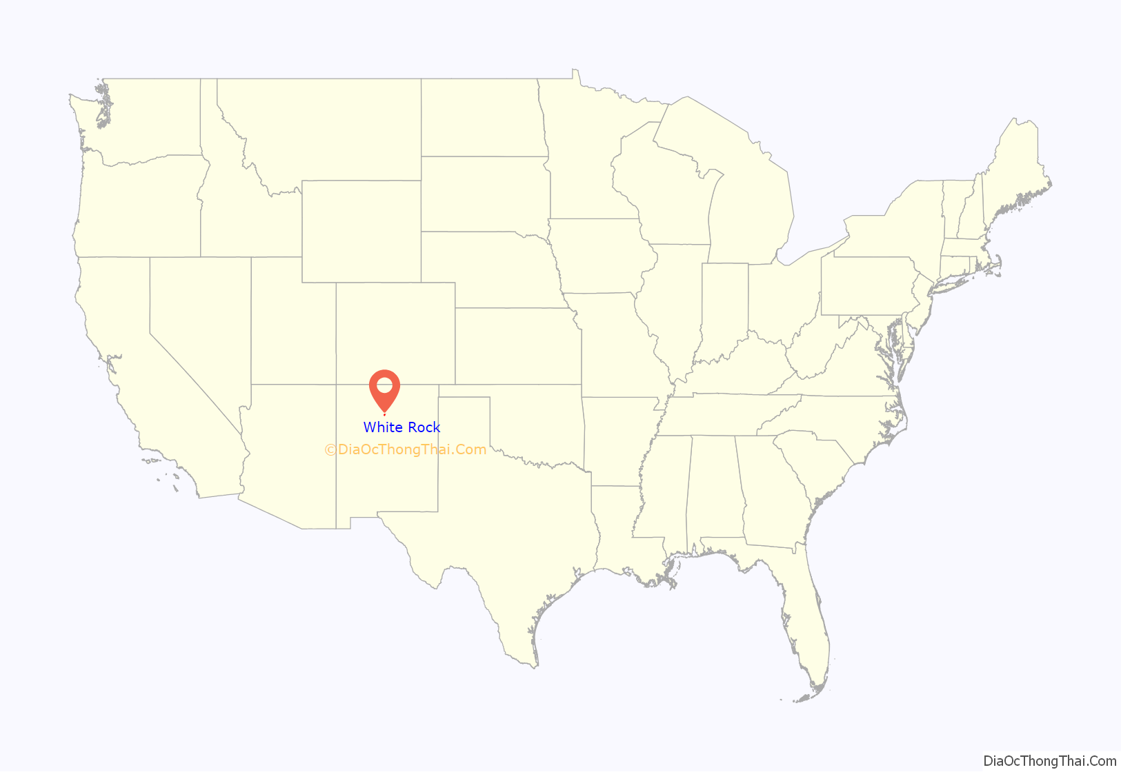
White Rock is an unincorporated community and census-designated place (CDP) in Los Alamos County, New Mexico. It is one of two major population centers in the county; the other is Los Alamos (the county seat). The population was 5,725 at the 2010 census. It is largely a bedroom community for employees of Los Alamos National Laboratory and their families. Access to White Rock from the town of Los Alamos and other cities and towns in New Mexico is via New Mexico State Road 4, which forms the northwestern boundary of the community. Administratively, White Rock is a neighborhood of Los Alamos; locals refer to Los Alamos (meaning not White Rock) as “the Townsite,” or “the Hill”.
| Name: | White Rock CDP |
|---|---|
| LSAD Code: | 57 |
| LSAD Description: | CDP (suffix) |
| State: | New Mexico |
| County: | Los Alamos County |
| Elevation: | 6,365 ft (1,940 m) |
| Total Area: | 7.11 sq mi (18.41 km²) |
| Land Area: | 7.07 sq mi (18.30 km²) |
| Water Area: | 0.04 sq mi (0.11 km²) |
| Total Population: | 5,852 |
| Population Density: | 828.19/sq mi (319.76/km²) |
| ZIP code: | 87547 |
| Area code: | 505 |
| FIPS code: | 3584740 |
| GNISfeature ID: | 0912322 |
Online Interactive Map
Click on ![]() to view map in "full screen" mode.
to view map in "full screen" mode.
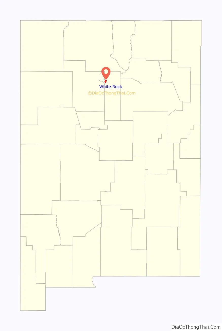
White Rock location map. Where is White Rock CDP?
History
In 1947 the United States Atomic Energy Commission acquired land from the United States Forest Service to build a temporary community to house construction workers. That community was the first White Rock, which was abandoned by 1953. By 1958 all of the old White Rock buildings had been demolished or removed. The second and present White Rock was begun in 1962.
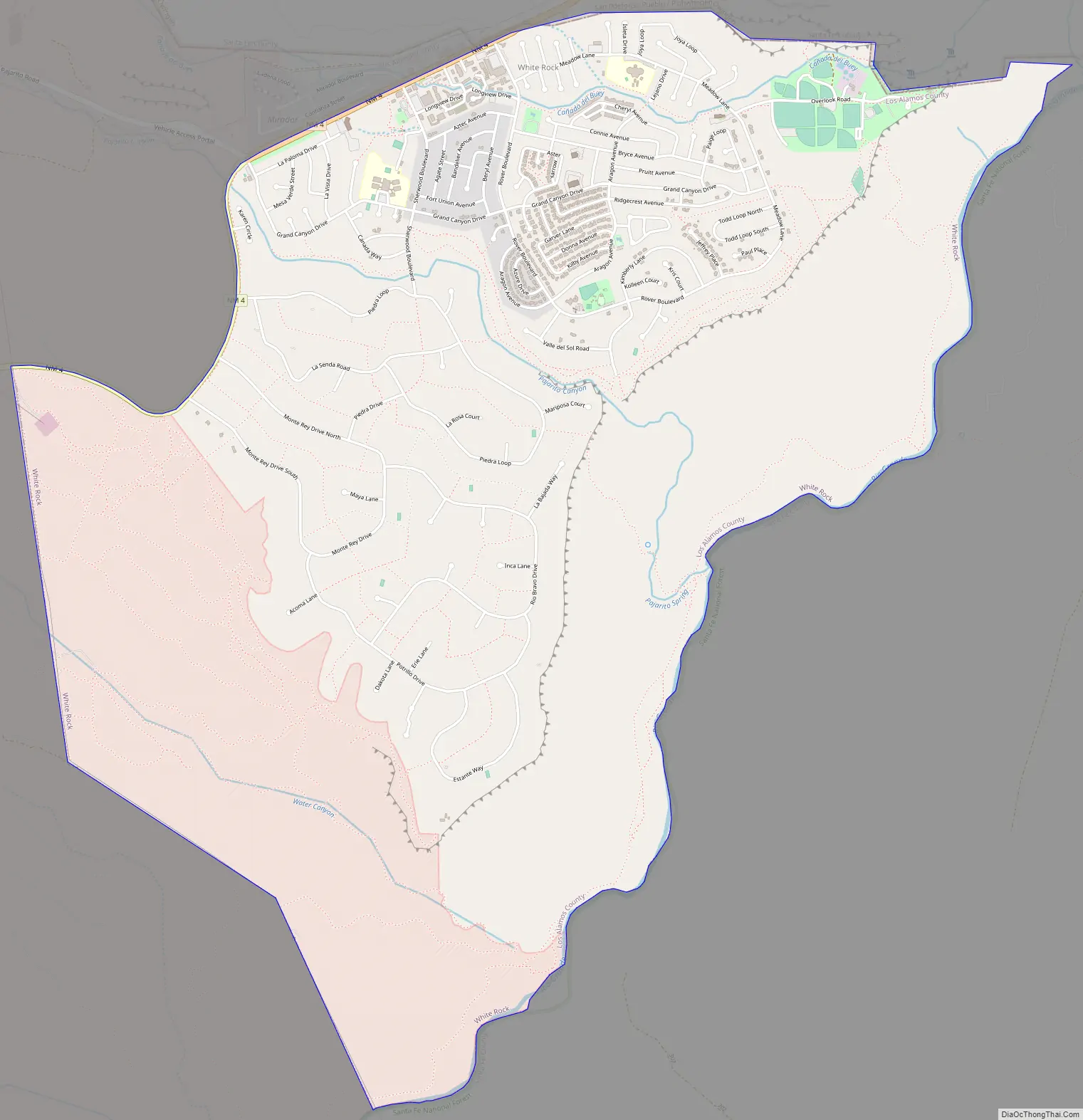
White Rock Road Map
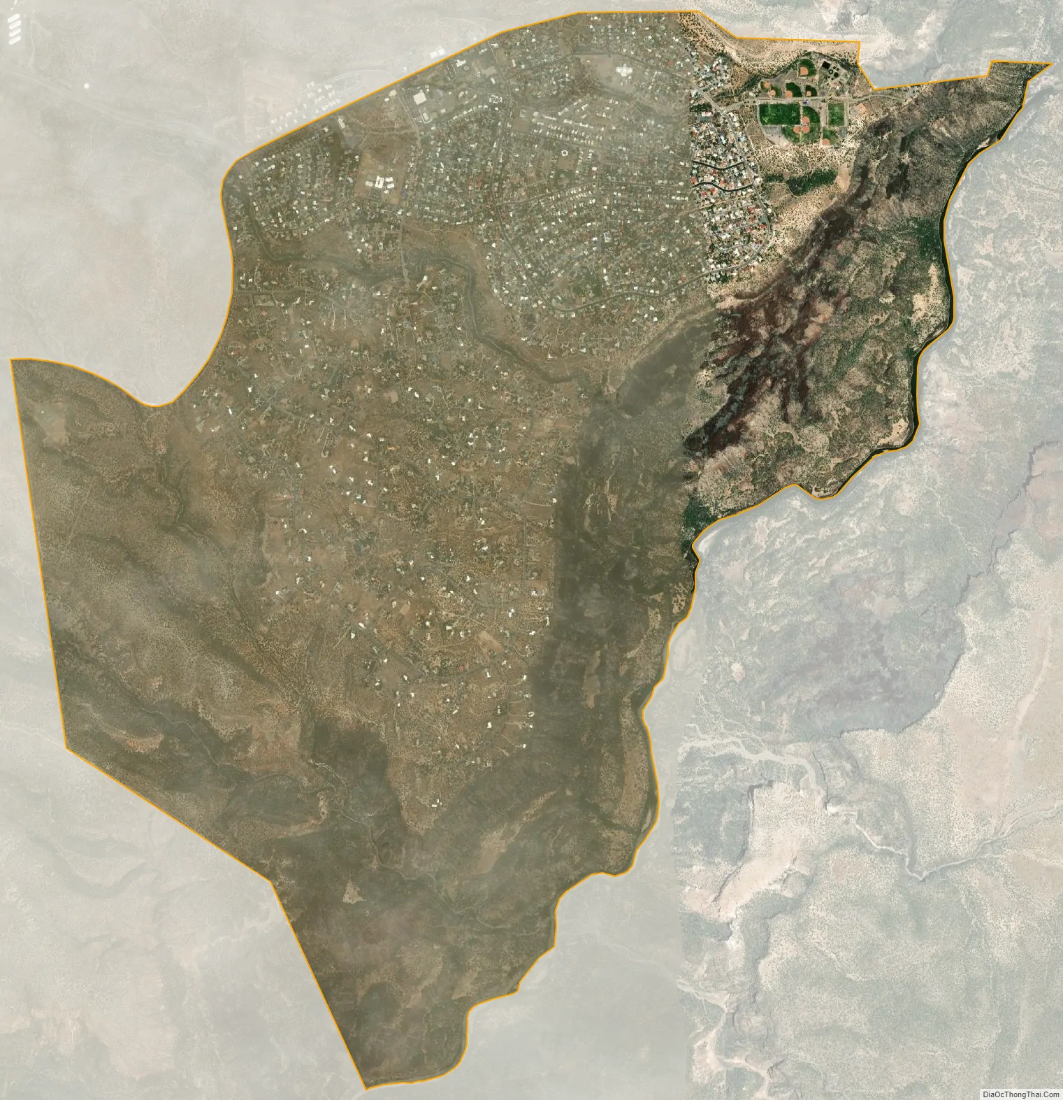
White Rock city Satellite Map
Geography
White Rock is located in southeastern Los Alamos County at 35°49′10″N 106°12′17″W / 35.81944°N 106.20472°W / 35.81944; -106.20472 (35.819439, -106.204779). It is bordered to the north and east by Santa Fe; the eastern border follows the Rio Grande through White Rock Canyon. The elevation of the White Rock townsite is 6,365 feet (1,940 m), 900 feet (270 m) above the river elevation in the canyon. The CDP includes the neighborhood of Pajarito Acres, directly south of and at the same elevation as the White Rock townsite.
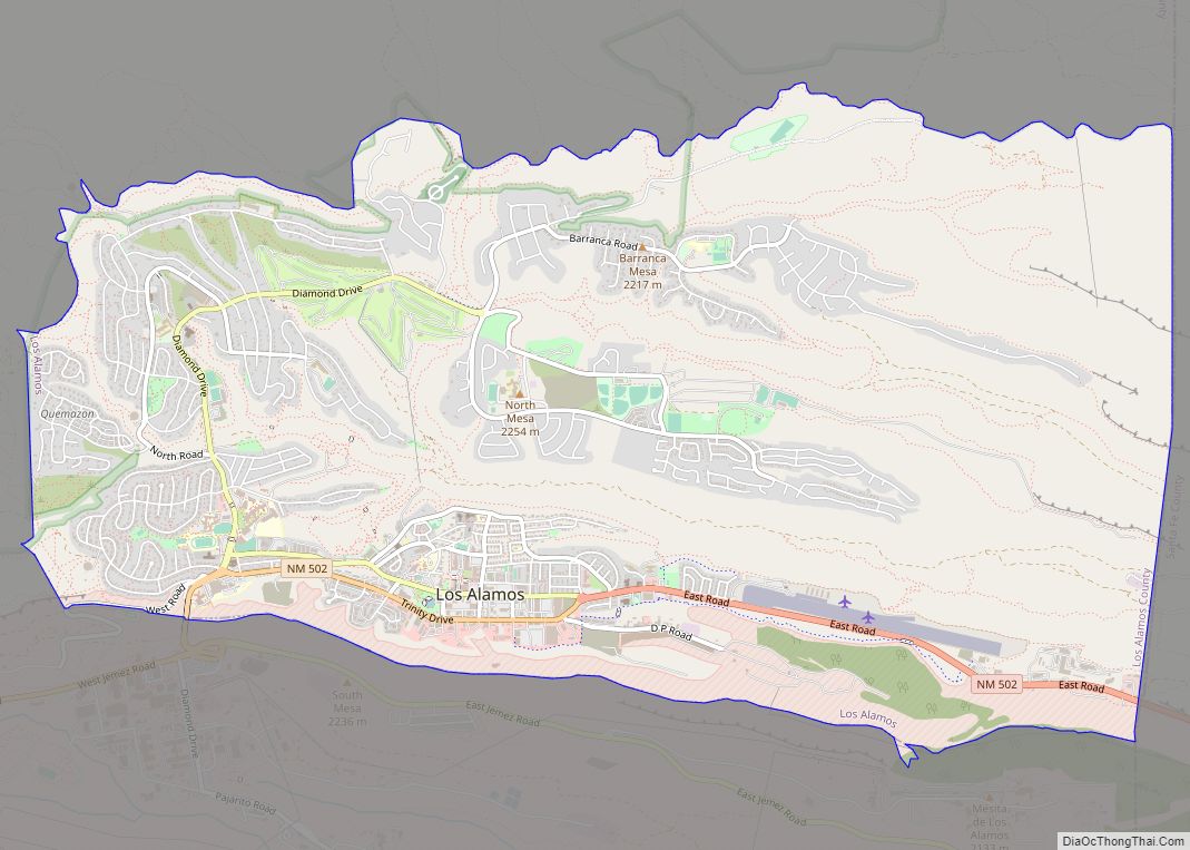
The center of the town of Los Alamos is 9 miles (14 km) northwest of White Rock, via New Mexico State Roads 4 and 502. A gated entrance to Los Alamos National Laboratory is on Pajarito Road, accessed directly from White Rock.
According to the United States Census Bureau, the White Rock CDP has a total area of 7.1 square miles (18.4 km), of which 0.04 square miles (0.1 km), or 0.59%, are water.
White Rock Canyon
Largely undeveloped White Rock Canyon, on the eastern edge of the community, provides a wilderness recreation area heavily used by residents of White Rock and Santa Fe. The canyon was carved through basalt and tuff by the south-flowing Rio Grande. The canyon runs from the Otowi Suspension Bridge in the north and to Cochiti Dam in the south, with many smaller tributary canyons such Los Alamos, Mortandad, Water, Ancho, Frijoles, and Capulin Canyon. White Rock is situated on a portion of the west side of the canyon along with Bandelier National Monument, a section of Los Alamos National Laboratory, San Ildefonso Pueblo, Cochiti Pueblo, and Santa Fe National Forest. Across the river to the east rises the Caja del Rio.
For a few decades the Chili Line, a narrow gauge railroad, ran on the east bank of the river as far south as the mouth of Diablo Canyon; some day the Rio Grande Trail may occupy the abandoned right of way.
Averaging 1,000 feet (300 m) deep, the canyon provides spectacular vistas, rugged terrain and home to rare plant species as well as endangered animal species. Along the rim of the canyon are many basalt cliffs that are used by rock climbers.
- Distance: 2.8 miles (4.5 km) one way
- Elevation: 6,300 to 6,400 feet (2,000 m)
- Elevation Change: 100 feet (30 m)
- Fitness Level: Easy
- Seasons: All seasons
- Trail Surface: Rocks and packed dirt
- Hazards: Cliffs, rattlesnakes
The trailhead begins about 100 yards southwest of the overlook viewing platform, and is accessible from a small parking lot at the end of the last side road branching east off Overlook Road. Partway to the river a meadow lies on top of a large Toreva block bench (a large piece of terrain which has moved downhill as a unit). At the midway point, the material underfoot changes from dark sharp basaltic rocks to light rounded granitic stones. The trail passes a large spring seeping from scree as the trail nears the Rio Grande. This water and water from the river are not safe to drink.
- Distance: 1.1-mile (1.8 km) one way
- Elevation: 5,450 to 6,250 feet (1,900 m)
- Elevation Change: 800 feet (240 m)
- Fitness Level: Strenuous, but short
- Seasons: All seasons, except after heavy snow
- Trail Surface: Rocky and steep trail
- Hazards: Cliffs, loose footing, swift river
This trail, also known as Pajarito Springs Trail, is accessible from Piedra Loop in La Senda. Numerous petroglyphs appear along the way, unseen by many hikers concentrating on their footing on this very steep and challenging trail. The rock drawings are varied in style, from Kokopelli to abstract and geometric designs. The local Tewa may have imported some designs from Native Americans of the Great Plains. The Pajarito Springs are several in number and combine to form a small creek flowing into a pool via a small waterfall. The trail continues to the Rio Grande.
- Distance: 1.0-mile (1.6 km) one way
- Elevation: 5,500 to 6,300 feet (1,900 m)
- Elevation Change: 800 feet (240 m)
- Fitness Level: Strenuous, but short
- Seasons: All seasons, except after heavy snow
- Trail Surface: Very rocky trail
- Hazards: Cliffs, loose footing, swift river
- Distance: 3.2 miles (5.1 km) one way
- Elevation: 5,400 to 5,500 feet (1,700 m)
- Elevation Change: 100 feet (30 m)
- Fitness Level: Easy
- Skill Level: Sections of the trail require route-finding ability
- Seasons: All seasons, except after heavy snow
- Trail Surface: Sand, river cobbles and rocks
- Hazards: Swift river
See also
Map of New Mexico State and its subdivision: Map of other states:- Alabama
- Alaska
- Arizona
- Arkansas
- California
- Colorado
- Connecticut
- Delaware
- District of Columbia
- Florida
- Georgia
- Hawaii
- Idaho
- Illinois
- Indiana
- Iowa
- Kansas
- Kentucky
- Louisiana
- Maine
- Maryland
- Massachusetts
- Michigan
- Minnesota
- Mississippi
- Missouri
- Montana
- Nebraska
- Nevada
- New Hampshire
- New Jersey
- New Mexico
- New York
- North Carolina
- North Dakota
- Ohio
- Oklahoma
- Oregon
- Pennsylvania
- Rhode Island
- South Carolina
- South Dakota
- Tennessee
- Texas
- Utah
- Vermont
- Virginia
- Washington
- West Virginia
- Wisconsin
- Wyoming