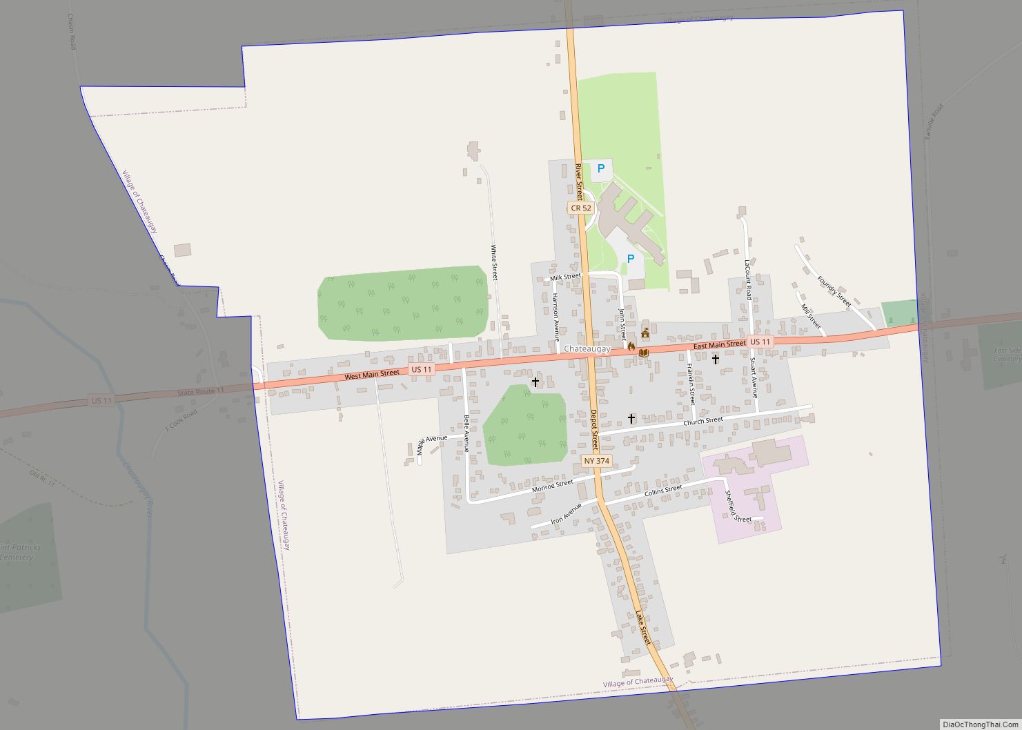
Map of Cheektowaga CDP

Map of Cheektowaga CDP

Cheektowaga is a suburban community and census-designated place (CDP) in Erie County, New York, United States. The population was 75,178 at the 2010 census, making it the most populous census-designated place in New York. It is within the town of Cheektowaga. The CDP includes Buffalo Niagara International Airport. Cheektowaga is part of the Buffalo–Niagara Falls … Read more

Map of Chazy CDP

Map of Chazy CDP

Chazy is a hamlet and census-designated place (CDP) in the town of Chazy, Clinton County, New York, United States. The population was 565 at the 2010 census, out of a total town population of 4,284. Chazy CDP overview: Name: Chazy CDP LSAD Code: 57 LSAD Description: CDP (suffix) State: New York County: Clinton County Elevation: … Read more

Map of Chautauqua CDP, New York

Map of Chautauqua CDP, New York

Chautauqua is a hamlet and census-designated place (CDP) in the town of Chautauqua in Chautauqua County, New York, United States. It corresponds to the area of the Chautauqua Institution, a historic district, adult education center, and summer resort on the southwest shore of Chautauqua Lake in far western New York. The permanent residential population was … Read more

Map of Clarkson CDP, New York

Map of Clarkson CDP, New York

Clarkson is a census-designated place (CDP) in Monroe County, New York, United States. The population was 4,358 at the 2010 Census. The town is surrounded by the town of the same name, and has an intersection that includes State Routes 19 and 104. Clarkson CDP overview: Name: Clarkson CDP LSAD Code: 57 LSAD Description: CDP … Read more

Map of Clark Mills CDP

Map of Clark Mills CDP

Clark Mills is a hamlet (and census-designated place) in Oneida County, New York, United States. The population was 1,905 at the 2010 census. The community is located at the northeastern corner of the Town of Kirkland, west of the City of Utica. Clark Mills CDP overview: Name: Clark Mills CDP LSAD Code: 57 LSAD Description: … Read more

Map of Clarence CDP, New York

Map of Clarence CDP, New York

Clarence is a hamlet and census-designated place (CDP) within the town of Clarence in Erie County, New York, United States. The population was 2,646 at the 2010 census. Clarence is part of the Buffalo–Niagara Falls Metropolitan Statistical Area. Clarence CDP overview: Name: Clarence CDP LSAD Code: 57 LSAD Description: CDP (suffix) State: New York County: … Read more

Map of Clarence Center CDP

Map of Clarence Center CDP

Clarence Center is a affluent hamlet and census-designated place (CDP) in the town of Clarence in Erie County, New York, United States. The population was 2,257 at the 2010 census. It is part of the Buffalo–Niagara Falls Metropolitan Statistical Area. Clarence Center, within the south-central part of the town, is the location of most of … Read more

Map of Churchville village

Map of Churchville village, New York

Churchville is a village in Monroe County, New York, United States. According to the 2010 census, the population was 1,961. The village is named after Samuel Church, an early settler. The Village of Churchville is west of the City of Rochester in the north part of the Town of Riga. It is at the intersection … Read more

Map of Chittenango village

Map of Chittenango village

Chittenango is a village located in Madison County, New York, United States. The village is in the southern part of the Town of Sullivan. The population was 4,896 at the 2020 census. Chittenango is the birthplace of L. Frank Baum, author of The Wonderful Wizard of Oz. Chittenango village overview: Name: Chittenango village LSAD Code: … Read more

Map of Chestnut Ridge village

Map of Chestnut Ridge village

Chestnut Ridge is a village in the town of Ramapo, Rockland County, New York, United States, located north of the state of New Jersey, east of Airmont, south of Spring Valley, and west of Nanuet. The population was 10,505 at the 2020 census. Chestnut Ridge was incorporated in 1986. Prior to 1986, Chestnut Ridge was … Read more

Map of Chestertown CDP, New York

Map of Chestertown CDP, New York

Chestertown is a hamlet of the Town of Chester, in Warren County, New York, United States. It is located by the junction of Route 8 and U.S. Route 9, in the Adirondack Mountains. The population was 677 at the 2010 census, which lists the community as a census-designated place. Chestertown CDP overview: Name: Chestertown CDP … Read more

Map of Chester village, New York

Map of Chester village, New York

Chester is a village in Orange County, New York, United States. The population was 3,993 at the 2020 census. It was named after the City of Chester in the Cheshire region of northwest England. Chester is part of the Poughkeepsie–Newburgh–Middletown, NY Metropolitan Statistical Area as well as the larger New York–Newark–Bridgeport, NY-NJ–CT–PA Combined Statistical Area. … Read more