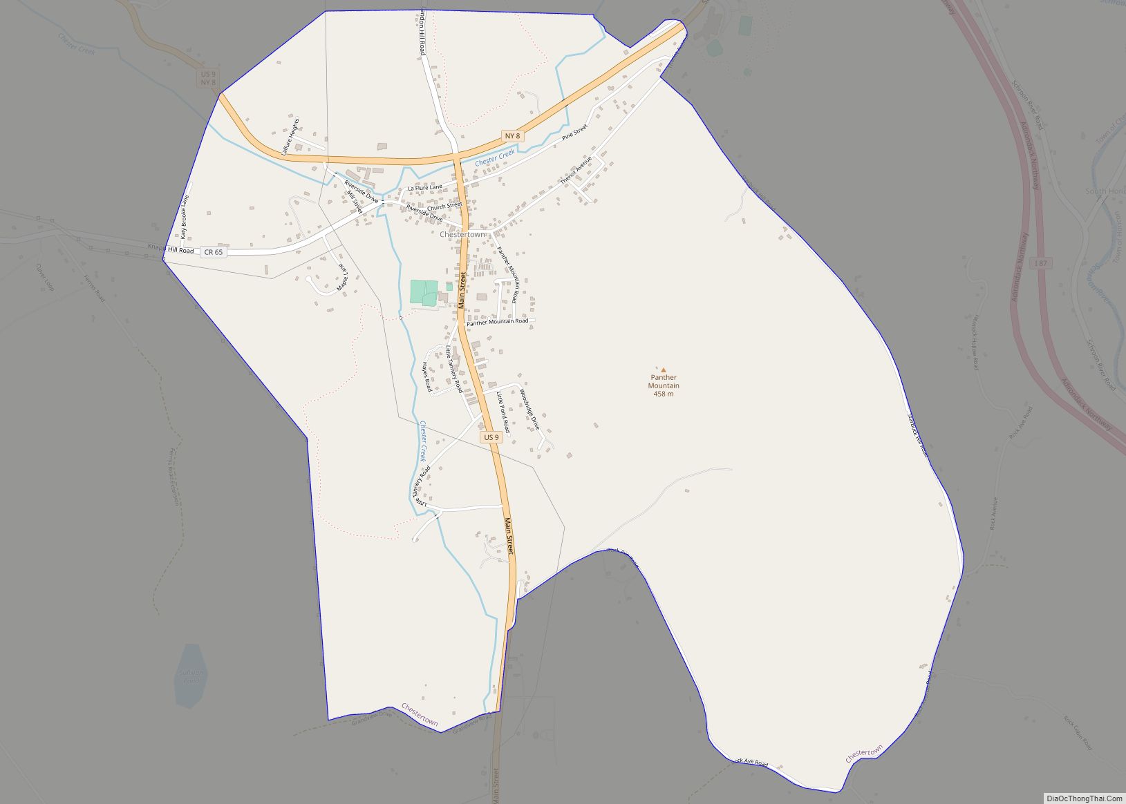
Map of Chestnut Ridge village

Map of Chestnut Ridge village

Chestnut Ridge is a village in the town of Ramapo, Rockland County, New York, United States, located north of the state of New Jersey, east of Airmont, south of Spring Valley, and west of Nanuet. The population was 10,505 at the 2020 census. Chestnut Ridge was incorporated in 1986. Prior to 1986, Chestnut Ridge was … Read more

Map of Cobleskill village

Map of Cobleskill village

Cobleskill is a village in the western part of the town of Cobleskill in Schoharie County, New York, United States. The population was 4,678 at the 2010 census. The village is southwest of Amsterdam. The State University of New York at Cobleskill is located at the western side of the village. Cobleskill village overview: Name: … Read more

Map of Clyde village, New York

Map of Clyde village, New York

Clyde is a village in Wayne County, New York, United States. The population was 2,093 at the 2010 census. It was named after the River Clyde, in Scotland, and the village sits on the Clyde River, a tributary of the Seneca River. The Village of Clyde is in the town of Town of Galen and … Read more

Map of Clintondale CDP

Map of Clintondale CDP

Clintondale is a hamlet (and census-designated place) in Ulster County, New York, United States. The population was 1,938 at the 2020 census. Clintondale is located at the northern town line of the Town of Plattekill. The community is on US Route 44 and NY 55 at the junction of County Route 22. Clintondale CDP overview: … Read more

Map of Clinton village, New York

Map of Clinton village, New York

Clinton (or Ka-dah-wis-dag, “white field” in Seneca language) is a village in Oneida County, New York, United States. The population was 1,942 at the 2010 census, declining to 1,683 in the 2020 census 13% decline). It was named for George Clinton, the first Governor of New York. The Village of Clinton, site of Hamilton College, … Read more

Map of Clifton Springs village

Map of Clifton Springs village

Clifton Springs is a village located in Ontario County, New York, United States. The population was 2,127 at the 2010 census. The village takes its name from local mineral springs. The Village of Clifton Springs is located primarily in the Town of Manchester, but the eastern part is in the Town of Phelps. The village … Read more

Map of Cleveland village, New York

Map of Cleveland village, New York

Cleveland is a village in Oswego County, New York, United States. The population was 750 at the 2010 census. The Village of Cleveland is located at the eastern boundary of the Town of Constantia on NY Route 49. Cleveland village overview: Name: Cleveland village LSAD Code: 47 LSAD Description: village (suffix) State: New York County: … Read more

Map of Clayville village

Map of Clayville village, New York

Clayville is a village in Oneida County, New York, United States. The population was 350 at the 2010 census. The Village of Clayville (formerly called Paris Furnace) is inside the Town of Paris. Clayville village overview: Name: Clayville village LSAD Code: 47 LSAD Description: village (suffix) State: New York County: Oneida County Elevation: 984 ft (300 m) … Read more

Map of Clayton village, New York

Map of Clayton village, New York

Clayton is a village in the town of Clayton in Jefferson County, New York, United States. The village population was 1,978 at the 2010 census. Clayton is the home of the Antique Boat Museum and Clayton Opera House. The village is a summer resort, offering galleries, boutiques and quality services to summer visitors. Clayton village … Read more

Map of Claverack-Red Mills CDP

Map of Claverack-Red Mills CDP

Claverack-Red Mills, commonly known as Claverack, is a census-designated place (CDP) in Columbia County, New York, United States. The population was 913 at the 2010 census. The census region is in the western part of the town of Claverack and derives its name from the two hamlets of Claverack and Red Mills. The community has … Read more

Map of Cohocton village

Map of Cohocton village

Cohocton is a village in Steuben County, New York, United States. The population was 838 at the 2010 census. The name is derived from an Iroquois phrase for “log in the water.” The Village of Cohocton is in the southeast part of the Town of Cohocton, and is northwest of Bath, New York. Cohocton village … Read more

Map of Congers CDP

Map of Congers CDP

Congers is a suburban hamlet and census-designated place in the town of Clarkstown, Rockland County, New York, United States. It is located north of Valley Cottage, east of New City, across Lake DeForest, south of Haverstraw, and west of the Hudson River. It lies 19 miles (31 km) north of New York City’s Bronx boundary. As … Read more