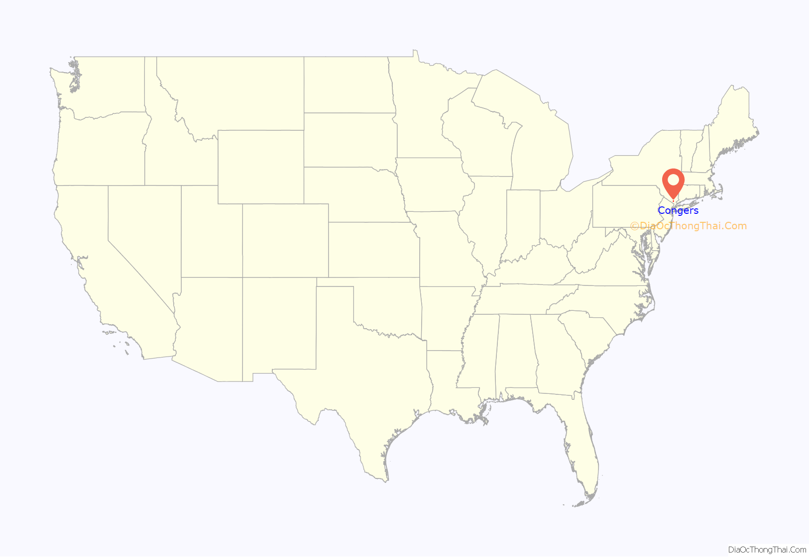
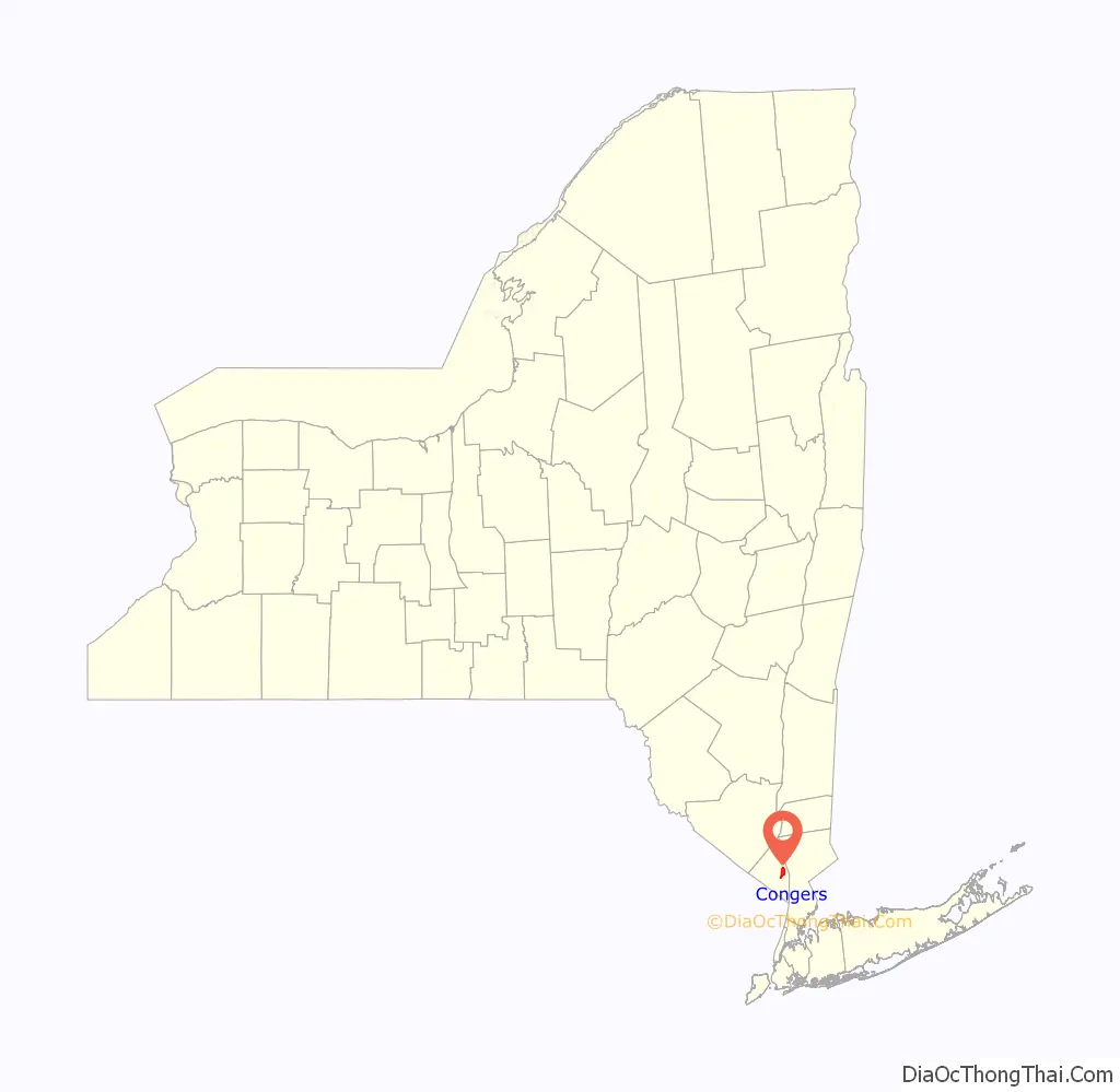
Congers is a suburban hamlet and census-designated place in the town of Clarkstown, Rockland County, New York, United States. It is located north of Valley Cottage, east of New City, across Lake DeForest, south of Haverstraw, and west of the Hudson River. It lies 19 miles (31 km) north of New York City’s Bronx boundary. As of the 2010 census, the CDP population was 8,363.
| Name: | Congers CDP |
|---|---|
| LSAD Code: | 57 |
| LSAD Description: | CDP (suffix) |
| State: | New York |
| County: | Rockland County |
| Elevation: | 177 ft (54 m) |
| Total Area: | 3.93 sq mi (10.18 km²) |
| Land Area: | 3.19 sq mi (8.25 km²) |
| Water Area: | 0.74 sq mi (1.93 km²) |
| Total Population: | 8,532 |
| Population Density: | 2,678.81/sq mi (1,034.25/km²) |
| ZIP code: | 10920 |
| Area code: | 845 |
| FIPS code: | 3617739 |
| GNISfeature ID: | 0947282 |
Online Interactive Map
Click on ![]() to view map in "full screen" mode.
to view map in "full screen" mode.
Congers location map. Where is Congers CDP?
History
Congers, named after Abraham B. Conger, was settled in the late 17th century by Dutch, German and English settlers. It was known as Cedar Grove Corner and then Waldberg, which in German means “forest mountain”.
In the 19th century the Congers railroad station, three churches, a school, the firehouse and the Central and Globe hotels were built. The first floor of the then Globe hotel on the southeastern corner of Congers Road is presently the Last Chance Saloon. The Clarktown Dutch Reformed Church still stands at the corner of Congers Road and Kings Highway.
Kings Highway was the first major road in the county and for many years the only road from New York to Albany.
Today there exist nine structures with recognized historical markers dating back to the 18th century, including the DeBaum House on Kings Highway, the Smith House on Gilchrest Road and the Snedeker House, where the Commander-in-chief George Washington is believed to have spent a night.
The Swartout estate, which was occupied by George Swartout, was part of a large tract of land confiscated by the government about 1777. It was purchased by General Jacobus Swartwout, who was a collaborator of George Washington, and member of a family who traced their residence in Rockland County to 1660.
DeForest Lake, built in 1955/6, was named after Henry L. Deforest, President of the Spring Valley Works and Supply Company.
Several roads are named after Union Civil War generals, including Grant, Burnside, Sheridan, Sherman, and Rosecrans avenues.
A memorial in honor of 1st Lieutenant Raymond B. Jauss is located at the park adjacent to the railroad crossing at the center of town. Jauss received a Distinguished Service Cross for his actions in World War I, and was killed on July 15, 1918 near Crezancy, France. He was a graduate of Columbia University and his family had a summer home in Congers. Jauss was married to a childhood sweetheart – and fellow Congers resident – Harriet James; their wedding occurred two days before he sailed for Europe.
Congers had regular passenger train service along the New York Central Railroad’s West Shore Railroad from Weehawken, New Jersey (opposite Midtown Manhattan) north to Newburgh, Kingston and Albany until 1958. A shortened commuter service continued to West Haverstraw until 1959.
St Paul’s Church
Catholics in Congers initially attended St. Peter’s Church in Haverstraw. Rev. Thomas McGare of St. Peter’s built St Paul’s Church, Clarkstown’s first Catholic church, on Lake Road in the early 1890s. In 1901 Rev. John A. Nageleisen built mission stations in Rockland Lake, Bardonia, and New City.
Gilchrest Road crossing accident
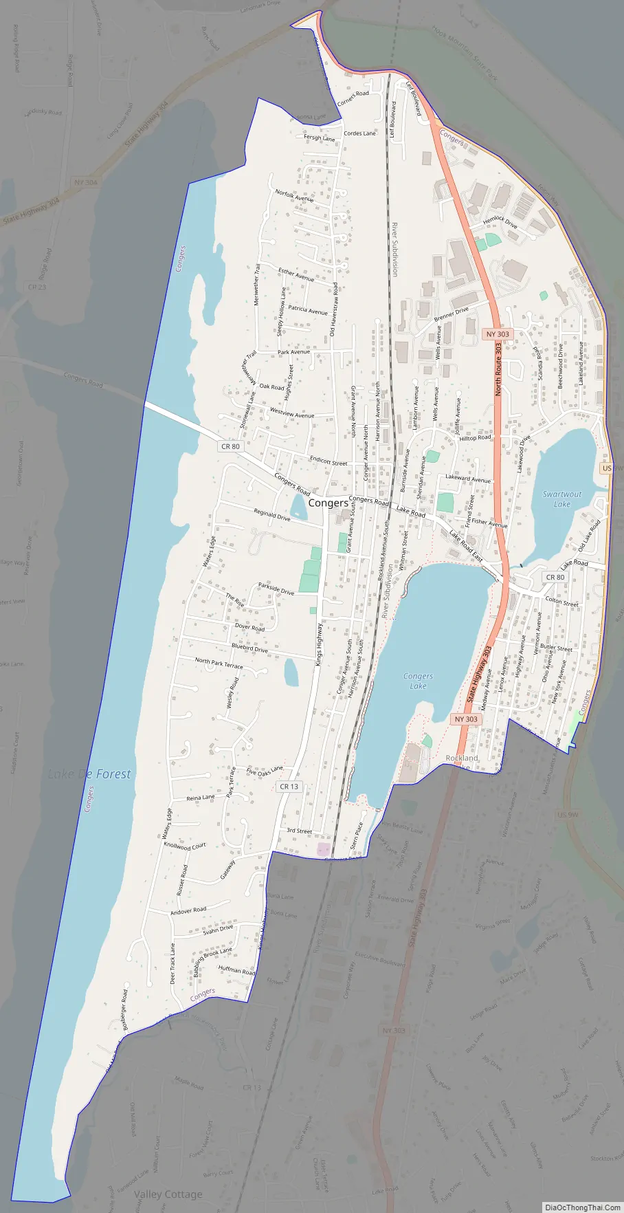
Congers Road Map
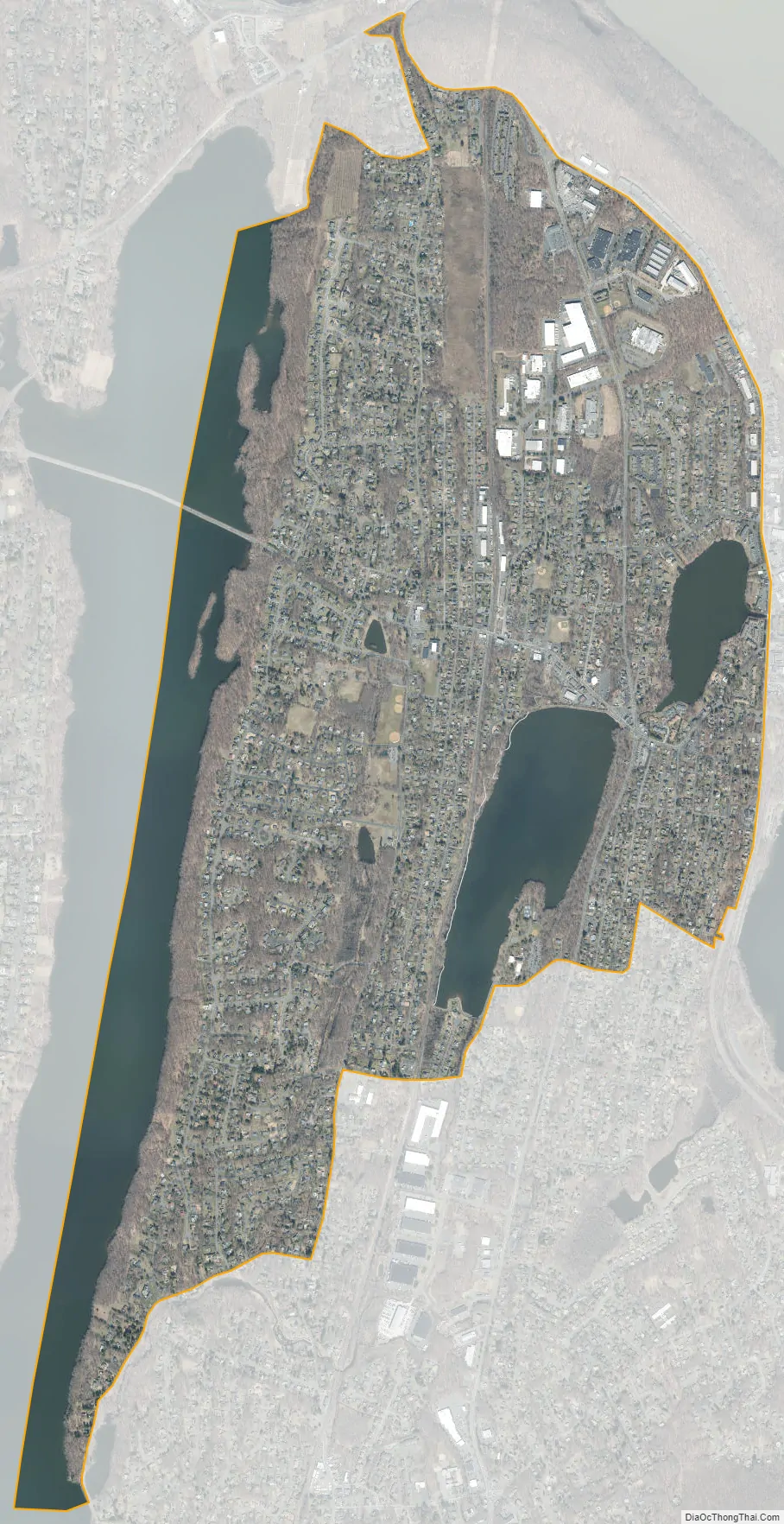
Congers city Satellite Map
Geography
Congers is located at 41°8′47″N 73°56′39″W / 41.14639°N 73.94417°W / 41.14639; -73.94417 (41.146445, −73.944036).
According to the United States Census Bureau, the CDP has a total area of 3.9 square miles (10 km), of which 3.2 square miles (8.3 km) is land and 0.7 square miles (1.8 km) (18.39%) is water. The high percentage of Congers that sits under water is due to the hamlet’s emplacement within and between four lakes: Congers Lake, Rockland Lake, Swartwout (also Swarthout) Lake, and the county reservoir, Lake DeForest. Congers is adjacent to Rockland Lake State Park, along the Hudson River.
See also
Map of New York State and its subdivision:- Albany
- Allegany
- Bronx
- Broome
- Cattaraugus
- Cayuga
- Chautauqua
- Chemung
- Chenango
- Clinton
- Columbia
- Cortland
- Delaware
- Dutchess
- Erie
- Essex
- Franklin
- Fulton
- Genesee
- Greene
- Hamilton
- Herkimer
- Jefferson
- Kings
- Lake Ontario
- Lewis
- Livingston
- Madison
- Monroe
- Montgomery
- Nassau
- New York
- Niagara
- Oneida
- Onondaga
- Ontario
- Orange
- Orleans
- Oswego
- Otsego
- Putnam
- Queens
- Rensselaer
- Richmond
- Rockland
- Saint Lawrence
- Saratoga
- Schenectady
- Schoharie
- Schuyler
- Seneca
- Steuben
- Suffolk
- Sullivan
- Tioga
- Tompkins
- Ulster
- Warren
- Washington
- Wayne
- Westchester
- Wyoming
- Yates
- Alabama
- Alaska
- Arizona
- Arkansas
- California
- Colorado
- Connecticut
- Delaware
- District of Columbia
- Florida
- Georgia
- Hawaii
- Idaho
- Illinois
- Indiana
- Iowa
- Kansas
- Kentucky
- Louisiana
- Maine
- Maryland
- Massachusetts
- Michigan
- Minnesota
- Mississippi
- Missouri
- Montana
- Nebraska
- Nevada
- New Hampshire
- New Jersey
- New Mexico
- New York
- North Carolina
- North Dakota
- Ohio
- Oklahoma
- Oregon
- Pennsylvania
- Rhode Island
- South Carolina
- South Dakota
- Tennessee
- Texas
- Utah
- Vermont
- Virginia
- Washington
- West Virginia
- Wisconsin
- Wyoming


