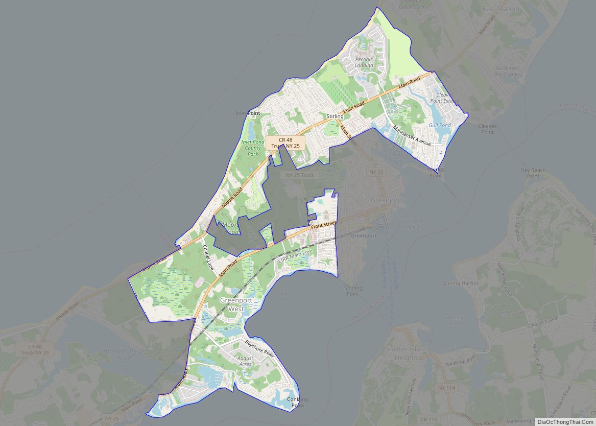
Map of Greenville CDP, New York

Map of Greenville CDP, New York

Greenville, commonly known as Edgemont, is a census-designated place (CDP) in the town of Greenburgh in Westchester County, New York, United States. The population was 9,394 at the 2020 census. Most of its residents refer to the area as Edgemont, which is also the name of its school district. It is an ethnically diverse inner … Read more

Map of Greenvale CDP

Map of Greenvale CDP

Greenvale is a hamlet and census-designated place (CDP) in the towns of North Hempstead and Oyster Bay in Nassau County, on the North Shore of Long Island, in New York, United States. It is considered part of the Greater Roslyn area, which is anchored by the Incorporated Village of Roslyn. The population was 1,904 at … Read more

Map of Greenport village

Map of Greenport village

Greenport is a village in Suffolk County, on the North Fork of Long Island, in New York, United States. The population was 2,197 at the 2010 census. The Incorporated Village of Greenport is located entirely within the Town of Southold and is the only incorporated community in the town. Greenport was a major port for … Read more

Map of Hamilton village, New York

Map of Hamilton village, New York

The Village of Hamilton is a village located within the town of Hamilton in Madison County, New York, United States. Notably, it is the location of Colgate University and has a population of 4,239, according to the 2010 census. The 2017 movie Pottersville starring Michael Shannon and Judy Greer was filmed here. Hamilton village overview: … Read more

Map of Hamburg village, New York

Map of Hamburg village, New York

Hamburg is a village in Erie County, New York, United States. The population was 9,409 at the 2010 census. The village is named after Hamburg, a city in Germany. It is part of the Buffalo–Niagara Falls Metropolitan Statistical Area. The village of Hamburg lies in the southeast part of the town of Hamburg and is … Read more

Map of Hall CDP

Map of Hall CDP

Hall is a hamlet (and census-designated place) in Ontario County, New York, United States, near the city of Geneva, along State Route 14A in the Town of Seneca. Located in the Finger Lakes region, Hall has a fire department and a post office with a downtown zip code of 14463, though the urbanized area extends … Read more

Map of Halesite CDP

Map of Halesite CDP

Halesite is a hamlet and census-designated place (CDP) in the Town of Huntington in Suffolk County, on the North Shore of Long Island, in New York, United States. The population was 2,498 at the 2010 census. Halesite CDP overview: Name: Halesite CDP LSAD Code: 57 LSAD Description: CDP (suffix) State: New York County: Suffolk County … Read more

Map of Hailesboro CDP

Map of Hailesboro CDP

Hailesboro is a hamlet and census-designated place in St. Lawrence County, New York, United States. Its population was 624 as of the 2010 census. Hailesboro has a post office with ZIP code 13645. New York State Route 58 and New York State Route 812 pass through the community. Hailesboro CDP overview: Name: Hailesboro CDP LSAD … Read more

Map of Hagaman village

Map of Hagaman village

Hagaman (/ˈheɪɡəmən/), formerly Hagamans Mills, is a village in Montgomery County, New York, United States. The population was 1,292 at the 2010 census. It is named after Joseph Hagaman, the founding father. The Village of Hagaman is in the Town of Amsterdam, northeast of the City of Amsterdam. Hagaman village overview: Name: Hagaman village LSAD … Read more

Map of Hadley CDP, New York

Map of Hadley CDP, New York

Hadley is the primary hamlet and a census-designated place (CDP) within the town of Hadley, Saratoga County, New York, United States. As of the 2010 census, the population was 1,009, out of 1,971 residents in the entire town of Hadley. Before that, the community was part of the Lake Luzerne-Hadley census-designated place. Hadley CDP is … Read more

Map of Guilford CDP, New York

Map of Guilford CDP, New York

Guilford is a census-designated place (CDP) in Chenango County, New York, United States. The population was 362 at the 2010 census. It is located in the town of Guilford. Guilford CDP overview: Name: Guilford CDP LSAD Code: 57 LSAD Description: CDP (suffix) State: New York County: Chenango County Elevation: 1,513 ft (461 m) Total Area: 1.45 sq mi (3.77 km²) … Read more

Map of Groveland Station CDP

Map of Groveland Station CDP

Groveland Station is a census-designated place (CDP) in Livingston County, New York, United States. The CDP consists of the hamlet of Groveland and nearby residential areas. The CDP population was 281 as of the 2010 census. New York State Route 63 passes through the community. Groveland Station CDP overview: Name: Groveland Station CDP LSAD Code: … Read more