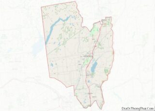
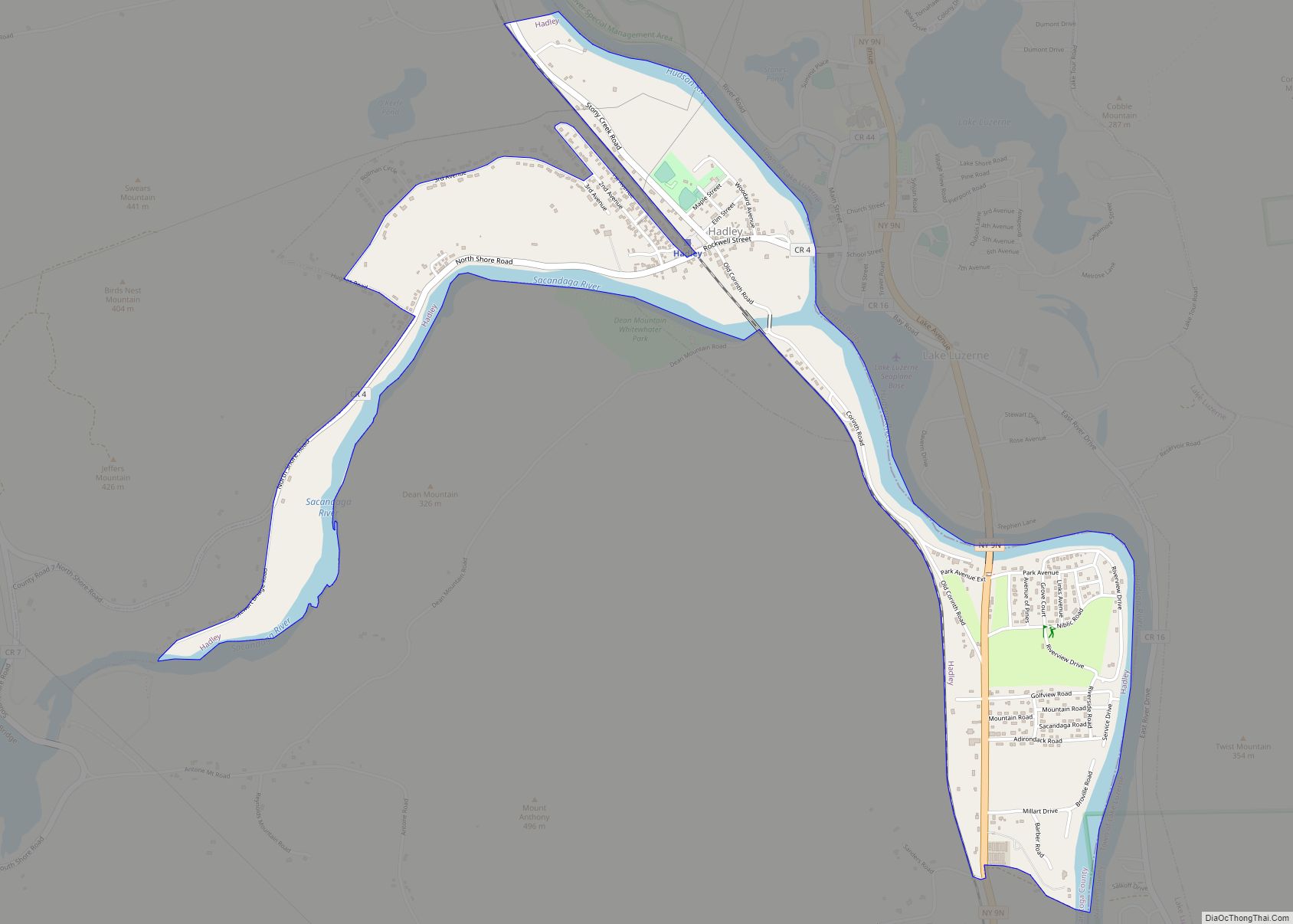
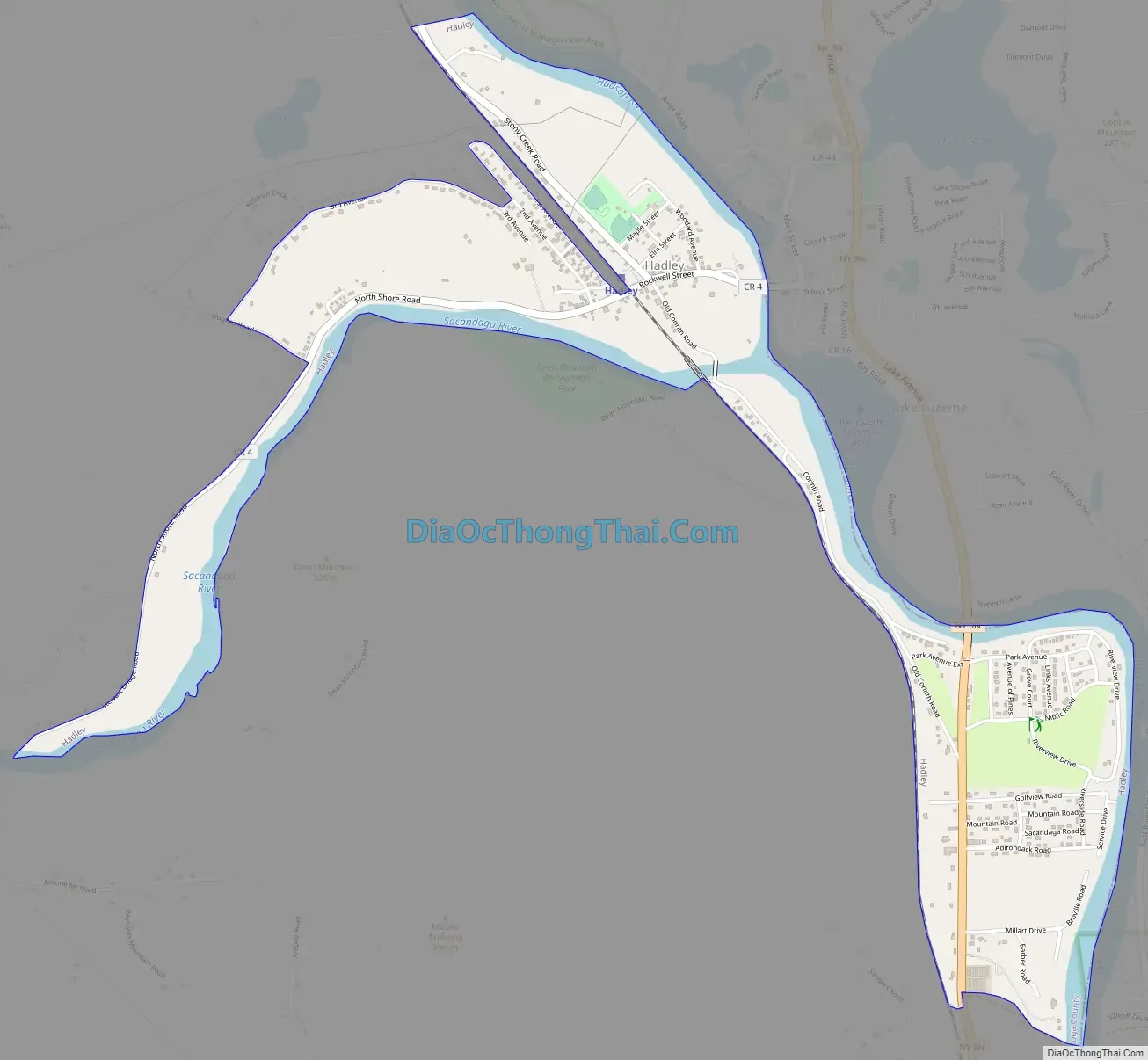
Hadley is the primary hamlet and a census-designated place (CDP) within the town of Hadley, Saratoga County, New York, United States. As of the 2010 census, the population was 1,009, out of 1,971 residents in the entire town of Hadley. Before that, the community was part of the Lake Luzerne-Hadley census-designated place.
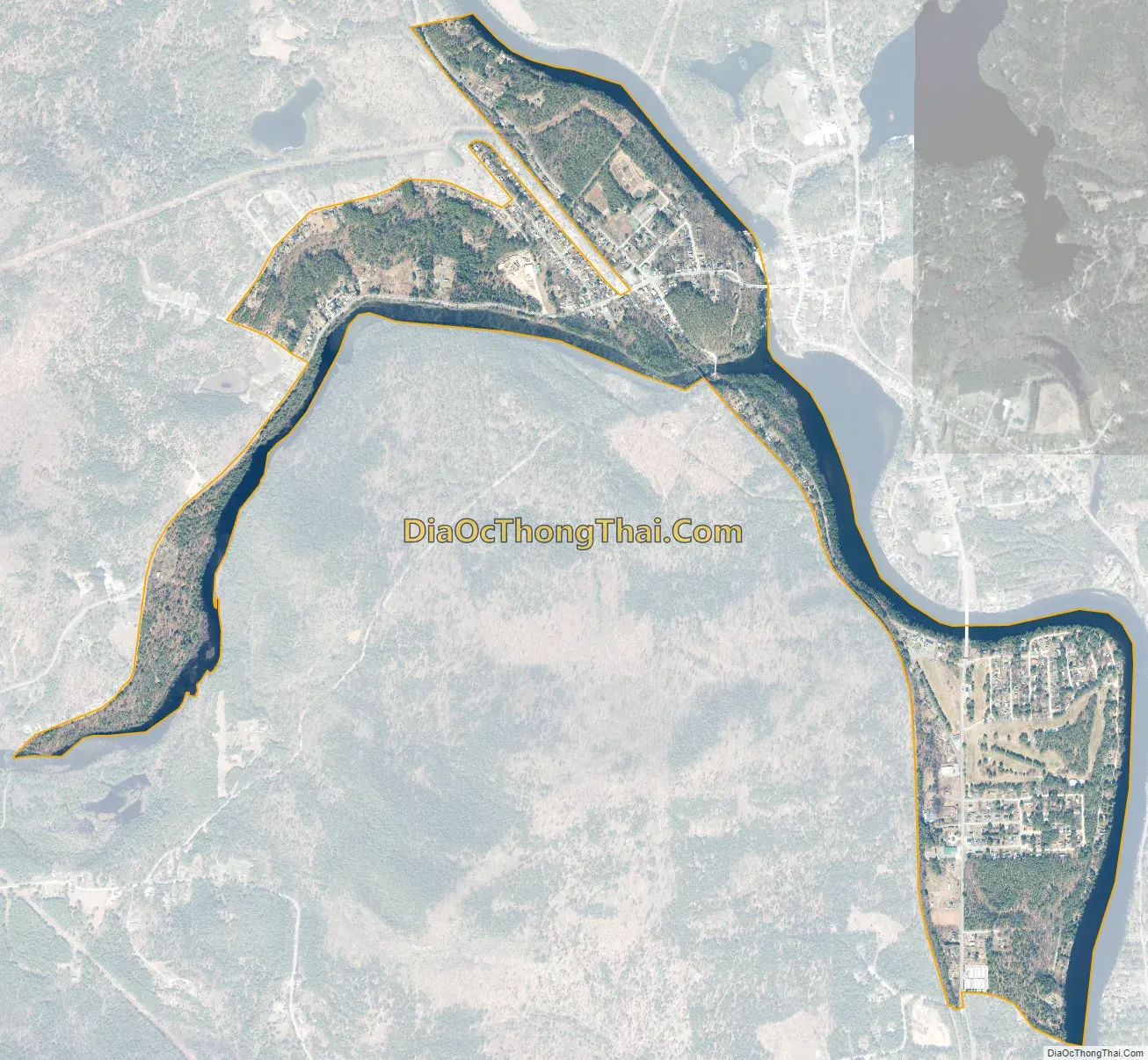
Hadley CDP is in northern Saratoga County, in the southeastern part of its town. It is bordered to the east by the Hudson River, across which is the town of Lake Luzerne in Warren County. The Sacandaga River forms the southern edge of Hadley, joining the Hudson at the community’s southeastern corner.
By road, Hadley is 5 miles (8 km) north of Corinth, 12 miles (19 km) west of Glens Falls, and 19 miles (31 km) north of Saratoga Springs.
| Name: | Hadley CDP |
|---|---|
| LSAD Code: | 57 |
| LSAD Description: | CDP (suffix) |
| State: | New York |
| County: | Saratoga County |
| Elevation: | 630 ft (190 m) |
| Total Area: | 1.67 sq mi (4.31 km²) |
| Land Area: | 1.45 sq mi (3.77 km²) |
| Water Area: | 0.21 sq mi (0.55 km²) |
| Total Population: | 1,124 |
| Population Density: | 773.04/sq mi (298.40/km²) |
| ZIP code: | 12835 |
| Area code: | 518/838 |
| FIPS code: | 3631258 |
| GNISfeature ID: | 2584264 |
Online Interactive Map
Click on ![]() to view map in "full screen" mode.
to view map in "full screen" mode.
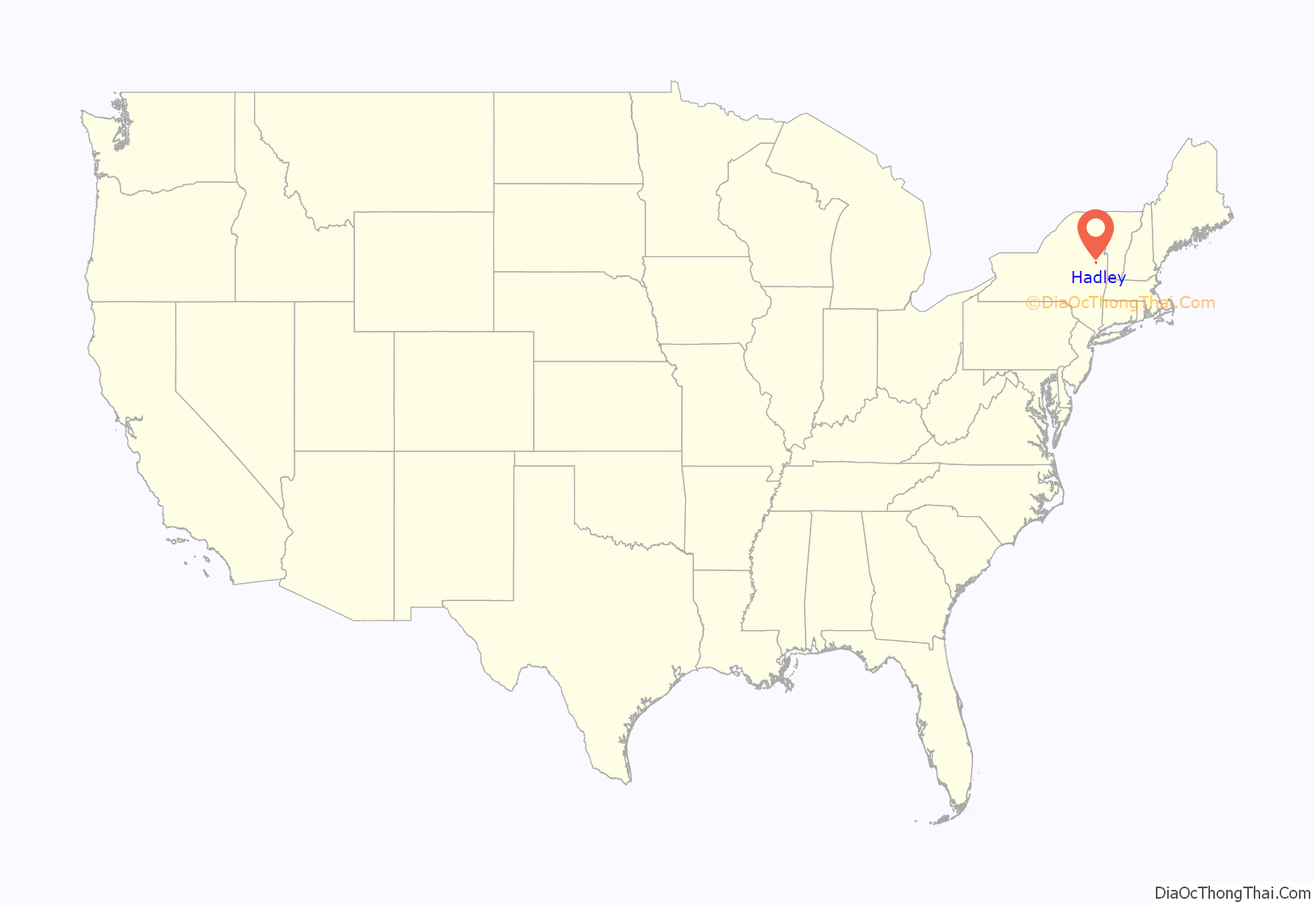
Hadley location map. Where is Hadley CDP?

Hadley Road Map
Hadley city Satellite Map
See also
Map of New York State and its subdivision:- Albany
- Allegany
- Bronx
- Broome
- Cattaraugus
- Cayuga
- Chautauqua
- Chemung
- Chenango
- Clinton
- Columbia
- Cortland
- Delaware
- Dutchess
- Erie
- Essex
- Franklin
- Fulton
- Genesee
- Greene
- Hamilton
- Herkimer
- Jefferson
- Kings
- Lake Ontario
- Lewis
- Livingston
- Madison
- Monroe
- Montgomery
- Nassau
- New York
- Niagara
- Oneida
- Onondaga
- Ontario
- Orange
- Orleans
- Oswego
- Otsego
- Putnam
- Queens
- Rensselaer
- Richmond
- Rockland
- Saint Lawrence
- Saratoga
- Schenectady
- Schoharie
- Schuyler
- Seneca
- Steuben
- Suffolk
- Sullivan
- Tioga
- Tompkins
- Ulster
- Warren
- Washington
- Wayne
- Westchester
- Wyoming
- Yates
- Alabama
- Alaska
- Arizona
- Arkansas
- California
- Colorado
- Connecticut
- Delaware
- District of Columbia
- Florida
- Georgia
- Hawaii
- Idaho
- Illinois
- Indiana
- Iowa
- Kansas
- Kentucky
- Louisiana
- Maine
- Maryland
- Massachusetts
- Michigan
- Minnesota
- Mississippi
- Missouri
- Montana
- Nebraska
- Nevada
- New Hampshire
- New Jersey
- New Mexico
- New York
- North Carolina
- North Dakota
- Ohio
- Oklahoma
- Oregon
- Pennsylvania
- Rhode Island
- South Carolina
- South Dakota
- Tennessee
- Texas
- Utah
- Vermont
- Virginia
- Washington
- West Virginia
- Wisconsin
- Wyoming