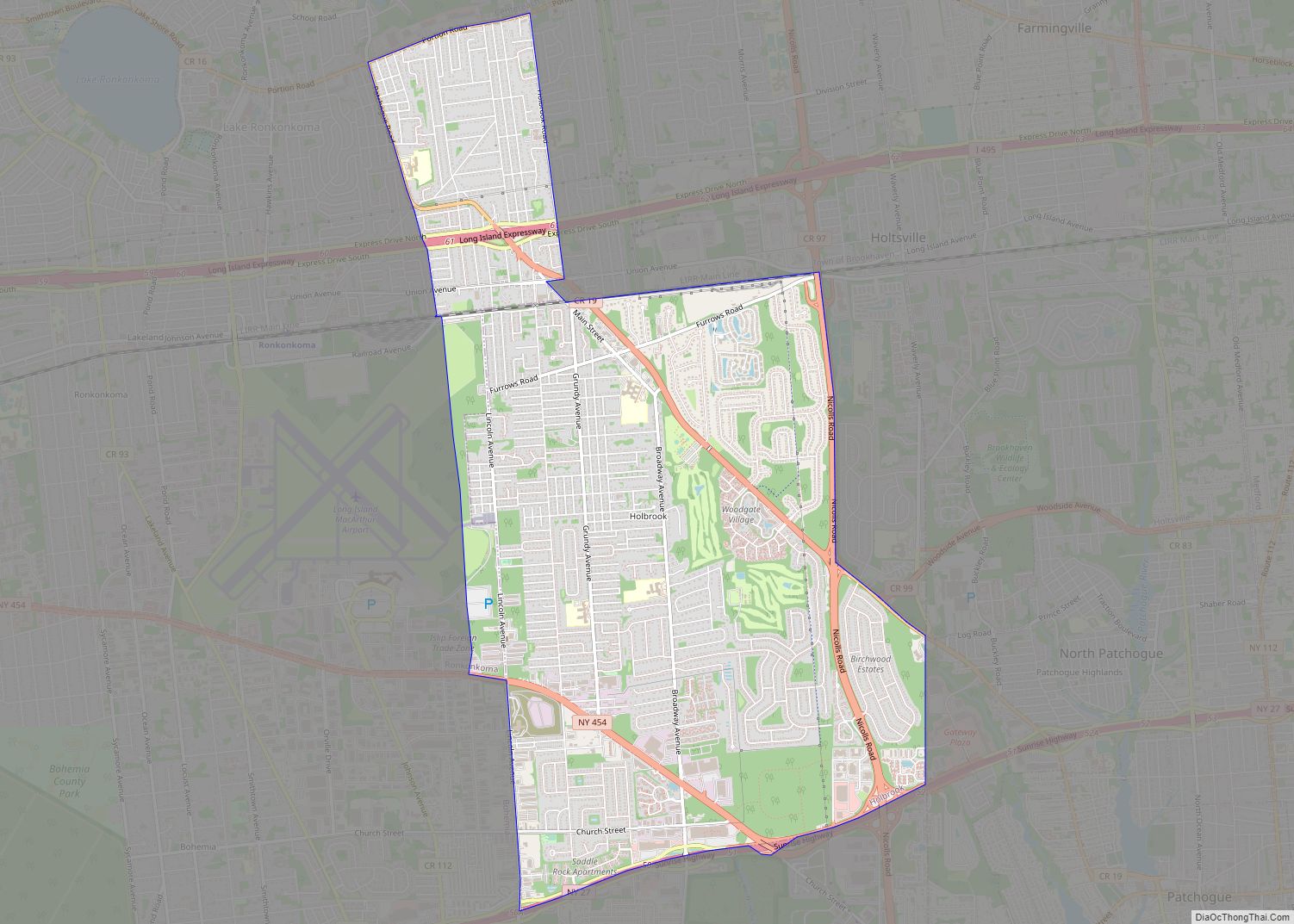
Map of Hillside Lake CDP

Map of Hillside Lake CDP

Hillside Lake is a hamlet and census-designated place (CDP) in Dutchess County, New York, United States. The population was 1,084 at the 2010 census. It is part of the Poughkeepsie–Newburgh–Middletown, NY Metropolitan Statistical Area as well as the larger New York–Newark–Bridgeport, NY-NJ–CT–PA Combined Statistical Area. Hillside Lake CDP overview: Name: Hillside Lake CDP LSAD Code: … Read more

Map of Homer village, New York

Map of Homer village, New York

Homer is a village in Cortland County, New York, United States. The population was 3,291 at the 2010 census. The village name is derived from the surrounding town, which was named after the poet Homer. The village of Homer lies mostly within the town of Homer, except for a small section on the south side … Read more

Map of Holtsville CDP

Map of Holtsville CDP

Holtsville is a hamlet and census-designated place (CDP) in Suffolk County, on Long Island, in New York, United States. The population was 19,714 at the 2010 census. The hamlet is mainly in the Town of Brookhaven, while the southwestern portion is in the Town of Islip. An IRS Processing Center is located in Holtsville, along … Read more

Map of Hudson Falls village

Map of Hudson Falls village

Hudson Falls (formerly Sandy Hill) is a village located in Washington County, New York, United States. The village is in the southwest of the town of Kingsbury, on U.S. Route 4. Hudson Falls is part of the Glens Falls Metropolitan Statistical Area. As of the 2010 census, the village had a population of 7,281. It … Read more

Map of Houghton CDP, New York

Map of Houghton CDP, New York

Houghton is a hamlet (and census-designated place) located in the Town of Caneadea in Allegany County, western New York, United States. The population was 1,693 at the 2010 census. Houghton CDP overview: Name: Houghton CDP LSAD Code: 57 LSAD Description: CDP (suffix) State: New York County: Allegany County Elevation: 1,207 ft (368 m) Total Area: 2.73 sq mi (7.07 km²) … Read more

Map of Hortonville CDP

Map of Hortonville CDP, New York

Hortonville is a census-designated place in the town of Delaware, Sullivan County, New York, United States. As of the 2010 census, its population was 218. Its ZIP code is 12745. Hortonville is the birthplace of explorer Frederick Cook, famous for his claim of being the first man to reach the North Pole on April 21, … Read more

Map of Horseheads village

Map of Horseheads village

Horseheads is a village in Chemung County, New York, United States. The population was 6,606 at the 2020 census. The name is derived from the number of bleached skulls of pack horses left behind by the Sullivan Expedition. The village of Horseheads is located within the town of Horseheads. It is north of the city … Read more

Map of Horseheads North CDP

Map of Horseheads North CDP

Horseheads North is a census-designated place (CDP) in Chemung County, New York, United States. It is part of the Elmira Metropolitan Statistical Area. As of the 2010 census, the population of the CDP was 2,843. Horseheads North CDP overview: Name: Horseheads North CDP LSAD Code: 57 LSAD Description: CDP (suffix) State: New York County: Chemung … Read more

Map of Hornell city

Map of Hornell city

Hornell is a city in Steuben County, New York, United States. The population was 8,259 at the 2020 census. The city is named after the Hornell family, early settlers. The City of Hornell is surrounded by Town of Hornellsville. Hornell is about 55 miles (89 km) south of Rochester and is near the western edge of … Read more

Map of Hopewell Junction CDP

Map of Hopewell Junction CDP

Hopewell Junction is a hamlet and census-designated place (CDP) in Dutchess County, New York, United States. The population was 1330 at the 2020 census. It is part of the Poughkeepsie–Newburgh–Middletown, NY Metropolitan Statistical Area as well as the larger New York–Newark–Bridgeport, NY-NJ–CT–PA Combined Statistical Area. Hopewell Junction is located within the town of East Fishkill. … Read more

Map of Hoosick Falls village

Map of Hoosick Falls village

Hoosick Falls is a village in Rensselaer County, New York, United States. The population was 3,501 at the 2010 census. During its peak, in 1900, the village had a population of approximately 7,000. The village of Hoosick Falls is near the center of the town of Hoosick on NY 22. The village center is listed … Read more

Map of Honeoye CDP

Map of Honeoye CDP

Honeoye (/ˈhʌniɔɪ/ HUN-ee-oy) is a hamlet in the Town of Richmond, in Ontario County, New York, United States. The population was 579 at the 2010 census, which lists the community as a census-designated place (CDP). It is located 33 miles (53 kilometers) south of downtown Rochester. The community is at the north end of Honeoye … Read more