Hudson Falls (formerly Sandy Hill) is a village located in Washington County, New York, United States. The village is in the southwest of the town of Kingsbury, on U.S. Route 4. Hudson Falls is part of the Glens Falls Metropolitan Statistical Area. As of the 2010 census, the village had a population of 7,281. It was the county seat of Washington County until 1994, when the county seat was moved to Fort Edward.
| Name: | Hudson Falls village |
|---|---|
| LSAD Code: | 47 |
| LSAD Description: | village (suffix) |
| State: | New York |
| County: | Washington County |
| Incorporated: | 1810 as Sandy Hill, 1910 as Hudson Falls |
| Elevation: | 295 ft (90 m) |
| Total Area: | 1.92 sq mi (4.97 km²) |
| Land Area: | 1.86 sq mi (4.82 km²) |
| Water Area: | 0.06 sq mi (0.15 km²) |
| Total Population: | 7,427 |
| Population Density: | 3,990.87/sq mi (1,540.49/km²) |
| ZIP code: | 12839 |
| Area code: | 518 |
| FIPS code: | 3635980 |
| GNISfeature ID: | 0974163 |
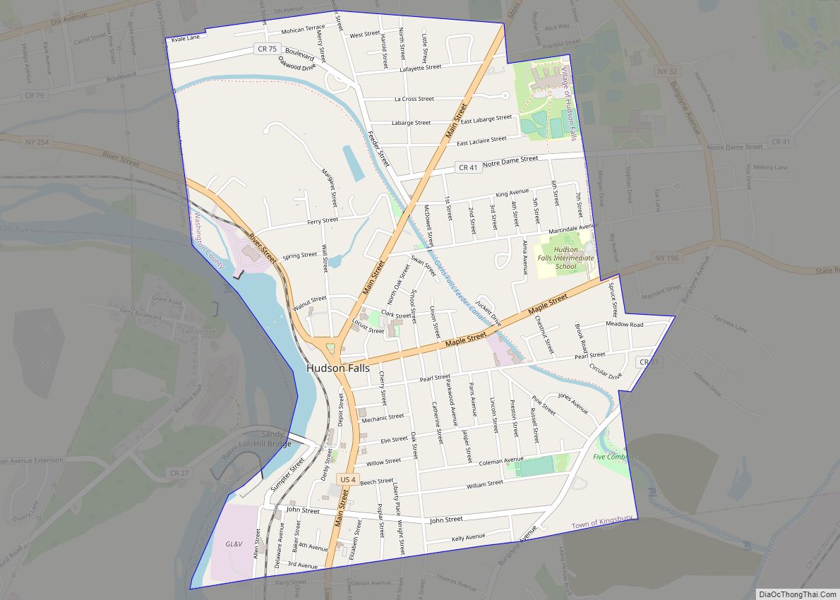
Online Interactive Map
Click on ![]() to view map in "full screen" mode.
to view map in "full screen" mode.
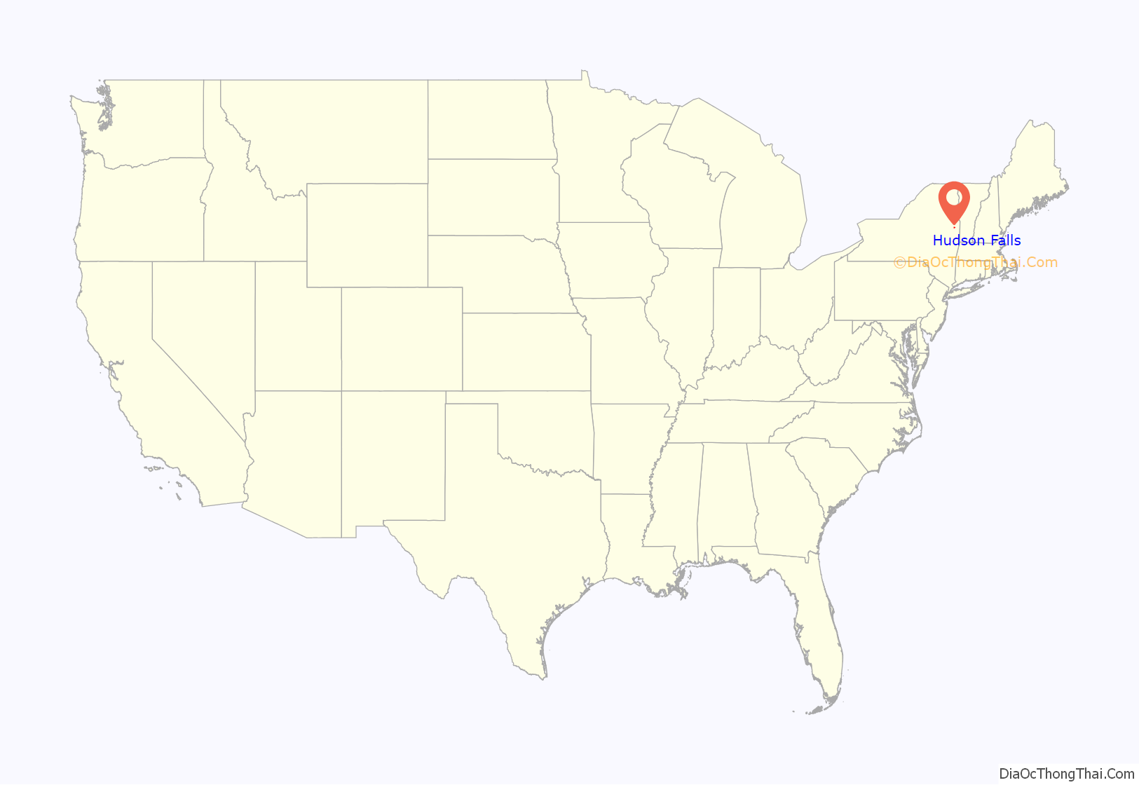
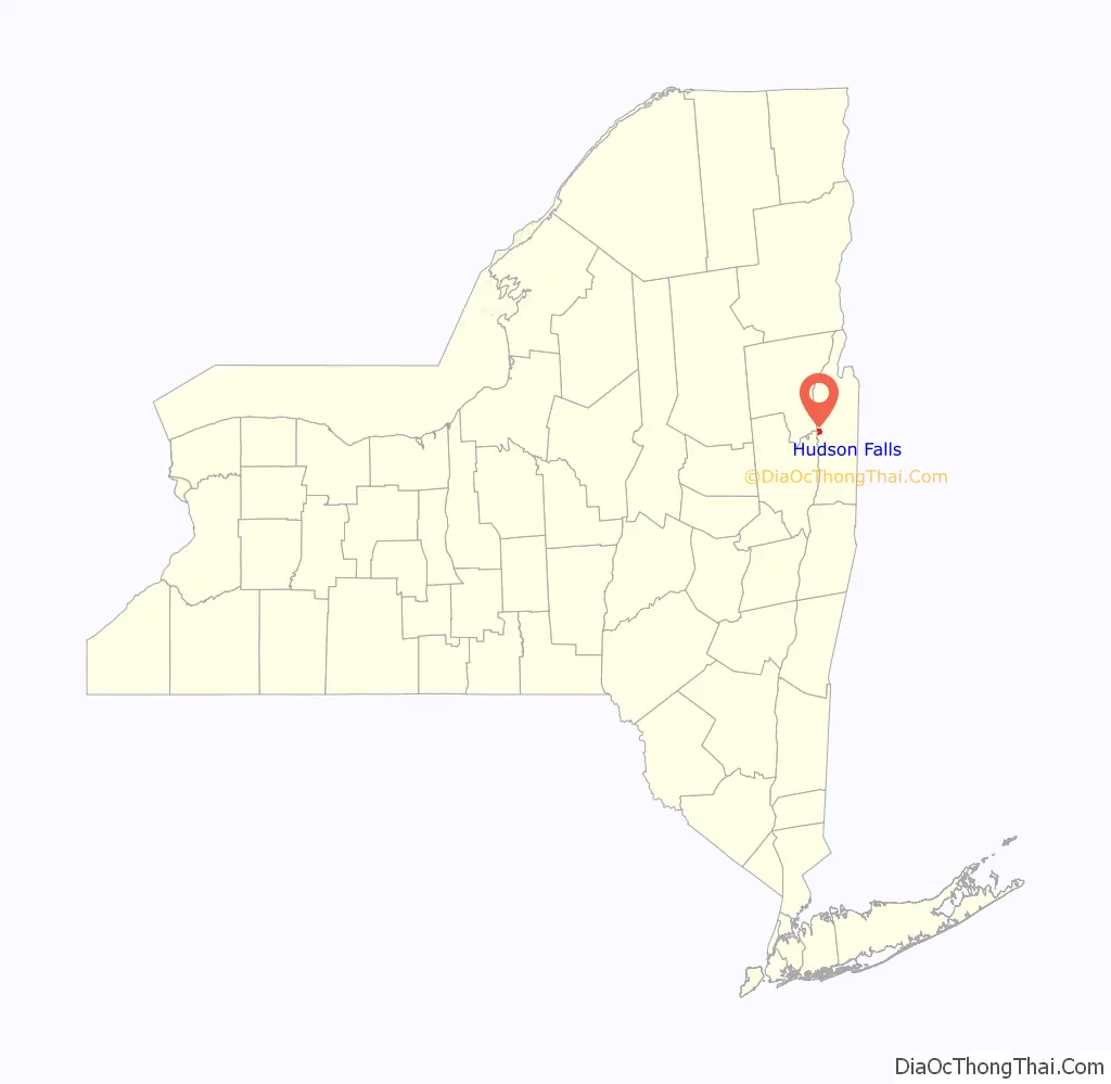
Hudson Falls location map. Where is Hudson Falls village?
History
In 1764, Albert Baker built Kingsbury’s first sawmill near what is known today as Baker’s Falls. As early as 1792, the area of Kingsbury near Baker’s Falls was referred to as Sandy Hill. In 1810, the hamlet incorporated as a village, keeping the name Sandy Hill. Its boundaries expanded to their current limits in the 1840s.
Around 1824, the Glens Falls Feeder Canal was constructed to bring water from the Hudson River to the Champlain Canal. With the opening of the Feeder Canal, Sandy Hill became a prosperous manufacturing center, producing lumber, paper, pianos, wagons, pulleys, and other products. The Glens Falls Feeder Canal is no longer used commercial traffic, but the route of Canal is a fourteen mile long park, with a walking & bike trail on the old tow path.
Stone quarried in Hudson Falls was used to construct the Bennington Battle Monument (1889) and the Brooklyn Bridge. The former site of the quarry has been redeveloped for use by the Washington-Saratoga-Warren-Hamilton-Essex Board of Cooperative Educational Services.
In 1851, Francis Wolle invented the first bag-making machine, and formed a company that would later become the Union Bag and Paper Company. In 1892 the company relocated from Bethlehem, Pennsylvania to Hudson Falls, where it had a paper mill. In 1906, Union Paper and Bag Co. built the Fenimore Bridge (Sandy Hill Bridge), spanning the Hudson River between Hudson Falls built in Washington County and town of Moreau in Saratoga County, since the company had plants in both locations. For a brief period of time, the closed-spandrel arch bridge was the longest multiple span, reinforced-concrete arch bridge in the world. The bridge is now closed, but local officials hope to turn it into a pedestrian walkway.
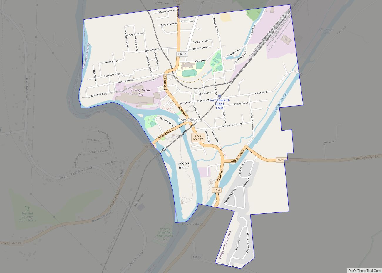
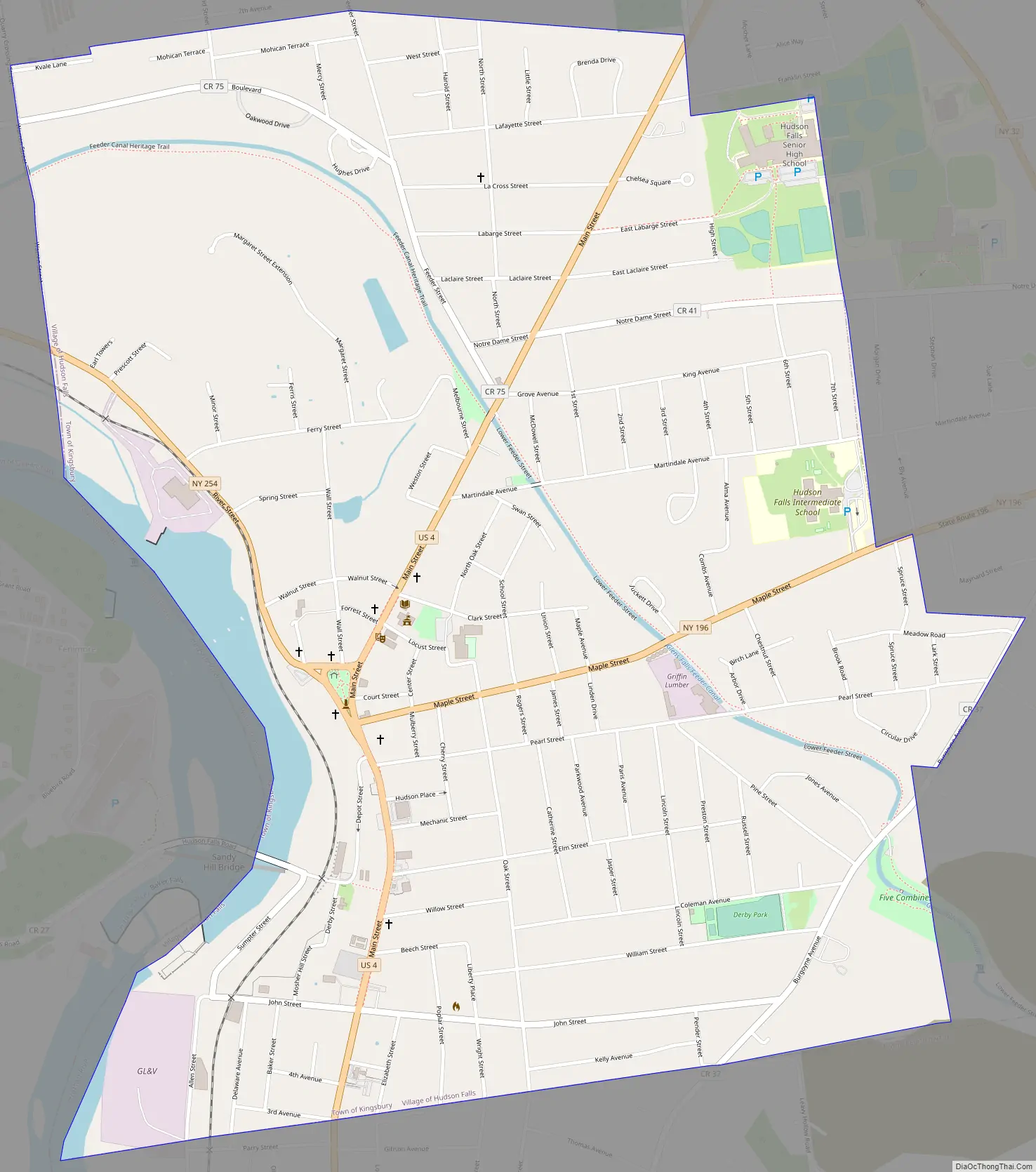
Hudson Falls Road Map
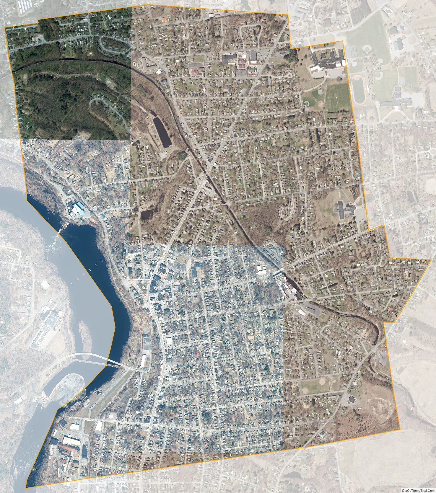
Hudson Falls city Satellite Map
Geography
According to the United States Census Bureau, the village has a total area of 1.9 square miles (4.9 km), of which 1.8 square miles (4.7 km) is land and 0.04 square miles (0.10 km) is water. The total area is 2.13% water.
The village is on the east bank of the Hudson River at the western border of Washington County. A village green lies in the center of the commercial district.
NY Route 196 (Maple Street) and NY Route 254 (River Street) intersect US Route 4 in Hudson Falls.
See also
Map of New York State and its subdivision:- Albany
- Allegany
- Bronx
- Broome
- Cattaraugus
- Cayuga
- Chautauqua
- Chemung
- Chenango
- Clinton
- Columbia
- Cortland
- Delaware
- Dutchess
- Erie
- Essex
- Franklin
- Fulton
- Genesee
- Greene
- Hamilton
- Herkimer
- Jefferson
- Kings
- Lake Ontario
- Lewis
- Livingston
- Madison
- Monroe
- Montgomery
- Nassau
- New York
- Niagara
- Oneida
- Onondaga
- Ontario
- Orange
- Orleans
- Oswego
- Otsego
- Putnam
- Queens
- Rensselaer
- Richmond
- Rockland
- Saint Lawrence
- Saratoga
- Schenectady
- Schoharie
- Schuyler
- Seneca
- Steuben
- Suffolk
- Sullivan
- Tioga
- Tompkins
- Ulster
- Warren
- Washington
- Wayne
- Westchester
- Wyoming
- Yates
- Alabama
- Alaska
- Arizona
- Arkansas
- California
- Colorado
- Connecticut
- Delaware
- District of Columbia
- Florida
- Georgia
- Hawaii
- Idaho
- Illinois
- Indiana
- Iowa
- Kansas
- Kentucky
- Louisiana
- Maine
- Maryland
- Massachusetts
- Michigan
- Minnesota
- Mississippi
- Missouri
- Montana
- Nebraska
- Nevada
- New Hampshire
- New Jersey
- New Mexico
- New York
- North Carolina
- North Dakota
- Ohio
- Oklahoma
- Oregon
- Pennsylvania
- Rhode Island
- South Carolina
- South Dakota
- Tennessee
- Texas
- Utah
- Vermont
- Virginia
- Washington
- West Virginia
- Wisconsin
- Wyoming