Map of Horseheads village
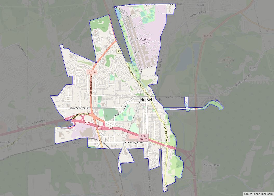
Horseheads is a village in Chemung County, New York, United States. The population was 6,606 at the 2020 census. The name is derived from the number of bleached skulls of pack horses left behind by the Sullivan Expedition. The village of Horseheads is located within the town of Horseheads. It is north of the city ... Read more
Map of Horseheads village
Map of Interlaken village, New York
Interlaken is a village in Seneca County, New York, United States. The population was 602 at the 2010 census. The name is related to the village’s position between two lakes. The Village of Interlaken is in the northern part of the Town of Covert and is northwest of Ithaca, New York. Interlaken village overview: Name: ... Read more
Map of Interlaken village, New York
Map of Ilion village
Ilion is a village in Herkimer County, New York, United States. The population was 7,790 at the 2017 census. The village is at the northern edge of the town of German Flatts, though a tiny portion is in the town of Frankfort. It is south of the Mohawk River and Erie Canal. Ilion village overview: ... Read more
Map of Ilion village
Map of Hyde Park CDP, New York
Hyde Park is a hamlet and census-designated place (CDP) in the town of Hyde Park, Dutchess County, New York, United States. Its population was 1,908 as of the 2010 census. The hamlet of Hyde Park is on the western side of the town of Hyde Park, bordered on the west by the Hudson River. The ... Read more
Map of Hyde Park CDP, New York
Map of Hurley CDP, New York
Hurley is a hamlet (and census-designated place) in the Town of Hurley, Ulster County, New York, United States. The population was 3,346 at the 2020 census. Hurley is a community near the eastern town line of the Town of Hurley. Much of the hamlet is within the Hurley Historic District, a National Historic Landmark. Hurley ... Read more
Map of Hurley CDP, New York
Map of Huntington CDP, New York
Huntington is a hamlet and census-designated place (CDP) located within the Town of Huntington in Suffolk County, on the North Shore of Long Island, in New York, United States. The population was 18,406 at the 2010 census. The hamlet serves as the Town Seat of the Town of Huntington. The hamlet’s central business district, known ... Read more
Map of Huntington CDP, New York
Map of Huntington Station CDP
Huntington Station is a hamlet and census-designated place (CDP) in the Town of Huntington in Suffolk County, on Long Island, in New York, in the United States. The population was reported as 34,878 with the 2020 census. Huntington Station CDP overview: Name: Huntington Station CDP LSAD Code: 57 LSAD Description: CDP (suffix) State: New York ... Read more
Map of Huntington Station CDP
Map of Huntington Bay village
Huntington Bay is a village in the Town of Huntington in Suffolk County, on East Neck on the North Shore of Long Island, in New York, United States. The population was 1,425 at the time of the 2010 census. Huntington Bay village overview: Name: Huntington Bay village LSAD Code: 47 LSAD Description: village (suffix) State: ... Read more
Map of Huntington Bay village
Map of Hunter village, New York
Hunter is a village in Greene County, New York, United States. The population was 429 at the 2020 census, down from 502 at the 2010 census. The village is in the northwestern part of the town of Hunter on Route 23A. Hunter village overview: Name: Hunter village LSAD Code: 47 LSAD Description: village (suffix) State: ... Read more
Map of Hunter village, New York
Map of Hunt CDP
Hunt is a hamlet and census-designated place (CDP) in Livingston County, New York, United States. Its population was 78 as of the 2010 census. Hunt has a post office with ZIP code 14846. Hunt CDP overview: Name: Hunt CDP LSAD Code: 57 LSAD Description: CDP (suffix) State: New York County: Livingston County Elevation: 1,342 ft (409 m) ... Read more
Map of Hunt CDP
Map of Hudson city, New York
Hudson is a city in Columbia County, New York, United States. At the 2020 census, it had a population of 5,894. On the east side of the Hudson River, 120 miles from the Atlantic Ocean, it was named after the river’s explorer Henry Hudson. Hudson city overview: Name: Hudson city LSAD Code: 25 LSAD Description: ... Read more
Map of Hudson city, New York
Map of Irondequoit CDP
Irondequoit /ɪˈrɒndəkɔɪt/ is a town (and census-designated place) in Monroe County, New York, United States. As of 2019, the coterminous town-CDP had a total population of 50,055. Irondequoit is a suburb of the city of Rochester, lying just north and east of the city limits. The name is of Iroquois origin and means “where the ... Read more
Map of Irondequoit CDP