Map of Irvington village, New York

Map of Irvington village, New York

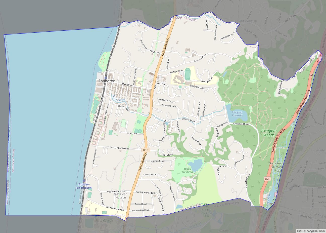
Irvington, sometimes known as Irvington-on-Hudson, is a suburban village in the town of Greenburgh in Westchester County, New York, United States. It is located on the eastern bank of the Hudson River, 20 miles (32 km) north of midtown Manhattan in New York City, and is served by a station stop on the Metro-North Hudson Line. … Read more

Map of Irondequoit CDP

Map of Irondequoit CDP

Irondequoit /ɪˈrɒndəkɔɪt/ is a town (and census-designated place) in Monroe County, New York, United States. As of 2019, the coterminous town-CDP had a total population of 50,055. Irondequoit is a suburb of the city of Rochester, lying just north and east of the city limits. The name is of Iroquois origin and means “where the … Read more

Map of Inwood CDP, New York

Map of Inwood CDP, New York

Inwood is a hamlet and census-designated place (CDP) in Nassau County, on Long Island, in New York, United States. The population was 9,792 at the 2010 census. It is considered part of Long Island’s Five Towns area and is located within the Town of Hempstead. Inwood CDP overview: Name: Inwood CDP LSAD Code: 57 LSAD … Read more

Map of Jamestown West CDP

Map of Jamestown West CDP

Jamestown West is a census-designated place (CDP) located near Jamestown in Chautauqua County, New York, United States. Also known as West Ellicott because of its location in the Town of Ellicott, the area population was 2,408 as of the 2010 census. Jamestown West is located in a nook between the city of Jamestown and the … Read more

Map of Jamesport CDP, New York

Map of Jamesport CDP, New York

Jamesport is a village in Riverhead in Suffolk County, New York. A census-designated place population estimate was around 1,710 at the 2010 census. Jamesport consists of a downtown area and surrounding farms. Hallock State Park Preserve (previously Jamesport State Park) is located north of Jamesport in the adjacent village of Northville. Jamesport CDP overview: Name: … Read more

Map of Ithaca city, New York

Map of Ithaca city, New York

Ithaca /ˈɪθəkə/ is a city and the county seat of Tompkins County, New York. Situated on the southern shore of Cayuga Lake in the Finger Lakes region of New York, Ithaca is the largest community in the Ithaca metropolitan statistical area. It is named after the Greek island of Ithaca. A college town, Ithaca is … Read more

Map of Islip CDP

Map of Islip CDP

Islip (/ˈaɪslɪp/ EYE-slip) is a hamlet and census-designated place (CDP) that lies within the town of the same name in Suffolk County, New York. Located on the south shore of Long Island, the CDP had a population of 18,869 at the time of the 2010 census, a decline of 8% from the 2000 census. Islip … Read more

Map of Islip Terrace CDP

Map of Islip Terrace CDP

Islip Terrace (formerly known as Germantown) is a hamlet and census-designated place (CDP) in the Town of Islip in Suffolk County, on the South Shore of Long Island, in New York, United States. The population was 5,389 at the 2010 census. Islip Terrace CDP overview: Name: Islip Terrace CDP LSAD Code: 57 LSAD Description: CDP … Read more

Map of Islandia village

Map of Islandia village

Islandia is a village in the northern part of the Town of Islip in Suffolk County, on Long Island, in New York, United States. The population was 3,335 at the 2010 census. Islandia village overview: Name: Islandia village LSAD Code: 47 LSAD Description: village (suffix) State: New York County: Suffolk County Incorporated: April 1985 Elevation: … Read more

Map of Katonah CDP

Map of Katonah CDP

Katonah /ˈkətoʊnə/ is a hamlet and census-designated place (CDP) within the town of Bedford, Westchester County, in the U.S. state of New York. The Katonah CDP had a population of 1,679 at the 2010 census. Katonah CDP overview: Name: Katonah CDP LSAD Code: 57 LSAD Description: CDP (suffix) State: New York County: Westchester County Elevation: … Read more

Map of Kaser village

Map of Kaser village

Kaser is a village in the town of Ramapo, Rockland County, New York, United States. The village is completely surrounded by the hamlet of Monsey. As of the 2020 United States census, the village population was 5,491. Kaser is a village with a population consisting almost entirely of Hasidic Jews of the Viznitz denomination. The … Read more

Map of Jordan village, New York

Map of Jordan village, New York

Jordan is a village in Onondaga County, New York, United States. As of the 2020 census, the population was 1,192. It is part of the Syracuse Metropolitan Statistical Area. It was named after the Jordan River. Jordan is located in the northwest part of the town of Elbridge, west of Syracuse. Jordan village overview: Name: … Read more