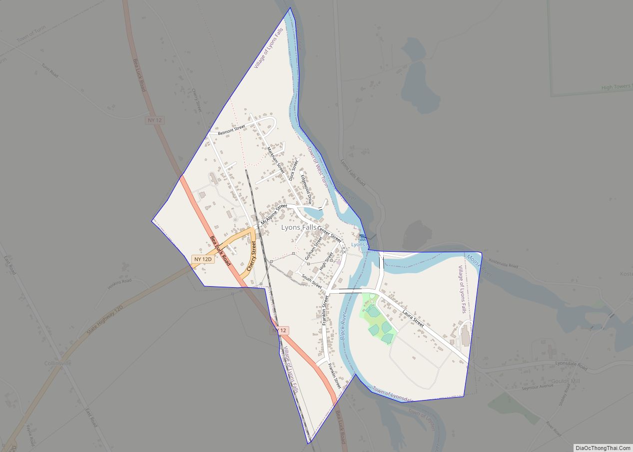
Map of Mahopac CDP

Map of Mahopac CDP

Mahopac (/ˈmeɪəˌpæk/ or /ˌməˈhoʊpæk/) is a hamlet (and census-designated place) in the town of Carmel in Putnam County, New York, United States. Also known as Lake Mahopac, the exurb is located some 47 miles (76 km) north of New York City, on US Route 6 at the county’s southern central border with Westchester County. As of … Read more

Map of Madrid CDP, New York

Map of Madrid CDP, New York

Madrid is the primary hamlet and a census-designated place (CDP) in the town of Madrid in St. Lawrence County, New York, United States. At the 2020 census, it had a population of 736, out of 1,735 in the entire town of Madrid. The community is in northern St. Lawrence County, south of the center of … Read more

Map of Madison village, New York

Map of Madison village, New York

Madison is a village in Madison County, New York, United States. The population was 305 at the 2010 census. The village and its town are named after President James Madison. The Village of Madison is in the central part of the Town of Madison on US Route 20. Madison village overview: Name: Madison village LSAD … Read more

Map of Manorhaven village

Map of Manorhaven village

Manorhaven is a village in Nassau County, on the North Shore of Long Island, in New York, United States. It is considered part of the Greater Port Washington area, which is anchored by Port Washington. The population was 6,556 at the 2010 census. The Incorporated Village of Manorhaven is located on the Cow Neck Peninsula, … Read more

Map of Mannsville village

Map of Mannsville village, New York

Mannsville is a village in the town of Ellisburg in Jefferson County, New York, United States. The population was 354 at the 2010 census, down from 400 in 2000. The name is from Barzillian Mann, early developer. Mannsville is in the southeastern part of Ellisburg and is south of Watertown. Mannsville village overview: Name: Mannsville … Read more

Map of Manlius village, New York

Map of Manlius village, New York

Manlius is a village in Onondaga County, New York, United States, and a southeast suburb of Syracuse. As of the 2020 census, the population was 4,662. The Village of Manlius is located near the southern boundary of the Town of Manlius. An area of approximately three blocks within the village, running along Seneca Street and … Read more

Map of Manhasset CDP

Map of Manhasset CDP

Manhasset is a hamlet and census-designated place (CDP) in Nassau County, on the North Shore of Long Island, in New York, United States. It is considered the anchor community of the Greater Manhasset area. The population was 8,176 at the 2020 census. As with other unincorporated communities in New York, its local affairs are administered … Read more

Map of Manhasset Hills CDP

Map of Manhasset Hills CDP

Manhasset Hills is a hamlet and census-designated place (CDP) in the Town of North Hempstead in Nassau County, on Long Island, in New York, United States. The population was 3,592 at the 2010 census. Neighboring communities include Herricks, North Hills, North New Hyde Park, and Lake Success. Manhasset Hills CDP overview: Name: Manhasset Hills CDP … Read more

Map of Manchester village, New York

Map of Manchester village, New York

Manchester is a village located within the Town of Manchester in Ontario County, New York, United States. The population was 1,709 at the 2010 census. The village was named after Manchester in England. The Village of Manchester is located in the southwest part of the town, north of Canandaigua. Manchester village overview: Name: Manchester village … Read more

Map of Mamaroneck village

Map of Mamaroneck village

Mamaroneck /məˈmærənɛk/ mə-MAR-ə-nek is a village in Westchester County, New York, United States. The population was 18,929 at the 2010 census. As of 2019 its population was an estimated 19,131. It is located partially within the town of Mamaroneck and partially within the town of Rye. The portion in Rye is unofficially called “Rye Neck“. … Read more

Map of Malverne village

Map of Malverne village

Malverne is a village in the Town of Hempstead in Nassau County, on Long Island, in New York, United States. The population was 8,514 at the 2010 census. Malverne village overview: Name: Malverne village LSAD Code: 47 LSAD Description: village (suffix) State: New York County: Nassau County Incorporated: April 20, 1921 Elevation: 36 ft (11 m) Total … Read more

Map of Malverne Park Oaks CDP

Map of Malverne Park Oaks CDP

Malverne Park Oaks is a hamlet and census-designated place (CDP) in the Town of Hempstead in Nassau County, on Long Island, in New York, United States. The population was 505 at the 2010 census. Malverne Park Oaks CDP overview: Name: Malverne Park Oaks CDP LSAD Code: 57 LSAD Description: CDP (suffix) State: New York County: … Read more